Waterfall

Settlement in Staffordshire Staffordshire Moorlands

England

Waterfall

River Hamps valley View looking south-east from public footpath over the valley of the River Hamps.
River Hamps valley Credit: Cathy Cox

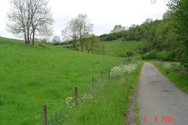
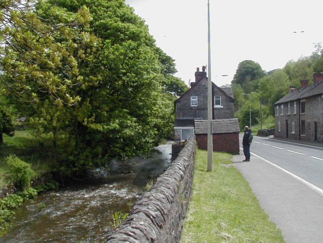
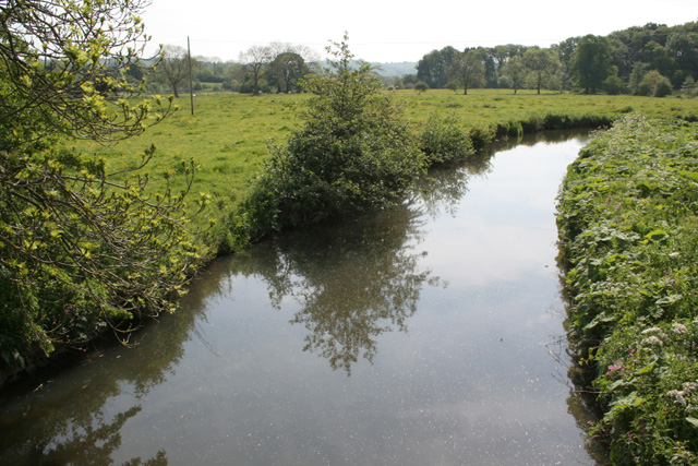
Waterfall is a small village located in the district of Staffordshire, England. Situated in the picturesque Peak District National Park, it is surrounded by stunning natural landscapes and scenic beauty. The village is nestled in a valley alongside the River Hamps, which adds to its charm and tranquility.

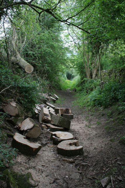
Waterfall is renowned for its idyllic countryside, making it a popular destination for nature enthusiasts and hikers. The area boasts a network of walking trails and paths, allowing visitors to explore its unspoiled beauty. Some of the notable routes include the Manifold Way, a scenic trail following the route of an old railway line, and the Staffordshire Way, which offers breathtaking views of the surrounding hills and valleys.

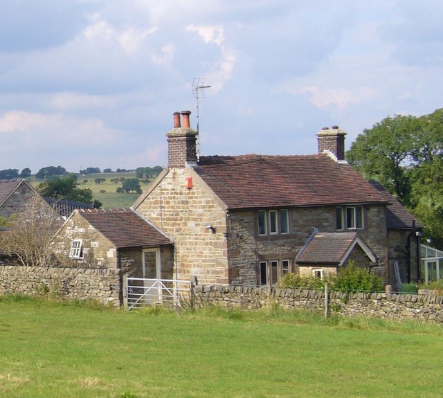
In addition to its natural attractions, Waterfall is also home to a close-knit community. The village has a small population, and its residents take great pride in their heritage and local traditions. There is a sense of community spirit that is evident in the various events and activities organized throughout the year, such as village fairs and seasonal celebrations.

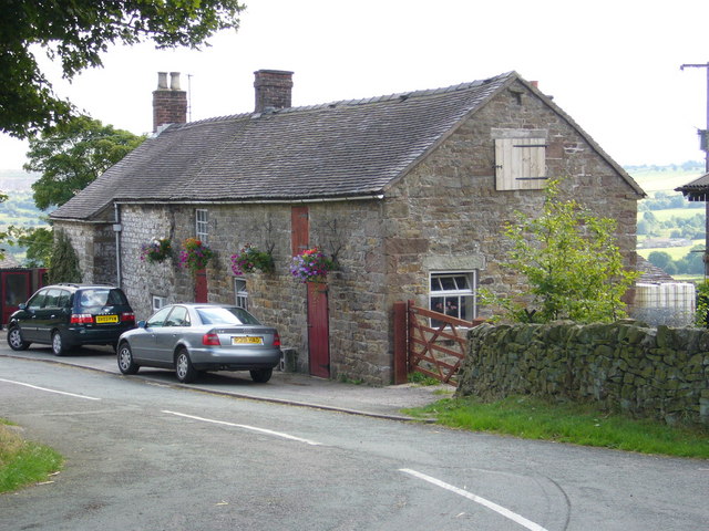
Waterfall may be small in size, but it offers a range of amenities for both residents and visitors. There are a few local shops and businesses that cater to the needs of the community, including a village pub and a small grocery store. For those seeking a wider range of amenities, the nearby town of Leek is easily accessible.

Overall, Waterfall, Staffordshire is a peaceful and picturesque village that offers a perfect retreat for those seeking to escape the hustle and bustle of city life and immerse themselves in the beauty of the English countryside.

If you have any feedback on the listing, please let us know in the comments section below.
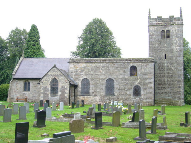
Waterfall Images

Images are sourced within 2km of 53.060527/-1.880783 or Grid Reference SK0851. Thanks to Geograph Open Source API. All images are credited.

River Hamps valley View looking south-east from public footpath over the valley of the River Hamps.
River Hamps valley
View looking south-east from public footpath over the valley of the River Hamps.
River Hamps valley View looking north along the Manifold Way where it follows the track-bed of the Leek & Manifold Valley Light Railway which ran for 30 years from 1904 to 1934.
River Hamps valley
View looking north along the Manifold Way where it follows the track-bed of the Leek & Manifold Valley Light Railway which ran for 30 years from 1904 to 1934.
Waterhouses, Staffordshire View from the main road (A52) about 600 yards to the east of the main part of the village. Pleasant-looking uniform row of cottages on the road to Waterfall at the far side of rough pasture.
Waterhouses, Staffordshire
View from the main road (A52) about 600 yards to the east of the main part of the village. Pleasant-looking uniform row of cottages on the road to Waterfall at the far side of rough pasture.
Waterhouses, Staffordshire The River Hamps flows east here through Waterhouses and alongside the A52 before it turns north towards the R Manifold.
Waterhouses, Staffordshire
The River Hamps flows east here through Waterhouses and alongside the A52 before it turns north towards the R Manifold.
Manifold Trail ... but running along the valley of the R Hamps at this point, just north of the A52. The River Hamps was remarkable for having a dry bed along much of this length despite other rivers in the area being fairly high at the time of the photo.
Manifold Trail
... but running along the valley of the R Hamps at this point, just north of the A52. The River Hamps was remarkable for having a dry bed along much of this length despite other rivers in the area being fairly high at the time of the photo.
Martinslow Farm near Winkhill
Martinslow Farm
near Winkhill
Waterhouses Church of England Primary School Waterfall Lane, Waterhouses, Staffordshire. Deliberately underexposed for the cloud effect.
Waterhouses Church of England Primary School
Waterfall Lane, Waterhouses, Staffordshire. Deliberately underexposed for the cloud effect.
Waterfall Cross Cottage at the end of Bentygrange Lane near Waterhouses, Staffordshire
Waterfall Cross
Cottage at the end of Bentygrange Lane near Waterhouses, Staffordshire
Waterfall Parochial Hall Waterfall Lane, Waterhouses, ST10 3HY, Staffordshire. Formerly the village primary school - the children now go to <a href="https://www.geograph.org.uk/photo/224946">SK0750 : Waterhouses Church of England Primary School</a>. What is the subtle difference between a parish hall and a "parochial hall" as this one styles itself?
Waterfall Parochial Hall
Waterfall Lane, Waterhouses, ST10 3HY, Staffordshire. Formerly the village primary school - the children now go to SK0750 : Waterhouses Church of England Primary School. What is the subtle difference between a parish hall and a "parochial hall" as this one styles itself?
Not a waterfall The ford in Waterfall, Staffordshire almost completely dried up after a dry summer. For symmetry, there ought to be a waterfall in the nearby village of Ford (<a href="https://www.geograph.org.uk/photo/225105">SK0653 : Not a ford</a>) but there is not.
Not a waterfall
The ford in Waterfall, Staffordshire almost completely dried up after a dry summer. For symmetry, there ought to be a waterfall in the nearby village of Ford (SK0653 : Not a ford) but there is not.
Saint James and Saint Bartholomew Parish Church, Waterfall, Staffordshire. Built in 1792. There seem to be a significant number of late 18th century churches in this area such as <a href="https://www.geograph.org.uk/photo/224498">SK0646 : Church of St John the Baptist</a> and <a href="https://www.geograph.org.uk/photo/223663">SK0558 : Church of St. John the Baptist</a>. This may reflect increases in population with the expansion of mining and quarrying at the start of the Industrial Revolution.
Saint James and Saint Bartholomew
Parish Church, Waterfall, Staffordshire. Built in 1792. There seem to be a significant number of late 18th century churches in this area such as SK0646 : Church of St John the Baptist and SK0558 : Church of St. John the Baptist. This may reflect increases in population with the expansion of mining and quarrying at the start of the Industrial Revolution.
River Hamps near Winkhill
At the back of Back o' th' Brook My Navigator Atlas indicates that this a road that could be driven. Even without the logs, I wouldn't like to try. The OS map is not so optimistic
At the back of Back o' th' Brook
My Navigator Atlas indicates that this a road that could be driven. Even without the logs, I wouldn't like to try. The OS map is not so optimistic
Deepdale Farm , Grindon
Signpost to Back o' th' Brook Unusually there is a lack of apostrophes on the sign compared with maps and the Gazetteer.
Signpost to Back o' th' Brook
Unusually there is a lack of apostrophes on the sign compared with maps and the Gazetteer.
Picnic site sign The ford at Back o' th' Brook has been renovated, the work including a brand new picnic table.  This informal notice brings a nice touch to the site.
Picnic site sign
The ford at Back o' th' Brook has been renovated, the work including a brand new picnic table. This informal notice brings a nice touch to the site.
The ford at Back o' th' Brook Stepping stones and handrail and picnic table are all part of a recent restoration. A bit more water than in the first picture!
The ford at Back o' th' Brook
Stepping stones and handrail and picnic table are all part of a recent restoration. A bit more water than in the first picture!
The ford at Back o' th' Brook Commemorative plaque. Instead of an unsightly signboard, the plaque has simply been attached to a boulder lying on the ground. The vegetation does however appear to be taking over!
The ford at Back o' th' Brook
Commemorative plaque. Instead of an unsightly signboard, the plaque has simply been attached to a boulder lying on the ground. The vegetation does however appear to be taking over!
Show me another place!

Waterfall is located at Grid Ref: SK0851 (Lat: 53.060527, Lng: -1.880783)

Administrative County: Staffordshire

District: Staffordshire Moorlands

Police Authority: Staffordshire

What 3 Words

///crazy.stamp.rejoiced. Near Mayfield, Staffordshire

Related Wikis

Back o'th' Brook

Back o'th' Brook is a village in Staffordshire, England. The population for the 2011 census can be found under Waterhouses

Waterhouses, Staffordshire

Waterhouses is a village in the south of the Staffordshire Peak District in England. It is around 8 miles from Leek and Ashbourne, being nearly the halfway...

Sparrowlee railway station

Sparrowlee was the name of a railway station on the Leek and Manifold Valley Light Railway, a 2 ft 6 in (762 mm) narrow gauge line which ran for 8 miles...

Waterhouses railway station (Staffordshire)

Waterhouses railway station was a railway station that served the village of Waterhouses, Staffordshire. It was opened jointly by the North Staffordshire...

Brown End Quarry

Brown End Quarry is a nature reserve of the Staffordshire Wildlife Trust, near the village of Waterhouses in Staffordshire, England. It is designated a...

Leek and Manifold Valley Light Railway

The Leek and Manifold Valley Light Railway (L&MVLR) was a narrow gauge railway in Staffordshire, England that operated between 1904 and 1934. The line...

Caldon Low Halt railway station

Caldon Low Halt railway station was a railway station near the hamlet of Cauldon, Staffordshire. It was opened by the North Staffordshire Railway (NSR...

Cauldon

Cauldon or Caldon is a village and former civil parish, 19 miles (31 km) north east of Stafford, now in the parish of Waterhouses, in the Staffordshire...

Nearby Amenities

Located within 500m of 53.060527,-1.880783
Waterfall
Place: village
Wikidata: Q19850737
Lat/Long: 53.060759/-1.8806153
Ford: yes
Lat/Long: 53.0642969/-1.8779592
Bench
Ele: 222.9097900
Lat/Long: 53.0642208/-1.8778316
Telephone
Booth: K6
Covered: booth
Ele: 252.9506836
Lat/Long: 53.060688/-1.8805445
Ford: yes
Source: OS OpenData StreetView
Lat/Long: 53.0647566/-1.8830972
Post Box
Post Box Type: wall
Lat/Long: 53.0602704/-1.8811441
Barrier: stile
Material: stone
Source: survey;gps
Stile: squeezer
Lat/Long: 53.0611165/-1.8798272
Barrier: stile
Material: wood
Source: survey;gps
Stile: stepover
Lat/Long: 53.0612493/-1.8817222
Barrier: stile
Material: stone
Source: survey;gps
Stile: squeezer
Lat/Long: 53.0613915/-1.8811347
Barrier: stile
Material: wood
Source: survey;gps
Stile: stepover
Lat/Long: 53.0615678/-1.8809873
Barrier: stile
Material: stone
Source: survey;gps
Stile: squeezer
Lat/Long: 53.0589719/-1.8783914
Barrier: stile
Material: stone
Source: survey;gps
Stile: squeezer
Lat/Long: 53.0605146/-1.88062
Bench
Ele: 252.7104492
Lat/Long: 53.0606598/-1.8807024
Barrier: stile
Material: stone
Source: survey;gps
Stile: squeezer
Lat/Long: 53.0612408/-1.8808898
Barrier: stile
Material: stone
Source: survey;gps
Stile: squeezer
Lat/Long: 53.0611158/-1.8781897
Barrier: stile
Material: stone
Source: survey;gps
Stile: squeezer
Lat/Long: 53.0617832/-1.8796237
Barrier: stile
Material: stone
Source: survey;gps
Stile: squeezer
Lat/Long: 53.0624542/-1.879208
Barrier: stile
Material: stone
Source: survey;gps
Stile: squeezer
Lat/Long: 53.0570867/-1.8778052
Barrier: stile
Material: stone
Source: survey;gps
Stile: squeezer
Lat/Long: 53.0592254/-1.8783644
Fixme: sign but no stile. footpath obstructed by barbed wire fence.
Lat/Long: 53.0576454/-1.8751863
Barrier: entrance
Source: survey;gps
Lat/Long: 53.0573255/-1.8783685
Bench
Source: survey;gps
Lat/Long: 53.0574385/-1.8818502
Barrier: entrance
Source: survey;gps
Lat/Long: 53.0575892/-1.8790647
Barrier: stile
Material: stone
Source: survey;gps
Stile: squeezer
Lat/Long: 53.0578791/-1.879537
Barrier: stile
Material: wood
Source: survey;gps
Stile: stepover
Lat/Long: 53.0580897/-1.8815234
Barrier: stile
Material: stone
Source: survey;gps
Stile: squeezer
Lat/Long: 53.0590711/-1.8806367
Barrier: stile
Material: stone
Source: survey;gps
Stile: squeezer
Lat/Long: 53.0598659/-1.8814079
Barrier: stile
Material: stone
Source: survey;gps
Stile: squeezer
Lat/Long: 53.0610362/-1.8764343
Barrier: stile
Material: stone
Source: survey;gps
Stile: squeezer
Lat/Long: 53.0579314/-1.8861699
Barrier: stile
Source: survey;gps
Stile: squeezer
Lat/Long: 53.058718/-1.8825751
Barrier: stile
Material: stone
Source: survey;gps
Stile: squeezer
Lat/Long: 53.0610016/-1.8881105
Barrier: stile
Material: stone
Source: survey;gps
Stile: squeezer
Lat/Long: 53.0588624/-1.8870341
Barrier: stile
Material: wood
Source: survey;gps
Stile: stepover
Lat/Long: 53.060994/-1.888105
Barrier: stile
Material: wood
Source: survey;gps
Stile: squeezer
Lat/Long: 53.0632829/-1.8749955
Barrier: stile
Material: wood
Source: survey;gps
Stile: stepover
Lat/Long: 53.0639017/-1.8780451
Historic: stocks
Lat/Long: 53.0608168/-1.8803801
Historic: water_pump
Lat/Long: 53.060727/-1.8806006
Advertising: board
Lat/Long: 53.0587293/-1.8825968
The data included in this document is from www.openstreetmap.org. The data is made available under ODbL.

Have you been to Waterfall?

Leave your review of Waterfall below (or comments, questions and feedback).