Nibs Stile Hole

Lake, Pool, Pond, Freshwater Marsh in Yorkshire South Lakeland

England

Nibs Stile Hole

Stangerthwaite Ford This ford on the River Lune is found on the track to Stangerthwaite.
Stangerthwaite Ford Credit: John Walton

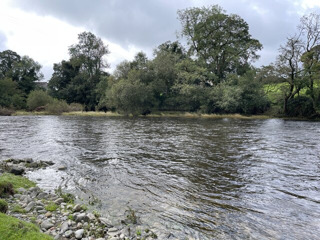
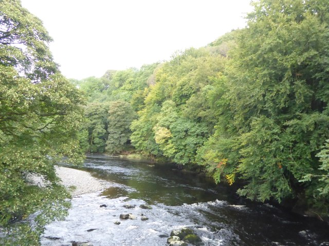
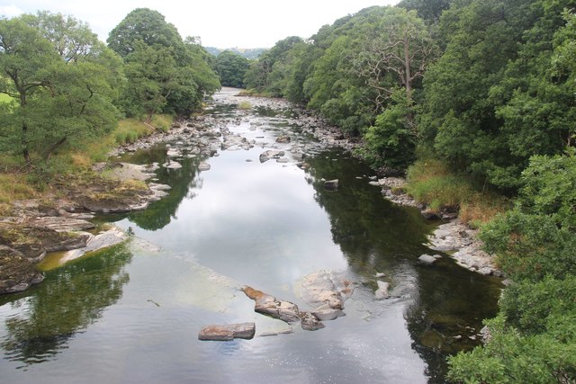
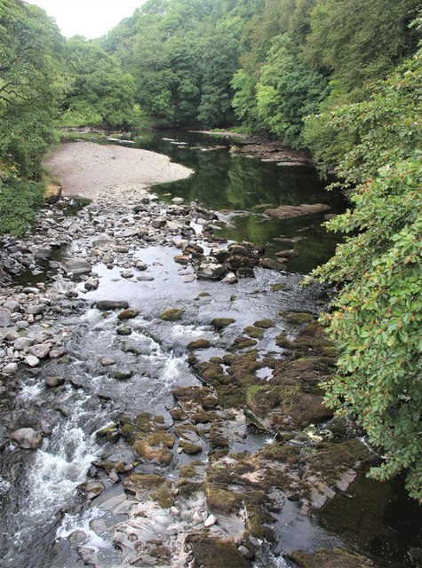
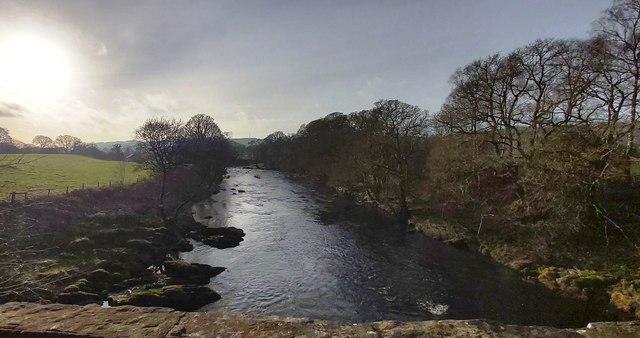
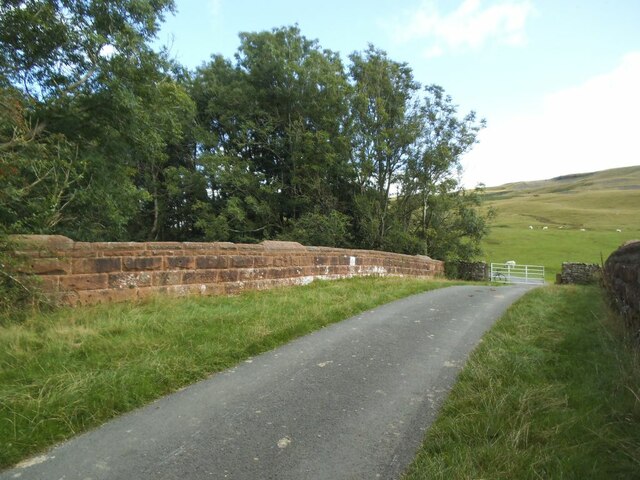
Nibs Stile Hole is a small freshwater marsh located in Yorkshire, England. Situated amidst the picturesque countryside, this hidden gem offers a serene and tranquil setting for nature enthusiasts and wildlife lovers. Covering an area of approximately 2 acres, Nibs Stile Hole is primarily known for its diverse range of aquatic life and rich biodiversity.

The marsh is surrounded by lush green vegetation, including reeds, grasses, and sedges, which provide a perfect habitat for a variety of plant and animal species. The water in the marsh is sourced from nearby springs and streams, ensuring a constant flow of fresh, clean water throughout the year.

The shallow depth of Nibs Stile Hole makes it an ideal breeding ground for several species of amphibians, including frogs, toads, and newts. Additionally, the marsh is home to a wide range of bird species, such as reed warblers, herons, and kingfishers, who feed on the abundant fish and invertebrates found in the water.

The marshland also supports a diverse array of insects, including dragonflies, damselflies, and water beetles. These insects not only contribute to the marsh's ecological balance but also attract other species, such as bats and swallows, who feed on them.

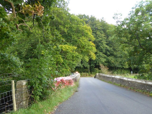
Nibs Stile Hole is a popular destination for nature walks and birdwatching, with several paths and observation points for visitors to enjoy the surrounding natural beauty. The marsh is managed by local conservation organizations, who work towards preserving its unique ecosystem and ensuring its protection for future generations.

Overall, Nibs Stile Hole is a haven of tranquility and a thriving ecosystem, providing a valuable habitat for a wide range of plant and animal species.

If you have any feedback on the listing, please let us know in the comments section below.

Nibs Stile Hole Images

Images are sourced within 2km of 54.318298/-2.5767832 or Grid Reference SD6291. Thanks to Geograph Open Source API. All images are credited.

Stangerthwaite Ford This ford on the River Lune is found on the track to Stangerthwaite.
Stangerthwaite Ford
This ford on the River Lune is found on the track to Stangerthwaite.
Middleton Bridge, over the River Rawthey
The River Rawthey from Middleton Bridge
Track heading across a field
River Rawthey At Middleton Bridge.
River Rawthey
At Middleton Bridge.
River Rawthey At Middleton Bridge.
River Rawthey
At Middleton Bridge.
The River Rawthey from Middleton Bridge
Jordan Lane railway bridge The railway was the LMS route between the 'Little North Western' line at Clapham and their main line to Scotland at Lowgill, via Ingleton. The last passenger train ran in 1954 and the line was lifted around 1967. See <a href="https://www.geograph.org.uk/photo/3534909">SD6390 : Bridge of dismantled railway over Jordan Lane</a> for the other side.
Jordan Lane railway bridge
The railway was the LMS route between the 'Little North Western' line at Clapham and their main line to Scotland at Lowgill, via Ingleton. The last passenger train ran in 1954 and the line was lifted around 1967. See SD6390 : Bridge of dismantled railway over Jordan Lane for the other side.
Holme Farm Described as an 'open' farm in the sense that they run activities for the public, as well as a campsite. This track through the farmyard is also open in the sense of being a public bridleway.
Holme Farm
Described as an 'open' farm in the sense that they run activities for the public, as well as a campsite. This track through the farmyard is also open in the sense of being a public bridleway.
Railway formation north-east of Jordan Lane The railway was the LMS route between the 'Little North Western' line at Clapham and their main line to Scotland at Lowgill, via Ingleton. The last passenger train ran in 1954 and the line was lifted around 1967.
Railway formation north-east of Jordan Lane
The railway was the LMS route between the 'Little North Western' line at Clapham and their main line to Scotland at Lowgill, via Ingleton. The last passenger train ran in 1954 and the line was lifted around 1967.
Railway bridge, Jordan Lane The bridge carried the lane over the LMS route between the 'Little North Western' line at Clapham and their main line to Scotland at Lowgill, via Ingleton <a href="https://www.geograph.org.uk/photo/6984025">SD6390 : Railway formation north-east of Jordan Lane</a>. The last passenger train ran in 1954 and the line was lifted around 1967. Beyond the bridge, a gate gives access to an unfenced road across Holme Fell.
Railway bridge, Jordan Lane
The bridge carried the lane over the LMS route between the 'Little North Western' line at Clapham and their main line to Scotland at Lowgill, via Ingleton SD6390 : Railway formation north-east of Jordan Lane. The last passenger train ran in 1954 and the line was lifted around 1967. Beyond the bridge, a gate gives access to an unfenced road across Holme Fell.
River Lune at Killington New Bridge
Waterlogged Field in the Lune Valley
River Lune
River Lune
Lune Viaduct Lune Viaduct, Ingleton branch. The Ingleton branch left the Skipton - Lancaster line at Clapham Junction and ran through Ingleton, Kirkby Lonsdale & Sedburgh, joining what is now the WCML at Lowgill, south of Tebay. Had the Midland and the LNWR reached agreement before parliament forced the Midland to build the S&C, this would have been the Midland’s main line to Scotland. As it was, the Midland was ordered to follow through with its plans for the S&C, and the Ingleton branch operated for around a century as a country backwater and sometime diversionary route. The stone pillars are from the characteristic Cumbrian red Sandstone, the two sets of arches are linked with a cast iron span. Opened 1861, closed to passengers 1954 and closed outright 1967.
Lune Viaduct
Lune Viaduct, Ingleton branch. The Ingleton branch left the Skipton - Lancaster line at Clapham Junction and ran through Ingleton, Kirkby Lonsdale & Sedburgh, joining what is now the WCML at Lowgill, south of Tebay. Had the Midland and the LNWR reached agreement before parliament forced the Midland to build the S&C, this would have been the Midland’s main line to Scotland. As it was, the Midland was ordered to follow through with its plans for the S&C, and the Ingleton branch operated for around a century as a country backwater and sometime diversionary route. The stone pillars are from the characteristic Cumbrian red Sandstone, the two sets of arches are linked with a cast iron span. Opened 1861, closed to passengers 1954 and closed outright 1967.
Crossdale Beck Just a few hundred yards along the line from the Lune Viaduct, Crossdale Beck was crossed by the former North Western Railway's Ingleton Branch by culverting the stream and constructing a significant embankment on top.
Crossdale Beck
Just a few hundred yards along the line from the Lune Viaduct, Crossdale Beck was crossed by the former North Western Railway's Ingleton Branch by culverting the stream and constructing a significant embankment on top.
The Lane to Ghyll Farm
Severely trimmed hedges bounding farm lane The lane is heading south towards the A683. It left the A684 as a bridleway at Ingmire Hall but shortly before reaching the next road it becomes one those ways known by the OS as an 'other route with public access'.
The hill rising in the distance will be Holme Knott.
Severely trimmed hedges bounding farm lane
The lane is heading south towards the A683. It left the A684 as a bridleway at Ingmire Hall but shortly before reaching the next road it becomes one those ways known by the OS as an 'other route with public access'. The hill rising in the distance will be Holme Knott.
Show me another place!

Nibs Stile Hole is located at Grid Ref: SD6291 (Lat: 54.318298, Lng: -2.5767832)

Division: West Riding

Administrative County: Cumbria

District: South Lakeland

Police Authority: Cumbria

What 3 Words

///civic.guidebook.teaching. Near Sedbergh, Cumbria

Related Wikis

St Gregory's Church, Vale of Lune

St Gregory's Church, Vale of Lune, also known as the Vale of Lune Chapel, is a redundant Anglican church situated on the A684 road about 1.5 miles (2 km...

Ingmire Hall

Ingmire Hall is a grade II listed 16th century country house built around the remains of a pele tower some 2 miles west of Sedbergh, Cumbria, England.The...

Brigflatts Meeting House

Brigflatts Meeting House or Briggflatts Meeting House is a Friends Meeting House of the Religious Society of Friends (Quakers), near Sedbergh, Cumbria...

Sedbergh railway station

Sedbergh railway station was located in the West Riding of Yorkshire, serving the town and locale of Sedbergh on the Ingleton Branch Line. The town now...

River Rawthey

The River Rawthey is a river in Cumbria in northwest England. The headwaters of the Rawthey are at Rawthey Gill Foot, where Rawthey Gill meets Haskhaw...

River Dee, Cumbria

The River Dee is a river running through the extreme south east of Cumbria, a part of the Craven region traditionally part of the West Riding of Yorkshire...

Firbank

Firbank is a village and civil parish in the South Lakeland district of the English county of Cumbria. It has a population of 97. As Firbank had a population...

Firbank Fell

Firbank Fell is a hill in Cumbria between the towns of Kendal and Sedbergh that is renowned as a place where George Fox, the founder of the Religious Society...

Nearby Amenities

Located within 500m of 54.318298,-2.5767832
Barrier: stile
Lat/Long: 54.3142072/-2.5752841
Hiking: yes
Information: guidepost
Source: GPS survey
Tourism: information
Lat/Long: 54.32068/-2.5710073
Hiking: yes
Information: guidepost
Source: GPS survey
Tourism: information
Lat/Long: 54.3204735/-2.5711253
Hiking: yes
Information: guidepost
Source: GPS survey
Tourism: information
Lat/Long: 54.3168604/-2.574977
Hiking: yes
Information: guidepost
Source: GPS survey
Tourism: information
Lat/Long: 54.315741/-2.5763986
Fixme: Continue
Lat/Long: 54.3144635/-2.5757937
Barrier: entrance
Lat/Long: 54.3143641/-2.5736694
Luneside
Image: https://www.geograph.org.uk/photo/3198733
Place: farm
Source Name: OS_OpenData_StreetView
Lat/Long: 54.3204446/-2.5713775
Power: pole
Lat/Long: 54.3221119/-2.5791113
Power: pole
Lat/Long: 54.3221178/-2.5801191
Power: pole
Lat/Long: 54.320764/-2.5713132
The data included in this document is from www.openstreetmap.org. The data is made available under ODbL.

Have you been to Nibs Stile Hole?

Leave your review of Nibs Stile Hole below (or comments, questions and feedback).