The Loups

Lake, Pool, Pond, Freshwater Marsh in Yorkshire South Lakeland

England

The Loups

Middleton Bridge, over the River Rawthey
Middleton Bridge, over the River Rawthey Credit: David Smith

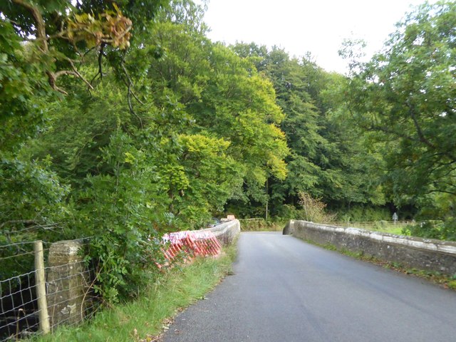
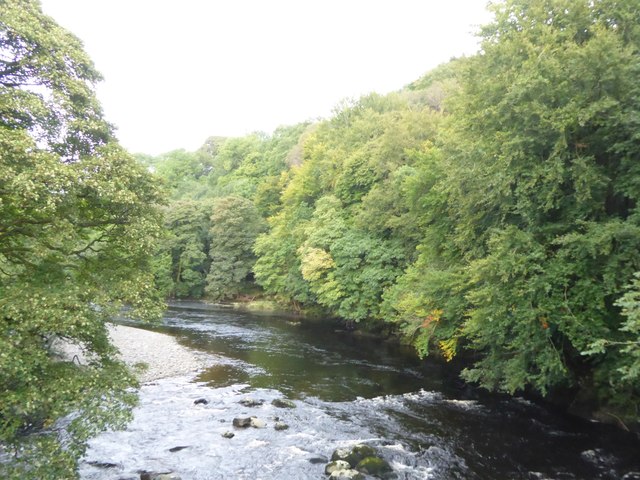
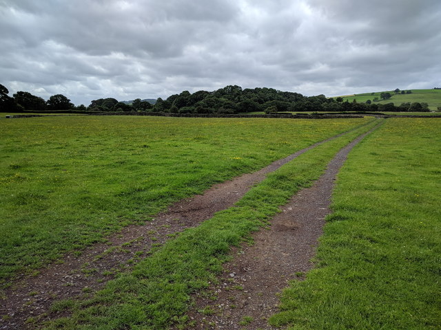
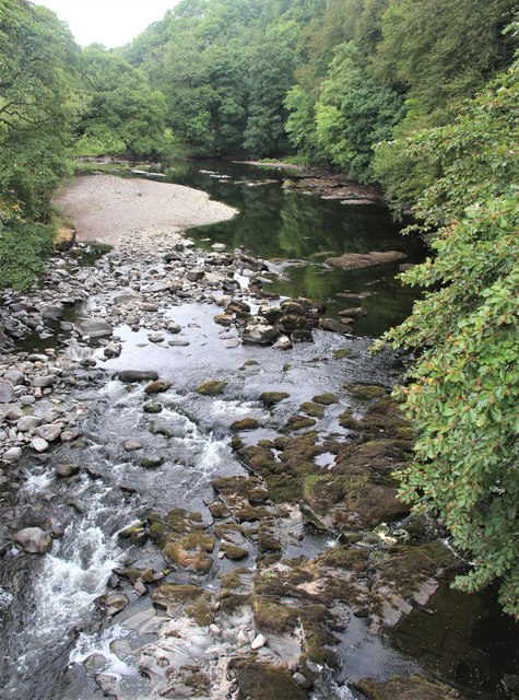
The Loups, located in Yorkshire, is a picturesque freshwater marsh that encompasses a lake, pool, pond, and wetland. This stunning natural habitat is spread across a sprawling area, offering a diverse range of flora and fauna.

The centerpiece of The Loups is the shimmering lake, which stretches over a significant portion of the marsh. The lake is characterized by its crystal-clear waters and serves as a vital water source for the surrounding ecosystem. It supports a variety of aquatic plants, such as lilies and reeds, which provide shelter and food for numerous species of fish, birds, and insects.

Adjacent to the lake is a tranquil pool, which is relatively smaller in size but equally enchanting. This secluded water body is known for its calm and stillness, attracting various waterfowl that come to feed and breed. The pool is surrounded by lush vegetation, including water lilies and rushes, which add to its allure.

Further into the marsh, there is a smaller pond nestled amidst the reeds and grasses. This pond is teeming with life, hosting a diverse range of amphibians, insects, and small aquatic creatures. It serves as a breeding ground for frogs and toads, their distinctive calls filling the air during the breeding season.

The Loups, with its combination of the lake, pool, and pond, provides a thriving habitat for an array of wildlife. It is home to numerous bird species, including ducks, herons, and kingfishers, which can be spotted diving and swooping across the water. The marshland is also frequented by mammals like otters and water voles, which make their homes along the marshy edges.

Overall, The Loups in Yorkshire is a remarkable freshwater marsh that offers a harmonious blend of water bodies and wetland vegetation, fostering a rich and diverse ecosystem. It is a haven for nature enthusiasts and a vital habitat for a wide range of plant and animal species.

If you have any feedback on the listing, please let us know in the comments section below.
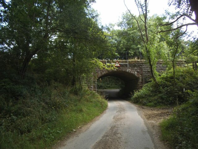
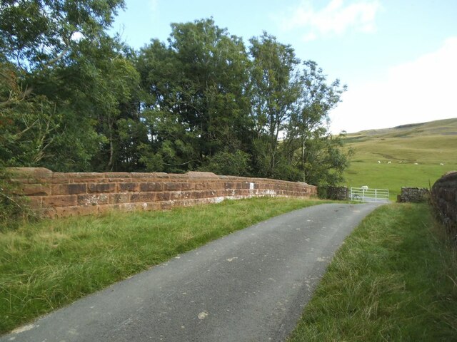
The Loups Images

Images are sourced within 2km of 54.319781/-2.5748515 or Grid Reference SD6291. Thanks to Geograph Open Source API. All images are credited.

Middleton Bridge, over the River Rawthey
The River Rawthey from Middleton Bridge
Track heading across a field
River Rawthey At Middleton Bridge.
River Rawthey
At Middleton Bridge.
Jordan Lane railway bridge The railway was the LMS route between the 'Little North Western' line at Clapham and their main line to Scotland at Lowgill, via Ingleton. The last passenger train ran in 1954 and the line was lifted around 1967. See <a href="https://www.geograph.org.uk/photo/3534909">SD6390 : Bridge of dismantled railway over Jordan Lane</a> for the other side.
Jordan Lane railway bridge
The railway was the LMS route between the 'Little North Western' line at Clapham and their main line to Scotland at Lowgill, via Ingleton. The last passenger train ran in 1954 and the line was lifted around 1967. See SD6390 : Bridge of dismantled railway over Jordan Lane for the other side.
Holme Farm Described as an 'open' farm in the sense that they run activities for the public, as well as a campsite. This track through the farmyard is also open in the sense of being a public bridleway.
Holme Farm
Described as an 'open' farm in the sense that they run activities for the public, as well as a campsite. This track through the farmyard is also open in the sense of being a public bridleway.
Railway formation north-east of Jordan Lane The railway was the LMS route between the 'Little North Western' line at Clapham and their main line to Scotland at Lowgill, via Ingleton. The last passenger train ran in 1954 and the line was lifted around 1967.
Railway formation north-east of Jordan Lane
The railway was the LMS route between the 'Little North Western' line at Clapham and their main line to Scotland at Lowgill, via Ingleton. The last passenger train ran in 1954 and the line was lifted around 1967.
Railway bridge, Jordan Lane The bridge carried the lane over the LMS route between the 'Little North Western' line at Clapham and their main line to Scotland at Lowgill, via Ingleton <a href="https://www.geograph.org.uk/photo/6984025">SD6390 : Railway formation north-east of Jordan Lane</a>. The last passenger train ran in 1954 and the line was lifted around 1967. Beyond the bridge, a gate gives access to an unfenced road across Holme Fell.
Railway bridge, Jordan Lane
The bridge carried the lane over the LMS route between the 'Little North Western' line at Clapham and their main line to Scotland at Lowgill, via Ingleton SD6390 : Railway formation north-east of Jordan Lane. The last passenger train ran in 1954 and the line was lifted around 1967. Beyond the bridge, a gate gives access to an unfenced road across Holme Fell.
River Lune at Killington New Bridge
Waterlogged Field in the Lune Valley
River Lune
River Lune
Lune Viaduct Lune Viaduct, Ingleton branch. The Ingleton branch left the Skipton - Lancaster line at Clapham Junction and ran through Ingleton, Kirkby Lonsdale & Sedburgh, joining what is now the WCML at Lowgill, south of Tebay. Had the Midland and the LNWR reached agreement before parliament forced the Midland to build the S&C, this would have been the Midland’s main line to Scotland. As it was, the Midland was ordered to follow through with its plans for the S&C, and the Ingleton branch operated for around a century as a country backwater and sometime diversionary route. The stone pillars are from the characteristic Cumbrian red Sandstone, the two sets of arches are linked with a cast iron span. Opened 1861, closed to passengers 1954 and closed outright 1967.
Lune Viaduct
Lune Viaduct, Ingleton branch. The Ingleton branch left the Skipton - Lancaster line at Clapham Junction and ran through Ingleton, Kirkby Lonsdale & Sedburgh, joining what is now the WCML at Lowgill, south of Tebay. Had the Midland and the LNWR reached agreement before parliament forced the Midland to build the S&C, this would have been the Midland’s main line to Scotland. As it was, the Midland was ordered to follow through with its plans for the S&C, and the Ingleton branch operated for around a century as a country backwater and sometime diversionary route. The stone pillars are from the characteristic Cumbrian red Sandstone, the two sets of arches are linked with a cast iron span. Opened 1861, closed to passengers 1954 and closed outright 1967.
Crossdale Beck Just a few hundred yards along the line from the Lune Viaduct, Crossdale Beck was crossed by the former North Western Railway's Ingleton Branch by culverting the stream and constructing a significant embankment on top.
Crossdale Beck
Just a few hundred yards along the line from the Lune Viaduct, Crossdale Beck was crossed by the former North Western Railway's Ingleton Branch by culverting the stream and constructing a significant embankment on top.
The road to High Branthwaite Branthwaite is in the valley of the River Lune, on the lower slopes of Winder in the Howgill Fells.
The road to High Branthwaite
Branthwaite is in the valley of the River Lune, on the lower slopes of Winder in the Howgill Fells.
Three sheep grazing Contented animals in a field on the north-east side of Howgill Lane near to Sedbergh.
Arant Haw is the hill beyond.
Three sheep grazing
Contented animals in a field on the north-east side of Howgill Lane near to Sedbergh. Arant Haw is the hill beyond.
The Lane to Ghyll Farm
Severely trimmed hedges bounding farm lane The lane is heading south towards the A683. It left the A684 as a bridleway at Ingmire Hall but shortly before reaching the next road it becomes one those ways known by the OS as an 'other route with public access'.
The hill rising in the distance will be Holme Knott.
Severely trimmed hedges bounding farm lane
The lane is heading south towards the A683. It left the A684 as a bridleway at Ingmire Hall but shortly before reaching the next road it becomes one those ways known by the OS as an 'other route with public access'. The hill rising in the distance will be Holme Knott.
Field with tree shadows The tree casting the shadows and bearing the twigs seen against the sky is on the north bank of the River Rawthey near to Sedbergh.
Winder is the hill in the distance.
Field with tree shadows
The tree casting the shadows and bearing the twigs seen against the sky is on the north bank of the River Rawthey near to Sedbergh. Winder is the hill in the distance.
Show me another place!

The Loups is located at Grid Ref: SD6291 (Lat: 54.319781, Lng: -2.5748515)

Division: West Riding

Administrative County: Cumbria

District: South Lakeland

Police Authority: Cumbria

What 3 Words

///devoured.oddly.churn. Near Sedbergh, Cumbria

Related Wikis

St Gregory's Church, Vale of Lune

St Gregory's Church, Vale of Lune, also known as the Vale of Lune Chapel, is a redundant Anglican church situated on the A684 road about 1.5 miles (2 km...

Ingmire Hall

Ingmire Hall is a grade II listed 16th century country house built around the remains of a pele tower some 2 miles west of Sedbergh, Cumbria, England.The...

Brigflatts Meeting House

Brigflatts Meeting House or Briggflatts Meeting House is a Friends Meeting House of the Religious Society of Friends (Quakers), near Sedbergh, Cumbria...

Sedbergh railway station

Sedbergh railway station was located in the West Riding of Yorkshire, serving the town and locale of Sedbergh on the Ingleton Branch Line. The town now...

River Rawthey

The River Rawthey is a river in Cumbria in northwest England. The headwaters of the Rawthey are at Rawthey Gill Foot, where Rawthey Gill meets Haskhaw...

River Dee, Cumbria

The River Dee is a river running through the extreme south east of Cumbria, a part of the Craven region traditionally part of the West Riding of Yorkshire...

Firbank

Firbank is a village and civil parish in the South Lakeland district of the English county of Cumbria. It has a population of 97. As Firbank had a population...

Sedbergh School

Sedbergh School is a public school (English private boarding and day school) in the town of Sedbergh in Cumbria, North West England. It comprises a junior...

Nearby Amenities

Located within 500m of 54.319781,-2.5748515
Barrier: stile
Lat/Long: 54.3223313/-2.5702743
Give Way
Direction: backward
Lat/Long: 54.3237968/-2.5740916
Hiking: yes
Image: https://www.geograph.org.uk/photo/5142820
Information: guidepost
Source: GPS survey
Tourism: information
Lat/Long: 54.3226558/-2.5699653
Hiking: yes
Information: guidepost
Source: GPS survey
Tourism: information
Lat/Long: 54.32068/-2.5710073
Hiking: yes
Information: guidepost
Source: GPS survey
Tourism: information
Lat/Long: 54.3204735/-2.5711253
Hiking: yes
Information: guidepost
Source: GPS survey
Tourism: information
Lat/Long: 54.3168604/-2.574977
Hiking: yes
Information: guidepost
Source: GPS survey
Tourism: information
Lat/Long: 54.315741/-2.5763986
Luneside
Image: https://www.geograph.org.uk/photo/3198733
Place: farm
Source Name: OS_OpenData_StreetView
Lat/Long: 54.3204446/-2.5713775
Power: pole
Lat/Long: 54.3221119/-2.5791113
Power: pole
Lat/Long: 54.3221178/-2.5801191
Power: pole
Lat/Long: 54.3223331/-2.5688805
Power: pole
Lat/Long: 54.3215384/-2.5700151
Power: pole
Lat/Long: 54.320764/-2.5713132
The data included in this document is from www.openstreetmap.org. The data is made available under ODbL.

Have you been to The Loups?

Leave your review of The Loups below (or comments, questions and feedback).