Browne's Pond

Lake, Pool, Pond, Freshwater Marsh in Somerset Sedgemoor

England

Browne's Pond

Carnival night With a very appropriate theme given the weather conditions, the 2005 Bridgwater Carnival entry from Sidvale Carnival club negotiates the Bath Bridge, where the A39 Bath Road crosses over the railway, during the 2005 Bridgwater carnival procession.
Carnival night Credit: Phil Williams

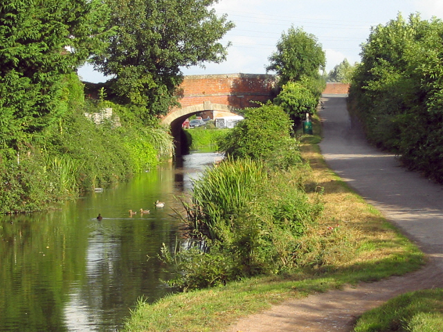
Browne's Pond, located in Somerset, is a serene and picturesque body of water that falls under the classification of a freshwater marsh. Spanning an area of approximately 10 acres, it is a relatively small and secluded pond, surrounded by lush vegetation and diverse wildlife.

The pond itself is home to an array of aquatic plants, such as lily pads and water lilies, which create a vibrant and serene atmosphere. Its calm and crystal-clear waters serve as a habitat for various species of fish, including bass, trout, and catfish, making it a popular spot for fishing enthusiasts.

Surrounding the pond, a dense growth of trees and shrubs provides a natural barrier, ensuring privacy and tranquility for visitors. Numerous hiking trails wind through the area, offering opportunities for nature lovers to explore the surrounding woodland and observe the diverse bird species that frequent the pond.

Browne's Pond is also a favorite destination for birdwatchers, as it attracts a wide variety of migratory birds throughout the year. Visitors may spot species such as herons, ducks, and geese, adding to the pond's natural charm.

The pond's location, away from the hustle and bustle of urban life, makes it an ideal retreat for those seeking solace and a connection with nature. Whether it be fishing, birdwatching, or simply enjoying the serene beauty of the marsh, Browne's Pond offers a peaceful and enchanting escape for all who visit.

If you have any feedback on the listing, please let us know in the comments section below.

Browne's Pond Images

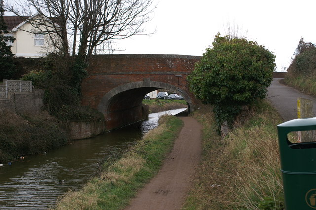
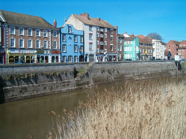
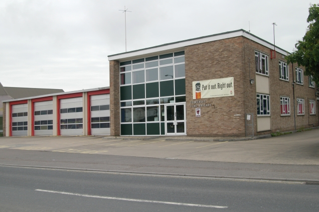
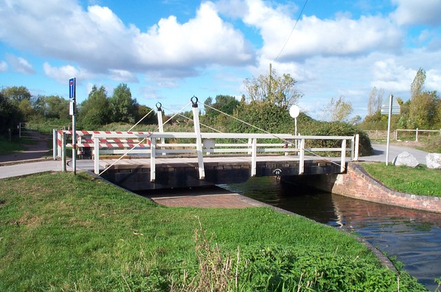
Images are sourced within 2km of 51.123093/-3.0025493 or Grid Reference ST2936. Thanks to Geograph Open Source API. All images are credited.

Carnival night With a very appropriate theme given the weather conditions, the 2005 Bridgwater Carnival entry from Sidvale Carnival club negotiates the Bath Bridge, where the A39 Bath Road crosses over the railway, during the 2005 Bridgwater carnival procession.
Carnival night
With a very appropriate theme given the weather conditions, the 2005 Bridgwater Carnival entry from Sidvale Carnival club negotiates the Bath Bridge, where the A39 Bath Road crosses over the railway, during the 2005 Bridgwater carnival procession.
Riverside Business Park, Bridgwater
Shops Parkway shops and Post Office, Sydenham, Bridgwater
Shops
Parkway shops and Post Office, Sydenham, Bridgwater
Pig & Whistle Pub On the Parkway, Sydenham, Bridgwater
Pig & Whistle Pub
On the Parkway, Sydenham, Bridgwater
Bridgwater & Taunton Canal Bridge is A38
Bridgwater & Taunton Canal
Bridge is A38
West Quay and the River Parrett Looking across the River Parrett from the eastern end of the town bridge to West Quay. The River Parrett has a considerable tidal range and a tidal gauge can be seen to the right of the view. The buildings have a Dutch look about them and were influenced by settlers from Holland who came to the town in its past. The site of Bridgwater Castle - destroyed by Cromwell - lies behind the pale green building. The only remnants of the castle are its Watergate and part of its curtain wall, neither visible in this view.
West Quay and the River Parrett
Looking across the River Parrett from the eastern end of the town bridge to West Quay. The River Parrett has a considerable tidal range and a tidal gauge can be seen to the right of the view. The buildings have a Dutch look about them and were influenced by settlers from Holland who came to the town in its past. The site of Bridgwater Castle - destroyed by Cromwell - lies behind the pale green building. The only remnants of the castle are its Watergate and part of its curtain wall, neither visible in this view.
Bridgwater Fire Station Bridgwater Fire Station, Salmon Parade, Bridgwater, Somerset.
Bridgwater Fire Station
Bridgwater Fire Station, Salmon Parade, Bridgwater, Somerset.
Crossways Swing Bridge at Huntworth Crossing the Bridgwater and Taunton Canal.
Crossways Swing Bridge at Huntworth
Crossing the Bridgwater and Taunton Canal.
The Huntworth Motorway Viaduct on the M5 The viaduct crosses a canal, river and railway.The bungalow used to be just off a quiet lane by the canal. The area under the viaduct is used for storing caravans.
The Huntworth Motorway Viaduct on the M5
The viaduct crosses a canal, river and railway.The bungalow used to be just off a quiet lane by the canal. The area under the viaduct is used for storing caravans.
Intercity train and the Huntworth M5 Motorway Viaduct A Virgin Cross-Country train has just come underneath the motorway.
Intercity train and the Huntworth M5 Motorway Viaduct
A Virgin Cross-Country train has just come underneath the motorway.
The Hope Inn Built in 1930, this large public house stands on the Taunton Road in Bridgwater and was the scene of the photographer's first stag night party in 1987.
The Hope Inn
Built in 1930, this large public house stands on the Taunton Road in Bridgwater and was the scene of the photographer's first stag night party in 1987.
Fire at Bigwood and Staple (disused printworks) The semi-derelict building was destroyed by the fire, and was demolished soon after the fire.  The road was closed for over a week, because the damaged building was considered unsafe.
Fire at Bigwood and Staple (disused printworks)
The semi-derelict building was destroyed by the fire, and was demolished soon after the fire. The road was closed for over a week, because the damaged building was considered unsafe.
Bridgwater Town Bridge The River Parrett entering Bridgwater from the south, with West Quay beyond the bridge.
Bridgwater Town Bridge
The River Parrett entering Bridgwater from the south, with West Quay beyond the bridge.
Bridgwater and Taunton Canal Bridge over the A38 Taunton Road, Bridgwater
Bridgwater and Taunton Canal
Bridge over the A38 Taunton Road, Bridgwater
Bridgwater Railway Station (1841) Designed by Isambard Kingdom Brunel and regarded as one of the best surviving GWR stations.
Bridgwater Railway Station (1841)
Designed by Isambard Kingdom Brunel and regarded as one of the best surviving GWR stations.
Bridgwater Railway Station (1841) Designed by Isambard Kingdom Brunel and regarded as one of the best surviving GWR stations. On the Taunton to Bristol line.
Bridgwater Railway Station (1841)
Designed by Isambard Kingdom Brunel and regarded as one of the best surviving GWR stations. On the Taunton to Bristol line.
Pill box near Bridgwater Station There's one at each end of this bridge, where the A372 crosses the railway. Part of the 'Taunton Stop Line', intended to halt any German advance into the West Country.
Pill box near Bridgwater Station
There's one at each end of this bridge, where the A372 crosses the railway. Part of the 'Taunton Stop Line', intended to halt any German advance into the West Country.
Corner of Eastover and East Quay Looking down towards the Taxi rank
Corner of Eastover and East Quay
Looking down towards the Taxi rank
Show me another place!

Browne's Pond is located at Grid Ref: ST2936 (Lat: 51.123093, Lng: -3.0025493)

Administrative County: Somerset

District: Sedgemoor

Police Authority: Avon and Somerset

What 3 Words

///detail.cracks.luck. Near Bridgwater, Somerset

Related Wikis

Robert Blake School

Robert Blake School, formerly Robert Blake Science College, is a mixed secondary school in Bridgwater, Somerset, England.The school, which was established...

Bridgwater Friary

Bridgwater Friary was a Franciscan monastery in Bridgwater, Somerset, England, established in 1245 and dissolved in 1538. It was founded by William Briwere...

Bridgwater Town Mill

The Bridgwater Town Mill is at the end of Blake Street, Bridgwater, England, next to the Blake Museum. It is fed by the Durleigh Brook, which discharges...

Blake Museum

The Blake Museum is in Bridgwater, Somerset, England at what is believed to be the birthplace of Robert Blake, General at Sea (1598–1657). Since April...

Nearby Amenities

Located within 500m of 51.123093,-3.0025493
Crossing
Bicycle: yes
Crossing Island: yes
Crossing Ref: pelican
Lat/Long: 51.1259191/-3.0014209
Crossing
Bicycle: yes
Crossing Island: yes
Crossing Ref: pelican
Lat/Long: 51.1254419/-3.0045779
Crossing
Bicycle: yes
Crossing Island: yes
Crossing Ref: pelican
Lat/Long: 51.1259121/-3.0019288
Crossing
Bicycle: yes
Crossing Island: yes
Crossing Ref: pelican
Lat/Long: 51.1258219/-3.0018326
Mini Roundabout
Direction: clockwise
Lat/Long: 51.1271839/-3.0029306
Traffic Signals
Traffic Signals: signal
Traffic Signals Direction: forward
Lat/Long: 51.1256545/-3.0042435
Brand: National Grid
Brand Wikidata: Q1465461
Colour: gray
Line Management: transition
Location Transition: yes
Material: metal
Operator: National Grid Electricity Distribution
Operator Old: Western Power Distribution
Operator Wikidata: Q7988183
Owner: National Grid Electricity Distribution (South West) Plc
Owner Wikidata: Q114397866
Power: tower
Structure: lattice
Lat/Long: 51.1223491/-2.9974348
Crossing
Bicycle: yes
Crossing Island: yes
Crossing Ref: pelican
Lat/Long: 51.1255227/-3.0044305
Crossing
Crossing: uncontrolled
Lat/Long: 51.1249353/-3.0042305
Crossing
Crossing: uncontrolled
Lat/Long: 51.1249562/-3.0044356
Post Box
Brand: Royal Mail
Collection Times: Mo-Fr 18:00; Sa 13:30
Operator: Royal Mail
Operator Wikidata: Q638098
Post Box Apertures: 2
Post Box Type: wall
Ref: TA6 801
Royal Cypher: no
Source: survey
Survey Date: 2017-03-15
Lat/Long: 51.1265898/-3.0044143
Post Box
Collection Times: Mo-Fr 09:00; Sa 07:00
Operator: Royal Mail
Operator Wikidata: Q638098
Post Box Type: wall
Ref: TA6 59D
Royal Cypher: GVIR
Royal Cypher Wikidata: Q33102169
Source: survey
Survey Date: 2017-03-15
Lat/Long: 51.1268386/-2.9987101
Crossing
Crossing: uncontrolled
Lat/Long: 51.124937/-3.0050572
Crossing
Crossing: uncontrolled
Lat/Long: 51.1250357/-3.0046283
Crossing
Crossing: uncontrolled
Lat/Long: 51.1247723/-3.0026927
Crossing
Crossing: uncontrolled
Lat/Long: 51.1255639/-3.0036281
Crossing
Crossing: uncontrolled
Lat/Long: 51.1255987/-3.002339
Crossing
Bicycle: yes
Crossing Island: yes
Crossing Ref: pelican
Lat/Long: 51.1257227/-3.001592
Barrier: bollard
Bicycle: yes
Foot: yes
Motorcycle: yes
Lat/Long: 51.1259936/-3.0008501
Crossing
Bicycle: yes
Crossing Island: yes
Crossing Ref: pelican
Lat/Long: 51.1260194/-3.0014443
Crossing
Bicycle: yes
Crossing Island: yes
Crossing Ref: pelican
Lat/Long: 51.1260868/-3.001773
Barrier: entrance
Bicycle: yes
Foot: yes
Lat/Long: 51.1266659/-3.0042906
Crossing
Bicycle: yes
Crossing Island: yes
Crossing Ref: pelican
Lat/Long: 51.1257802/-3.0014761
Traffic Signals
Traffic Signals: signal
Lat/Long: 51.1258506/-3.001591
Traffic Signals
Traffic Signals: signal
Lat/Long: 51.1259396/-3.0016733
Traffic Signals
Bicycle: yes
Crossing: traffic_signals
Crossing Ref: puffin
Lat/Long: 51.1207252/-2.9991085
Barrier: stile
Bicycle: yes
Foot: yes
Lat/Long: 51.1239528/-3.0065666
Post Box
Indoor: yes
Operator: Royal Mail
Operator Wikidata: Q638098
Post Box Type: pillar
Ref: TA6 711
Lat/Long: 51.1247297/-3.0029532
Bus Stop
St Mary Street (N bound)
Bench: no
Bus: yes
Naptan AtcoCode: 3600SOA56510
Naptan NaptanCode: sotdmpmj
Public Transport: platform
Shelter: no
Tactile Paving: no
Lat/Long: 51.1266441/-3.0022845
Post Box
Operator: Royal Mail
Operator Wikidata: Q638098
Post Box Type: pillar
Ref: TA6 903
Royal Cypher: EIIR
Royal Cypher Wikidata: Q33102113
Lat/Long: 51.1212185/-2.9993862
Bus Stop
Bridgwater National Tyres (N bound)
Bench: no
Bus: yes
Naptan AtcoCode: 3600SOA10378
Naptan NaptanCode: sotampwd
Network: The Buses of Somerset
Network Wikidata: Q17018973
Operator: First South West
Operator Wikidata: Q5454172
Public Transport: platform
Ref: B1
Shelter: yes
Tactile Paving: no
Lat/Long: 51.1201719/-2.9990462
Telephone
Booth: KX100
Covered: booth
Operator: BT
Operator Wikidata: Q593786
Lat/Long: 51.1204301/-2.9992427
Atm
Opening Hours: 24/7
Wheelchair: yes
Lat/Long: 51.120608/-2.9988807
Barrier: bollard
Bicycle: yes
Foot: yes
Material: wood
Lat/Long: 51.122051/-2.9976956
Traffic Signals
Traffic Signals: signal
Traffic Signals Direction: forward
Lat/Long: 51.1256662/-3.0047453
Traffic Signals
Traffic Signals: signal
Traffic Signals Direction: forward
Lat/Long: 51.1254186/-3.00457
Somerset Space Walk - Pluto
Artist Name: Pip Youngman
Artwork Type: sculpture
Tourism: artwork
Lat/Long: 51.1242605/-3.0073263
Post Office
Taunton Road Post Office
Addr City: Bridgwater
Addr Country: GB
Addr County: Somerset
Addr Housenumber: 135
Addr Postcode: TA6 6BD
Addr Street: Taunton Road
Brand: Post Office
Brand Wikidata: Q1783168
Contact Website: https://www.postoffice.co.uk/branch-finder/4405498/taunton-road
Opening Hours: Mo-Su 06:00-23:00
Operator: Post Office Ltd
Ref Pol Id: 147962
Lat/Long: 51.1205989/-2.9988115
Millennium Milepost Bridgwater
Description: 1) Taunton 14 2) Bridgewater town Centre 0.25
Image: https://www.cyclestreets.net/location/194708/cyclestreets194708-size640.jpg
Information: guidepost
Ncn Milepost: mccoll
Sustrans Ref: MP 704
Tourism: information
Lat/Long: 51.1269688/-3.0000413
Cafe
The Purple Spoon
Lat/Long: 51.1243712/-3.0068694
Entrance: main
Lat/Long: 51.1247472/-3.0028966
Leisure: slipway
Lat/Long: 51.1242387/-3.007124
Parcel Locker
Brand: InPost
Brand Wikidata: Q3182097
Opening Hours: 24/7
Operator: InPost
Parcel Mail In: yes
Parcel Pickup: yes
Lat/Long: 51.1247464/-3.0030339
Bus Stop
Hope Inn
Bus: yes
Direction: 340
Naptan AtcoCode: 3600SOA10361
Naptan Bearing: N
Naptan CommonName: Hope Inn
Naptan Indicator: N-bound
Naptan NaptanCode: sotamptj
Naptan PlusbusZoneRef: BRDGWTR
Naptan Street: Taunton Road
Naptan Verified: no
Network: The Buses of Somerset
Network Wikidata: Q17018973
Operator: First South West
Operator Wikidata: Q5454172
Public Transport: platform
Ref: B1;21;21A
Lat/Long: 51.1221905/-2.9998135
Bus Stop
Hope Inn
Bus: yes
Direction: 160
Naptan AtcoCode: 3600SOA10360
Naptan Bearing: SE
Naptan CommonName: Hope Inn
Naptan Indicator: SE-bound
Naptan NaptanCode: sotamptm
Naptan PlusbusZoneRef: BRDGWTR
Naptan Verified: no
Network: The Buses of Somerset
Network Wikidata: Q17018973
Operator: First South West
Operator Wikidata: Q5454172
Public Transport: platform
Ref: B1;21;21A
Lat/Long: 51.1224836/-2.9998599
Addr City: Bridgwater
Addr Country: GB
Addr County: Somerset
Addr Flats: 1-28
Addr Housename: La Ciotat House
Addr Postcode: TA6 3SA
Addr Street: Old Taunton Road
Building Flats: 28
Lat/Long: 51.1249324/-2.9985766
Addr City: Bridgwater
Addr Country: GB
Addr County: Somerset
Addr Flats: 29-58
Addr Housename: La Ciotat House
Addr Postcode: TA6 3SB
Addr Street: Old Taunton Road
Building Flats: 30
Lat/Long: 51.1246932/-2.9984552
Addr City: Bridgwater
Addr Country: GB
Addr County: Somerset
Addr Flats: 59-81
Addr Housename: La Ciotat House
Addr Postcode: TA6 3SD
Addr Street: Old Taunton Road
Building Flats: 23
Lat/Long: 51.1243993/-2.9984488
The data included in this document is from www.openstreetmap.org. The data is made available under ODbL.

Have you been to Browne's Pond?

Leave your review of Browne's Pond below (or comments, questions and feedback).