Goring Heath

Settlement in Oxfordshire South Oxfordshire

England

Goring Heath

B4526, Cray's Pond
B4526, Cray's Pond Credit: JThomas

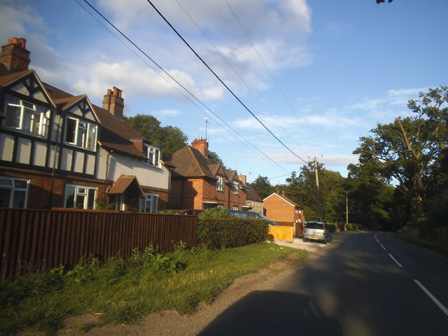
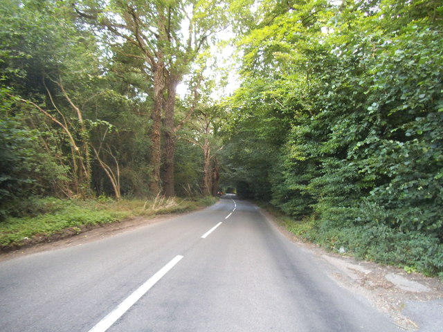
Goring Heath is a small village located in the county of Oxfordshire, England. Situated about 7 miles southwest of the town of Reading, it lies within the Chiltern Hills Area of Outstanding Natural Beauty. The village is primarily rural in nature, characterized by rolling hills, open fields, and scenic woodlands.

Historically, Goring Heath was an agricultural community, with farming being the main occupation of its residents. Today, it retains much of its rural charm and tranquility, making it an attractive place for those seeking a peaceful countryside setting.

The village is home to a relatively small population, with a close-knit community that fosters a strong sense of belonging. It boasts a village hall, which serves as a hub for various community activities and events. In addition, there is a church, St. John the Baptist, which dates back to the 12th century and holds regular services.

Goring Heath offers ample opportunities for outdoor pursuits, such as walking, cycling, and horse riding, thanks to its picturesque surroundings. The nearby Chiltern Hills provide numerous trails and pathways for nature enthusiasts to explore, offering breathtaking views of the countryside.

While Goring Heath may lack the amenities of larger towns, its proximity to Reading ensures easy access to a wider range of services, including shopping centers, schools, and healthcare facilities.

Overall, Goring Heath is a charming village that offers a peaceful and idyllic lifestyle amidst the natural beauty of Oxfordshire's countryside.

If you have any feedback on the listing, please let us know in the comments section below.

Goring Heath Images

Images are sourced within 2km of 51.510889/-1.05797 or Grid Reference SU6579. Thanks to Geograph Open Source API. All images are credited.

B4526, Cray's Pond
B4526, Cray's Pond
Greenmoor hill views
Direction Sign – Signpost on Hardwick Road, Whitchurch-on-Thames Located on the southwest side of the junction of Hardwick Road, Sheepwash Lane and a bridleway to Mapledurham, in Whitchurch-on-Thames parish. 3 arms and pawn finial. See also <a title="https://www.geograph.org.uk/photo/2182449" href="https://www.geograph.org.uk/photo/2182449">Link</a>.

Milestone Society National ID: OX_SU6577
Direction Sign – Signpost on Hardwick Road, Whitchurch-on-Thames
Located on the southwest side of the junction of Hardwick Road, Sheepwash Lane and a bridleway to Mapledurham, in Whitchurch-on-Thames parish. 3 arms and pawn finial. See also Link. Milestone Society National ID: OX_SU6577
 St John the Baptist Church, Whitchurch Hill
St John the Baptist Church, Whitchurch Hill
Grazing and woodland, Whitchurch Hill
B471, Whitchurch Hill Heading north towards Woodcote.
B471, Whitchurch Hill
Heading north towards Woodcote.
Elizabeth II postbox, Whitchurch Hill Postbox No. RG8 216.
Elizabeth II postbox, Whitchurch Hill
Postbox No. RG8 216.
Pumpkins by the Greenhouse Back after a couple of years off due to covid, the Tolhurst Organic Farm Squash & Pumpkin Festival was back this year. 
So many pumpkins.
This lot is by one of the old greenhouses which were once part of the Hardwick Hall kitchen garden.
The OS map still marks it with the crosshatch Greenhouse symbol.
Pumpkins by the Greenhouse
Back after a couple of years off due to covid, the Tolhurst Organic Farm Squash & Pumpkin Festival was back this year. So many pumpkins. This lot is by one of the old greenhouses which were once part of the Hardwick Hall kitchen garden. The OS map still marks it with the crosshatch Greenhouse symbol.
Squash & Pumpkin Festival, 2022 After a couple of years off due to covid, the Tolhurst Organic Farm Squash & Pumpkin Festival was back this year. 
We are in the old kitchen garden next to Hardwick Hall for the festival, but the farm covers several nearby fields.
Not just for Halloween, all these varieties are good to eat. Some better than others, but that's vegetables for you.
Squash & Pumpkin Festival, 2022
After a couple of years off due to covid, the Tolhurst Organic Farm Squash & Pumpkin Festival was back this year. We are in the old kitchen garden next to Hardwick Hall for the festival, but the farm covers several nearby fields. Not just for Halloween, all these varieties are good to eat. Some better than others, but that's vegetables for you.
The A4074 at the junction of Deadman's Lane
Long Toll at the junction of the B4256
Woodland by the A4074, Cane End
Long Toll at the junction of the B4256
The B4526, Goring Heath
Reading Road, Cane End
Deadman's Lane, Cane End
Long Toll at the junction of Goring Road
The King Charles Head, Goring Heath, Oxfordshire The history of this building from pub to private house can be seen here <a href="https://www.geograph.org.uk/photo/26752">SU6678 : Gutteridge Wood and The King Charles Head between Nunney Wood and Collins End</a>and here <a href="https://www.geograph.org.uk/photo/1166729">SU6678 : The King Charles Head</a>.
The King Charles Head, Goring Heath, Oxfordshire
The history of this building from pub to private house can be seen here SU6678 : Gutteridge Wood and The King Charles Head between Nunney Wood and Collins Endand here SU6678 : The King Charles Head.
Show me another place!

Goring Heath is located at Grid Ref: SU6579 (Lat: 51.510889, Lng: -1.05797)

Administrative County: Oxfordshire

District: South Oxfordshire

Police Authority: Thames Valley

What 3 Words

///brink.explains.reminder. Near Pangbourne, Berkshire

Related Wikis

Whitchurch Hill

Whitchurch Hill is a village in the Chiltern Hills in Oxfordshire, about 5.5 miles (9 km) northwest of Reading, Berkshire, near Whitchurch-on-Thames. The...

The Oratory Preparatory School

The Oratory Prep School is a Roman Catholic day and boarding school for some 330 boys and girls aged from two to thirteen, founded in 1925. The school...

Hardwick House, Oxfordshire

Hardwick House is a Tudor house on the banks of the River Thames on a slight rise at Whitchurch-on-Thames in the English county of Oxfordshire. It is reputed...

Crays Pond

Crays Pond is a hamlet situated in the parish of Goring Heath in South Oxfordshire. Crays Pond is about 2.4 miles (3.9 km) northeast of Goring-on-Thames...

Goring Rural District

Goring was a rural district in Oxfordshire, England from 1894 to 1932. It was formed from that part of the Bradfield rural sanitary district which was...

Exlade Street

Exlade Street is a hamlet in Checkendon civil parish in Oxfordshire, about 6 miles (9.7 km) northwest of Reading, in the Chiltern Hills. The hamlet is...

Hook End Recording Studios

Hook End Recording Studios was a recording studio located in Hook End Manor, a 16th-century Elizabethan house near Checkendon, Oxfordshire, England. Its...

The Oratory School

The Oratory School () is an HMC co-educational private Roman Catholic boarding and day school for pupils aged 11–18 located in Woodcote, 6 miles (9.7 km...

Nearby Amenities

Located within 500m of 51.510889,-1.05797
Bus Stop
Old Post Office
Bus: yes
Naptan AtcoCode: 340000347PO
Naptan Bearing: SW
Naptan CommonName: Old Post Office
Naptan Indicator: o/s Bus Shelter
Naptan Landmark: Bus Shelter
Naptan NaptanCode: oxfamagp
Naptan Street: Deadmans Lane
Naptan Verified: no
Public Transport: platform
Source: naptan_import
Lat/Long: 51.5078875/-1.0534019
Goring Heath
Place: hamlet
Lat/Long: 51.5076296/-1.0536513
Bus Stop
Old Post Office
Bus: yes
Naptan AtcoCode: 340001611HOS
Naptan Bearing: NE
Naptan CommonName: Old Post Office
Naptan Indicator: Opp Bus Shelter
Naptan Landmark: Bus Shelter
Naptan NaptanCode: oxfgdwjg
Naptan Notes: Timetable case only
Naptan Street: Deadmans Lane
Naptan Verified: no
Public Transport: platform
Source: naptan_import
Lat/Long: 51.5079617/-1.0533001
Barrier: kissing_gate
Foot: yes
Lat/Long: 51.5074263/-1.0563636
Barrier: kissing_gate
Foot: yes
Lat/Long: 51.5092817/-1.0595095
Direction: 165
Fixme: survey for panel count
Generator Method: photovoltaic
Generator Output Electricity: yes
Generator Solar Modules: 9
Generator Source: solar
Generator Type: solar_photovoltaic_panel
Location: roof
Power: generator
Lat/Long: 51.5076372/-1.0536509
Direction: 165
Fixme: survey for panel count
Generator Method: photovoltaic
Generator Output Electricity: yes
Generator Solar Modules: 8
Generator Source: solar
Generator Type: solar_photovoltaic_panel
Location: roof
Power: generator
Lat/Long: 51.5076103/-1.0537108
Direction: 180
Generator Method: photovoltaic
Generator Output Electricity: yes
Generator Solar Modules: 32
Generator Source: solar
Generator Type: solar_photovoltaic_panel
Location: roof
Power: generator
Lat/Long: 51.5112881/-1.0601335
Direction: 180
Fixme: survey for panel count
Generator Method: photovoltaic
Generator Output Electricity: yes
Generator Solar Modules: 14
Generator Source: solar
Generator Type: solar_photovoltaic_panel
Location: roof
Power: generator
Lat/Long: 51.5101704/-1.0631825
Direction: 90
Fixme: survey for panel count
Generator Method: photovoltaic
Generator Output Electricity: yes
Generator Solar Modules: 5
Generator Source: solar
Generator Type: solar_photovoltaic_panel
Location: roof
Power: generator
Lat/Long: 51.5102505/-1.0631551
Direction: 270
Fixme: survey for panel count
Generator Method: photovoltaic
Generator Output Electricity: yes
Generator Solar Modules: 5
Generator Source: solar
Generator Type: solar_photovoltaic_panel
Location: roof
Power: generator
Lat/Long: 51.5102508/-1.0631964
The data included in this document is from www.openstreetmap.org. The data is made available under ODbL.

Have you been to Goring Heath?

Leave your review of Goring Heath below (or comments, questions and feedback).