Ladygrove Shaw

Wood, Forest in Oxfordshire South Oxfordshire

England

Ladygrove Shaw

K6 telephone box and bus shelter, Cray's Pond
K6 telephone box and bus shelter, Cray's Pond Credit: JThomas

Ladygrove Shaw is a dense woodland located in Oxfordshire, England. Situated within the larger area of Ladygrove, this forested area covers approximately 100 acres and is renowned for its natural beauty and diverse ecosystem.

The woodland is characterized by a mix of broadleaf and coniferous trees, including oak, beech, ash, and pine. The dense canopy of foliage provides a tranquil and shaded atmosphere, making it a popular destination for nature enthusiasts and walkers.

Ladygrove Shaw is home to a wide range of wildlife, including various bird species, squirrels, foxes, and rabbits. The forest floor is adorned with vibrant wildflowers, ferns, and mosses, creating a picturesque setting.

The woodland offers several walking trails, allowing visitors to explore the forest at their leisure. These trails are well-maintained and marked, ensuring easy navigation. Along the paths, benches and picnic areas are scattered, providing opportunities for visitors to rest and enjoy the peaceful surroundings.

Ladygrove Shaw is also known for its rich history. It has been an important site for centuries and has witnessed various human activities over time. It is believed that the woodland was once used for timber production and charcoal making. Historical artifacts have also been discovered in the area, indicating human habitation dating back to medieval times.

Overall, Ladygrove Shaw in Oxfordshire is a captivating woodland, offering a serene escape from the bustling city life. With its diverse flora and fauna, well-defined trails, and historical significance, it presents a perfect opportunity for nature lovers and history enthusiasts to immerse themselves in the natural beauty of Oxfordshire.

If you have any feedback on the listing, please let us know in the comments section below.

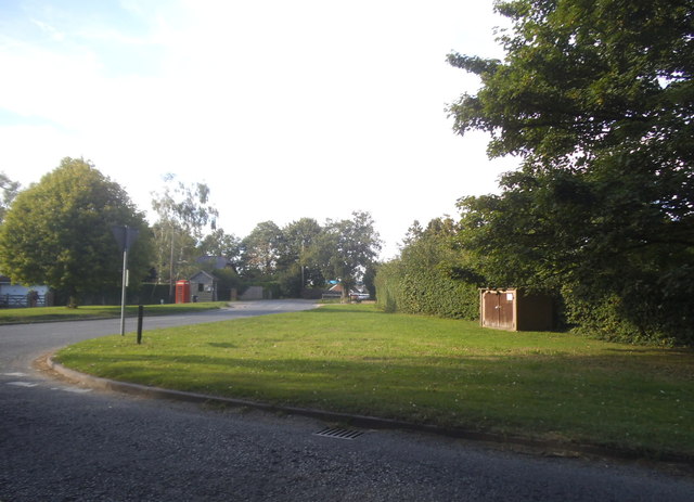
Ladygrove Shaw Images

Images are sourced within 2km of 51.511372/-1.0590724 or Grid Reference SU6579. Thanks to Geograph Open Source API. All images are credited.

K6 telephone box and bus shelter, Cray's Pond
Bus shelter on the B4256, Cray's Pond
B4526, Cray's Pond
B4526, Cray's Pond
The White Lion, Cray's Pond Not currently open (2022).
See <a href="https://www.geograph.org.uk/photo/2829589">SU6380 : The White Lion, Crays Pond</a> for happier times.
The White Lion, Cray's Pond
Not currently open (2022). See SU6380 : The White Lion, Crays Pond for happier times.
Garage and car sales, Cray's Pond
Greenmoor hill views
Direction Sign – Signpost on Hardwick Road, Whitchurch-on-Thames Located on the southwest side of the junction of Hardwick Road, Sheepwash Lane and a bridleway to Mapledurham, in Whitchurch-on-Thames parish. 3 arms and pawn finial. See also <a title="https://www.geograph.org.uk/photo/2182449" href="https://www.geograph.org.uk/photo/2182449">Link</a>.

Milestone Society National ID: OX_SU6577
Direction Sign – Signpost on Hardwick Road, Whitchurch-on-Thames
Located on the southwest side of the junction of Hardwick Road, Sheepwash Lane and a bridleway to Mapledurham, in Whitchurch-on-Thames parish. 3 arms and pawn finial. See also Link. Milestone Society National ID: OX_SU6577
 St John the Baptist Church, Whitchurch Hill
St John the Baptist Church, Whitchurch Hill
Grazing and woodland, Whitchurch Hill
B471, Whitchurch Hill Heading north towards Woodcote.
B471, Whitchurch Hill
Heading north towards Woodcote.
Elizabeth II postbox, Whitchurch Hill Postbox No. RG8 216.
Elizabeth II postbox, Whitchurch Hill
Postbox No. RG8 216.
Pumpkins by the Greenhouse Back after a couple of years off due to covid, the Tolhurst Organic Farm Squash & Pumpkin Festival was back this year. 
So many pumpkins.
This lot is by one of the old greenhouses which were once part of the Hardwick Hall kitchen garden.
The OS map still marks it with the crosshatch Greenhouse symbol.
Pumpkins by the Greenhouse
Back after a couple of years off due to covid, the Tolhurst Organic Farm Squash & Pumpkin Festival was back this year. So many pumpkins. This lot is by one of the old greenhouses which were once part of the Hardwick Hall kitchen garden. The OS map still marks it with the crosshatch Greenhouse symbol.
Squash & Pumpkin Festival, 2022 After a couple of years off due to covid, the Tolhurst Organic Farm Squash & Pumpkin Festival was back this year. 
We are in the old kitchen garden next to Hardwick Hall for the festival, but the farm covers several nearby fields.
Not just for Halloween, all these varieties are good to eat. Some better than others, but that's vegetables for you.
Squash & Pumpkin Festival, 2022
After a couple of years off due to covid, the Tolhurst Organic Farm Squash & Pumpkin Festival was back this year. We are in the old kitchen garden next to Hardwick Hall for the festival, but the farm covers several nearby fields. Not just for Halloween, all these varieties are good to eat. Some better than others, but that's vegetables for you.
The A4074 at the junction of Deadman's Lane
Long Toll at the junction of the B4256
Goring Road from the B4526
Woodland by the A4074, Cane End
Long Toll at the junction of the B4256
Show me another place!

Ladygrove Shaw is located at Grid Ref: SU6579 (Lat: 51.511372, Lng: -1.0590724)

Administrative County: Oxfordshire

District: South Oxfordshire

Police Authority: Thames Valley

What 3 Words

///noun.clarifies.helpers. Near Pangbourne, Berkshire

Related Wikis

Whitchurch Hill

Whitchurch Hill is a village in the Chiltern Hills in Oxfordshire, about 5.5 miles (9 km) northwest of Reading, Berkshire, near Whitchurch-on-Thames. The...

The Oratory Preparatory School

The Oratory Prep School is a Roman Catholic day and boarding school for some 330 boys and girls aged from two to thirteen, founded in 1925. The school...

Hardwick House, Oxfordshire

Hardwick House is a Tudor house on the banks of the River Thames on a slight rise at Whitchurch-on-Thames in the English county of Oxfordshire. It is reputed...

Crays Pond

Crays Pond is a hamlet situated in the parish of Goring Heath in South Oxfordshire. Crays Pond is about 2.4 miles (3.9 km) northeast of Goring-on-Thames...

Goring Rural District

Goring was a rural district in Oxfordshire, England from 1894 to 1932. It was formed from that part of the Bradfield rural sanitary district which was...

Exlade Street

Exlade Street is a hamlet in Checkendon civil parish in Oxfordshire, about 6 miles (9.7 km) northwest of Reading, in the Chiltern Hills. The hamlet is...

The Oratory School

The Oratory School () is an HMC co-educational private Roman Catholic boarding and day school for pupils aged 11–18 located in Woodcote, 6 miles (9.7 km...

Hook End Recording Studios

Hook End Recording Studios was a recording studio located in Hook End Manor, a 16th-century Elizabethan house near Checkendon, Oxfordshire, England. Its...

Nearby Amenities

Located within 500m of 51.511372,-1.0590724
Barrier: kissing_gate
Foot: yes
Lat/Long: 51.5074263/-1.0563636
Barrier: kissing_gate
Foot: yes
Lat/Long: 51.5092817/-1.0595095
Direction: 180
Generator Method: photovoltaic
Generator Output Electricity: yes
Generator Solar Modules: 32
Generator Source: solar
Generator Type: solar_photovoltaic_panel
Location: roof
Power: generator
Lat/Long: 51.5112881/-1.0601335
Direction: 180
Fixme: survey for panel count
Generator Method: photovoltaic
Generator Output Electricity: yes
Generator Solar Modules: 14
Generator Source: solar
Generator Type: solar_photovoltaic_panel
Location: roof
Power: generator
Lat/Long: 51.5101704/-1.0631825
Direction: 90
Fixme: survey for panel count
Generator Method: photovoltaic
Generator Output Electricity: yes
Generator Solar Modules: 5
Generator Source: solar
Generator Type: solar_photovoltaic_panel
Location: roof
Power: generator
Lat/Long: 51.5102505/-1.0631551
Direction: 270
Fixme: survey for panel count
Generator Method: photovoltaic
Generator Output Electricity: yes
Generator Solar Modules: 5
Generator Source: solar
Generator Type: solar_photovoltaic_panel
Location: roof
Power: generator
Lat/Long: 51.5102508/-1.0631964
The data included in this document is from www.openstreetmap.org. The data is made available under ODbL.

Have you been to Ladygrove Shaw?

Leave your review of Ladygrove Shaw below (or comments, questions and feedback).