Fox Covert
Wood, Forest in Nottinghamshire Bassetlaw
England
Fox Covert

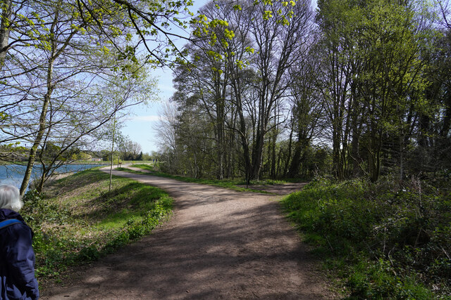
Fox Covert is a woodland area located in Nottinghamshire, England. Situated within the larger Sherwood Forest, it covers an approximate area of 500 acres and is known for its rich biodiversity and natural beauty.
The woodland is characterized by a mix of deciduous and coniferous trees, including oak, beech, pine, and birch, providing a diverse and vibrant habitat for numerous plant and animal species. The forest floor is adorned with a carpet of bluebells during the spring season, adding a touch of color to the serene surroundings.
Fox Covert is a popular destination for nature enthusiasts, hikers, and birdwatchers. The woodland is home to a variety of bird species, including great spotted woodpeckers, tawny owls, and buzzards. Visitors may also catch a glimpse of mammals such as foxes, badgers, and deer that roam freely within the area.
The woodland offers several well-maintained footpaths and trails, allowing visitors to explore the natural beauty at their own pace. These paths wind through the forest, leading to tranquil spots like small ponds and clearings, perfect for picnics or simply enjoying the peaceful ambiance.
Fox Covert is also of historical significance, as it is believed to have been part of the ancient Royal Forest of Sherwood. The forest has witnessed centuries of human activity, including the legend of Robin Hood, who is said to have roamed these very woods.
Overall, Fox Covert in Nottinghamshire is a captivating woodland that offers a peaceful escape into nature, with its diverse flora and fauna, picturesque trails, and intriguing historical connections.
If you have any feedback on the listing, please let us know in the comments section below.
Fox Covert Images
Images are sourced within 2km of 53.269651/-1.0209155 or Grid Reference SK6575. Thanks to Geograph Open Source API. All images are credited.


Fox Covert is located at Grid Ref: SK6575 (Lat: 53.269651, Lng: -1.0209155)
Administrative County: Nottinghamshire
District: Bassetlaw
Police Authority: Nottinghamshire
What 3 Words
///stitching.icons.decoded. Near Hardwick Village, Nottinghamshire
Nearby Locations
Related Wikis

Hardwick Village
Hardwick Village is a rural settlement located in the Bassetlaw administrative area of Nottinghamshire. It is within Clumber Park, part of a greater area...

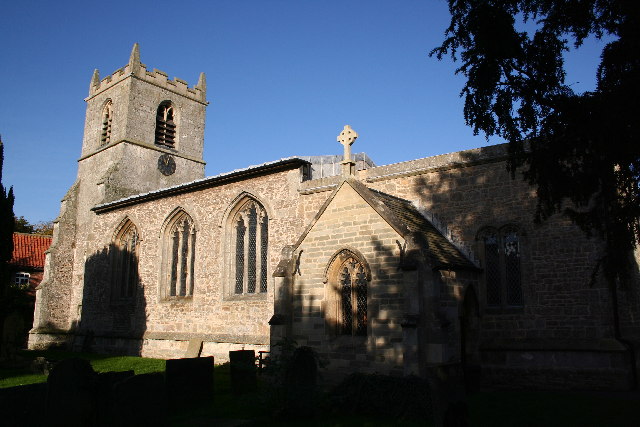
Our Lady and St Peter's Church, Bothamsall
Our Lady and St Peter's Church, Bothamsall is a Grade II listed parish church in the Church of England in Bothamsall. The church is part of the Lound Hall...
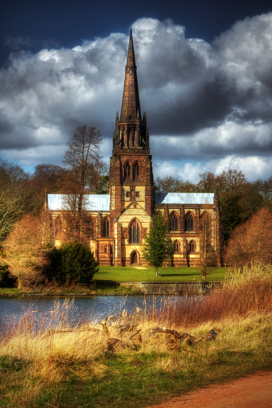
Church of St Mary the Virgin, Clumber Park
The Church of St. Mary the Virgin, Clumber Park, is an Anglican church in Clumber Park, Nottinghamshire, England. The church is Grade I listed by English...
Clumber and Hardwick
Clumber and Hardwick is a civil parish in the Bassetlaw district, in the county of Nottinghamshire, England. The parish includes the settlement of Hardwick...
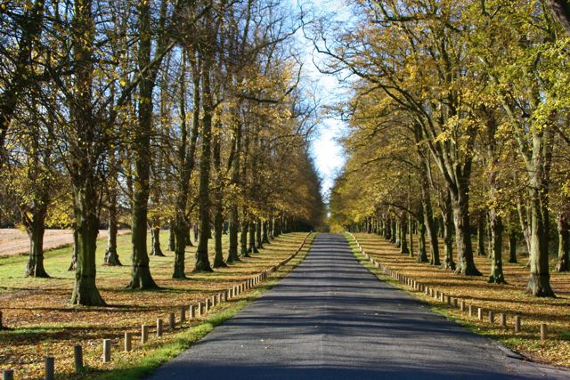
Clumber Park
Clumber Park is a country park in The Dukeries near Worksop in Nottinghamshire, England. The estate, which was the seat of the Pelham-Clintons, Dukes of...

St Giles' Church, Elkesley
St Giles' Church is a Grade I listed parish church in the Church of England.A church in Elkesleigh or Elchersleigh is mentioned in the Domesday Book. It...
Elkesley
Elkesley is a village in Nottinghamshire, England. According to the 2001 census it had a population of 805, increasing to 822 at the 2011 Census. It is...

Haughton, Nottinghamshire
Haughton is a hamlet in the English county of Nottinghamshire. Haughton lies on the south bank of the River Maun about one mile south west from Bothamsall...
Nearby Amenities
Located within 500m of 53.269651,-1.0209155Have you been to Fox Covert?
Leave your review of Fox Covert below (or comments, questions and feedback).