Goring

Settlement in Oxfordshire South Oxfordshire

England

Goring

Grazing near Goring
Grazing near Goring Credit: JThomas

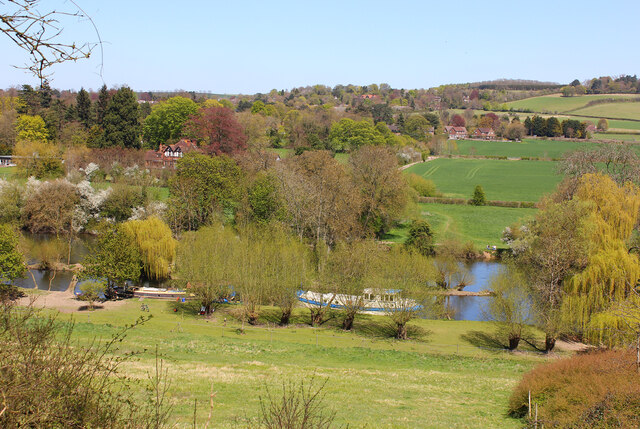
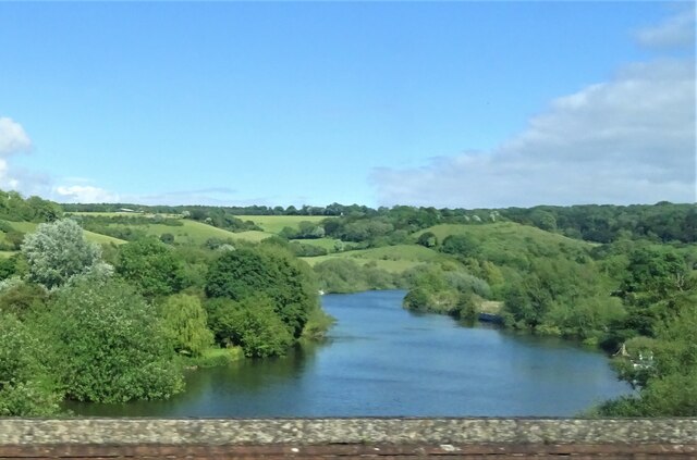
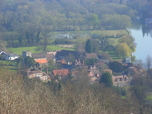
Goring, located in the county of Oxfordshire, England, is a picturesque village situated on the banks of the River Thames. With a population of around 3,500 residents, Goring is a charming and sought-after place to live due to its natural beauty and close proximity to the stunning Chiltern Hills.

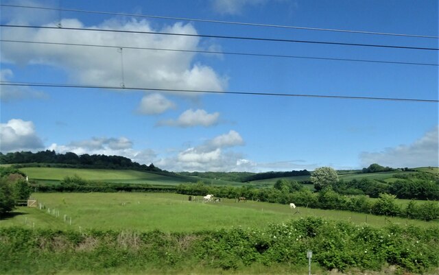
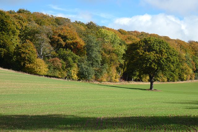
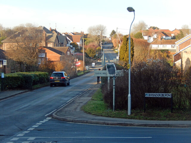
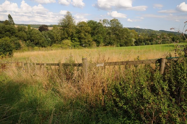
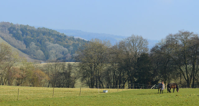
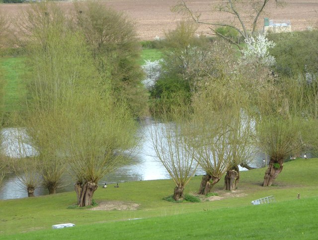
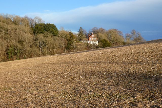
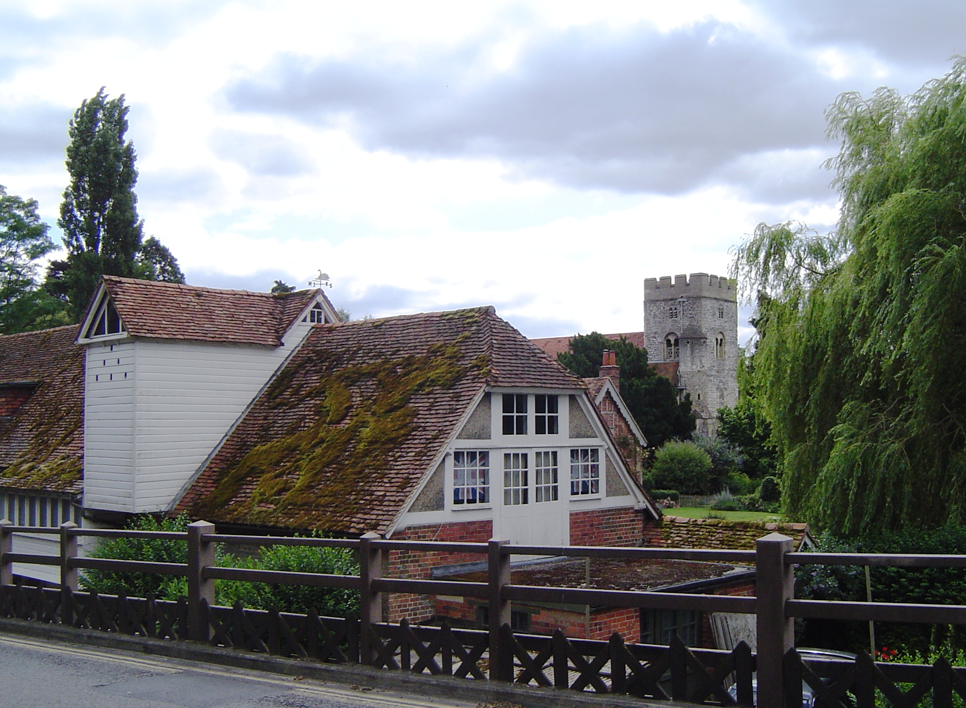
The village is well-known for its idyllic setting, surrounded by lush green fields, rolling hills, and the meandering river. Goring features a mix of architectural styles, including historic cottages, grand Georgian houses, and modern developments, which add to the village's character and appeal.

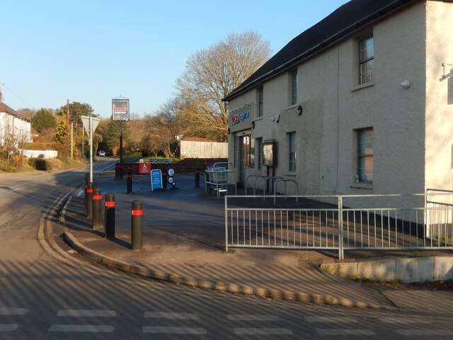
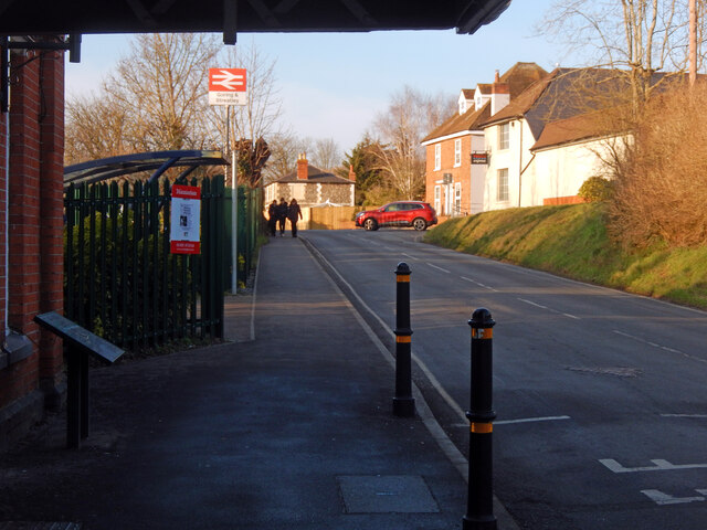
Goring boasts a vibrant community with a range of amenities and services. The village center offers a variety of independent shops, traditional pubs, quaint cafes, and quality restaurants. There is also a post office, library, and several convenience stores, ensuring residents have easy access to everyday necessities.

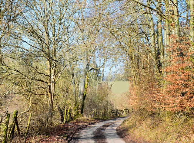
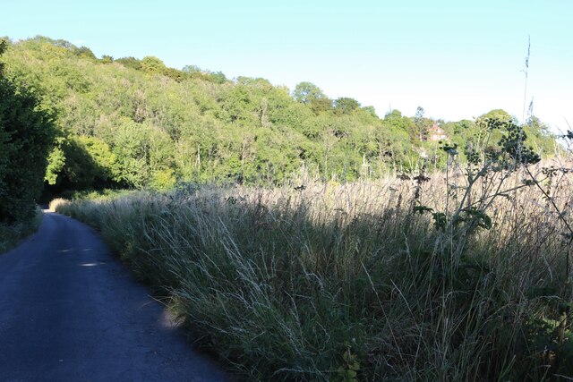
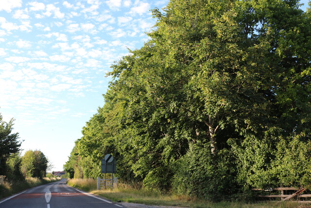
Nature enthusiasts and outdoor lovers are particularly drawn to Goring for its scenic walking and cycling routes, such as the Thames Path and the Ridgeway National Trail. The nearby Goring Gap offers breathtaking views of the river and surrounding countryside, making it a popular spot for picnics and leisurely strolls.

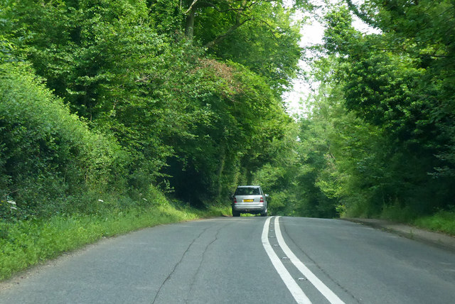
Transport links in Goring are excellent, with a regular train service connecting the village to major cities like Oxford and London. The village is also well-connected by road, with the A329 providing easy access to nearby towns and cities.

Overall, Goring is a delightful and picturesque village, offering a tranquil and close-knit community, stunning natural landscapes, and convenient access to modern amenities.

If you have any feedback on the listing, please let us know in the comments section below.

Goring Images

Images are sourced within 2km of 51.52258/-1.136473 or Grid Reference SU6080. Thanks to Geograph Open Source API. All images are credited.

Grazing near Goring
Grazing near Goring
Farmland, Goring A cereal crop beside Battle Road with Wroxhills Wood starting to show the signs of autumn.
Farmland, Goring
A cereal crop beside Battle Road with Wroxhills Wood starting to show the signs of autumn.
Wallingford Road, Goring Looking along the B4009 through this commuter village. Elvendon Road leads off to the right.
Wallingford Road, Goring
Looking along the B4009 through this commuter village. Elvendon Road leads off to the right.
Tesco Express, Goring This building, on the corner of Gatehampton Road and Reading Road, is unmistakeably a former pub - one of many around the country taken over by Tesco for a convenience store. Until it was closed in 2013 it was the Queens Arms, owned by Greene King, and opened by Tesco in August 2017. It is not known exactly when the pub was established; the first known reference was in 1843 but it seems likely that it was more or less contemporary with the nearby railway station opened a few years before.
Tesco Express, Goring
This building, on the corner of Gatehampton Road and Reading Road, is unmistakeably a former pub - one of many around the country taken over by Tesco for a convenience store. Until it was closed in 2013 it was the Queens Arms, owned by Greene King, and opened by Tesco in August 2017. It is not known exactly when the pub was established; the first known reference was in 1843 but it seems likely that it was more or less contemporary with the nearby railway station opened a few years before.
Gatehampton Road, Goring This is the view of Goring anybody emerging from Goring & Streatley station gets. In this image the main station buildings, protected by a canopy, are on the immediate left with a covered cycle rack beyond. The late afternoon sunshine catches the buildings further up the road, including a former pub now a Tesco Express, while three teenage boys approach having finished school for the day. The National Rail sign, perched on top of a high pole, completes the scene. Although an ancient settlement, Goring began to develop when the railway arrived in the 1830s and is now a sizeable commuter village with a population in excess of 3,000. Streatley is a smaller place connected to Goring by a bridge over the River Thames.
Gatehampton Road, Goring
This is the view of Goring anybody emerging from Goring & Streatley station gets. In this image the main station buildings, protected by a canopy, are on the immediate left with a covered cycle rack beyond. The late afternoon sunshine catches the buildings further up the road, including a former pub now a Tesco Express, while three teenage boys approach having finished school for the day. The National Rail sign, perched on top of a high pole, completes the scene. Although an ancient settlement, Goring began to develop when the railway arrived in the 1830s and is now a sizeable commuter village with a population in excess of 3,000. Streatley is a smaller place connected to Goring by a bridge over the River Thames.
Farmland above the River Thames Farmland above the River Thames, south of Streatley.
Farmland above the River Thames
Farmland above the River Thames, south of Streatley.
Downland, Stichens Green, Berkshire
Country lane, Lower Basildon, Berkshire
Old pollard willows on the river bank, downstream from Streatley There are some very ancient-looking  pollard willows along this stretch of the Thames.  These are on private land, so I took a zoom shot from close to the A329.

These trees also appear in Bill Nicholls' contribution <a href="https://www.geograph.org.uk/photo/1592751">SU5979 : Island in the river</a> near the right-hand margin.
Old pollard willows on the river bank, downstream from Streatley
There are some very ancient-looking pollard willows along this stretch of the Thames. These are on private land, so I took a zoom shot from close to the A329. These trees also appear in Bill Nicholls' contribution SU5979 : Island in the river near the right-hand margin.
A329 towards Streatley Passing Holies Walk Wood.
A329 towards Streatley
Passing Holies Walk Wood.
Direction Sign – Signpost Located on the west side of the t junction east of Wood Farm in Streatley parish. 3 arms and a flat cap.

Milestone Society National ID: BE_SU5879
Direction Sign – Signpost
Located on the west side of the t junction east of Wood Farm in Streatley parish. 3 arms and a flat cap. Milestone Society National ID: BE_SU5879
A329, Reading Road towards Streatley
River Thames The River Thames at Goring.
River Thames
The River Thames at Goring.
Farmland, Streatley With a house perched on a hillside at the southern end of Ash Copse.
Farmland, Streatley
With a house perched on a hillside at the southern end of Ash Copse.
Common Wood near Streatley
Harecroft Wood near Streatley
River Thames south of Goring
Wallingford Road leaving Streatley
Show me another place!

Goring is located at Grid Ref: SU6080 (Lat: 51.52258, Lng: -1.136473)

Administrative County: Oxfordshire

District: South Oxfordshire

Police Authority: Thames Valley

What 3 Words

///prospers.doing.plums. Near Goring, Oxfordshire
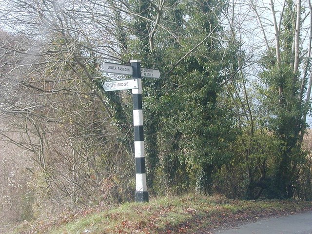
Related Wikis

Goring-on-Thames

Goring-on-Thames (or Goring) is a village and civil parish on the River Thames in South Oxfordshire, Oxfordshire, England. It is located about 5+1⁄2 mi...

Goring & Streatley railway station

Goring & Streatley railway station is on the Great Western Main Line, serving the twin villages of Goring-on-Thames in Oxfordshire and Streatley in Berkshire...

Goring Gap

The Goring Gap is the narrow valley, occupied by the River Thames, between the Chiltern Hills and the Berkshire Downs. It is approximately 10 miles (16...
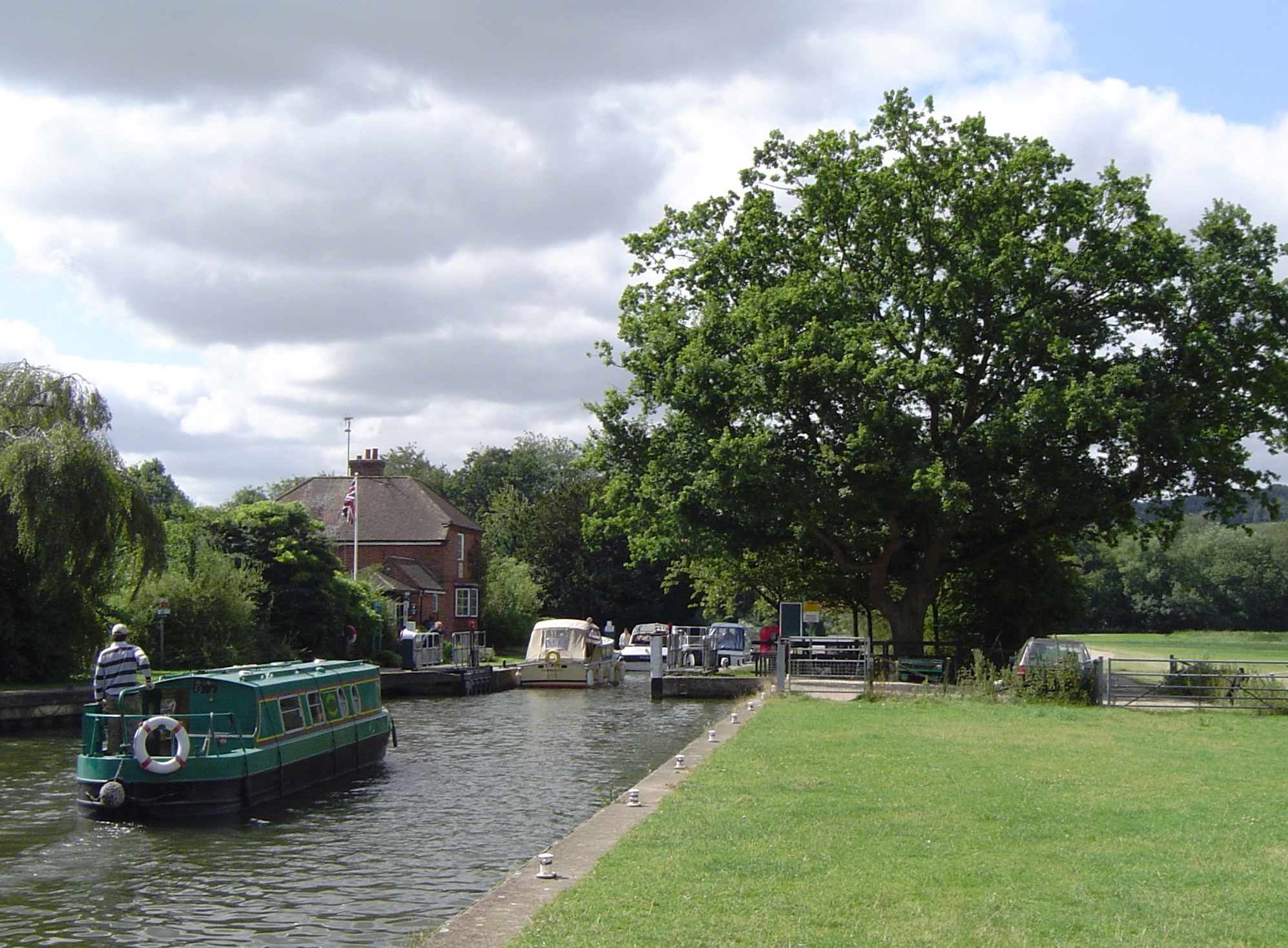
Goring Lock

Goring Lock is a lock and weir situated on the River Thames in England at the Goring Gap in the Chiltern Hills. The lock is located on the Oxfordshire...

Goring and Streatley Bridge

Goring and Streatley Bridge is a road bridge across the River Thames in England. The bridge links the twin villages of Goring-on-Thames, Oxfordshire, and...

Streatley, Berkshire

Streatley is a village and civil parish on the River Thames in Berkshire, England. The village faces Goring-on-Thames. The two places share in their shops...

Cleeve Lock

Cleeve Lock is a lock on the River Thames, in Oxfordshire, England. It is located just upstream of Goring and Streatley villages, on the eastern side...

Holies Down

Holies Down is a 5.6-hectare (14-acre) biological Site of Special Scientific Interest south of Streatley in Berkshire. It is in the North Wessex Downs...

Nearby Amenities

Located within 500m of 51.52258,-1.136473
Goring-on-Thames
Alt Name: Goring
Place: village
Lat/Long: 51.5214962/-1.1311269
Turning Circle
Turning Circle: hammer
Lat/Long: 51.5213259/-1.1318147
Turning Circle
Turning Circle: knuckle
Lat/Long: 51.5235896/-1.130403
Noexit: yes
Lat/Long: 51.5207461/-1.1413789
Bus Stop
Goring and Streatley Station
Naptan AtcoCode: 340000346STN
Naptan Bearing: N
Naptan CommonName: Goring and Streatley Station
Naptan Indicator: Entrance
Naptan Landmark: Goring and Streatley Railway Station
Naptan NaptanCode: oxfamatw
Naptan Street: Gatehampton Road
Naptan Verified: no
Source: naptan_import
Lat/Long: 51.5215014/-1.1328943
High Street
Naptan AtcoCode: 340000348MOM
Naptan Bearing: E
Naptan BusStopType: CUS
Naptan CommonName: High Street
Naptan Indicator: o/s
Naptan Landmark: Hotel
Naptan NaptanCode: oxfajwgt
Naptan Street: High Street
Naptan Verified: no
Source: naptan_import
Lat/Long: 51.5228428/-1.138381
High Street
Naptan AtcoCode: 340000348OPP
Naptan Bearing: W
Naptan BusStopType: CUS
Naptan CommonName: High Street
Naptan Indicator: Opposite Hotel
Naptan Landmark: Hotel
Naptan NaptanCode: oxfgjwdt
Naptan Street: High Street
Naptan Verified: no
Source: naptan_import
Lat/Long: 51.5227714/-1.1384545
Bus Stop
The Bridge
Bench: yes
Lit: yes
Naptan AtcoCode: 340000349BRI
Naptan Bearing: W
Naptan CommonName: The Bridge
Naptan Landmark: River Thames
Naptan NaptanCode: oxfgpgwp
Naptan Street: High Street
Naptan Verified: no
Shelter: no
Source: naptan_import
Tactile Paving: no
Lat/Long: 51.5229063/-1.1396181
Bus Stop
The Bridge
Bench: yes
Bus: yes
Lit: yes
Naptan AtcoCode: 340000349OPP
Naptan Bearing: E
Naptan BusStopType: CUS
Naptan CommonName: The Bridge
Naptan Indicator: opp
Naptan Landmark: River Thames
Naptan NaptanCode: oxfgpjaj
Naptan Street: High Street
Naptan Verified: no
Public Transport: platform
Shelter: no
Source: naptan_import
Tactile Paving: no
Lat/Long: 51.5229532/-1.139595
Bus Stop
Cleeve Road
Bus: yes
Naptan AtcoCode: 340000350CLE
Naptan Bearing: NE
Naptan CommonName: Cleeve Road
Naptan NaptanCode: oxfgpjad
Naptan Street: High Street
Naptan Verified: no
Public Transport: platform
Source: naptan_import
Lat/Long: 51.5229756/-1.1351182
Bus Stop
Cleeve Road
Bus: yes
Naptan AtcoCode: 340000350OPP
Naptan Bearing: SW
Naptan BusStopType: CUS
Naptan CommonName: Cleeve Road
Naptan Indicator: opp
Naptan NaptanCode: oxfgpjag
Naptan Street: High Street
Naptan Verified: no
Public Transport: platform
Source: naptan_import
Lat/Long: 51.5229174/-1.1350836
Turning Circle
Turning Circle: square
Lat/Long: 51.5265314/-1.137254
Turning Circle
Turning Circle: hammer
Lat/Long: 51.5194888/-1.1405189
Turning Circle
Turning Circle: y-head
Lat/Long: 51.5211177/-1.1341721
Goring Hardware
Addr Housenumber: 12
Addr Postcode: RG8 9HG
Addr Street: Red Cross Road
Opening Hours: Mo-Sa 09:00-17:00; Su 09:30-13:00
Shop: hardware
Lat/Long: 51.5221129/-1.134206
Oliver's
Shop: hairdresser
Lat/Long: 51.5220196/-1.1342797
Atm
Lat/Long: 51.5227211/-1.1375664
Bank
TSB
Addr Postcode: RG8 9AT
Addr Street: High Street
Atm: no
Brand Wikidata: Q7671560
Opening Hours: Mo-Fr 09:00-14:00
Lat/Long: 51.5225518/-1.1367474
Cafe
The Village Café
Addr City: Goring
Addr Postcode: RG8 9AY
Addr Street: The Arcade
Cuisine: coffee_shop
Facebook: https://www.facebook.com/pages/The-Village-Cafe-Goring/293791987358154
Phone: +441491874264
Lat/Long: 51.52252/-1.1366307
Inspired Crafts
Addr Housenumber: 2
Addr Postcode: RG8 9AY
Addr Street: The Arcade
Shop: craft
Lat/Long: 51.5224567/-1.1364616
Restaurant
Chef King
Addr Housenumber: 3 - 4
Addr Postcode: RG8 9AY
Addr Street: The Arcade
Cuisine: chinese
Lat/Long: 51.5223481/-1.1363973
Goring Village Butchers
Addr Housenumber: 5
Addr Postcode: RG8 9AY
Addr Street: The Arcade
Shop: butcher
Lat/Long: 51.5222438/-1.136388
Post Box
Lat/Long: 51.5254712/-1.1320877
Traffic Signals
Crossing Ref: pelican
Source: GPS
Traffic Signals: crossing
Lat/Long: 51.5259426/-1.1335472
Inspiration
Addr Housenumber: 1
Addr Postcode: RG8 9AY
Addr Street: The Arcade
Shop: gift
Lat/Long: 51.5225376/-1.1365114
The Goring Grocer
Addr Housenumber: 17A
Addr Postcode: RG8 9AR
Addr Street: High Street
Shop: deli
Lat/Long: 51.5226502/-1.1368959
Virgo Beauty
Addr Postcode: RG8 9AR
Addr Street: High Street
Shop: beauty
Lat/Long: 51.5226652/-1.1371051
Addr Housenumber: 10
Addr Postcode: RG8 9AT
Addr Street: High Street
Shop: vacant
Lat/Long: 51.5225409/-1.1368654
Ruby Pepper
Addr Housenumber: 3
Addr Postcode: RG8 9AT
Addr Street: High Street
Shop: clothes
Lat/Long: 51.5225725/-1.1372284
Mary S
Addr Housenumber: 1-2
Addr Postcode: RG8 9AT
Addr Street: High Street
Shop: gift
Lat/Long: 51.5225608/-1.1371278
Beacon Flooring
Addr Housenumber: 16
Addr Postcode: RG8 9AR
Addr Street: High Street
Shop: carpet
Lat/Long: 51.5227111/-1.1374833
Davis Tate
Addr Housename: Colebrook House
Addr Postcode: RG8 9AR
Addr Street: High Street
Office: estate_agent
Lat/Long: 51.5227219/-1.1376965
Warmingham Estate Agents
Addr Housenumber: 4-5
Addr Postcode: RG8 9AT
Addr Street: High Street
Office: estate_agent
Lat/Long: 51.5225807/-1.1373058
Albert Fields
Addr Housenumber: 8
Addr Postcode: RG8 9AU
Addr Street: High Street
Shop: hairdresser
Lat/Long: 51.5225907/-1.1376679
Richard Wilson Long
Addr Housename: Cymbal House
Addr Postcode: RG8 9AU
Addr Street: High Street
Lawyer: solicitor
Office: lawyer
Lat/Long: 51.5225982/-1.1375499
Barbara's
Addr Housename: Wheel Orchard
Addr Postcode: RG8 9HB
Addr Street: Station Road
Shop: antiques
Lat/Long: 51.5217612/-1.1367385
The Thames Valet
Addr Housename: Hill View House
Addr Postcode: RG8 9HB
Addr Street: Station Road
Shop: dry_cleaning
Lat/Long: 51.5217955/-1.136752
Post Box
Collection Times: Mo-Fr 16:00; Sa 10:30
Operator: Royal Mail
Operator Wikidata: Q638098
Post Box Type: pillar
Ref: RG8 262
Royal Cypher: EIIR
Royal Cypher Wikidata: Q33102113
Source: GPS Survey
Lat/Long: 51.5225708/-1.1367095
Give Way
Direction: forward
Lat/Long: 51.5219499/-1.1339227
Atm
Lat/Long: 51.5221571/-1.1328475
Entrance: yes
Lat/Long: 51.5225105/-1.13462
Vending Machine
Operator: South Oxfordshire District Council
Payment Coins: yes
Vending: parking_tickets
Lat/Long: 51.5221108/-1.1369298
Swift Clik
Fixme: SwiftClik
Shop: stationery
Lat/Long: 51.5224282/-1.136599
Winser Financial Services
Fixme: financial services ?
Office: financial
Lat/Long: 51.5223039/-1.136528
Swift Ink
Fixme: Swiftink
Shop: stationery
Lat/Long: 51.5223665/-1.1365668
Grit Bin
Lat/Long: 51.5222709/-1.1368949
Man Made: tower
Tower Type: communication
Lat/Long: 51.5216735/-1.1330188
Vending Machine
Operator: selecta
Payment Coins: yes
Vending: drinks;sweets
Lat/Long: 51.521428/-1.1329722
Vending Machine
Payment Coins: no
Payment Credit Cards: yes
Payment Debit Cards: yes
Payment Notes: no
Vending: public_transport_tickets
Lat/Long: 51.5215824/-1.1329366
Post Box
Collection Times: Mo-Fr 09:00; Sa 07:00
Operator: Royal Mail
Operator Wikidata: Q638098
Post Box Type: wall
Ref: RG8 63D
Royal Cypher: EIIR
Lat/Long: 51.5215459/-1.1329249
Board Type: notice,public_transport
Information: board
Tourism: information
Lat/Long: 51.5216003/-1.132942
Bicycle Parking
Access: destination
Bicycle Parking: stands
Capacity: 12
Covered: yes
Lat/Long: 51.521383/-1.132912
Waste Basket
Lat/Long: 51.52143/-1.1332313
Addr Housenumber: 8
Lat/Long: 51.5220657/-1.1339478
Waste Basket
Check Date: 2021-06-06
Lat/Long: 51.52265/-1.1382585
Barrier: bollard
Lat/Long: 51.5225532/-1.1381941
Bench
Backrest: yes
Check Date: 2021-06-06
Lat/Long: 51.5225531/-1.1383307
Barrier: bollard
Lat/Long: 51.5226258/-1.1382356
Bench
Backrest: yes
Check Date: 2021-06-06
Lat/Long: 51.5226926/-1.138308
Barrier: bollard
Lat/Long: 51.5225883/-1.1382075
Bench
Backrest: yes
Check Date: 2021-06-06
Lat/Long: 51.5226692/-1.1382813
Telephone
Booth: KX100
Covered: booth
Payment Coins: yes
Payment Credit Cards: yes
Payment Debit Cards: yes
Lat/Long: 51.5214261/-1.1328666
Help Point
Lat/Long: 51.5214292/-1.1332206
Help Point
Lat/Long: 51.5215763/-1.1334704
Help Point
Lat/Long: 51.5215267/-1.1329993
Barrier: bollard
Lat/Long: 51.5216222/-1.1329169
Entrance: yes
Lat/Long: 51.5215647/-1.1329385
Barrier: bollard
Lat/Long: 51.5214399/-1.1328478
Barrier: bollard
Lat/Long: 51.5215534/-1.1328927
Entrance: yes
Lat/Long: 51.5214788/-1.1328935
Barrier: bollard
Lat/Long: 51.5215217/-1.1328746
Entrance: yes
Lat/Long: 51.5214858/-1.1387592
Bench
Backrest: yes
Lat/Long: 51.5215147/-1.1330003
Entrance: yes
Lat/Long: 51.5216317/-1.133039
Bench
Backrest: yes
Lat/Long: 51.521468/-1.1329839
Bench
Lat/Long: 51.5212556/-1.133122
Bench
Lat/Long: 51.5213056/-1.1329584
Bench
Backrest: yes
Lat/Long: 51.5217079/-1.1330805
Bench
Backrest: yes
Lat/Long: 51.5216465/-1.1330563
Bench
Backrest: yes
Lat/Long: 51.5213253/-1.1329651
Bench
Lat/Long: 51.5214651/-1.1332099
Entrance: yes
Lat/Long: 51.5214939/-1.1329857
Bench
Lat/Long: 51.5211458/-1.1329047
Bench
Backrest: yes
Lat/Long: 51.521453/-1.1329792
Bench
Lat/Long: 51.5211797/-1.1329161
Entrance: yes
Lat/Long: 51.5214314/-1.1331861
Bench
Lat/Long: 51.5212108/-1.1329423
Bench
Lat/Long: 51.5211133/-1.1328934
Toilets
Female: no
Male: yes
Opening Hours: Mo-Fr 06:30-13:00; Sa 06:30-12:00; Su off
Lat/Long: 51.5214071/-1.1329249
Entrance: yes
Lat/Long: 51.5214001/-1.1329241
Goring & Streatley
Addr City: Goring-on-Thames
Addr Housename: Goring & Streatley station
Addr Postcode: RG8 0EP
Addr Street: Gatehampton Road
Internet Access: wlan
Internet Access Fee: no
Level: 0
Naptan AtcoCode: 9100GORASTR
Network: National Rail
Network Website: https://www.nationalrail.co.uk/stations/gor/
Network Wikidata: Q26334
Operator: Great Western Railway
Operator Website: https://www.gwr.com/stations-and-destinations/stations/goring-and-streatley
Operator Wikidata: Q1419438
Phone: +44 3457 000 125
Railway: station
Ref Crs: GOR
Start Date: 1840-06-01
Wheelchair: yes
Wikidata: Q5586504
Wikipedia: en:Goring & Streatley railway station
Lat/Long: 51.5211885/-1.1331195
Addr Housenumber: 21
Addr Street: Thames Road
Entrance: yes
Lat/Long: 51.5248794/-1.1389004
Addr Housenumber: 18
Addr Street: Thames Road
Entrance: yes
Lat/Long: 51.5251003/-1.138837
Addr Housenumber: 20
Addr Street: Thames Road
Entrance: yes
Lat/Long: 51.5249386/-1.1388834
Addr Housenumber: 19
Addr Street: Thames Road
Entrance: yes
Lat/Long: 51.5250478/-1.1388521
Entrance: yes
Lat/Long: 51.5230467/-1.1404013
Telephone
Booth: K6
Covered: booth
Lat/Long: 51.5230257/-1.1402102
Addr Housenumber: 1
Addr Postcode: RG8 9HJ
Addr Street: Station Road
Entrance: yes
Lat/Long: 51.5214577/-1.138054
Addr Housenumber: 4
Addr Postcode: RG8 9HJ
Addr Street: Station Road
Entrance: yes
Lat/Long: 51.5214314/-1.1377171
Addr Housename: Springfield
Addr Street: Station Road
Lat/Long: 51.5217599/-1.1357811
Addr Housenumber: 2
Addr Postcode: RG8 9HJ
Addr Street: Station Road
Entrance: yes
Lat/Long: 51.5214437/-1.1379784
Addr Housenumber: 3
Addr Postcode: RG8 9HJ
Addr Street: Station Road
Entrance: yes
Lat/Long: 51.5214422/-1.1377935
Addr Housename: Pound Lock House
Addr Street: Station Road
Lat/Long: 51.52179/-1.1356203
Entrance: yes
Lat/Long: 51.5214313/-1.1376091
Entrance: yes
Lat/Long: 51.5214918/-1.1369541
Entrance: yes
Lat/Long: 51.521391/-1.1367567
Addr Housename: Beams End
Addr Postcode: RG8 9HA
Addr Street: Station Road
Lat/Long: 51.5213084/-1.1378692
Entrance: yes
Lat/Long: 51.5214208/-1.1370803
Addr Housename: Spirimont House
Addr Postcode: RG8 9HA
Addr Street: Station Road
Lat/Long: 51.5213377/-1.1380343
Entrance: yes
Lat/Long: 51.5215835/-1.138734
Entrance: yes
Lat/Long: 51.5215366/-1.1386062
Addr Housename: Brewery Cottages
Addr Housenumber: 3
Addr Postcode: RG8 9AR
Addr Street: High Street
Entrance: yes
Lat/Long: 51.5227345/-1.1360737
Bench
Backrest: yes
Lat/Long: 51.5230756/-1.1343597
Addr Housename: Studly Cottage
Addr Postcode: RG8 9BA
Lat/Long: 51.5225424/-1.135414
Addr Housename: Brewery Cottages
Addr Housenumber: 2
Addr Postcode: RG8 9AR
Addr Street: High Street
Entrance: yes
Lat/Long: 51.522717/-1.1361672
Addr Housename: Harpsden Cottage
Addr Postcode: RG8 9BA
Lat/Long: 51.5224265/-1.1353469
Grit Bin
Lat/Long: 51.523069/-1.134329
Addr Housename: Caversham Cottage
Addr Postcode: RG8 9BA
Lat/Long: 51.5224623/-1.1354113
Addr Housename: Brewery Cottages
Addr Housenumber: 1
Addr Postcode: RG8 9AR
Addr Street: High Street
Entrance: yes
Lat/Long: 51.5227101/-1.1362042
Addr Housename: Ivy Nook
Fixme: Re-confirm, forgotten!
Lat/Long: 51.5227322/-1.1355505
Entrance: yes
Lat/Long: 51.5227378/-1.1362909
Bicycle Parking
Bicycle Parking: stands
Capacity: 12
Check Date Capacity: 2023-04-22
Covered: yes
Lat/Long: 51.5217094/-1.1329933
Bench
Backrest: yes
Lat/Long: 51.5233704/-1.1333319
Community Centre
Goring Social Club
Lat/Long: 51.5228416/-1.1352157
Grange Close Bed & Breakfast
Addr Housenumber: 24
Addr Place: Goringrooms
Addr Postcode: RG8 9DY
Addr Street: Grange Close
Email: francesthompson1@btinternet.com
Internet Access: wlan
Operator: Frances Thompson
Rooms: 1
Smoking: no
Tourism: guest_house
Lat/Long: 51.5208002/-1.1397689
Tesco Express
Brand: Tesco Express
Brand Wikidata: Q98456772
Contact Website: https://www.tesco.com/store-locator/goring/gatehampton-rd
Opening Hours: Mo-Su 07:00-23:00
Operator: Tesco
Shop: supermarket
Lat/Long: 51.5221464/-1.1327337
Addr Housename: The Artists House
Fixme: confirm on the ground, forgotten if correct!
Lat/Long: 51.5211865/-1.1372922
Restaurant
Masoom's Tandoori Restaurant
Addr City: Goring
Addr Housename: The Laurels
Addr Postcode: RG8 9AT
Addr Street: High Street
Cuisine: indian
Opening Hours: Mo-Th 17:30-23:00,12:00-14:30; Fr 17:30-23:00; Sa-Su 12:00-14:30,17:30-23:00; PH off
Phone: +441491875078
Takeaway: yes
Website: https://www.masooms.co.uk/
Lat/Long: 51.5226305/-1.1362273
Pharmacy
Goring Pharmacy
Addr City: Goring
Addr Postcode: RG8 9AT
Addr Street: High Street
Dispensing: yes
Opening Hours: Mo-Fr 09:00-18:00; Sa 09:00-17:00
Shop: chemist
Lat/Long: 51.5226147/-1.1363132
Elevator
Lat/Long: 51.5212034/-1.1328909
Elevator
Lat/Long: 51.5211835/-1.1333442
Elevator
Lat/Long: 51.5211762/-1.1331007
Entrance: yes
Lat/Long: 51.5213557/-1.1332167
Entrance: yes
Lat/Long: 51.5213653/-1.1331359
Post Box
Collection Times: Mo-Fr 17:30, Sa 12:15
Post Box Type: wall
Ref: RG9 454
Royal Cypher: no
Lat/Long: 51.523044/-1.1402908
Bench
Backrest: yes
Source: GPS Survey
Lat/Long: 51.5224445/-1.141402
Bench
Backrest: yes
Source: GPS Survey
Lat/Long: 51.5221699/-1.1415388
Bench
Backrest: yes
Source: GPS Survey
Lat/Long: 51.5217911/-1.1417413
Bench
Backrest: yes
Source: GPS Survey
Lat/Long: 51.5215249/-1.1419438
Bench
Backrest: yes
Source: GPS Survey
Lat/Long: 51.5213179/-1.1421128
Bench
Backrest: yes
Source: GPS Survey
Lat/Long: 51.5210209/-1.1423542
Bench
Backrest: yes
Source: GPS Survey
Lat/Long: 51.5207142/-1.1425755
Defibrillator
Emergency: defibrillator
Lat/Long: 51.5215375/-1.1329974
Information: map
Map Size: city
Map Type: scheme
Tourism: information
Lat/Long: 51.5216665/-1.1329285
Historic: memorial
Memorial: war_memorial
Lat/Long: 51.5221516/-1.1392388
Enjoying the River Thames
Information: board
Tourism: information
Lat/Long: 51.5228523/-1.1412193
Goring Lock
Information: map
Map Size: site
Map Type: scheme
Tourism: information
Lat/Long: 51.5228315/-1.141229
Visitor Information
Board Type: notice
Information: board
Tourism: information
Website: http://www.visitgoringandstreatley.co.uk/
Lat/Long: 51.5225725/-1.1413547
Bench
Backrest: yes
Lat/Long: 51.5207513/-1.1422569
Bench
Backrest: yes
Lat/Long: 51.5207/-1.1425862
Waste Basket
Waste: dog_excrement
Lat/Long: 51.5205865/-1.1426713
Bench
Backrest: yes
Lat/Long: 51.5226603/-1.1388792
Bench
Backrest: yes
Lat/Long: 51.5230715/-1.141079
Bench
Backrest: yes
Material: wood
Lat/Long: 51.5229109/-1.1398108
Information: map
Tourism: information
Lat/Long: 51.5228407/-1.1397815
Bench
Backrest: yes
Lat/Long: 51.521413/-1.1295729
Bench
Backrest: yes
Lat/Long: 51.5246519/-1.1352032
Bench
Backrest: yes
Lat/Long: 51.5236716/-1.1343366
Bench
Backrest: yes
Lat/Long: 51.5246165/-1.1357985
Bench
Backrest: yes
Lat/Long: 51.523866/-1.1363919
Bench
Backrest: yes
Lat/Long: 51.5234733/-1.1362458
Bicycle Parking
Bicycle Parking: stands
Capacity: 6
Covered: no
Lat/Long: 51.5225575/-1.1366808
Defibrillator
Defibrillator Location: outside Goring Village Hall, High Street, Goring
Emergency: defibrillator
Indoor: no
Lat/Long: 51.522754/-1.1390333
Advertising: board
Lat/Long: 51.5227932/-1.1390603
Waterway: weir
Lat/Long: 51.5224472/-1.1436733
Direction: 175
Generator Method: photovoltaic
Generator Output Electricity: yes
Generator Solar Modules: 10
Generator Source: solar
Generator Type: solar_photovoltaic_panel
Location: roof
Power: generator
Lat/Long: 51.5261552/-1.1322752
Direction: 175
Generator Method: photovoltaic
Generator Output Electricity: yes
Generator Solar Modules: 14
Generator Source: solar
Generator Type: solar_photovoltaic_panel
Location: roof
Power: generator
Lat/Long: 51.5253729/-1.1311395
Turning Circle
Turning Circle: knuckle
Lat/Long: 51.524952/-1.1311366
Direction: 200
Generator Method: photovoltaic
Generator Output Electricity: yes
Generator Solar Modules: 16
Generator Source: solar
Generator Type: solar_photovoltaic_panel
Location: roof
Power: generator
Lat/Long: 51.5235433/-1.1308981
Direction: 175
Generator Method: photovoltaic
Generator Output Electricity: yes
Generator Solar Modules: 16
Generator Source: solar
Generator Type: solar_photovoltaic_panel
Location: roof
Power: generator
Lat/Long: 51.5233666/-1.1303944
Direction: 170
Generator Method: photovoltaic
Generator Output Electricity: yes
Generator Solar Modules: 6
Generator Source: solar
Generator Type: solar_photovoltaic_panel
Location: roof
Power: generator
Lat/Long: 51.5239577/-1.1314206
Direction: 90
Generator Method: photovoltaic
Generator Output Electricity: yes
Generator Solar Modules: 16
Generator Source: solar
Generator Type: solar_photovoltaic_panel
Location: roof
Power: generator
Lat/Long: 51.5247879/-1.1316873
Direction: 170
Generator Method: photovoltaic
Generator Output Electricity: yes
Generator Solar Modules: 12
Generator Source: solar
Generator Type: solar_photovoltaic_panel
Location: roof
Power: generator
Lat/Long: 51.5244597/-1.1316688
Direction: 270
Generator Method: photovoltaic
Generator Output Electricity: yes
Generator Solar Modules: 15
Generator Source: solar
Generator Type: solar_photovoltaic_panel
Location: roof
Power: generator
Lat/Long: 51.5260612/-1.1347411
Turning Circle
Turning Circle: knuckle
Lat/Long: 51.5255944/-1.1381279
Direction: 175
Generator Method: photovoltaic
Generator Output Electricity: yes
Generator Solar Modules: 16
Generator Source: solar
Generator Type: solar_photovoltaic_panel
Location: roof
Power: generator
Lat/Long: 51.5246449/-1.1369704
Direction: 75
Generator Method: photovoltaic
Generator Output Electricity: yes
Generator Solar Modules: 6
Generator Source: solar
Generator Type: solar_photovoltaic_panel
Location: roof
Power: generator
Lat/Long: 51.5230955/-1.1354276
Direction: 255
Generator Method: photovoltaic
Generator Output Electricity: yes
Generator Solar Modules: 6
Generator Source: solar
Generator Type: solar_photovoltaic_panel
Location: roof
Power: generator
Lat/Long: 51.5231063/-1.1354906
Give Way
Direction: forward
Lat/Long: 51.5219959/-1.1340014
Direction: 165
Generator Method: photovoltaic
Generator Output Electricity: yes
Generator Solar Modules: 10
Generator Source: solar
Generator Type: solar_photovoltaic_panel
Location: roof
Power: generator
Lat/Long: 51.5206149/-1.1388831
Direction: 160
Generator Method: photovoltaic
Generator Output Electricity: yes
Generator Solar Modules: 6
Generator Source: solar
Generator Type: solar_photovoltaic_panel
Location: roof
Power: generator
Lat/Long: 51.5195618/-1.1370613
Direction: 150
Fixme: survey for panel count
Generator Method: photovoltaic
Generator Output Electricity: yes
Generator Solar Modules: 23
Generator Source: solar
Generator Type: solar_photovoltaic_panel
Location: roof
Power: generator
Lat/Long: 51.5185574/-1.1356874
Direction: 160
Generator Method: photovoltaic
Generator Output Electricity: yes
Generator Solar Modules: 5
Generator Source: solar
Generator Type: solar_photovoltaic_panel
Location: roof
Power: generator
Lat/Long: 51.52059/-1.1350087
Direction: 165
Fixme: survey for panel count
Generator Method: photovoltaic
Generator Output Electricity: yes
Generator Solar Modules: 6
Generator Source: solar
Generator Type: solar_photovoltaic_panel
Location: roof
Power: generator
Lat/Long: 51.5199039/-1.1339071
Direction: 165
Generator Method: photovoltaic
Generator Output Electricity: yes
Generator Solar Modules: 16
Generator Source: solar
Generator Type: solar_photovoltaic_panel
Location: roof
Power: generator
Lat/Long: 51.5201947/-1.132121
Post Box
Collection Times: Mo-Fr 09:00; Sa 07:00
Operator: Royal Mail
Operator Wikidata: Q638098
Post Box Type: wall
Ref: RG8 310D
Royal Cypher: GR
Lat/Long: 51.5258762/-1.136777
Pub
The Miller of Mansfield
Addr City: Goring
Addr Postcode: RG8 9AW
Addr Street: High Street
Cuisine: breakfast;regional
Website: https://themillerofmansfield.com/wine-dine/
Lat/Long: 51.5227553/-1.1380002
The data included in this document is from www.openstreetmap.org. The data is made available under ODbL.

Have you been to Goring?

Leave your review of Goring below (or comments, questions and feedback).