Geshader

Settlement in Ross-shire

Scotland

Geshader

A slipway in Loch Miabhaig
A slipway in Loch Miabhaig Credit: Alan Reid

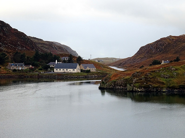
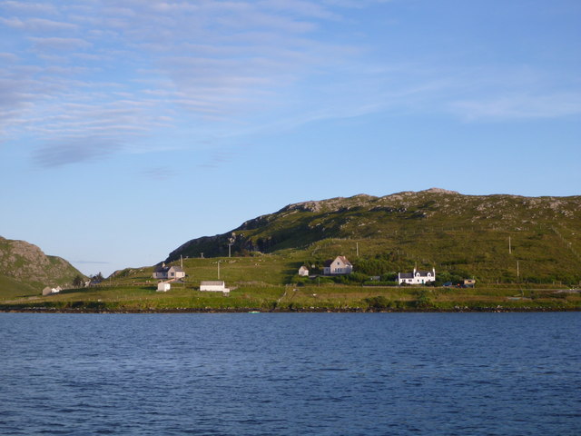
Geshader is a small village located in the county of Ross-shire, on the western coast of Scotland. Situated in the Outer Hebrides, Geshader is part of the Isle of Lewis and Harris, which is known for its stunning landscapes and rich cultural heritage.

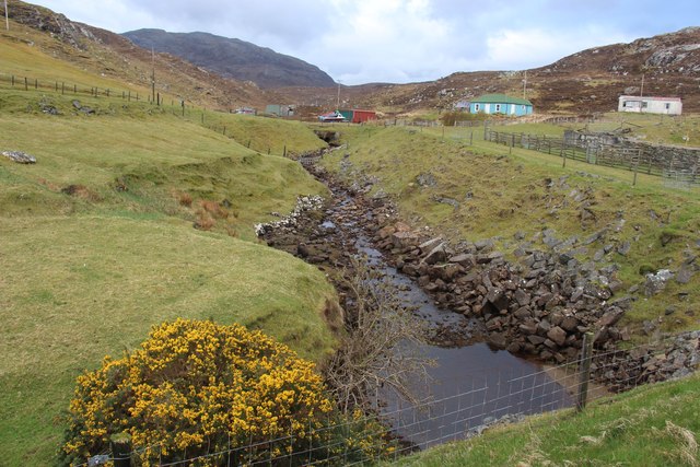
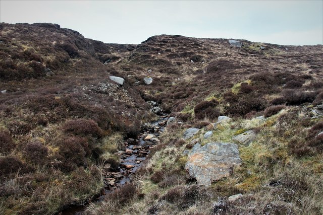
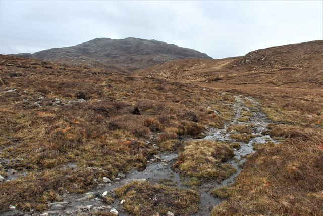
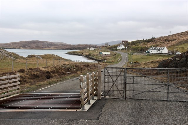
The village of Geshader is nestled amidst a picturesque setting, surrounded by rolling hills, rugged moorlands, and breathtaking coastal views. It is a peaceful and close-knit community, with a population of around 150 residents. The remote location of Geshader offers a tranquil and secluded atmosphere, making it an ideal destination for those seeking a retreat from the hustle and bustle of city life.

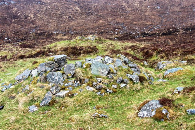
Geshader is known for its traditional crofting lifestyle, with many families still engaged in farming and sheep-rearing. The village is characterized by its charming white-washed cottages, some of which date back several centuries, showcasing the rich history and architectural heritage of the area.

The stunning natural beauty of Geshader attracts outdoor enthusiasts, with opportunities for hiking, birdwatching, and fishing in the nearby lochs and rivers. The coastline provides a habitat for a variety of marine life, and visitors can often spot seals, dolphins, and even whales in the surrounding waters.

While Geshader is a small village, it offers a few amenities to its residents and visitors, including a community hall, a post office, and a local shop. The nearest town, Stornoway, is approximately 25 miles away, providing additional services and amenities. Overall, Geshader offers a unique and idyllic setting for those seeking a peaceful retreat in the stunning Scottish Highlands.

If you have any feedback on the listing, please let us know in the comments section below.

Geshader Images

Images are sourced within 2km of 58.189484/-6.9535515 or Grid Reference NB0933. Thanks to Geograph Open Source API. All images are credited.

A slipway in Loch Miabhaig
Derelict house on slope of Beinn a' Ghlinne Ruaidh
Cerishader: postbox № HS2 158 A small postbox on the B8011, with its back to Loch Ròg. It is emptied at 9 o'clock each morning, except Sunday.
Cerishader: postbox № HS2 158
A small postbox on the B8011, with its back to Loch Ròg. It is emptied at 9 o'clock each morning, except Sunday.
Carishader postbox The sea inlet is part of Loch Ròg.
Carishader postbox
The sea inlet is part of Loch Ròg.
Old black house walls, Cairisiadar Looking up An Gleann Ruadh.
Old black house walls, Cairisiadar
Looking up An Gleann Ruadh.
Abhainn Mhòr a' Ghlinne Ruaidh
Bridge over the Abhainn Mhor a' Ghlinne Ruaidh
The settlement at Miavaig/Miabhaig Viewed across Loch Miabhaig.
The settlement at Miavaig/Miabhaig
Viewed across Loch Miabhaig.
Photo opportunity, Cairisiadar, Isle of Lewis An adjacent sign invites you to "Join the band".

One of the band members has swapped her guitar for bagpipes and gained a kilt since Colin visited in 2011: <a href="https://www.geograph.org.uk/photo/2646155">NB0933 : Join the Band</a>.
Photo opportunity, Cairisiadar, Isle of Lewis
An adjacent sign invites you to "Join the band". One of the band members has swapped her guitar for bagpipes and gained a kilt since Colin visited in 2011: NB0933 : Join the Band.
Bus shelter, Miabhaig, Isle of Lewis Looking along the course of the B8011, a footpath and the Abhainn a' Ghlinne along Gleann Bhaltois.

The Lewis bus shelter is designed to provide protection whichever way the wind is blowing.  This example has gained a piece of artwork by Janie Nicoll (<span class="nowrap"><a title="http://www.janienicoll.co.uk/artworks-2016.html" rel="nofollow ugc noopener" href="http://www.janienicoll.co.uk/artworks-2016.html">Link</a><img style="margin-left:2px;" alt="External link" title="External link - shift click to open in new window" src="https://s1.geograph.org.uk/img/external.png" width="10" height="10"/></span> ) since it was visited by Peter in 2014: <a href="https://www.geograph.org.uk/photo/4017964">NB0834 : Lewis style bus shelter (ii)</a>.
Bus shelter, Miabhaig, Isle of Lewis
Looking along the course of the B8011, a footpath and the Abhainn a' Ghlinne along Gleann Bhaltois. The Lewis bus shelter is designed to provide protection whichever way the wind is blowing. This example has gained a piece of artwork by Janie Nicoll (LinkExternal link ) since it was visited by Peter in 2014: NB0834 : Lewis style bus shelter (ii).
MV Cuma taking sea kayaks on board at Miabhaig MV Cuma takes tourists on week-long trips around the Outer Hebrides and out to St. Kilda. Some of those tourists, like us, are sea kayakers wanting to visit places they couldn't get to by paddling all the way (the crossing to St. Kilda is a bit epic for most people), and skipper Murdo can also arrange for a local paddler who knows all the best places to visit. If the weather is unsuitable (it was too rough to anchor safely off St. Kilda during our week) there are a vast number of more or less sheltered places to go. With a "mother ship" to provide safe rest and excellent food, the weather is no hindrance to a fantastic week !
MV Cuma taking sea kayaks on board at Miabhaig
MV Cuma takes tourists on week-long trips around the Outer Hebrides and out to St. Kilda. Some of those tourists, like us, are sea kayakers wanting to visit places they couldn't get to by paddling all the way (the crossing to St. Kilda is a bit epic for most people), and skipper Murdo can also arrange for a local paddler who knows all the best places to visit. If the weather is unsuitable (it was too rough to anchor safely off St. Kilda during our week) there are a vast number of more or less sheltered places to go. With a "mother ship" to provide safe rest and excellent food, the weather is no hindrance to a fantastic week !
Cairisiadar from Loch Rog The northwest end of this small community strung out along the B8011 catches the evening light as we return by boat to Miabhaig.
Cairisiadar from Loch Rog
The northwest end of this small community strung out along the B8011 catches the evening light as we return by boat to Miabhaig.
Abhainn Uasaig A short river at Carishader.
Abhainn Uasaig
A short river at Carishader.
A burn draining Geàrraidh Mhòr
Track to Loch an Druim Riabhaich
Geàrraidh Theurabridh A cluster of moor shielings.
Geàrraidh Theurabridh
A cluster of moor shielings.
Northwest boundary of Cairisiadar
Show me another place!

Geshader is located at Grid Ref: NB0933 (Lat: 58.189484, Lng: -6.9535515)

Unitary Authority: Na h-Eileanan an Iar

Police Authority: Highlands and Islands

What 3 Words

///deriving.twitching.grades. Near Carloway, Na h-Eileanan Siar

Related Wikis

Flodaigh, Lewis

Flodaigh is a small island in Loch Roag on the west coast of Lewis in the Outer Hebrides of Scotland. It is about 33 hectares (82 acres) in extent and...

Loch na Berie

Loch Na Berie is a broch in the Outer Hebrides of Scotland, located approximately 400 yards from the shore, and is thought to have been located on an island...

Cliff, Lewis

Cliff (Scottish Gaelic: Cliobh) is a small settlement on the Isle of Lewis, in the Outer Hebrides, Scotland. Cliff is within the parish of Uig. The settlement...

Fuaigh Beag

Fuaigh Beag or Vuia Be(a)g is an island in the Outer Hebrides. It is off the west coast of Lewis near Great Bernera in Loch Roag. Its name means "little...

Nearby Amenities

Located within 500m of 58.189484,-6.9535515
Ford: yes
Lat/Long: 58.1892471/-6.955805
Ford: yes
Lat/Long: 58.1888732/-6.9557842
The data included in this document is from www.openstreetmap.org. The data is made available under ODbL.

Have you been to Geshader?

Leave your review of Geshader below (or comments, questions and feedback).