Sgeir Ghlas

Coastal Feature, Headland, Point in Ross-shire

Scotland

Sgeir Ghlas

An Sùileachan Monument A monument to the Lewis land clearances <span class="nowrap"><a title="https://bhaltostrust.co.uk/suileachan-project/" rel="nofollow ugc noopener" href="https://bhaltostrust.co.uk/suileachan-project/">Link</a><img style="margin-left:2px;" alt="External link" title="External link - shift click to open in new window" src="https://s1.geograph.org.uk/img/external.png" width="10" height="10"/></span>
An Sùileachan Monument Credit: Sandy Gerrard

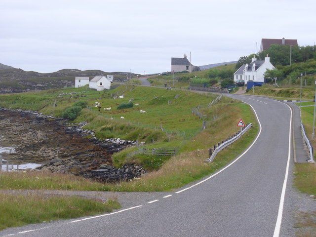
Sgeir Ghlas is a prominent coastal feature located in the county of Ross-shire, Scotland. It is classified as a headland or point, jutting out into the North Atlantic Ocean. The name Sgeir Ghlas translates to "green skerry" in Scottish Gaelic, which aptly describes the appearance of this geological formation.

Situated on the northern coast of Ross-shire, Sgeir Ghlas is characterized by its rugged and rocky terrain. The headland is composed of ancient igneous rocks, such as granite and gneiss, which have been shaped by the forces of erosion over millions of years. The result is a striking landscape of cliffs, caves, and stacks, providing a dramatic backdrop against the crashing waves of the ocean.

At Sgeir Ghlas, visitors can witness the raw power of nature as waves relentlessly batter the cliffs, creating an awe-inspiring spectacle. The headland also offers breathtaking panoramic views of the surrounding coastline, with its pristine beaches, scattered islands, and distant mountain ranges.

The area is home to a diverse range of wildlife, including seabirds such as puffins, gulls, and fulmars, which nest on the sheer cliffs. Marine life is also abundant, with seals, dolphins, and occasionally whales being spotted offshore. The headland serves as an important habitat and breeding ground for these creatures, making it a popular spot for nature enthusiasts and birdwatchers.

Access to Sgeir Ghlas is primarily via coastal paths and trails, providing opportunities for hiking and exploration. It is advised to take caution when visiting, as the cliffs can be unstable and the weather conditions unpredictable. Overall, Sgeir Ghlas is a captivating and picturesque coastal feature, offering a glimpse into the wild and untamed beauty of the Scottish coastline.

If you have any feedback on the listing, please let us know in the comments section below.

Sgeir Ghlas Images

Images are sourced within 2km of 58.194417/-6.9444598 or Grid Reference NB0933. Thanks to Geograph Open Source API. All images are credited.

An Sùileachan Monument A monument to the Lewis land clearances <span class="nowrap"><a title="https://bhaltostrust.co.uk/suileachan-project/" rel="nofollow ugc noopener" href="https://bhaltostrust.co.uk/suileachan-project/">Link</a><img style="margin-left:2px;" alt="External link" title="External link - shift click to open in new window" src="https://s1.geograph.org.uk/img/external.png" width="10" height="10"/></span>
An Sùileachan Monument
A monument to the Lewis land clearances LinkExternal link
A slipway in Loch Miabhaig
Derelict house on slope of Beinn a' Ghlinne Ruaidh
Lochan at Cragavig An old boundary wall snakes across the moorland
Lochan at Cragavig
An old boundary wall snakes across the moorland
Cerishader: postbox № HS2 158 A small postbox on the B8011, with its back to Loch Ròg. It is emptied at 9 o'clock each morning, except Sunday.
Cerishader: postbox № HS2 158
A small postbox on the B8011, with its back to Loch Ròg. It is emptied at 9 o'clock each morning, except Sunday.
Carishader postbox The sea inlet is part of Loch Ròg.
Carishader postbox
The sea inlet is part of Loch Ròg.
Old black house walls, Cairisiadar Looking up An Gleann Ruadh.
Old black house walls, Cairisiadar
Looking up An Gleann Ruadh.
Abhainn Mhòr a' Ghlinne Ruaidh
Bridge over the Abhainn Mhor a' Ghlinne Ruaidh
Name That Tune This cheerful accordionist stands just inside a field by the cattle grid on the B8011 north of Cairisiadar. The label at his feet reads 'Name That Tune'.
Name That Tune
This cheerful accordionist stands just inside a field by the cattle grid on the B8011 north of Cairisiadar. The label at his feet reads 'Name That Tune'.
Cairisiadar (Carishader) Though the B8011 has been much improved, there are still some single-track stretches, notably where it crosses narrow bridges which have not been rebuilt, as here at Cairisiadar.
Cairisiadar (Carishader)
Though the B8011 has been much improved, there are still some single-track stretches, notably where it crosses narrow bridges which have not been rebuilt, as here at Cairisiadar.
Miabhaig harbour pontoon View from RIB afloat to pontoon at Miabhaig, Ceann A Tuath Na Hearadh (North Harris).  Compare to <a href="https://www.geograph.org.uk/photo/575251">NB0934 : Miabhaig Jetty</a> taken by Dave Fergusson on 1 Oct 2007.
Miabhaig harbour pontoon
View from RIB afloat to pontoon at Miabhaig, Ceann A Tuath Na Hearadh (North Harris). Compare to NB0934 : Miabhaig Jetty taken by Dave Fergusson on 1 Oct 2007.
If you are ever up this way... RIB moored alongside Miabhaig pontoon <a href="https://www.geograph.org.uk/photo/2429707">NB0934 : Miabhaig harbour pontoon</a> on Ceann A Tuath Na Hearadah (North Harris) from which we enjoyed a great trip.  (No financial benefit in anyway to me from posting this; simply a community service.)
If you are ever up this way...
RIB moored alongside Miabhaig pontoon NB0934 : Miabhaig harbour pontoon on Ceann A Tuath Na Hearadah (North Harris) from which we enjoyed a great trip. (No financial benefit in anyway to me from posting this; simply a community service.)
Join the Band Name That Tune and take a seat to have your photograph taken with the band at Carishader / Cairisiadar. Maybe it's Heather and Pete playing the field.
Join the Band
Name That Tune and take a seat to have your photograph taken with the band at Carishader / Cairisiadar. Maybe it's Heather and Pete playing the field.
Sheep Pens at Carishader One of many roadside pens on Lewis where sheep farming is a major agricultural industry.
Sheep Pens at Carishader
One of many roadside pens on Lewis where sheep farming is a major agricultural industry.
Carishader / Cairisiadar Elongated roadside crofting community on the shore of Loch Rog.
Carishader / Cairisiadar
Elongated roadside crofting community on the shore of Loch Rog.
Show me another place!

Sgeir Ghlas is located at Grid Ref: NB0933 (Lat: 58.194417, Lng: -6.9444598)

Unitary Authority: Na h-Eileanan an Iar

Police Authority: Highlands and Islands

What 3 Words

///evoked.euphoric.household. Near Carloway, Na h-Eileanan Siar

Related Wikis

Flodaigh, Lewis

Flodaigh is a small island in Loch Roag on the west coast of Lewis in the Outer Hebrides of Scotland. It is about 33 hectares (82 acres) in extent and...

Loch na Berie

Loch Na Berie is a broch in the Outer Hebrides of Scotland, located approximately 400 yards from the shore, and is thought to have been located on an island...

Fuaigh Beag

Fuaigh Beag or Vuia Be(a)g is an island in the Outer Hebrides. It is off the west coast of Lewis near Great Bernera in Loch Roag. Its name means "little...

Cliff, Lewis

Cliff (Scottish Gaelic: Cliobh) is a small settlement on the Isle of Lewis, in the Outer Hebrides, Scotland. Cliff is within the parish of Uig. The settlement...

Nearby Amenities

Located within 500m of 58.194417,-6.9444598
Passing Place
Lat/Long: 58.1939064/-6.9478717
Carishader
Naptan AtcoCode: 6010731586
Naptan Bearing: SE
Naptan BusStopType: CUS
Naptan CommonName: Carishader
Naptan Indicator: Village
Naptan Landmark: Near house No7
Naptan NaptanCode: 94723843
Naptan Street: Village
Naptan Verified: no
Source: naptan_import
Lat/Long: 58.1919241/-6.9380955
Noexit: yes
Lat/Long: 58.1929794/-6.9444875
Barrier: cattle_grid
Lat/Long: 58.1936767/-6.9468999
Noexit: yes
Lat/Long: 58.1937896/-6.9468552
Otter Bunkhouse
Addr City: Eilean Leòdhais
Addr City En: Isle of Lewis
Addr Country: GB
Addr Housename: Carishader
Addr Housenumber: 2
Addr Postcode: HS2 9ER
Addr Street: Uig
Guest House: hostel
Opening Hours: 24/7
Phone: +44 7942 349 775
Tourism: hostel
Website: https://www.otterbunkhouse.com/
Lat/Long: 58.1931004/-6.9422157
Noexit: yes
Lat/Long: 58.1926538/-6.9455414
Passing Place
Lat/Long: 58.1935443/-6.9458441
Power: pole
Lat/Long: 58.1914128/-6.9382127
Power: pole
Lat/Long: 58.1916312/-6.9392672
Power: pole
Lat/Long: 58.1920201/-6.9397286
Power: pole
Lat/Long: 58.1925139/-6.9403937
Power: pole
Lat/Long: 58.1925762/-6.9415607
Power: pole
Lat/Long: 58.1926527/-6.9428425
Power: pole
Lat/Long: 58.1923627/-6.9442653
Power: pole
Lat/Long: 58.1921153/-6.9452685
Power: pole
Lat/Long: 58.1922904/-6.9465907
Power: pole
Lat/Long: 58.1927594/-6.9467302
Power: pole
Lat/Long: 58.1932924/-6.9468884
Power: pole
Lat/Long: 58.1938027/-6.9470253
Power: pole
Lat/Long: 58.1943605/-6.9471878
Power: pole
Lat/Long: 58.1950414/-6.9482194
Power: pole
Lat/Long: 58.195734/-6.9488923
Power: pole
Lat/Long: 58.1963299/-6.9496461
Power: pole
Lat/Long: 58.1969699/-6.9504542
Power: pole
Lat/Long: 58.1931317/-6.9407506
Power: pole
Lat/Long: 58.1928668/-6.9402314
Power: pole
Lat/Long: 58.1926399/-6.9397083
Power: pole
Lat/Long: 58.192297/-6.9391314
Power: pole
Lat/Long: 58.191235/-6.9387754
Passing Place
Lat/Long: 58.1923126/-6.9386082
Power: pole
Lat/Long: 58.1926699/-6.9464291
Power: pole
Lat/Long: 58.1930234/-6.9465967
The data included in this document is from www.openstreetmap.org. The data is made available under ODbL.

Have you been to Sgeir Ghlas?

Leave your review of Sgeir Ghlas below (or comments, questions and feedback).