Lochan Tràigh Mhòr

Lake, Pool, Pond, Freshwater Marsh in Ross-shire

Scotland

Lochan Tràigh Mhòr

An Sùileachan Monument A monument to the Lewis land clearances <span class="nowrap"><a title="https://bhaltostrust.co.uk/suileachan-project/" rel="nofollow ugc noopener" href="https://bhaltostrust.co.uk/suileachan-project/">Link</a><img style="margin-left:2px;" alt="External link" title="External link - shift click to open in new window" src="https://s1.geograph.org.uk/img/external.png" width="10" height="10"/></span>
An Sùileachan Monument Credit: Sandy Gerrard

Lochan Tràigh Mhòr, located in Ross-shire, is a picturesque freshwater loch nestled amidst the Scottish Highlands. Spanning approximately 20 acres, this body of water is often referred to as a loch, pool, pond, or freshwater marsh due to its size and unique characteristics.

Surrounded by lush greenery and rolling hills, Lochan Tràigh Mhòr offers a serene and tranquil setting for both locals and tourists alike. Its crystal-clear waters reflect the surrounding landscape, creating a stunning visual spectacle. The loch is fed by various small streams and springs, ensuring a constant supply of fresh water.

The diverse flora and fauna that inhabit Lochan Tràigh Mhòr make it a haven for nature enthusiasts. The loch is home to a wide range of aquatic plants, including water lilies and reeds, which provide a habitat for numerous species of birds, insects, and small mammals. The surrounding marshland further enhances the biodiversity of the area, attracting various amphibians, such as frogs and newts.

Visitors to Lochan Tràigh Mhòr can enjoy a range of activities, including fishing, boating, and wildlife spotting. The loch is known for its abundant population of brown trout, making it a popular spot for anglers. Additionally, the tranquil atmosphere and breathtaking surroundings make it an ideal location for nature walks and picnics.

Overall, Lochan Tràigh Mhòr is a captivating natural wonder, offering visitors a chance to immerse themselves in the beauty of Scotland's scenic landscape and witness the thriving ecosystem that thrives within its waters.

If you have any feedback on the listing, please let us know in the comments section below.

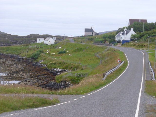
Lochan Tràigh Mhòr Images

Images are sourced within 2km of 58.196423/-6.9518615 or Grid Reference NB0933. Thanks to Geograph Open Source API. All images are credited.

An Sùileachan Monument A monument to the Lewis land clearances <span class="nowrap"><a title="https://bhaltostrust.co.uk/suileachan-project/" rel="nofollow ugc noopener" href="https://bhaltostrust.co.uk/suileachan-project/">Link</a><img style="margin-left:2px;" alt="External link" title="External link - shift click to open in new window" src="https://s1.geograph.org.uk/img/external.png" width="10" height="10"/></span>
An Sùileachan Monument
A monument to the Lewis land clearances LinkExternal link
A slipway in Loch Miabhaig
Derelict house on slope of Beinn a' Ghlinne Ruaidh
Lochan at Cragavig An old boundary wall snakes across the moorland
Lochan at Cragavig
An old boundary wall snakes across the moorland
Cerishader: postbox № HS2 158 A small postbox on the B8011, with its back to Loch Ròg. It is emptied at 9 o'clock each morning, except Sunday.
Cerishader: postbox № HS2 158
A small postbox on the B8011, with its back to Loch Ròg. It is emptied at 9 o'clock each morning, except Sunday.
Carishader postbox The sea inlet is part of Loch Ròg.
Carishader postbox
The sea inlet is part of Loch Ròg.
Old black house walls, Cairisiadar Looking up An Gleann Ruadh.
Old black house walls, Cairisiadar
Looking up An Gleann Ruadh.
Gleann Bhaltois (Glen Valtos) 6 Gleann Bhaltois is a spectacular example of a glacial meltwater channel. At the end of the last Ice Age, about 10,000 years ago, there is thought to have been a lake where Uig Bay now lies, dammed by ice to the west. The outlet from the lake was at the head of what is now Gleann Bhaltois, and carved a deep steep-sided glen, exploiting a fault line in the rocks. At this point, the glen steps down from its winding upper course through a rock fall to the much straighter lower course.
Gleann Bhaltois (Glen Valtos) 6
Gleann Bhaltois is a spectacular example of a glacial meltwater channel. At the end of the last Ice Age, about 10,000 years ago, there is thought to have been a lake where Uig Bay now lies, dammed by ice to the west. The outlet from the lake was at the head of what is now Gleann Bhaltois, and carved a deep steep-sided glen, exploiting a fault line in the rocks. At this point, the glen steps down from its winding upper course through a rock fall to the much straighter lower course.
Gleann Bhaltois (Glen Valtos) 7 Gleann Bhaltois is a spectacular example of a glacial meltwater channel. At the end of the last Ice Age, about 10,000 years ago, there is thought to have been a lake where Uig Bay now lies, dammed by ice to the west. The outlet from the lake was at the head of what is now Gleann Bhaltois, and carved a deep steep-sided glen, exploiting a fault line in the rocks.
Gleann Bhaltois (Glen Valtos) 7
Gleann Bhaltois is a spectacular example of a glacial meltwater channel. At the end of the last Ice Age, about 10,000 years ago, there is thought to have been a lake where Uig Bay now lies, dammed by ice to the west. The outlet from the lake was at the head of what is now Gleann Bhaltois, and carved a deep steep-sided glen, exploiting a fault line in the rocks.
Name That Tune This cheerful accordionist stands just inside a field by the cattle grid on the B8011 north of Cairisiadar. The label at his feet reads 'Name That Tune'.
Name That Tune
This cheerful accordionist stands just inside a field by the cattle grid on the B8011 north of Cairisiadar. The label at his feet reads 'Name That Tune'.
Cairisiadar (Carishader) Though the B8011 has been much improved, there are still some single-track stretches, notably where it crosses narrow bridges which have not been rebuilt, as here at Cairisiadar.
Cairisiadar (Carishader)
Though the B8011 has been much improved, there are still some single-track stretches, notably where it crosses narrow bridges which have not been rebuilt, as here at Cairisiadar.
Miabhaig harbour pontoon View from RIB afloat to pontoon at Miabhaig, Ceann A Tuath Na Hearadh (North Harris).  Compare to <a href="https://www.geograph.org.uk/photo/575251">NB0934 : Miabhaig Jetty</a> taken by Dave Fergusson on 1 Oct 2007.
Miabhaig harbour pontoon
View from RIB afloat to pontoon at Miabhaig, Ceann A Tuath Na Hearadh (North Harris). Compare to NB0934 : Miabhaig Jetty taken by Dave Fergusson on 1 Oct 2007.
If you are ever up this way... RIB moored alongside Miabhaig pontoon <a href="https://www.geograph.org.uk/photo/2429707">NB0934 : Miabhaig harbour pontoon</a> on Ceann A Tuath Na Hearadah (North Harris) from which we enjoyed a great trip.  (No financial benefit in anyway to me from posting this; simply a community service.)
If you are ever up this way...
RIB moored alongside Miabhaig pontoon NB0934 : Miabhaig harbour pontoon on Ceann A Tuath Na Hearadah (North Harris) from which we enjoyed a great trip. (No financial benefit in anyway to me from posting this; simply a community service.)
Join the Band Name That Tune and take a seat to have your photograph taken with the band at Carishader / Cairisiadar. Maybe it's Heather and Pete playing the field.
Join the Band
Name That Tune and take a seat to have your photograph taken with the band at Carishader / Cairisiadar. Maybe it's Heather and Pete playing the field.
Sheep Pens at Carishader One of many roadside pens on Lewis where sheep farming is a major agricultural industry.
Sheep Pens at Carishader
One of many roadside pens on Lewis where sheep farming is a major agricultural industry.
Carishader / Cairisiadar Elongated roadside crofting community on the shore of Loch Rog.
Carishader / Cairisiadar
Elongated roadside crofting community on the shore of Loch Rog.
Show me another place!

Lochan Tràigh Mhòr is located at Grid Ref: NB0933 (Lat: 58.196423, Lng: -6.9518615)

Unitary Authority: Na h-Eileanan an Iar

Police Authority: Highlands and Islands

What 3 Words

///likening.motel.laugh. Near Carloway, Na h-Eileanan Siar

Related Wikis

Flodaigh, Lewis

Flodaigh is a small island in Loch Roag on the west coast of Lewis in the Outer Hebrides of Scotland. It is about 33 hectares (82 acres) in extent and...

Loch na Berie

Loch Na Berie is a broch in the Outer Hebrides of Scotland, located approximately 400 yards from the shore, and is thought to have been located on an island...

Cliff, Lewis

Cliff (Scottish Gaelic: Cliobh) is a small settlement on the Isle of Lewis, in the Outer Hebrides, Scotland. Cliff is within the parish of Uig. The settlement...

Kneep

Kneep (Scottish Gaelic: Cnìp) is a village on the Isle of Lewis, in the Outer Hebrides, Scotland. Kneep is within the parish of Uig.Various archaeological...

Related Videos

THIS CLIFF IS 40 METERS HIGH! ft. A Random German

Shout out to the random german guy Subscribe, or you will fall of the cliff! Btw Subscribe to Don't Subscribe.

Reef beach 30th May

4K drone footage of Reef beach, Uig, Western Isles captured on my DJI Mini 2 drone with a ND64 filter.

Kneep, Isle of Lewis.

Kneep (Scottish Gaelic: Cnìp) is a village on the Isle of Lewis, in the Outer Hebrides, Scotland. Kneep is within the parish of Uig.

Nearby Amenities

Located within 500m of 58.196423,-6.9518615
Power: pole
Lat/Long: 58.195734/-6.9488923
Power: pole
Lat/Long: 58.1963299/-6.9496461
Power: pole
Lat/Long: 58.1969699/-6.9504542
Power: pole
Lat/Long: 58.197517/-6.9509146
Power: pole
Lat/Long: 58.1981776/-6.9514386
The data included in this document is from www.openstreetmap.org. The data is made available under ODbL.

Have you been to Lochan Tràigh Mhòr?

Leave your review of Lochan Tràigh Mhòr below (or comments, questions and feedback).