Aberllefenni

Settlement in Merionethshire

Wales

Aberllefenni

Aberllefenni, pwll & plas One of the slate-blue pools in the middle of Aberllefenni, fed by the Afon Llefenni just before it tumbles down into the Dulas. The chimneys and roof seen in the distance are of the C17 Plas Aberlefenni.
Aberllefenni, pwll & plas Credit: Mike Parker

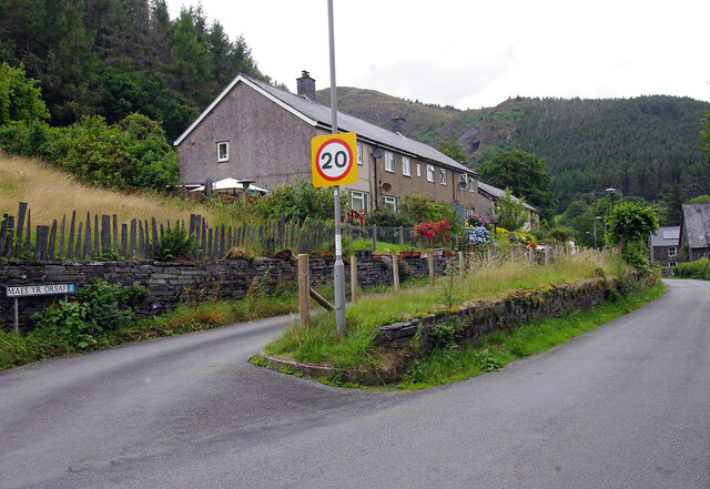
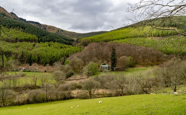
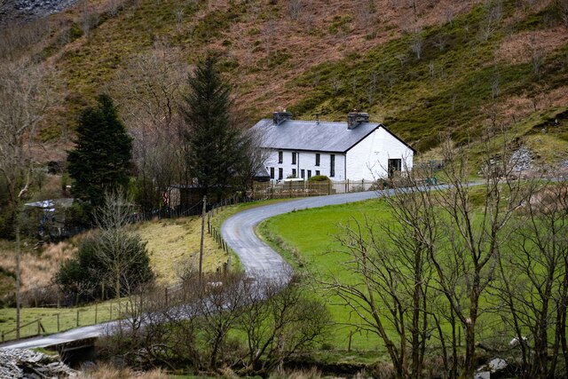
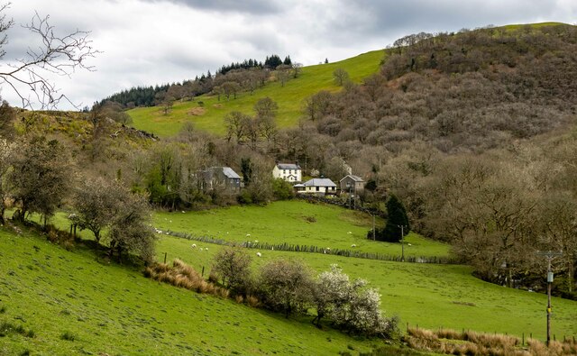
Aberllefenni is a small village located in the county of Merionethshire, Wales. Situated in the southern part of Snowdonia National Park, Aberllefenni is known for its picturesque setting and rich history.

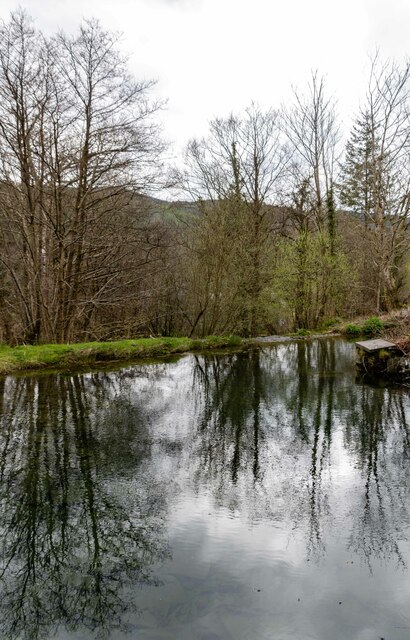
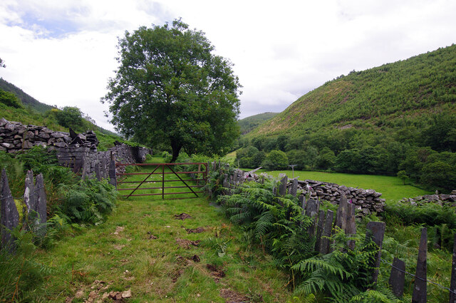
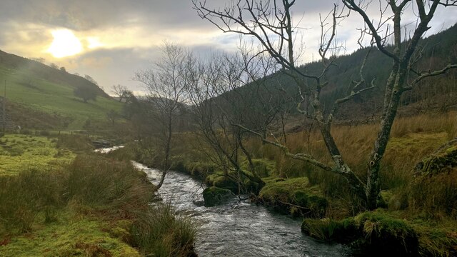
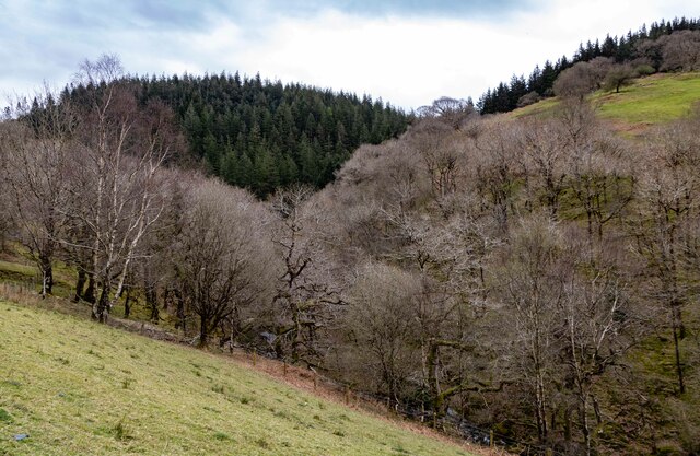
The village is nestled in the Dyfi Forest, surrounded by lush greenery and rolling hills. It is located approximately 9 miles southwest of the town of Machynlleth and is easily accessible via the A487 road. Aberllefenni is a rural community with a population of around 100 residents.

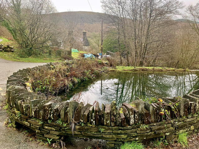
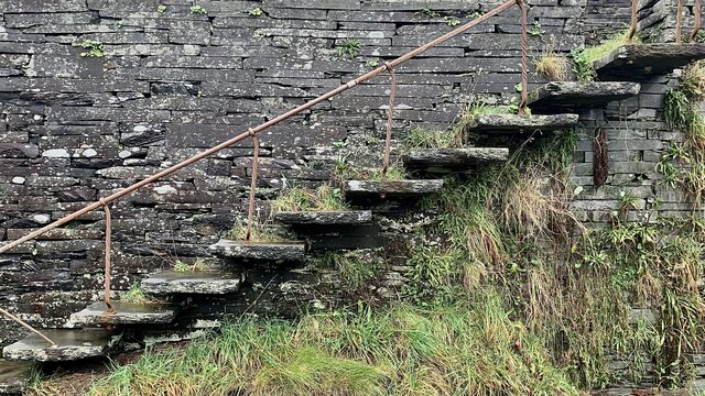
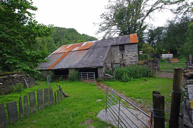
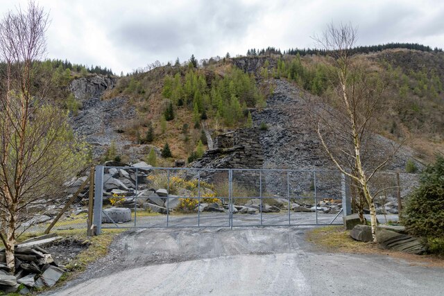
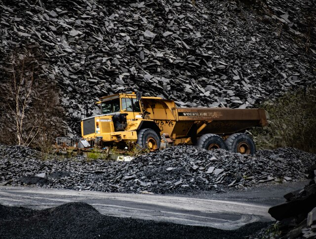
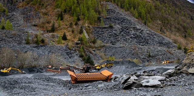
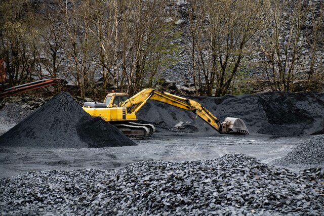
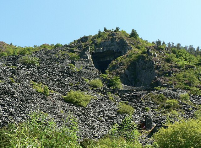
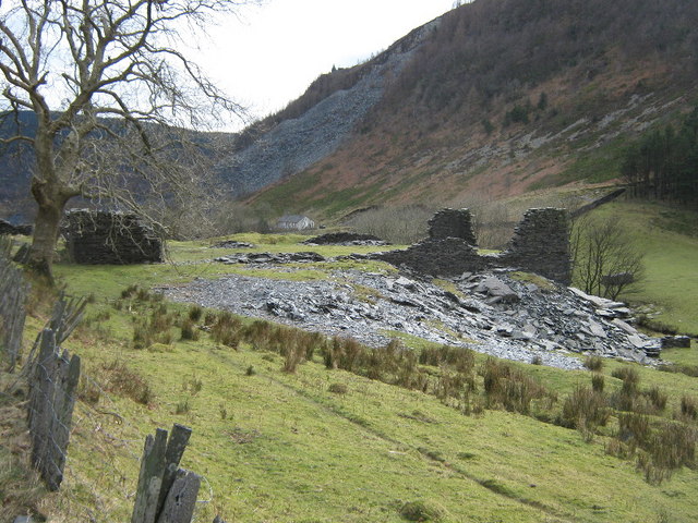
One of Aberllefenni's notable features is its historic slate quarry, which has been in operation since the 16th century. The quarry has been a significant source of employment in the area, providing high-quality slate for various construction projects. Today, the quarry is still active, albeit on a smaller scale, and continues to produce slate for both domestic and international markets.

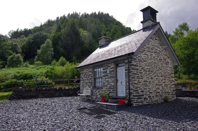
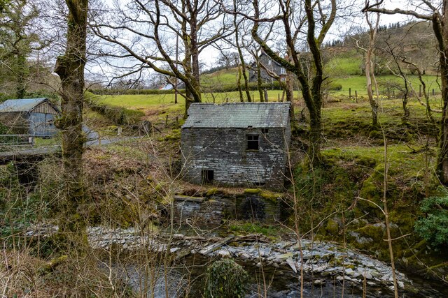
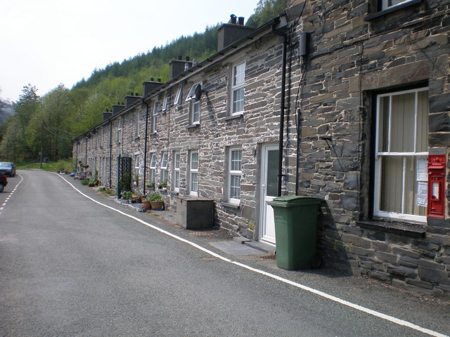
The village itself consists of a cluster of traditional stone houses and cottages, giving it a charming and timeless feel. It also boasts a local pub, The Quarryman's Arms, which serves as a gathering place for both locals and visitors. The surrounding natural landscape offers ample opportunities for outdoor activities such as hiking, mountain biking, and birdwatching.

Aberllefenni's close proximity to Snowdonia National Park makes it an ideal base for exploring the region's stunning scenery and attractions. The nearby Dyfi Valley offers breathtaking views, while the historic town of Machynlleth provides cultural amenities, including art galleries, museums, and a bustling weekly market.

Overall, Aberllefenni is a tranquil and scenic village with a rich industrial heritage, making it an appealing destination for nature lovers and history enthusiasts alike.

If you have any feedback on the listing, please let us know in the comments section below.

Aberllefenni Images

Images are sourced within 2km of 52.672794/-3.819851 or Grid Reference SH7709. Thanks to Geograph Open Source API. All images are credited.

Aberllefenni, pwll & plas One of the slate-blue pools in the middle of Aberllefenni, fed by the Afon Llefenni just before it tumbles down into the Dulas. The chimneys and roof seen in the distance are of the C17 Plas Aberlefenni.
Aberllefenni, pwll & plas
One of the slate-blue pools in the middle of Aberllefenni, fed by the Afon Llefenni just before it tumbles down into the Dulas. The chimneys and roof seen in the distance are of the C17 Plas Aberlefenni.
Grisiau i'r orsaf, Aberllefenni Everything in Aberllefeni is slate, including the steps embedded into the wall that once climbed up on to the platform of the village railway station.
Grisiau i'r orsaf, Aberllefenni
Everything in Aberllefeni is slate, including the steps embedded into the wall that once climbed up on to the platform of the village railway station.
Aberllefenni Pond at Aberllefenni.
Aberllefenni
Pond at Aberllefenni.
The Bell House, Aberllefenni Former office for the slate quarry, renovated c.2014. Grade II listed building, see <span class="nowrap"><a title="https://cadwpublic-api.azurewebsites.net/reports/listedbuilding/FullReport?lang=&id=22718" rel="nofollow ugc noopener" href="https://cadwpublic-api.azurewebsites.net/reports/listedbuilding/FullReport?lang=&id=22718">Link</a><img style="margin-left:2px;" alt="External link" title="External link - shift click to open in new window" src="https://s1.geograph.org.uk/img/external.png" width="10" height="10"/></span>
The Bell House, Aberllefenni
Former office for the slate quarry, renovated c.2014. Grade II listed building, see LinkExternal link
Barn, Aberllefenni
Barn, Aberllefenni
Route of Corris Railway The narrow gauge Corris Railway was built to carry slate from local quarries to Machynlleth and quays on the Dovey estuary. The line closed in 1948.
Route of Corris Railway
The narrow gauge Corris Railway was built to carry slate from local quarries to Machynlleth and quays on the Dovey estuary. The line closed in 1948.
Maes Yr Orsaf, Aberllefenni The street sign indicates that this is the site of the Corris Railway station. The houses were built after closure of the railway in 1948.
Maes Yr Orsaf, Aberllefenni
The street sign indicates that this is the site of the Corris Railway station. The houses were built after closure of the railway in 1948.
Nant Ceiswyn The view along the river, Nant Ceiswyn, that runs the length of the old slate quarrying valley of Cwm Ratgoed.
Nant Ceiswyn
The view along the river, Nant Ceiswyn, that runs the length of the old slate quarrying valley of Cwm Ratgoed.
Bluemaris
Bluemaris
Capel Bethesda
Capel Bethesda
Aberllefenni Quarry Entrance to Aberllefenni Slate Quarry.
Aberllefenni Quarry
Entrance to Aberllefenni Slate Quarry.
Aberllefenni Quarry Dump truck in Aberllefenni Slate Quarry.
Aberllefenni Quarry
Dump truck in Aberllefenni Slate Quarry.
Aberllefenni Quarry
Aberllefenni Quarry
Troed-yr esgair
Troed-yr esgair
Aberllefenni Quarry Excavator at Aberllefenni Slate Quarry.
Aberllefenni Quarry
Excavator at Aberllefenni Slate Quarry.
Coed Cwmcelli
Coed Cwmcelli
Aberllefenni slate quarry
Show me another place!

Aberllefenni is located at Grid Ref: SH7709 (Lat: 52.672794, Lng: -3.819851)

Unitary Authority: Gwynedd

Police Authority: North Wales

What 3 Words

///captures.global.witty. Near Corris, Gwynedd

Related Wikis

Aberllefenni

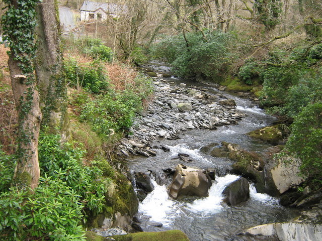
Aberllefenni is a village in the south of Gwynedd, Wales. It lies in the historic county of Merionethshire/Sir Feirionnydd, in the valley of the Afon Dulas...

Cwm Hengae

Cwm Hengae is a valley that runs roughly north-west from the village of Aberllefenni in Wales. The Afon Llefenni river runs along the valley and several...

Narrow Vein Mudstone Formation

The Narrow Vein Mudstone Formation (commonly known as the Narrow Vein) is an Ordovician lithostratigraphic group (a sequence of rock strata) in Mid Wales...

Aberllefenni quarries

Aberllefenni quarry is the collective name of three slate quarries, Foel Grochan, Hen Gloddfa (also known as Hen Chwarel) and Ceunant Ddu, located in Cwm...

Nant Ceiswyn

The Nant Ceiswyn (sometimes known as the Afon Ceiswyn) is a small river in Mid Wales. It flows from the northern flank of Mynydd Dolgoed down to Pont Cymerau...

Nant Llwydiarth

The Nant Llwydiarth is a small river in Mid Wales. It flows from the southern flank of Mynydd Hendre-ddu down to Pont Cymerau, north-east of Aberllefenni...

Cambergi quarry

Cambergi quarry (also known as Wenallt quarry) was a slate quarry in Cwm Hengae, west of Aberllefenni in North Wales. It operated between 1873 and about...

Mynydd Cambergi

Mynydd Cambergi or Mynydd Cam-bergi is a mountain in southern Snowdonia, Wales. It is a summit on a long ridge between Mynydd y Waun to the north and Foel...

Related Videos

Summer Camp 2022

Our Summer Camp 2022 video. Covid disrupted our summer camp program for two years so this one has been a long time ...

King Arthur's Labyrinth - Snowdonia Attractions

Voted best Family Attraction in Mid Wales!

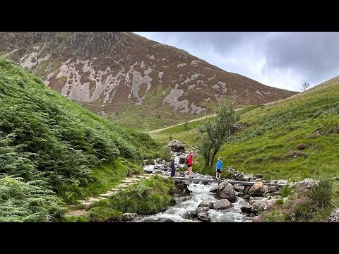
Short Walk in Wales with Mrs and Bear.

No route planned, just out in the hills enjoying life with the family.

Nearby Amenities

Located within 500m of 52.672794,-3.819851
Aberllefenni
Is In: Gwynedd
Place: village
Source: npe
Wikidata: Q3398817
Lat/Long: 52.671808/-3.8189232
Man Made: adit
Lat/Long: 52.6769759/-3.8209784
Man Made: adit
Lat/Long: 52.6771599/-3.8206336
Power: pole
Lat/Long: 52.6761684/-3.8238485
Power: pole
Lat/Long: 52.6759933/-3.8230521
Power: pole
Lat/Long: 52.6690584/-3.8160706
Power: pole
Lat/Long: 52.6697787/-3.8160892
Power: pole
Lat/Long: 52.6705233/-3.8161215
Power: pole
Lat/Long: 52.6712057/-3.816135
Historic: memorial
Memorial: war_memorial
Lat/Long: 52.6713505/-3.8206016
Power: pole
Lat/Long: 52.6763951/-3.8240066
Location Transition: yes
Power: pole
Lat/Long: 52.6761772/-3.8226816
Power: pole
Lat/Long: 52.6732538/-3.8178603
Power: pole
Lat/Long: 52.6736263/-3.8185295
Power: pole
Lat/Long: 52.6739556/-3.8191143
Power: pole
Lat/Long: 52.6743736/-3.8198586
Power: pole
Lat/Long: 52.6748428/-3.8207102
Location Transition: yes
Power: pole
Lat/Long: 52.6749387/-3.8206445
Power: pole
Lat/Long: 52.6745167/-3.8197392
Power: pole
Lat/Long: 52.6740646/-3.8186865
Power: pole
Lat/Long: 52.6738532/-3.8182372
Power: pole
Lat/Long: 52.6728871/-3.8161853
Power: pole
Lat/Long: 52.672056/-3.8161773
Telephone
Defibrillator
Booth: K6
Covered: booth
Defibrillator Location: inside red phone box in Aberllefenni
Emergency: defibrillator
Man Made: telephone_box
Lat/Long: 52.6727103/-3.8200946
The data included in this document is from www.openstreetmap.org. The data is made available under ODbL.

Have you been to Aberllefenni?

Leave your review of Aberllefenni below (or comments, questions and feedback).