Ness of Clousta

Coastal Feature, Headland, Point in Shetland

Scotland

Ness of Clousta

View from Muckle Head Looking east from the top of Muckle Head that sits out in the North Voe of Clousta. The small islet is cut off at high water and there is a tidal pool on the right.
View from Muckle Head Credit: David Nicolson

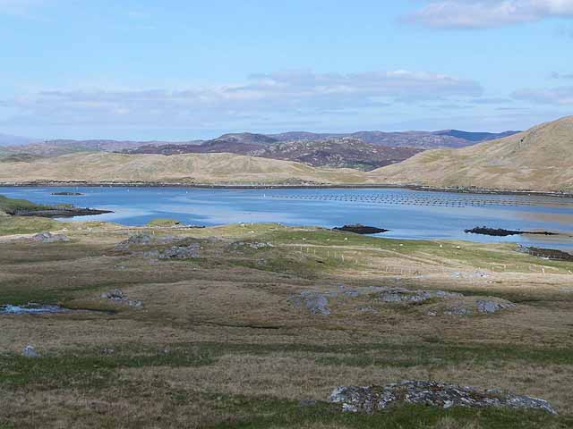
Ness of Clousta is a prominent coastal feature located in the Shetland Islands, Scotland. It is a headland that stretches out into the North Sea, forming a distinctive point along the coastline. The headland is situated on the western side of the island of Yell, one of the larger islands in the Shetland archipelago.

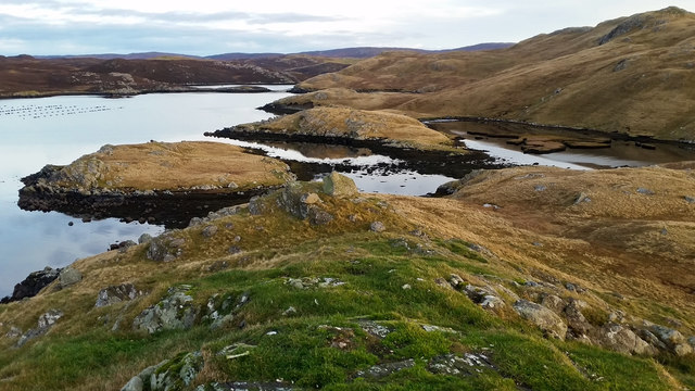
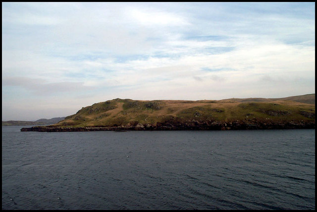
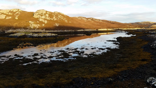
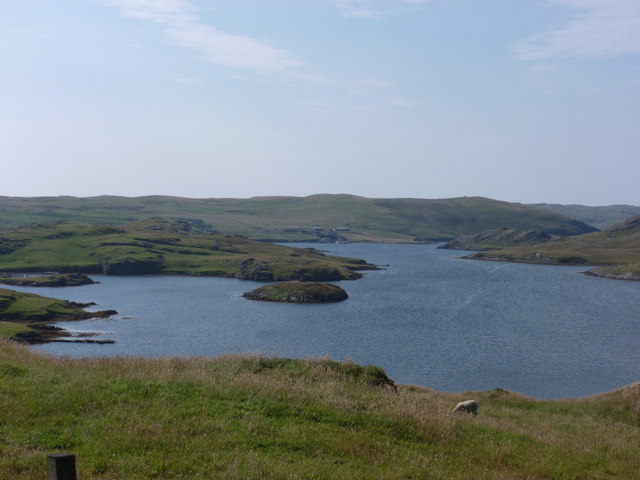
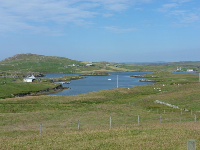
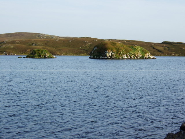
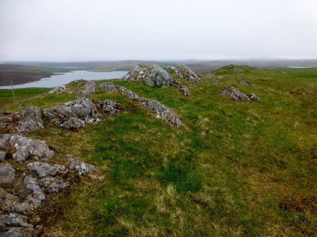
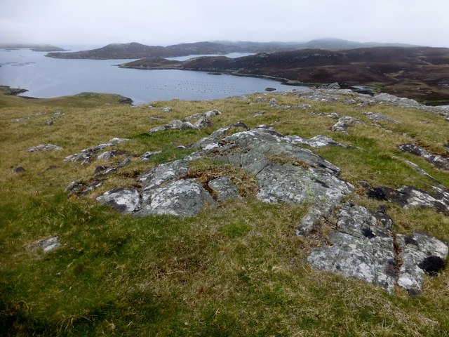
Ness of Clousta is characterized by its rugged and dramatic cliffs that rise steeply from the sea, reaching heights of up to 150 feet (45 meters). The cliffs are composed of layers of sedimentary rock, displaying a variety of colors and textures. At the base of the cliffs, there are rocky shores and small coves, which provide a habitat for various marine species.

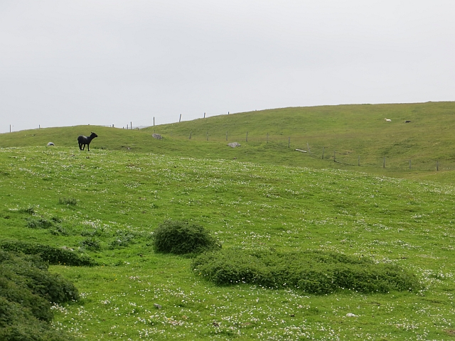
The headland offers breathtaking views of the surrounding coastline and is a popular spot for both locals and tourists to visit. It is a prime location for birdwatching, as the cliffs serve as nesting sites for a wide range of seabirds, including puffins, guillemots, and razorbills. Visitors can also spot seals and dolphins in the waters surrounding Ness of Clousta.

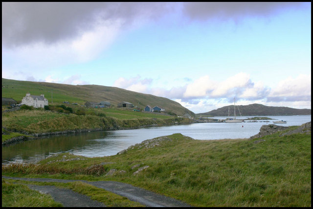
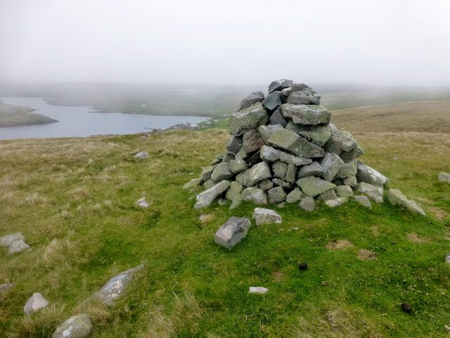
Access to Ness of Clousta is relatively easy, with a well-maintained footpath leading to the headland. The area is managed by the Shetland Islands Council, which is responsible for preserving its natural beauty and protecting the wildlife that inhabits it.

Overall, Ness of Clousta is a captivating coastal feature that showcases the stunning natural landscapes of the Shetland Islands. Its towering cliffs, diverse wildlife, and picturesque views make it a must-visit destination for nature enthusiasts and photographers alike.

If you have any feedback on the listing, please let us know in the comments section below.

Ness of Clousta Images

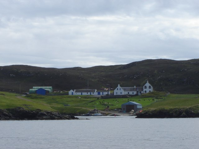
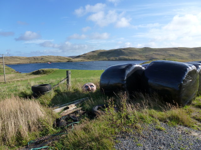
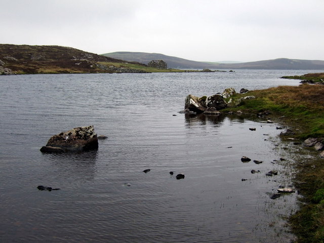
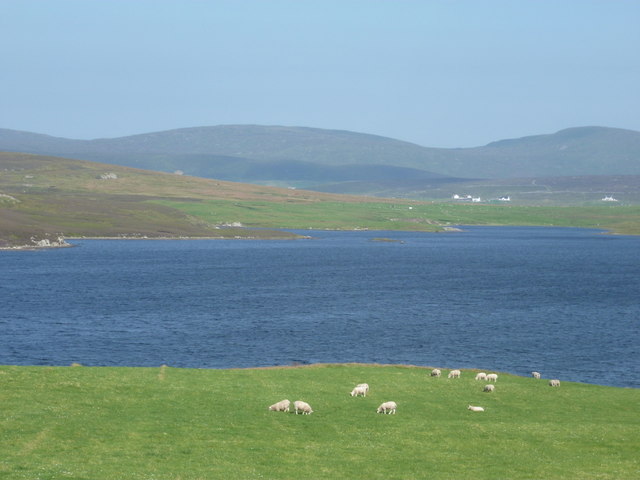
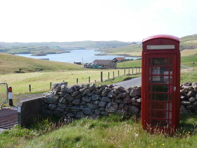
Images are sourced within 2km of 60.303834/-1.4532744 or Grid Reference HU3057. Thanks to Geograph Open Source API. All images are credited.

View from Muckle Head Looking east from the top of Muckle Head that sits out in the North Voe of Clousta. The small islet is cut off at high water and there is a tidal pool on the right.
View from Muckle Head
Looking east from the top of Muckle Head that sits out in the North Voe of Clousta. The small islet is cut off at high water and there is a tidal pool on the right.
Noonsbrough Settlement Noonsbrough houses and pier with yacht moored
Noonsbrough Settlement
Noonsbrough houses and pier with yacht moored
Longa Ness Coast of Longa Ness from Brindister
Longa Ness
Coast of Longa Ness from Brindister
The Brigs of Clousta Da Brigs o Clousta at low tide.
The Brigs of Clousta
Da Brigs o Clousta at low tide.
Buildings at Vementry, Shetland These buildings are on the Shetland Mainland.  The uninhabited Isle of Vementry is close by, across the sound.
Buildings at Vementry, Shetland
These buildings are on the Shetland Mainland. The uninhabited Isle of Vementry is close by, across the sound.
Brindister Voe - skerry The small skerry is unnamed on the map but must be a nuisance to local boatmen.
The Ness of Noonsbrough at the back.
Oh, a scary at the front!
Brindister Voe - skerry
The small skerry is unnamed on the map but must be a nuisance to local boatmen. The Ness of Noonsbrough at the back. Oh, a scary at the front!
Clings Water Narrow bay at western end of Clings Water with small stone ruin still bearing some roof timbers.
Clings Water
Narrow bay at western end of Clings Water with small stone ruin still bearing some roof timbers.
Clousta: sheep graze by Loch of Vaara Looking across the Loch of Vaara towards a few houses in Braewick to the west side of Aith Voe, as sheep happily graze in fields between us and the loch.
Clousta: sheep graze by Loch of Vaara
Looking across the Loch of Vaara towards a few houses in Braewick to the west side of Aith Voe, as sheep happily graze in fields between us and the loch.
Clousta: the telephone box This must be one of the remotest telephone boxes in Britain, in the hamlet of Clousta at the dead end of a three-mile lane from Twatt and Bixter. Behind it, we have a good view of the Voe of Clousta.
Clousta: the telephone box
This must be one of the remotest telephone boxes in Britain, in the hamlet of Clousta at the dead end of a three-mile lane from Twatt and Bixter. Behind it, we have a good view of the Voe of Clousta.
Clousta: Voe of Clousta Looking down the voe from the lane to Noonsbrough. Holme of Clousta is the small island in the centre.
Clousta: Voe of Clousta
Looking down the voe from the lane to Noonsbrough. Holme of Clousta is the small island in the centre.
Clousta: a tractor-driving mannequin This figure stands outside a house by the Voe of Clousta and has a birthday greeting message on his fluorescent jacket.
Clousta: a tractor-driving mannequin
This figure stands outside a house by the Voe of Clousta and has a birthday greeting message on his fluorescent jacket.
Clousta: Voe of Setter Looking along the Voe of Setter from the lane to Noonsbrough. The Voe is a branch of the Voe of Clousta, which runs left-to-right across the picture.
Clousta: Voe of Setter
Looking along the Voe of Setter from the lane to Noonsbrough. The Voe is a branch of the Voe of Clousta, which runs left-to-right across the picture.
Isles on Loch of Clousta Two small islets on the Loch of Clousta. Many of these small islets on Shetlands lochs have rich vegetation in comparison to the shores which have been intensively grazed by sheep.
Isles on Loch of Clousta
Two small islets on the Loch of Clousta. Many of these small islets on Shetlands lochs have rich vegetation in comparison to the shores which have been intensively grazed by sheep.
Fish farm in Bridister Voe The Ness of Noonsbrough on the far shore. The further hills are beyond the Voe of Clousta (not visible).
Fish farm in Bridister Voe
The Ness of Noonsbrough on the far shore. The further hills are beyond the Voe of Clousta (not visible).
Skiords Summit Bagged with Tricky Speirs.
Name: Skiords
Hill number: 103983
Height: 76m / 249ft
Area: 22: Shetland Islands
Class: 0
Grid ref: HU311568 (est)
Drop: 48m
Col: 28m
Skiords Summit
Bagged with Tricky Speirs. Name: Skiords Hill number: 103983 Height: 76m / 249ft Area: 22: Shetland Islands Class: 0 Grid ref: HU311568 (est) Drop: 48m Col: 28m
Dutch Ward Bagged with Tricky Speirs.
Name: Dutch Ward
Hill number: 103981
Height: 76m / 249ft
Area: 22: Shetland Islands
Class: 0
Grid ref: HU290577 (est)
Drop: 59m
Col: 17m
Dutch Ward
Bagged with Tricky Speirs. Name: Dutch Ward Hill number: 103981 Height: 76m / 249ft Area: 22: Shetland Islands Class: 0 Grid ref: HU290577 (est) Drop: 59m Col: 17m
Muckle Billerin Bagged with Tricky Speirs.

Name: Muckle Billerin
Hill number: 103980
Height: 76m / 249ft
Area: 22: Shetland Islands
Class: 0
Grid ref: HU306579 (est)
Drop: 67m
Col: 9m
Muckle Billerin
Bagged with Tricky Speirs. Name: Muckle Billerin Hill number: 103980 Height: 76m / 249ft Area: 22: Shetland Islands Class: 0 Grid ref: HU306579 (est) Drop: 67m Col: 9m
Kinnin Knowes Dry grassland on well contoured land above Voe of Clousta.
Kinnin Knowes
Dry grassland on well contoured land above Voe of Clousta.
Show me another place!

Ness of Clousta is located at Grid Ref: HU3057 (Lat: 60.303834, Lng: -1.4532744)

Unitary Authority: Shetland Islands

Police Authority: Highlands and Islands

What 3 Words

///bond.signed.fuels. Near Aith, Shetland Islands

Related Wikis

Clousta

Clousta is a hamlet on Mainaland, in the island's west, Shetland, Scotland. Approximately seventy people live here, many of whom are commuters, but local...

Brindister, West Mainland

Brindister is a settlement on the West Mainland of Shetland, Scotland. It is within the parish of Sandsting, and on the western shore of Brindister Voe...

Vementry

Vementry (Old Norse: "Vemunðarey") is an uninhabited Scottish island in Shetland on the north side of the West Mainland, lying south of Muckle Roe. �...

Linga (near Vementry)

Linga is one of the Shetland Islands, near Vementry. It is one of many islands in Shetland called Linga. The island is uninhabited. == Geography and... ==

Nearby Amenities

Located within 500m of 60.303834,-1.4532744
Power: pole
Lat/Long: 60.3012925/-1.4463033
The data included in this document is from www.openstreetmap.org. The data is made available under ODbL.

Have you been to Ness of Clousta?

Leave your review of Ness of Clousta below (or comments, questions and feedback).