Lang Head
Coastal Feature, Headland, Point in Shetland
Scotland
Lang Head
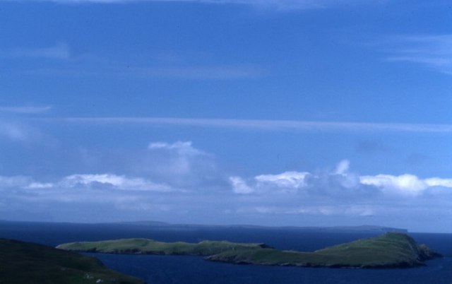
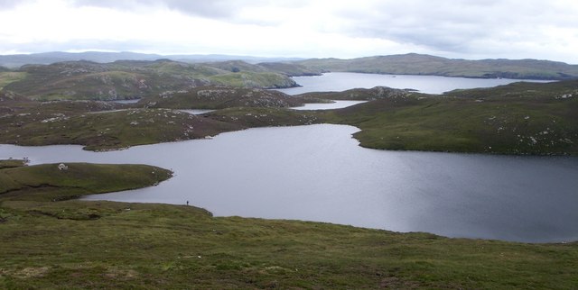
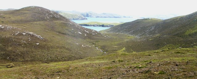
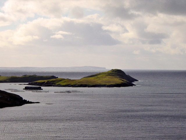
Lang Head is a prominent coastal feature located on the island of Shetland, off the northern coast of Scotland. It is a headland or a point that juts out into the North Sea, offering stunning views of the surrounding landscape. The headland is situated in the west-central part of Shetland, near the village of Walls.
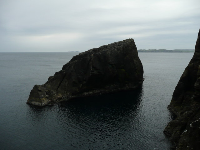
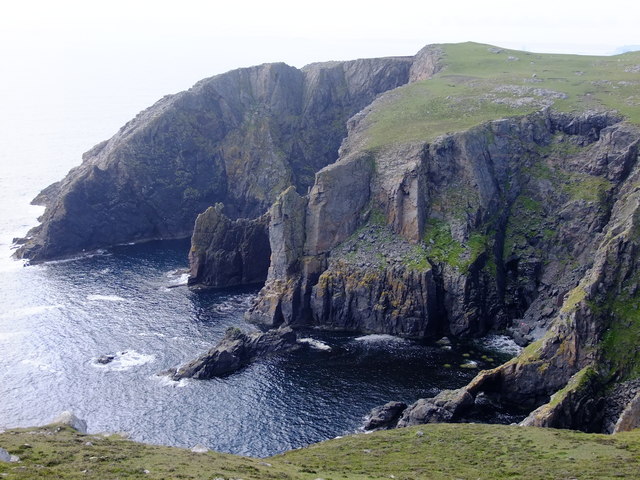
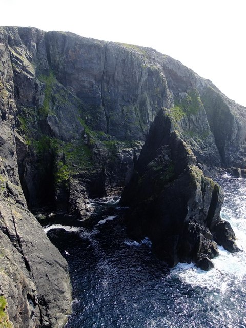
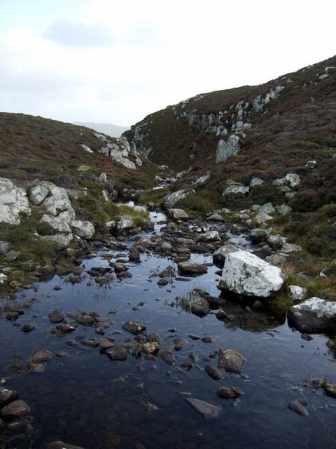
At Lang Head, the land abruptly meets the sea, forming steep cliffs that tower above the water. These cliffs are composed of rugged rocks, primarily consisting of sandstone and shale, which have been shaped over centuries by the relentless crashing waves. The headland rises to an elevation of approximately 50 meters (164 feet) above sea level, providing an elevated vantage point for visitors to admire the coastal scenery.
The area around Lang Head is rich in wildlife, making it a popular spot for nature enthusiasts. The cliffs provide nesting sites for various seabirds, including puffins, guillemots, and razorbills. Visitors may also spot seals basking on the rocks or swimming in the surrounding waters.
Access to Lang Head is relatively easy, with a well-maintained footpath that leads to the headland. The path offers stunning views along the way, allowing visitors to appreciate the natural beauty of the coastline. As Lang Head is exposed to the ocean's full force, it can be quite windy, so appropriate clothing is recommended.
Overall, Lang Head is a picturesque and remarkable coastal feature, offering visitors a chance to experience the wild and rugged beauty of Shetland's coastline.
If you have any feedback on the listing, please let us know in the comments section below.
Lang Head Images
Images are sourced within 2km of 60.41837/-1.4520987 or Grid Reference HU3070. Thanks to Geograph Open Source API. All images are credited.


Lang Head is located at Grid Ref: HU3070 (Lat: 60.41837, Lng: -1.4520987)
Unitary Authority: Shetland Islands
Police Authority: Highlands and Islands
What 3 Words
///snooze.handsets.diplomas. Near Brae, Shetland Islands
Nearby Locations
Related Wikis

Gunnister
Gunnister is a small 'abandoned' village at the North-West Mainland in Shetland, Scotland. It is most commonly known for the Gunnister Man - the remains...

Mavis Grind
Mavis Grind (Old Norse: Mæfeiðs grind or Mæveiðs grind, meaning "gate of the narrow isthmus") is a narrow isthmus joining the Northmavine peninsula to...
Punds Water
Punds Water is a freshwater loch near Mangaster in Northmavine, Shetland. It also gives its name to a nearby Neolithic heel-shaped cairn. == Heel-shaped... ==
Sullom
Sullom is a village on the Shetland peninsula of Northmavine, between Haggrister and Bardister. It lies on the northwest side of Sullom Voe, to which it...

Muckle Roe
Muckle Roe is an island in Shetland, Scotland, in St. Magnus Bay, to the west of Mainland. It has a population of around 130 people, who mainly croft and...

Brae
"Brae" is also the Lowland Scots language word for the slope or brow of a hill.Brae (Old Norse: Breiðeið, meaning "the wide isthmus") is a village on the...
Busta Voe
Busta Voe, (HU665350), in the north central Mainland, Shetland, is a sea inlet lying between the village of Brae and the island of Muckle Roe. At the head...

The Drongs
The Drongs are a group of sea stacks off the coast of Hillswick Ness, Northmavine, Shetland, Scotland. They lie to the west of the Isle of Westerhouse...
Have you been to Lang Head?
Leave your review of Lang Head below (or comments, questions and feedback).