Pen yr Hwbyn

Coastal Feature, Headland, Point in Cardiganshire

Wales

Pen yr Hwbyn

Bench with a view as you go east from Mwnt Recently opened when this picture was taken, the section of the Ceredigion Coast Path leaves Mwnt near the small church <a title="https://www.geograph.org.uk/photo/886615" href="https://www.geograph.org.uk/photo/886615">Link</a> and has fine views all the way to Aberporth.  Returning westerly, you cannot see the dramatic cliff faces so well. Here you can rest just after leaving (or just before arriving in) Mwnt. This first section is a permissive path.
Bench with a view as you go east from Mwnt Credit: Zorba the Geek

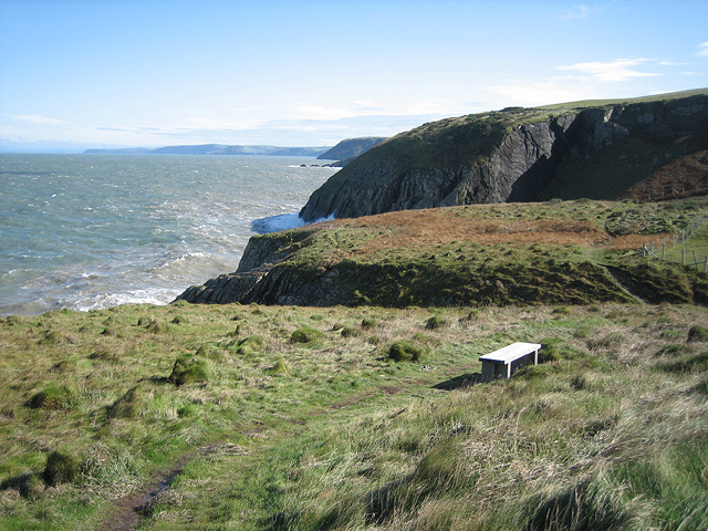
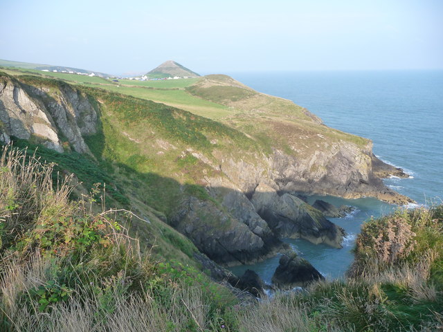
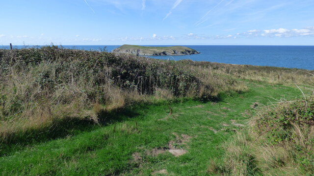
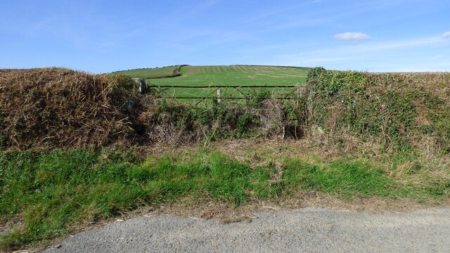
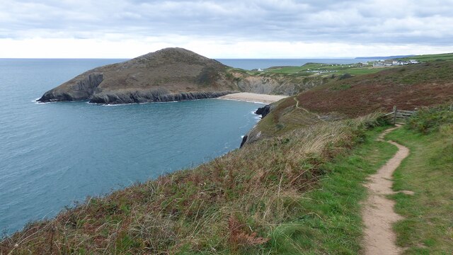
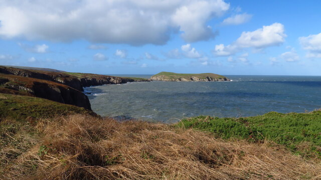
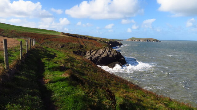
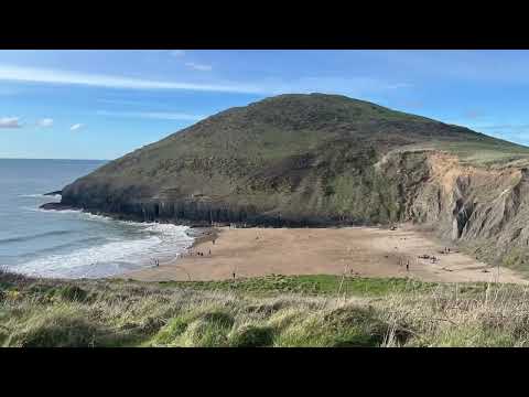
Pen yr Hwbyn is a prominent headland located in Cardiganshire, Wales. Situated along the rugged coastline, it offers stunning panoramic views of the surrounding area and the Irish Sea. The name "Pen yr Hwbyn" translates to "the end of the ridge," which accurately describes its geographical formation.

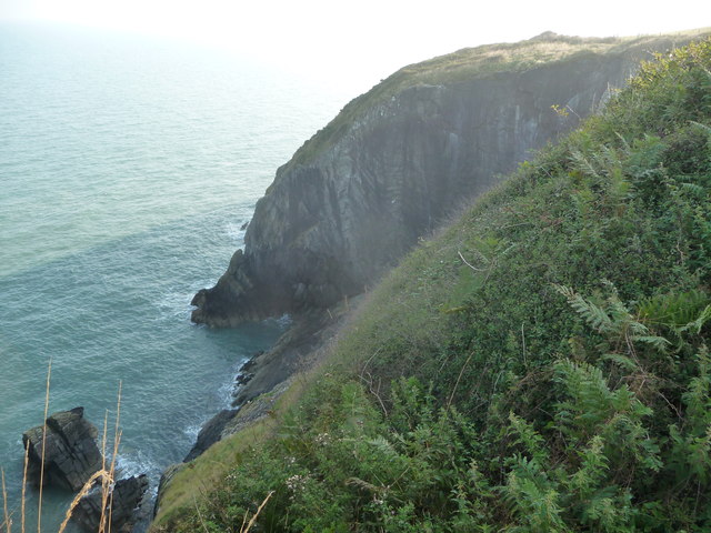
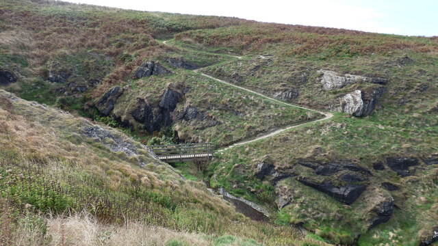
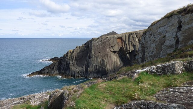
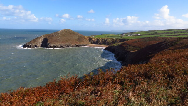
This coastal feature is characterized by its towering cliffs and rocky outcrops, making it a popular destination for outdoor enthusiasts and nature lovers. The headland is primarily composed of sedimentary rocks, including sandstone and shale, which have been shaped over millions of years by the constant erosion caused by the crashing waves.

The headland is home to a diverse range of flora and fauna, with various seabirds nesting in the cliffs and wildflowers dotting the landscape during the warmer months. The surrounding waters are also teeming with marine life, making it a popular spot for fishing and snorkeling.

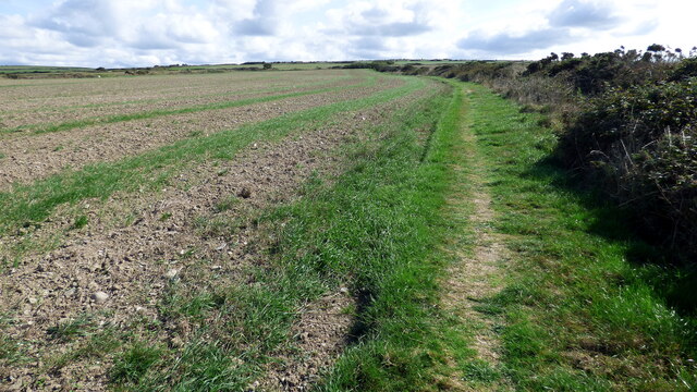
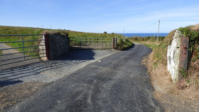
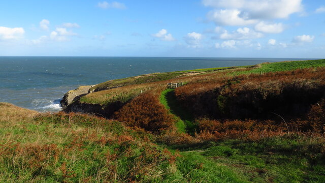
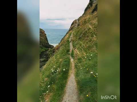
Pen yr Hwbyn is easily accessible via a well-maintained footpath that winds its way along the cliff edge, providing visitors with breathtaking vistas at every turn. The headland also boasts a small, secluded beach nestled at its base, which can be reached via a steep and narrow staircase.

Due to its exposed location, Pen yr Hwbyn is subject to strong winds and powerful waves, making it important for visitors to exercise caution while exploring the area. Nonetheless, its natural beauty and dramatic scenery make it a must-visit destination for those seeking an authentic coastal experience in Cardiganshire.

If you have any feedback on the listing, please let us know in the comments section below.

Pen yr Hwbyn Images

Images are sourced within 2km of 52.134062/-4.6576934 or Grid Reference SN1851. Thanks to Geograph Open Source API. All images are credited.

Bench with a view as you go east from Mwnt Recently opened when this picture was taken, the section of the Ceredigion Coast Path leaves Mwnt near the small church <a title="https://www.geograph.org.uk/photo/886615" href="https://www.geograph.org.uk/photo/886615">Link</a> and has fine views all the way to Aberporth.  Returning westerly, you cannot see the dramatic cliff faces so well. Here you can rest just after leaving (or just before arriving in) Mwnt. This first section is a permissive path.
Bench with a view as you go east from Mwnt
Recently opened when this picture was taken, the section of the Ceredigion Coast Path leaves Mwnt near the small church Link and has fine views all the way to Aberporth. Returning westerly, you cannot see the dramatic cliff faces so well. Here you can rest just after leaving (or just before arriving in) Mwnt. This first section is a permissive path.
Ffynnongrog Farm No longer a working farm; two of the barns are converted to holiday lets, as is the old house. One of the lets has an interesting poster from 1953, advertising the sale of various agricultural implements and farm stock of the time, including a 1934 Morris ('in running order', no less), a Deere tractor, umpteen cattle & pigs, working horses (one of which was in foal) and so on. Times gone by, eh?
Ffynnongrog Farm
No longer a working farm; two of the barns are converted to holiday lets, as is the old house. One of the lets has an interesting poster from 1953, advertising the sale of various agricultural implements and farm stock of the time, including a 1934 Morris ('in running order', no less), a Deere tractor, umpteen cattle & pigs, working horses (one of which was in foal) and so on. Times gone by, eh?
Barn conversions at Ffynnongrog Self catering lets at Ffynnongrog Farm; the left-hand unit sleeps two, the right-hand one will cater for six.
Barn conversions at Ffynnongrog
Self catering lets at Ffynnongrog Farm; the left-hand unit sleeps two, the right-hand one will cater for six.
View to cliffs from the coast path near Mwnt I just missed a bird of prey heading off around this cliff corner at my approach. Just one of many birds and animals seen on my walk along this stretch of coast this morning (including Red Kite pairs, single Buzzard, fox, many snails, quite a few Choughs, but no seals!).
View to cliffs from the coast path near Mwnt
I just missed a bird of prey heading off around this cliff corner at my approach. Just one of many birds and animals seen on my walk along this stretch of coast this morning (including Red Kite pairs, single Buzzard, fox, many snails, quite a few Choughs, but no seals!).
On the Wales Coast Path near Mwnt in August A quiet section of the path that I cannot recommend enough - secluded enough to spot lots of wildlife and scenically pretty varied with a great outlook along the coast and often inland too.
On the Wales Coast Path near Mwnt in August
A quiet section of the path that I cannot recommend enough - secluded enough to spot lots of wildlife and scenically pretty varied with a great outlook along the coast and often inland too.
Footpath Diversion At this point the coastal footpath heads inland away from the cliff top.  The original intention was for the path to follow the cliff but the landowner successfully challenged this.  To be fair there are other sections which are also not that near the sea.
Footpath Diversion
At this point the coastal footpath heads inland away from the cliff top. The original intention was for the path to follow the cliff but the landowner successfully challenged this. To be fair there are other sections which are also not that near the sea.
The coastal path heads inland
Bridge across a stream The Ceredigion coastal path crosses a stream at this point.
Bridge across a stream
The Ceredigion coastal path crosses a stream at this point.
Pen Ffynnoncyff Hill The high hedges around here restrict views somewhat.
Pen Ffynnoncyff Hill
The high hedges around here restrict views somewhat.
Cliff at Pen yr Hwbyn
Minor road near Ffynoncyff
Lime Kiln at Mwnt
Lime Kiln at Mwnt
Ceredigion Coastal Path Leading to Mwnt
Mwnt Church <span class="nowrap"><a title="https://www.spab.org.uk/news/building-focus-mwnt-church" rel="nofollow ugc noopener" href="https://www.spab.org.uk/news/building-focus-mwnt-church">Link</a><img style="margin-left:2px;" alt="External link" title="External link - shift click to open in new window" src="https://s1.geograph.org.uk/img/external.png" width="10" height="10"/></span>
Mwnt Church
Heading NE on Wales Coast Path near Pen Tew
View towards Cardigan Island from Wales Coast Path at Pen Tew
On Wales Coast Path below Crug Farm near Gwbert - view towards Cardigan Island
Traeth y Mwnt & Foel-y-Mwnt
Show me another place!

Pen yr Hwbyn is located at Grid Ref: SN1851 (Lat: 52.134062, Lng: -4.6576934)

Unitary Authority: Ceredigion

Police Authority: Dyfed Powys

What 3 Words

///slowly.gratitude.clear. Near Cardigan, Ceredigion

Related Wikis

Mwnt

Mwnt (Welsh: [ˈmʊnt]) is an ancient parish in Ceredigion, Wales, 4.5 miles (7.2 km) north of Cardigan. The Wales Coast Path passes through this very small...

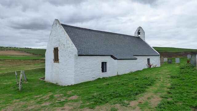
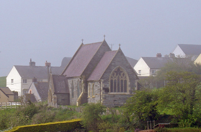
Church of the Holy Cross, Mwnt

The Church of the Holy Cross (Welsh: Eglwys y Grog) at Mwnt, Ceredigion, Wales, is a parish church and Grade I listed building dating probably from the...

Cardigan Island

Cardigan Island (Welsh: Ynys Aberteifi) is an uninhabited island north of Cardigan, Ceredigion, south-west Wales. It reaches a height of 52 metres (171...

Y Ferwig

Y Ferwig (sometimes spelled Verwig) is a small village and community about 2 to 3 miles from Cardigan, Wales. == Amenities == The village is made up of...

Gwbert

Gwbert (Welsh pronunciation: [ˈɡubɛrt]), also known as Gwbert-on-Sea, is a cliff-top coastal village in Y Ferwig community, Ceredigion, Wales. It lies...

Banc y Mwldan

Banc y Mwldan is a Site of Special Scientific Interest in Ceredigion, west Wales. == References == == See also == List of Sites of Special Scientific...
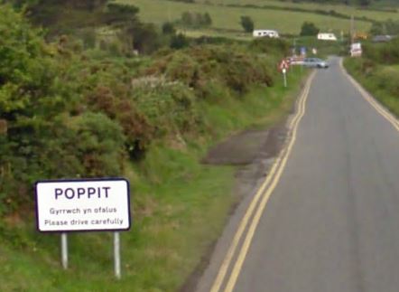
Poppit Sands

Poppit (Welsh: Poppit) is a small, dispersed settlement which lies on the southern side of the estuary of the River Teifi, near Cardigan, in northern Pembrokeshire...

River Teifi

The River Teifi (English: ; Welsh: Afon Teifi, pronounced [ˈavɔn ˈtəɪvɪ]) in Wales forms the boundary for most of its length between the counties of Ceredigion...

Related Videos

Walking the coast path, Aberporth, Mwnt and to Cardigan Island

A day out exploring the Cardigan bay coast path from Mwnt to Aberporth, towards Cardigan Island. Some beautiful wild unspoilt ...

Mwnt Cliff Walk, Sea view, Ceredigion, Wales

A short walk through. Most visitors will see the Church and walk up the headland, but not many climb this part. The views are ...

Wales in autumn

Wales in autumn.

Nearby Amenities

Located within 500m of 52.134062,-4.6576934
Pen yr Hwbyn
Natural: cape
Wikimedia Commons: File:Pen yr Hwbyn - geograph.org.uk - 59710.jpg
Lat/Long: 52.1342216/-4.6581684
Ogof Filast
Alt Name: Ogof Filiast
Fixme: Guesswork based on OS 1:25k historic and aerial imagery.
Natural: cave_entrance
Lat/Long: 52.1337576/-4.6515023
The data included in this document is from www.openstreetmap.org. The data is made available under ODbL.

Have you been to Pen yr Hwbyn?

Leave your review of Pen yr Hwbyn below (or comments, questions and feedback).