Rubha Sgeir a' Bhathaidh

Coastal Feature, Headland, Point in Sutherland

Scotland

Rubha Sgeir a' Bhathaidh

Cnoc Gorm Beag
Cnoc Gorm Beag Credit: David Brown

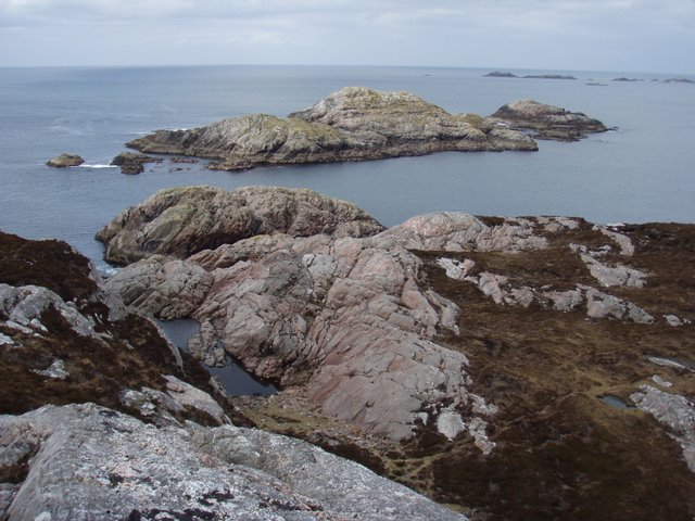
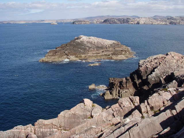
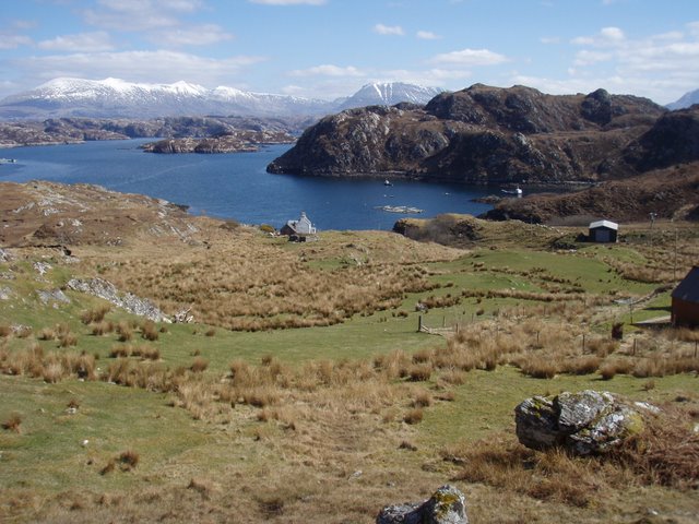
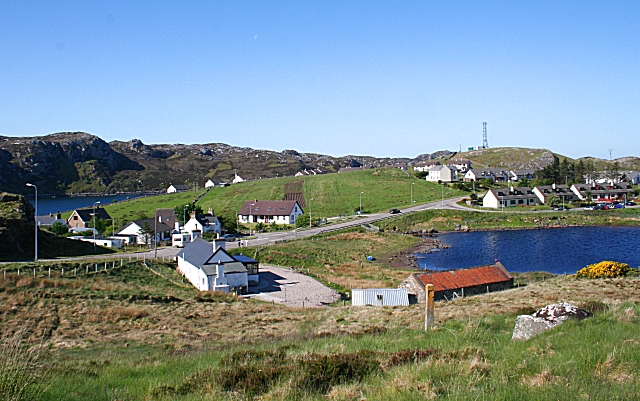
Rubha Sgeir a' Bhathaidh is a prominent coastal feature located in Sutherland, Scotland. This headland, also known as the Point of the Drowned Rocks, is situated on the northwestern coast of Scotland, overlooking the North Atlantic Ocean.

The headland is characterized by its rugged and dramatic cliffs, rising up to approximately 100 meters in height. These cliffs are composed of ancient rocks, displaying layers of sedimentary deposits that date back millions of years. The geology of Rubha Sgeir a' Bhathaidh provides a fascinating insight into the geological history of the region.

The headland is also home to a variety of marine life. The turbulent waters surrounding Rubha Sgeir a' Bhathaidh attract a diverse range of seabirds, including puffins, gannets, and razorbills. The surrounding waters are also known to be frequented by seals and dolphins, making it a popular spot for wildlife enthusiasts.

The location of Rubha Sgeir a' Bhathaidh also holds historical significance. The headland is believed to have been a prominent landmark for sailors navigating the treacherous waters off the coast of Scotland. In addition, there are remnants of ancient settlements and structures, indicating human habitation in the area dating back to prehistoric times.

Overall, Rubha Sgeir a' Bhathaidh is a stunning coastal feature that offers breathtaking views, rich geological history, and a diverse range of wildlife. It is a must-visit destination for nature lovers and those interested in exploring Scotland's natural and cultural heritage.

If you have any feedback on the listing, please let us know in the comments section below.

Rubha Sgeir a' Bhathaidh Images

Images are sourced within 2km of 58.424512/-5.112971 or Grid Reference NC1852. Thanks to Geograph Open Source API. All images are credited.

Cnoc Gorm Beag
Cnoc Gorm Beag
Eileanan Dubha  The narrow unnamed lochan sits above Loch Dùghaill.  The island nearest the mainland is tidal.
Eileanan Dubha
The narrow unnamed lochan sits above Loch Dùghaill. The island nearest the mainland is tidal.
Lochan na Creige  Riabhach
Lochan na Creige Riabhach
Eilean an t- Sithein  Looking across the mouth of Loch Laxford over to Ardmore point.
Eilean an t- Sithein
Looking across the mouth of Loch Laxford over to Ardmore point.
Ardmore Point The end of the peninsula separating Loch Laxford from Loch Dùghaill.
Ardmore Point
The end of the peninsula separating Loch Laxford from Loch Dùghaill.
Bagh nan Cleathan
Bagh nan Cleathan
Loch Eileanach  Crag Riabhach behind the loch.
Loch Eileanach
Crag Riabhach behind the loch.
Northern end of Loch Eileanach
Sgeir Ruadh
Sgeir Ruadh
The North shore of Loch Dùghaill.
The view West over Bàgh Lochan nam Ban.
Looking East over Lochan nam Ban.
The view along Bàgh Glac Cùl a’ Gheodha.
Looking through the narrow entrance to Lochan na Saile with Bàgh Lochan na Saile beyond.
Un-named lochan just enters NC1852. The large boulder in the lochan is shown on the 1:25000 map.
Un-named lochan just enters NC1852.
The large boulder in the lochan is shown on the 1:25000 map.
An interesting ‘log’ on the shore of Lochan na Saile. This log made a welcome seat. It was slightly tapered towards both ends from the middle suggesting it could have been part of the rigging on a sailing ship at one time. The coastline here offers challenging walking as there are loads of rocks and deep heather with no paths, often having to climb up and around impassible sections.
An interesting ‘log’ on the shore of Lochan na Saile.
This log made a welcome seat. It was slightly tapered towards both ends from the middle suggesting it could have been part of the rigging on a sailing ship at one time. The coastline here offers challenging walking as there are loads of rocks and deep heather with no paths, often having to climb up and around impassible sections.
Looking NNE from the top of Rubha Sgeir a’ Bhàthaidh. This shows the very rugged landscape all over this area.
Looking NNE from the top of Rubha Sgeir a’ Bhàthaidh.
This shows the very rugged landscape all over this area.
Looking down from the top of Rubha Sgeir a’ Bhàthaidh into Bàgh Geodh’ nan Daoine.
Show me another place!

Rubha Sgeir a' Bhathaidh is located at Grid Ref: NC1852 (Lat: 58.424512, Lng: -5.112971)

Unitary Authority: Highland

Police Authority: Highlands and Islands

What 3 Words

///rave.liquid.consented. Near Oldshoremore, Highland

Related Wikis

Fanagmore

Fanagmore (Scottish Gaelic: An Fheannag Mhòr) is a hamlet in Sutherland, Highland, in far northwestern Scotland. It lies on the south shore of Loch Laxford...

Foindle

Foindle (Scottish Gaelic: An Fhionndail) is a village on the south shore of Loch Laxford in Lairg, Sutherland, Scottish Highlands and is in the Scottish...

Tarbet, Sutherland

Tarbet (Scottish Gaelic, An Tairbeart) is a hamlet in Sutherland, on the west coast of Scotland. It is the nearest port of contact to the Scottish Wildlife...

Kinlochbervie

Kinlochbervie (Scottish Gaelic: Ceann Loch Biorbhaidh, IPA: [ˈkʲʰaun̪ˠˈɫ̪ɔxˈpiɾivɪ]) is a scattered harbour village in the north west of Sutherland, in...

Nearby Amenities

Located within 500m of 58.424512,-5.112971
Source: PGS
Lat/Long: 58.4287431/-5.115088
Source: PGS
Lat/Long: 58.427828/-5.1157228
Source: PGS
Lat/Long: 58.4275873/-5.1148888
Source: PGS
Lat/Long: 58.4276555/-5.1115567
Source: PGS
Lat/Long: 58.4273111/-5.1111771
Source: PGS
Lat/Long: 58.426986/-5.1122998
Source: PGS
Lat/Long: 58.426623/-5.1125427
Source: PGS
Lat/Long: 58.4267142/-5.1127082
Source: PGS
Lat/Long: 58.4265122/-5.1131399
Source: PGS
Lat/Long: 58.4262528/-5.1133049
Source: PGS
Lat/Long: 58.426078/-5.1133107
Source: PGS
Lat/Long: 58.4254175/-5.1135729
Source: PGS
Lat/Long: 58.4252353/-5.1136583
Source: PGS
Lat/Long: 58.4251058/-5.1131407
Source: PGS
Lat/Long: 58.4248371/-5.1135664
Source: PGS
Lat/Long: 58.4245731/-5.114103
Source: PGS
Lat/Long: 58.4240629/-5.1141499
Source: PGS
Lat/Long: 58.4237903/-5.1133157
Source: PGS
Lat/Long: 58.4237203/-5.1123403
Source: PGS
Lat/Long: 58.4234465/-5.1123365
Source: PGS
Lat/Long: 58.4233042/-5.1118558
Created By: almien_coastlines
Source: PGS
Lat/Long: 58.42283/-5.111146
Source: PGS
Lat/Long: 58.4225675/-5.1127127
Source: PGS
Lat/Long: 58.4225387/-5.1121337
Source: PGS
Lat/Long: 58.4225497/-5.1099357
Source: PGS
Lat/Long: 58.4233177/-5.1092802
Source: PGS
Lat/Long: 58.4234207/-5.108859
Source: PGS
Lat/Long: 58.423999/-5.1085877
Source: PGS
Lat/Long: 58.424392/-5.1081203
Source: PGS
Lat/Long: 58.4247282/-5.1077238
Source: PGS
Lat/Long: 58.42472/-5.1071545
Source: PGS
Lat/Long: 58.42519/-5.1052668
Created By: almien_coastlines
Source: PGS
Lat/Long: 58.42486/-5.104435
Source: PGS
Lat/Long: 58.4244254/-5.1050996
Created By: almien_coastlines
Source: PGS
Lat/Long: 58.424209/-5.105129
Created By: almien_coastlines
Source: PGS
Lat/Long: 58.423442/-5.105083
Source: PGS
Lat/Long: 58.4228969/-5.1051785
Source: PGS
Lat/Long: 58.4223251/-5.1055812
Bagh Lochan na Saile
Natural: bay
Lat/Long: 58.4241905/-5.1067329
The data included in this document is from www.openstreetmap.org. The data is made available under ODbL.

Have you been to Rubha Sgeir a' Bhathaidh?

Leave your review of Rubha Sgeir a' Bhathaidh below (or comments, questions and feedback).