Rubh' a Mhill Glaise

Coastal Feature, Headland, Point in Sutherland

Scotland

Rubh' a Mhill Glaise

"Rock face" The sea cliffs at Droman en route to Sheigra. Droman's answer to the Easter Islands...
"Rock face" Credit: Simon Bonney

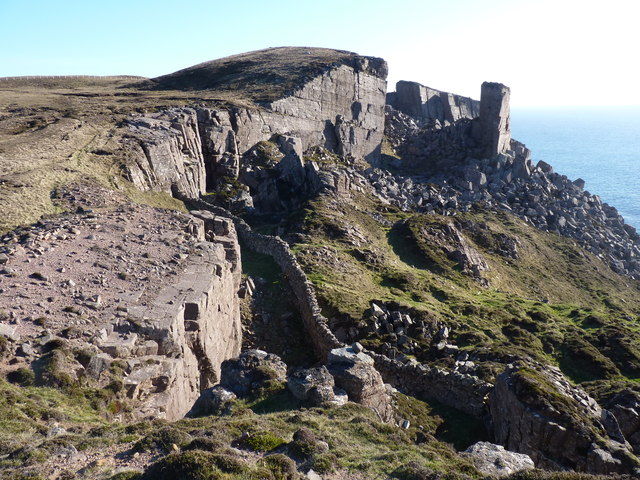
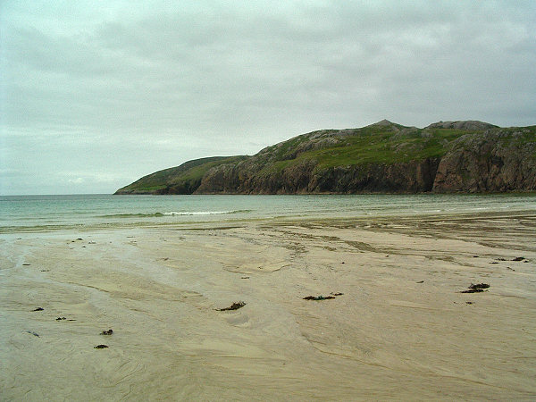
Rubh' a Mhill Glaise is a prominent coastal feature located in Sutherland, Scotland. Also known as the Point of the Green Hill, this headland stretches out into the North Atlantic Ocean, offering breathtaking views of the surrounding landscape.

Situated on the northwest coast of Scotland, Rubh' a Mhill Glaise is characterized by its rugged cliffs and rocky outcrops. The headland is made up of layers of ancient sandstone, which have been weathered over time by the relentless force of the sea. These cliffs provide nesting sites for various seabirds, including guillemots and kittiwakes, making it a popular spot for birdwatchers and nature enthusiasts.

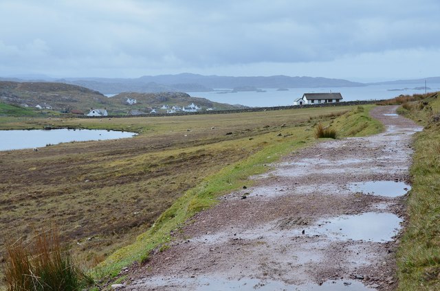
The headland is accessible via a coastal path that winds its way along the edge of the cliffs, offering stunning vistas of the clear blue waters below and the distant mountains on the horizon. The path is relatively easy to walk, although caution is advised as some sections can be steep and uneven.

Rubh' a Mhill Glaise is also known for its rich maritime history. It is believed that the headland was used as a lookout point during World War II to spot enemy vessels, and remnants of wartime structures can still be seen in the area.

Overall, Rubh' a Mhill Glaise is a captivating coastal feature that offers visitors a chance to immerse themselves in the natural beauty and history of the Sutherland coastline.

If you have any feedback on the listing, please let us know in the comments section below.

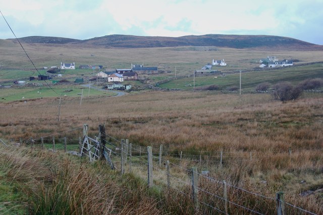
Rubh' a Mhill Glaise Images

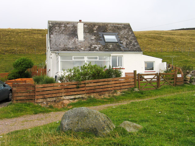
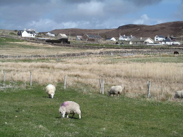
Images are sourced within 2km of 58.490125/-5.1244781 or Grid Reference NC1760. Thanks to Geograph Open Source API. All images are credited.

"Rock face" The sea cliffs at Droman en route to Sheigra. Droman's answer to the Easter Islands...
"Rock face"
The sea cliffs at Droman en route to Sheigra. Droman's answer to the Easter Islands...
'Clach Mhor' with boulder in front The cottage at Blairmore is named Clach Mhor which means big stone - perhaps it refers to the embedded boulder in the foreground of the image! The path passing in front of the building passes through the moorland beyond eventually to reach Sandwood Bay.
(In 2004 the cottage was a holiday let, (perhaps it still is), where the photographer spent the last full week of August.)
'Clach Mhor' with boulder in front
The cottage at Blairmore is named Clach Mhor which means big stone - perhaps it refers to the embedded boulder in the foreground of the image! The path passing in front of the building passes through the moorland beyond eventually to reach Sandwood Bay. (In 2004 the cottage was a holiday let, (perhaps it still is), where the photographer spent the last full week of August.)
Sheigra Sheep grazing below the small community of Sheigra at the very end of the road from Kinlochbervie.
Sheigra
Sheep grazing below the small community of Sheigra at the very end of the road from Kinlochbervie.
Outbuilding, Balchrick
Road to Balchrick
Road to Balchrick
Na Stacain A large cairn on the top
Na Stacain
A large cairn on the top
Cliffs near Sheigra Rather more challenging than I anticipated to get into this square!
Cliffs near Sheigra
Rather more challenging than I anticipated to get into this square!
Colourful meadows at Blairmore Damp grassland allowed to run riot in the summer.
Colourful meadows at Blairmore
Damp grassland allowed to run riot in the summer.
Cnoc an Staca At some time in the past the whole cliff in this area started to slide towards the sea leaving a spectacular rocky  shoreline.
Cnoc an Staca
At some time in the past the whole cliff in this area started to slide towards the sea leaving a spectacular rocky shoreline.
Car park at Blairmore Car park and toilets at the starting point for the walk to Sandwood Bay.
Car park at Blairmore
Car park and toilets at the starting point for the walk to Sandwood Bay.
Blairmore On the track to Sandwood Bay with Loch Aisir to the left.
Blairmore
On the track to Sandwood Bay with Loch Aisir to the left.
Wasn't that last year? The old dog looks suitably cheesed off with the out-of-date Olympics publicity, particularly this far from London.
Wasn't that last year?
The old dog looks suitably cheesed off with the out-of-date Olympics publicity, particularly this far from London.
Cliffs near Sheigra
Cliffs near Sheigra
Loch Aisir Viewed from the track to Sandwood Bay on a disappointingly dull morning.
Loch Aisir
Viewed from the track to Sandwood Bay on a disappointingly dull morning.
Loch Aisir
Loch Aisir
Crofting township of Sheigra
Loch Poll a' Mhurain Possible Greenshank habitat.
Loch Poll a' Mhurain
Possible Greenshank habitat.
Coastal fringe west of Sheigra Atlantic swell surges into a deep cleft even on windless a day.
Coastal fringe west of Sheigra
Atlantic swell surges into a deep cleft even on windless a day.
Show me another place!

Rubh' a Mhill Glaise is located at Grid Ref: NC1760 (Lat: 58.490125, Lng: -5.1244781)

Unitary Authority: Highland

Police Authority: Highlands and Islands

What 3 Words

///outpost.bill.recitals. Near Oldshoremore, Highland

Related Wikis

Sheigra

Sheigra or Shegra is a small holiday settlement on the east coast of the Tongue district of Sutherland in the Highland council area in Scotland. It is...

Droman, Sutherland

Droman is a small remote crofting township on the north west coast of Lairg in Sutherland, Scottish Highlands and is in the Scottish council area of Highland...

Balchrick

Balchrick (Scottish Gaelic: Baile a' Chnuic) is a township on the north east shore of Lairg in Sutherland, Scottish Highlands and is in the Scottish council...

Eilean an Ròin Mòr

Eilean an Ròin Mòr is an uninhabited island in north west Sutherland. == Geography == Eilean an Ròin Mòr, with its neighbour, Eilean an Ròin Beag, forms...

Nearby Amenities

Located within 500m of 58.490125,-5.1244781
Natural: rock
Source: OS7
Tidal: yes
Lat/Long: 58.4896224/-5.1288898
Natural: rock
Source: OS7
Tidal: yes
Lat/Long: 58.488323/-5.126167
Caravans: no
Tents: yes
Tourism: camp_site
Lat/Long: 58.4914109/-5.1197425
Bagh Sheigra
Natural: bay
Lat/Long: 58.4891626/-5.1217274
Barrier: stile
Lat/Long: 58.4921621/-5.123173
The data included in this document is from www.openstreetmap.org. The data is made available under ODbL.

Have you been to Rubh' a Mhill Glaise?

Leave your review of Rubh' a Mhill Glaise below (or comments, questions and feedback).