Mwnt

Heritage Site in Cardiganshire

Wales

Mwnt

Cliff at Hatling Bigni
Cliff at Hatling Bigni Credit: Sandy Gerrard

Mwnt is a small coastal village located in Cardiganshire, Wales. Situated on the west coast of Wales, Mwnt is renowned for its picturesque beauty and historical significance. The village is a designated heritage site, attracting visitors from all over the world.

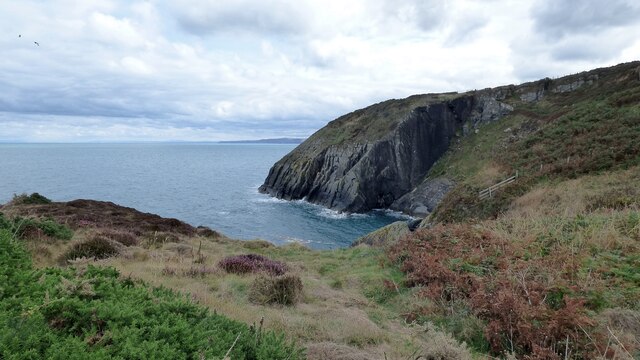
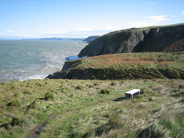
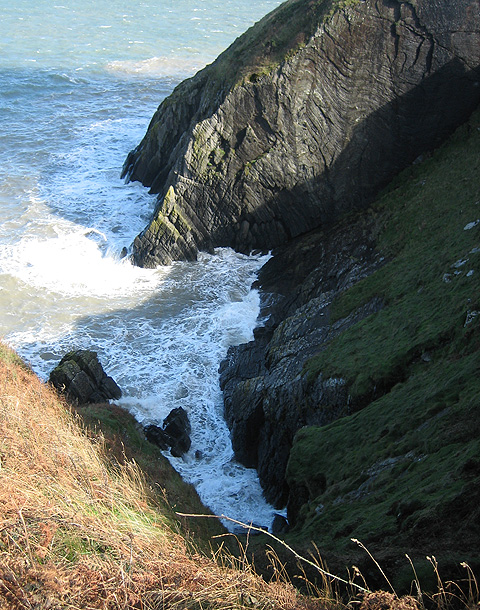
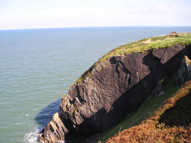
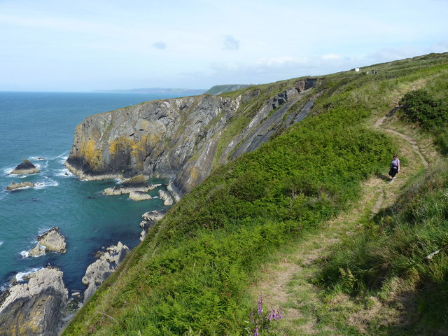
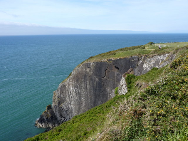
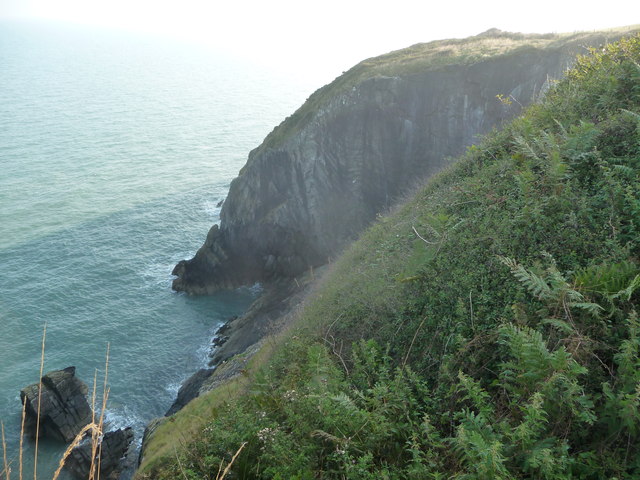
The most prominent feature of Mwnt is its stunning beach, which stretches for approximately one mile. The golden sands and crystal-clear waters make it an ideal spot for swimming, sunbathing, and enjoying various water sports. The beach is also famous for its unique rock formations, which add to its natural charm.

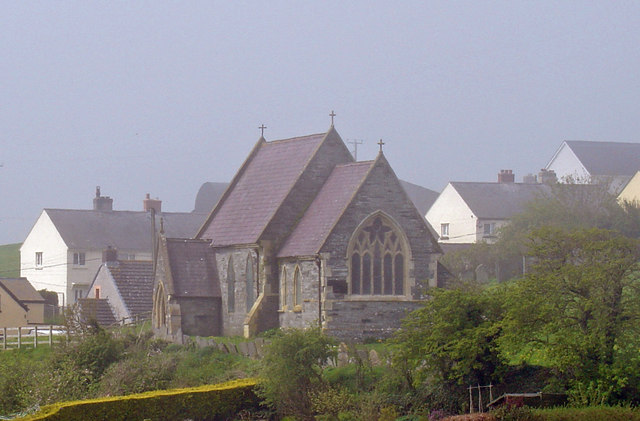
At the heart of Mwnt sits the historic Church of the Holy Cross. Built in the 14th century, this medieval church stands on a hill overlooking the village and offers breathtaking views of the surrounding coastline. The church is known for its simple yet elegant architecture and is still used for regular worship services.

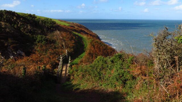
The area surrounding Mwnt is rich in wildlife and is a designated nature reserve. The cliffs and fields are home to a diverse range of flora and fauna, including rare plants and birds. Visitors can enjoy scenic walks along the coastal path, taking in the stunning views and observing the local wildlife.

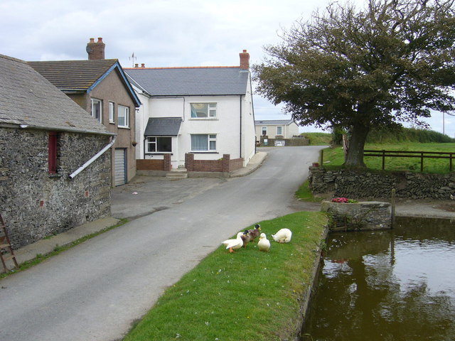
Mwnt is also steeped in history, with evidence of ancient settlements dating back to the Iron Age. The village was once a bustling port and played a significant role in the local economy. Today, visitors can explore the remains of a 12th-century defensive structure known as Mwnt Castle, which offers a glimpse into the area's past.

In conclusion, Mwnt in Cardiganshire is a captivating heritage site that offers visitors a combination of natural beauty, historical significance, and a tranquil atmosphere. Whether it's relaxing on the beach, exploring the ancient church, or immersing oneself in the local wildlife, Mwnt is a must-visit destination for those seeking an authentic Welsh experience.

If you have any feedback on the listing, please let us know in the comments section below.

Mwnt Images

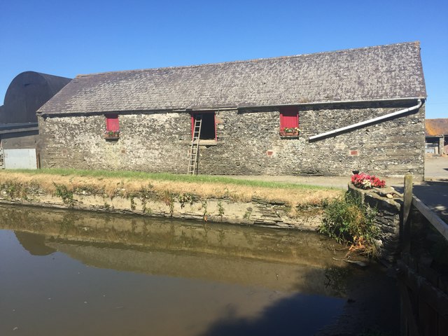
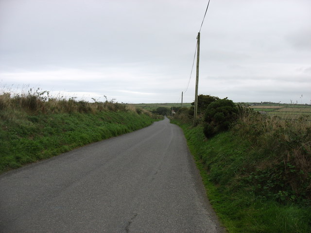
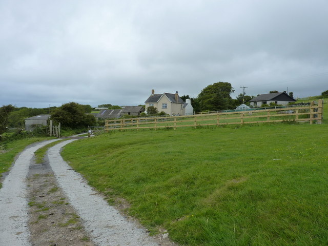
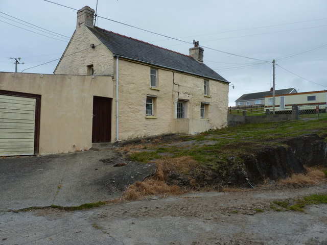
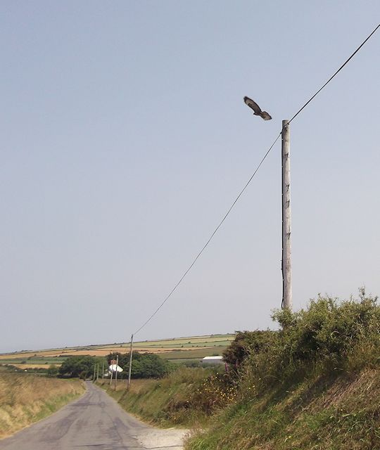
Images are sourced within 2km of 52.132/-4.646 or Grid Reference SN1851. Thanks to Geograph Open Source API. All images are credited.

Cliff at Hatling Bigni
View W along Wales Coast Path from Godre Gwyn
Blaenwaun Farm plus ducks.
Blaenwaun Farm
plus ducks.
Bench with a view as you go east from Mwnt Recently opened when this picture was taken, the section of the Ceredigion Coast Path leaves Mwnt near the small church <a title="https://www.geograph.org.uk/photo/886615" href="https://www.geograph.org.uk/photo/886615">Link</a> and has fine views all the way to Aberporth.  Returning westerly, you cannot see the dramatic cliff faces so well. Here you can rest just after leaving (or just before arriving in) Mwnt. This first section is a permissive path.
Bench with a view as you go east from Mwnt
Recently opened when this picture was taken, the section of the Ceredigion Coast Path leaves Mwnt near the small church Link and has fine views all the way to Aberporth. Returning westerly, you cannot see the dramatic cliff faces so well. Here you can rest just after leaving (or just before arriving in) Mwnt. This first section is a permissive path.
Hatling Bigni cliffs on Ceredigion Coast Path ... or is it an elephant relaxing in the foam?
Hatling Bigni cliffs on Ceredigion Coast Path
... or is it an elephant relaxing in the foam?
Cliffs at Hatling Bigni The Ordovician shales were laid down in shallow seas about 500 million years ago and movements of the earth crust later caused folding and displacement of the rock.
Cliffs at Hatling Bigni
The Ordovician shales were laid down in shallow seas about 500 million years ago and movements of the earth crust later caused folding and displacement of the rock.
Farm at Bigni
Farm at Bigni
Minor Road Near Blaenwaun
Blaenwaun Farm View of farm building across pond.
Blaenwaun Farm
View of farm building across pond.
The road to Felinwynt and Aberporth
Ffynnongrog Farm No longer a working farm; two of the barns are converted to holiday lets, as is the old house. One of the lets has an interesting poster from 1953, advertising the sale of various agricultural implements and farm stock of the time, including a 1934 Morris ('in running order', no less), a Deere tractor, umpteen cattle & pigs, working horses (one of which was in foal) and so on. Times gone by, eh?
Ffynnongrog Farm
No longer a working farm; two of the barns are converted to holiday lets, as is the old house. One of the lets has an interesting poster from 1953, advertising the sale of various agricultural implements and farm stock of the time, including a 1934 Morris ('in running order', no less), a Deere tractor, umpteen cattle & pigs, working horses (one of which was in foal) and so on. Times gone by, eh?
The old farmhouse at Craig-y-Mwnt
Coastal Path between Hatling Bigni and Pencestyll The white contraption about 100 yards away (on the hilltop) looked like a tent or caravan as we approached, but it turned out to be some kind of radio or microwave transmission device, presumably associated with the DERA research site at Aberporth a mile or so away. Signs on the fence suggested it contained a radioactive source, but whether that's actually true, or just there to discourage the investigations of inquisitive passers-by, isn't entirely clear.
Coastal Path between Hatling Bigni and Pencestyll
The white contraption about 100 yards away (on the hilltop) looked like a tent or caravan as we approached, but it turned out to be some kind of radio or microwave transmission device, presumably associated with the DERA research site at Aberporth a mile or so away. Signs on the fence suggested it contained a radioactive source, but whether that's actually true, or just there to discourage the investigations of inquisitive passers-by, isn't entirely clear.
Hatling Bigni cliff The Coastal Path skirts the edge of this void, rather too close for some people's comfort. The dog went back on the lead, that's for sure.
Hatling Bigni cliff
The Coastal Path skirts the edge of this void, rather too close for some people's comfort. The dog went back on the lead, that's for sure.
Barn conversions at Ffynnongrog Self catering lets at Ffynnongrog Farm; the left-hand unit sleeps two, the right-hand one will cater for six.
Barn conversions at Ffynnongrog
Self catering lets at Ffynnongrog Farm; the left-hand unit sleeps two, the right-hand one will cater for six.
Road to Felinwynt Just east of Tre-cefn
Road to Felinwynt
Just east of Tre-cefn
Disturbed Buzzard from Felinwynt road Track on right is to Tre-cefn Ganol. House in distance is Rosehill
Disturbed Buzzard from Felinwynt road
Track on right is to Tre-cefn Ganol. House in distance is Rosehill
View to cliffs from the coast path near Mwnt I just missed a bird of prey heading off around this cliff corner at my approach. Just one of many birds and animals seen on my walk along this stretch of coast this morning (including Red Kite pairs, single Buzzard, fox, many snails, quite a few Choughs, but no seals!).
View to cliffs from the coast path near Mwnt
I just missed a bird of prey heading off around this cliff corner at my approach. Just one of many birds and animals seen on my walk along this stretch of coast this morning (including Red Kite pairs, single Buzzard, fox, many snails, quite a few Choughs, but no seals!).
Show me another place!

Mwnt is located at Grid Ref: SN1851 (Lat: 52.132, Lng: -4.646)

Unitary Authority: Ceredigion

Police Authority: Dyfed Powys

What 3 Words

///chose.offshore.cleansed. Near Cardigan, Ceredigion

Related Wikis

Mwnt

Mwnt (Welsh: [ˈmʊnt]) is an ancient parish in Ceredigion, Wales, 4.5 miles (7.2 km) north of Cardigan. The Wales Coast Path passes through this very small...

Church of the Holy Cross, Mwnt

The Church of the Holy Cross (Welsh: Eglwys y Grog) at Mwnt, Ceredigion, Wales, is a parish church and Grade I listed building dating probably from the...

Y Ferwig

Y Ferwig (sometimes spelled Verwig) is a small village and community about 2 to 3 miles from Cardigan, Wales. == Amenities == The village is made up of...

Cardigan Island

Cardigan Island (Welsh: Ynys Aberteifi) is an uninhabited island north of Cardigan, Ceredigion, south-west Wales. It reaches a height of 52 metres (171...

Nearby Amenities

Located within 500m of 52.132,-4.646
Ogof Filast
Alt Name: Ogof Filiast
Fixme: Guesswork based on OS 1:25k historic and aerial imagery.
Natural: cave_entrance
Lat/Long: 52.1337576/-4.6515023
The data included in this document is from www.openstreetmap.org. The data is made available under ODbL.

Have you been to Mwnt?

Leave your review of Mwnt below (or comments, questions and feedback).