Rubha Ruadh

Coastal Feature, Headland, Point in Inverness-shire

Scotland

Rubha Ruadh

A pile of 'useful' stones on Torr Breac The planned use is not obvious, and they have been there long enough to feature on the 'aerial view' map.
A pile of 'useful' stones on Torr Breac Credit: David Medcalf

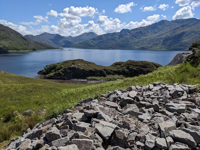
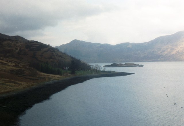
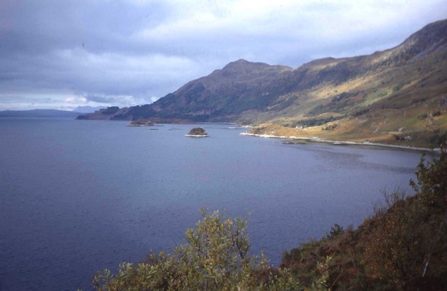
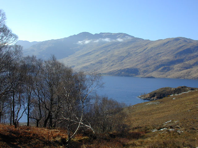
Rubha Ruadh, located in Inverness-shire, Scotland, is a captivating coastal feature known for its picturesque landscapes and stunning natural beauty. Also referred to as Red Point, this headland is situated on the west coast of the Highlands, overlooking the Inner Sound and the Isle of Skye.

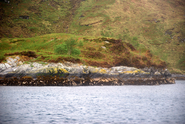
Rubha Ruadh is characterized by its rugged cliffs, sandy beaches, and crystal-clear turquoise waters. The headland is surrounded by rolling hills and verdant vegetation, providing a perfect backdrop for nature enthusiasts and photographers alike. The area is renowned for its diverse wildlife, including seals, dolphins, and a variety of bird species.

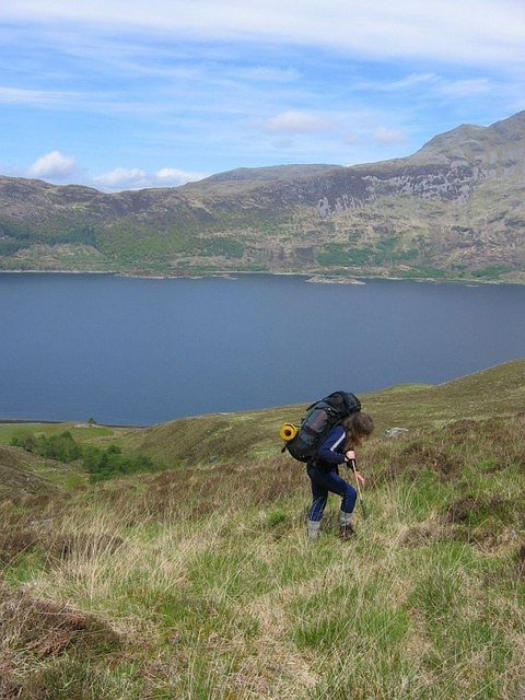
The sandy beaches of Rubha Ruadh stretch for approximately two miles, offering visitors ample space for leisurely walks, picnics, and sunbathing. The coastal waters are also a popular spot for swimming and water sports such as kayaking and paddleboarding. The headland is easily accessible from the nearby village of Gairloch, with a well-maintained footpath leading visitors to the scenic viewpoints and secluded coves.

For those who enjoy hiking, Rubha Ruadh provides numerous trails that showcase the region's natural wonders. The headland offers breathtaking panoramic views of the surrounding sea and mountains, making it a favorite spot for photographers and nature enthusiasts.

Rubha Ruadh is an idyllic coastal feature that offers visitors a chance to immerse themselves in the tranquility of nature. With its stunning landscapes, diverse wildlife, and recreational opportunities, this headland is a must-visit destination for anyone exploring the Inverness-shire region of Scotland.

If you have any feedback on the listing, please let us know in the comments section below.
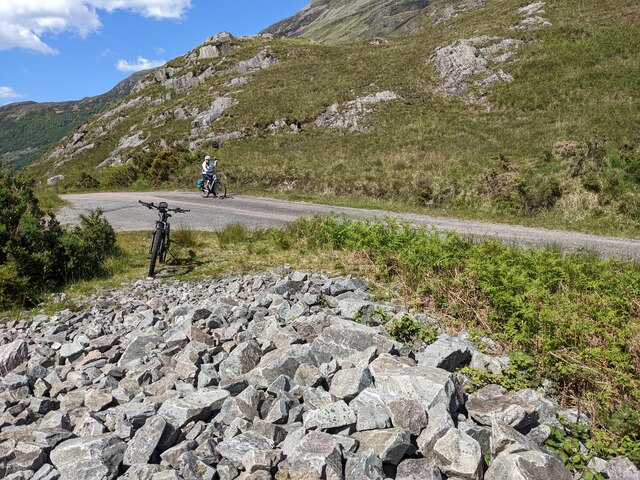
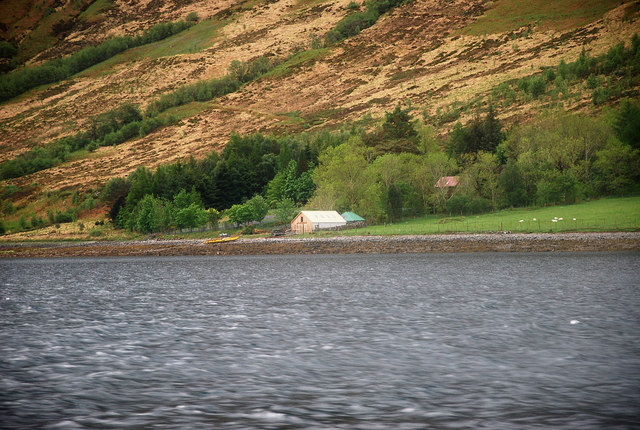
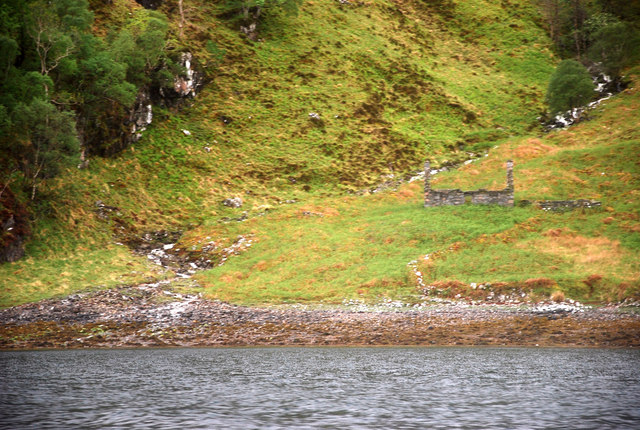
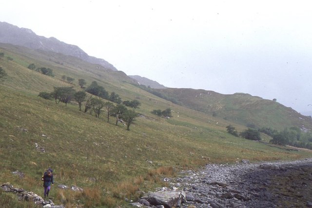
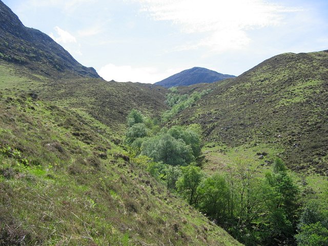
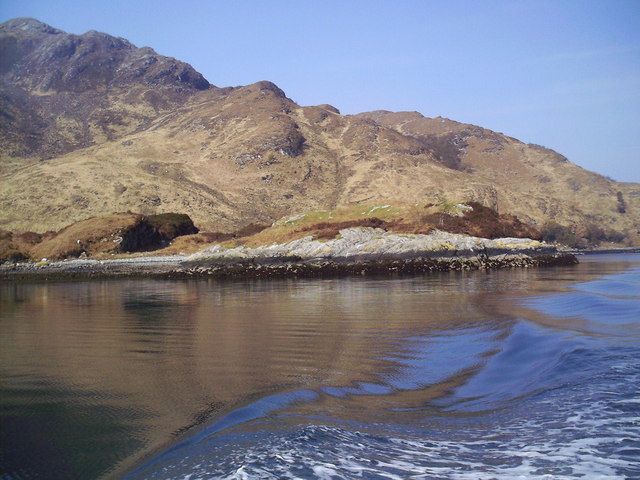
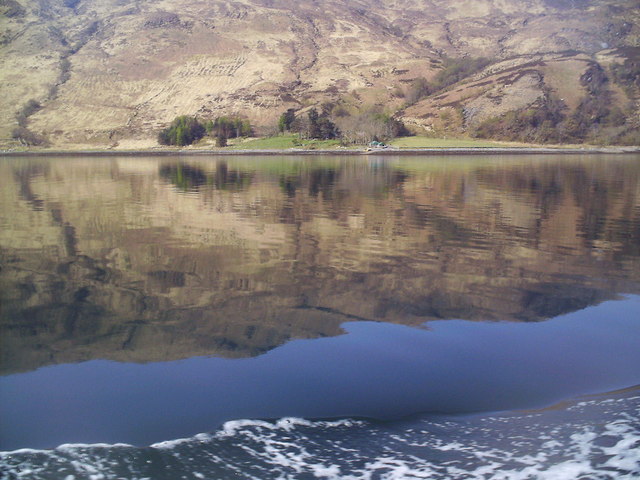
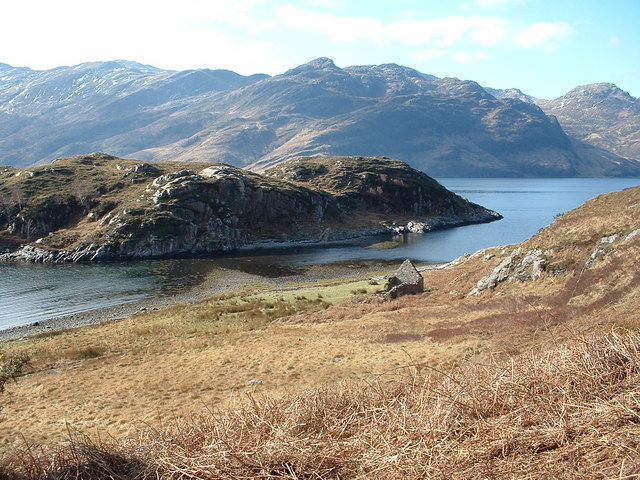
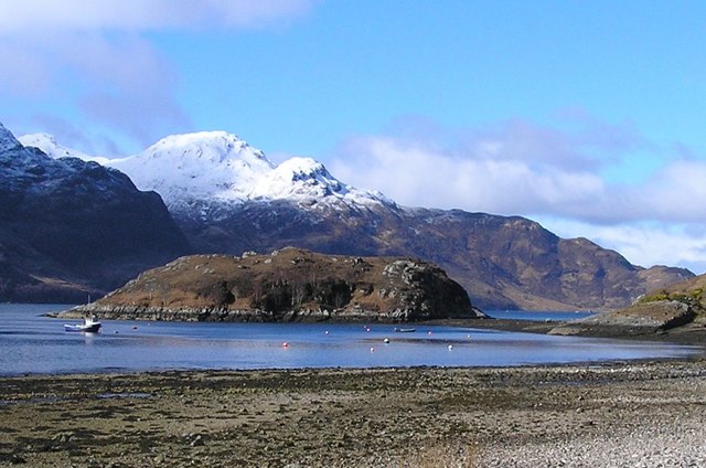
Rubha Ruadh Images

Images are sourced within 2km of 57.118884/-5.5925931 or Grid Reference NG8208. Thanks to Geograph Open Source API. All images are credited.

A pile of 'useful' stones on Torr Breac The planned use is not obvious, and they have been there long enough to feature on the 'aerial view' map.
A pile of 'useful' stones on Torr Breac
The planned use is not obvious, and they have been there long enough to feature on the 'aerial view' map.
Looking down on Eilean Ràrsaidh from Torr Breac
View from Corran
View from Corran
Eilean a' Phiobaire This low flattish islet is difficult to pick out in poor weather as it blends into the background scenery.
Eilean a' Phiobaire
This low flattish islet is difficult to pick out in poor weather as it blends into the background scenery.
Camas Domhain A lovely Knoydart bay with a remote settlement by the name of Li.
Camas Domhain
A lovely Knoydart bay with a remote settlement by the name of Li.
Ceum an Doill By the Allt Glac nan Sgadan stands a forlorn ruin.
Ceum an Doill
By the Allt Glac nan Sgadan stands a forlorn ruin.
Shoreline, Camas Domhain Rough going on the shores of Loch Hourn.  The line of trees in the background is a shelterbelt around Li.
Shoreline, Camas Domhain
Rough going on the shores of Loch Hourn. The line of trees in the background is a shelterbelt around Li.
Minor road at Torr Breac descending towards Arnisdale Looking south-eastward.
Minor road at Torr Breac descending towards Arnisdale
Looking south-eastward.
Sgamadail Glen falling from Beinn na Caillich to the north shore of Knoydart. Accessed by boat from Arnisdale.
The course of the burn is well wooded, steep sides of the watercourse providing shelter from grazing deer.
Sgamadail
Glen falling from Beinn na Caillich to the north shore of Knoydart. Accessed by boat from Arnisdale. The course of the burn is well wooded, steep sides of the watercourse providing shelter from grazing deer.
Remote Steading The farm of Li in the Knoydart Peninsula - maybe one of the most remotely inhabited buildings in the country - it's a hard day's walk from here to the nearest road (or beer!).
Remote Steading
The farm of Li in the Knoydart Peninsula - maybe one of the most remotely inhabited buildings in the country - it's a hard day's walk from here to the nearest road (or beer!).
Shore Line, Rubha Ruadh from Loch Hourn
Camas Domhain from Loch Hourn
Eilean Tioram Taken from the road leading to Arnisdale looking across Loch Hourn
Eilean Tioram
Taken from the road leading to Arnisdale looking across Loch Hourn
Eilean Tioram (Dry Island) The island is accessible at low tide - giving it the name "Dry Island".
Eilean Tioram (Dry Island)
The island is accessible at low tide - giving it the name "Dry Island".
Shoreline of Loch Hourn Beinn Mhialairigh on the other side of the bay.
Shoreline of Loch Hourn
Beinn Mhialairigh on the other side of the bay.
View across Camas Bay from Sgeir nan Gealag The houses of Arnisdale hug the shore, one of the more remote villages in the UK.
View across Camas Bay from Sgeir nan Gealag
The houses of Arnisdale hug the shore, one of the more remote villages in the UK.
West of Arnisdale As the road climbs out of Arnisdale, on your left rough grazing leads down to Loch Hourn. Part of Eilean Tioram can be seen on the right. Ladhar Bheinn crowns the horizon.
West of Arnisdale
As the road climbs out of Arnisdale, on your left rough grazing leads down to Loch Hourn. Part of Eilean Tioram can be seen on the right. Ladhar Bheinn crowns the horizon.
Ascent of Sgamadail Climbing the steep glen on the north shore of Knoydart. A backroute into Inverie having been dropped off on the coast.
Ascent of Sgamadail
Climbing the steep glen on the north shore of Knoydart. A backroute into Inverie having been dropped off on the coast.
Show me another place!

Rubha Ruadh is located at Grid Ref: NG8208 (Lat: 57.118884, Lng: -5.5925931)

Unitary Authority: Highland

Police Authority: Highlands and Islands

What 3 Words

///assess.balloons.treat. Near Glenelg, Highland

Related Wikis

Loch Hourn

Loch Hourn (Scottish Gaelic: Loch Shubhairne) is a sea loch which separates the peninsulas of Glenelg to the north and Knoydart to the south, on the west...

Arnisdale

Arnisdale (Scottish Gaelic: Àrnasdal) is a hamlet in the historic county of Inverness-shire in the local authority area of Highlands of Scotland. It lies...

Arnisdale Free Church

Arnisdale Free Church is a church building at one time connected to the Free Church of Scotland. It is sited in Arnisdale, Inverness-shire, Scotland. According...

Corran, Loch Hourn

Corran (Scottish Gaelic: An Corran) is a hamlet on the northern shore of Loch Hourn, in Lochalsh in Inverness-shire in the Highlands of Scotland. It is...

Nearby Amenities

Located within 500m of 57.118884,-5.5925931
Created By: almien_coastlines
Source: PGS
Lat/Long: 57.115073/-5.588861
Created By: almien_coastlines
Source: PGS
Lat/Long: 57.115589/-5.588663
Created By: almien_coastlines
Source: PGS
Lat/Long: 57.115845/-5.58868
Created By: almien_coastlines
Source: PGS
Lat/Long: 57.116603/-5.589204
Created By: almien_coastlines
Source: PGS
Lat/Long: 57.116849/-5.589692
Created By: almien_coastlines
Source: PGS
Lat/Long: 57.117095/-5.59018
Source: PGS
Lat/Long: 57.1177696/-5.5910728
Source: PGS
Lat/Long: 57.1183492/-5.5916529
Source: PGS
Lat/Long: 57.1188393/-5.5919004
Source: PGS
Lat/Long: 57.1193399/-5.592037
Created By: almien_coastlines
Source: PGS
Lat/Long: 57.119461/-5.593405
Created By: almien_coastlines
Source: PGS
Lat/Long: 57.119442/-5.594345
Source: PGS
Lat/Long: 57.1192521/-5.5973938
Created By: almien_coastlines
Source: PGS
Lat/Long: 57.119088/-5.599029
Created By: almien_coastlines
Source: PGS
Lat/Long: 57.119325/-5.599987
The data included in this document is from www.openstreetmap.org. The data is made available under ODbL.

Have you been to Rubha Ruadh?

Leave your review of Rubha Ruadh below (or comments, questions and feedback).