Àird Mhòr Keose

Coastal Feature, Headland, Point in Ross-shire

Scotland

Àird Mhòr Keose

Gate above Loch nan Caor, Isle of Lewis I'm guessing that this somewhat decorative field gate has previously been in a more domestic location!

According to the OS Name Book of 1848-1852, Loch nan Caor means Rowan Trees Loch.
Gate above Loch nan Caor, Isle of Lewis Credit: Claire Pegrum

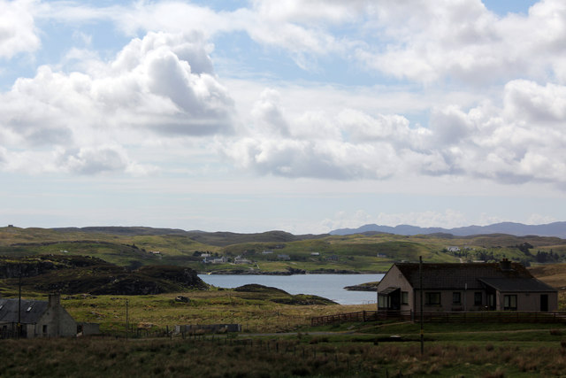
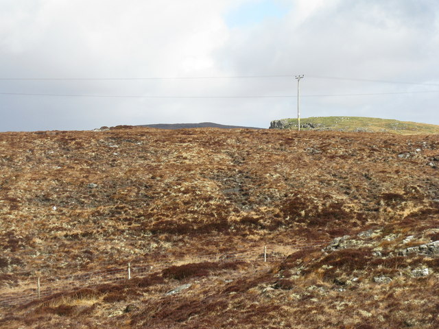
Àird Mhòr Keose is a prominent coastal feature located in Ross-shire, Scotland. It is characterized by its striking headland and point that juts out into the Atlantic Ocean. The name "Àird Mhòr" is derived from Scottish Gaelic, meaning "big headland," which aptly describes the size and prominence of this geographical feature.

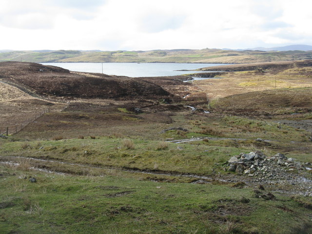
Situated on the west coast of Scotland, Àird Mhòr Keose offers breathtaking views of the surrounding landscape. It is marked by steep cliffs that stand tall against the crashing waves below. The rugged terrain and rocky shoreline provide a dramatic backdrop to the expanse of the Atlantic Ocean.

The headland serves as a natural barrier, protecting the land behind it from the full force of the ocean's currents and tides. Its strategic location has made it an important landmark for sailors and fishermen throughout history, aiding in navigation along the coast.

The area around Àird Mhòr Keose is rich in biodiversity. The cliffs provide nesting sites for various seabirds, including guillemots and kittiwakes. Visitors may also spot seals and dolphins swimming in the waters off the point.

For nature enthusiasts and photographers, Àird Mhòr Keose offers ample opportunities to capture the beauty of the Scottish coastline. The ruggedness of the landscape, combined with the ever-changing moods of the ocean, make it a captivating destination for those seeking a connection with nature.

Overall, Àird Mhòr Keose is a remarkable coastal feature that showcases the wild and untamed beauty of Scotland's west coast. Its impressive headland and point, along with its diverse wildlife, make it a must-visit destination for anyone exploring the Ross-shire region.

If you have any feedback on the listing, please let us know in the comments section below.

Àird Mhòr Keose Images

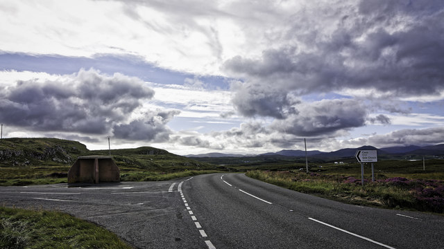
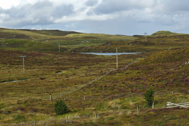
Images are sourced within 2km of 58.100187/-6.490519 or Grid Reference NB3521. Thanks to Geograph Open Source API. All images are credited.
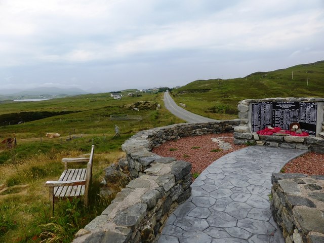
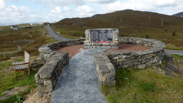
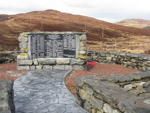
Gate above Loch nan Caor, Isle of Lewis I'm guessing that this somewhat decorative field gate has previously been in a more domestic location!

According to the OS Name Book of 1848-1852, Loch nan Caor means Rowan Trees Loch.
Gate above Loch nan Caor, Isle of Lewis
I'm guessing that this somewhat decorative field gate has previously been in a more domestic location! According to the OS Name Book of 1848-1852, Loch nan Caor means Rowan Trees Loch.
Bus shelter and signpost at a junction on the A859
Kinloch War Memorial 'In memory of all those from Kinloch who fought and died for Freedom'
A list of 54 men and women, aged from 15 - 46, who were lost in the Boer War [2], WW1 [41] and ww2 [11], and the crofts they came from. 
The hill beyond is Nabhar.
Kinloch War Memorial
'In memory of all those from Kinloch who fought and died for Freedom' A list of 54 men and women, aged from 15 - 46, who were lost in the Boer War [2], WW1 [41] and ww2 [11], and the crofts they came from. The hill beyond is Nabhar.
Loch Nabhar
Loch Nabhar
Laxay / Lacasaigh from the A859
Kinloch War Memorial, beside the A859
Kinloch War Memorial Further details are available on Canmore. <span class="nowrap"><a title="https://canmore.org.uk/site/318753/lewis-lacasaidh-kinloch-war-memorial" rel="nofollow ugc noopener" href="https://canmore.org.uk/site/318753/lewis-lacasaidh-kinloch-war-memorial">Link</a><img style="margin-left:2px;" alt="External link" title="External link - shift click to open in new window" src="https://s1.geograph.org.uk/img/external.png" width="10" height="10"/></span>
Kinloch War Memorial
Further details are available on Canmore. LinkExternal link
Moorland track east of Glìb Cheòis This track looks as if its main use is to provide access for peat cutting.
Moorland track east of Glìb Cheòis
This track looks as if its main use is to provide access for peat cutting.
Glìb Cheòis from the shore of Loch Cheòis Looking across the loch towards the last few houses at the end of the road in Glìb Cheòis.
Glìb Cheòis from the shore of Loch Cheòis
Looking across the loch towards the last few houses at the end of the road in Glìb Cheòis.
Loch Èireasort A view across Loch Èireasort and a fish farm from the track at Glìb Cheòis.
Loch Èireasort
A view across Loch Èireasort and a fish farm from the track at Glìb Cheòis.
Platform in Loch Cheois This small concrete platform is at the southern end of Loch Cheois. There is nothing to indicate its function. (There is a slight possibility that it is associated with the WWII "chariot" training facility at Tavay.)
Platform in Loch Cheois
This small concrete platform is at the southern end of Loch Cheois. There is nothing to indicate its function. (There is a slight possibility that it is associated with the WWII "chariot" training facility at Tavay.)
Lacasaidh Lacasaidh with Loch Èireasort behind
Lacasaidh
Lacasaidh with Loch Èireasort behind
Abhainn Eallaidh from the cemetery Flowing south to Loch Èireasort.
Abhainn Eallaidh from the cemetery
Flowing south to Loch Èireasort.
Kinloch War Memorial On the A859, adjacent to the cemetery car park.
Kinloch War Memorial
On the A859, adjacent to the cemetery car park.
Looking across Abhainn Eallaidh from the cemetery To Loch Èireasort and  Lacasaidh.
Looking across Abhainn Eallaidh from the cemetery
To Loch Èireasort and Lacasaidh.
Moorland  near Lacasaidh With electricity transmission line, and Cnoc Glas on the horizon.
Moorland near Lacasaidh
With electricity transmission line, and Cnoc Glas on the horizon.
The Harbour at Cèos The harbour at the crofting community of Cèos is mostly used to support the fish farms in Loch Èireasort
The Harbour at Cèos
The harbour at the crofting community of Cèos is mostly used to support the fish farms in Loch Èireasort
Kinloch War Memorial The Kinloch War Memorial and Garden of Remembrance was officially opened in 2005 to commemorate those who died during the wars of the last century. The tablet shockingly shows those who died from each croft in each war.
Kinloch War Memorial
The Kinloch War Memorial and Garden of Remembrance was officially opened in 2005 to commemorate those who died during the wars of the last century. The tablet shockingly shows those who died from each croft in each war.
Show me another place!

Àird Mhòr Keose is located at Grid Ref: NB3521 (Lat: 58.100187, Lng: -6.490519)

Unitary Authority: Na h-Eileanan an Iar

Police Authority: Highlands and Islands

What 3 Words

///misfits.panel.regretted. Near Leurbost, Na h-Eileanan Siar

Related Wikis

Loch Erisort

Loch Erisort (Scottish Gaelic: Èireasort) is an 8-mile-long narrow sea inlet on the east coast of the Isle of Lewis in the Outer Hebrides off the west...

Cabharstadh

Cabharstadh or Caversta (Scottish Gaelic: Cabharstaigh) is a village on the Isle of Lewis in the Outer Hebrides, Scotland. Caversta is situated in the...

Eilean Chaluim Chille

Eilean Chaluim Chille (Gaelic: island of Saint Columba, Calum Cille) is an unpopulated island in the Outer Hebrides. It lies off the east coast of Lewis...

Cromore

Cromore (Scottish Gaelic: Crò Mòr) is a crofting township on the Isle of Lewis in the district of Pairc, in the Outer Hebrides, Scotland. The settlement...

Nearby Amenities

Located within 500m of 58.100187,-6.490519
Created By: dmgroom_coastlines
Lat/Long: 58.09984/-6.48777
Created By: dmgroom_coastlines
Lat/Long: 58.09971/-6.48802
Created By: dmgroom_coastlines
Lat/Long: 58.09959/-6.48827
Created By: dmgroom_coastlines
Lat/Long: 58.09947/-6.48852
Created By: dmgroom_coastlines
Lat/Long: 58.10184/-6.49803
Passing Place
Lat/Long: 58.0997479/-6.4930609
Passing Place
Lat/Long: 58.1005468/-6.4934603
Barrier: cattle_grid
Lat/Long: 58.1015294/-6.4920888
Barrier: cattle_grid
Lat/Long: 58.1019599/-6.4919048
Barrier: cattle_grid
Lat/Long: 58.1023928/-6.4915467
Barrier: cattle_grid
Lat/Long: 58.1025915/-6.4931369
Passing Place
Lat/Long: 58.103609/-6.4954253
Barrier: cattle_grid
Lat/Long: 58.1037397/-6.4935028
Barrier: cattle_grid
Lat/Long: 58.1037545/-6.4951372
Turning Circle
Lat/Long: 58.1017026/-6.49202
Power: pole
Lat/Long: 58.1038941/-6.4896024
Power: pole
Lat/Long: 58.1041496/-6.491608
Power: pole
Lat/Long: 58.1033517/-6.4922507
Power: pole
Lat/Long: 58.103028/-6.492592
Power: pole
Lat/Long: 58.1022514/-6.493483
Power: pole
Lat/Long: 58.1020402/-6.4931504
Power: pole
Lat/Long: 58.1017631/-6.492722
Power: pole
Lat/Long: 58.101443/-6.4922294
Power: pole
Lat/Long: 58.1018439/-6.4921117
Power: pole
Lat/Long: 58.1036065/-6.4933116
Power: pole
Lat/Long: 58.1034611/-6.4949296
Power: pole
Lat/Long: 58.1040946/-6.4897117
Aird Mhor Keose
Place: locality
Lat/Long: 58.0995938/-6.4906669
The data included in this document is from www.openstreetmap.org. The data is made available under ODbL.

Have you been to Àird Mhòr Keose?

Leave your review of Àird Mhòr Keose below (or comments, questions and feedback).