Cnoc Àirigh Mhic an t-Saoir

Hill, Mountain in Ross-shire

Scotland

Cnoc Àirigh Mhic an t-Saoir

Gate above Loch nan Caor, Isle of Lewis I'm guessing that this somewhat decorative field gate has previously been in a more domestic location!

According to the OS Name Book of 1848-1852, Loch nan Caor means Rowan Trees Loch.
Gate above Loch nan Caor, Isle of Lewis Credit: Claire Pegrum

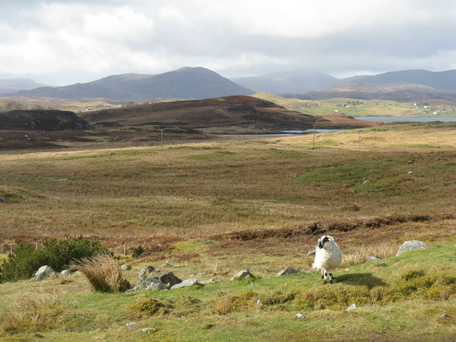
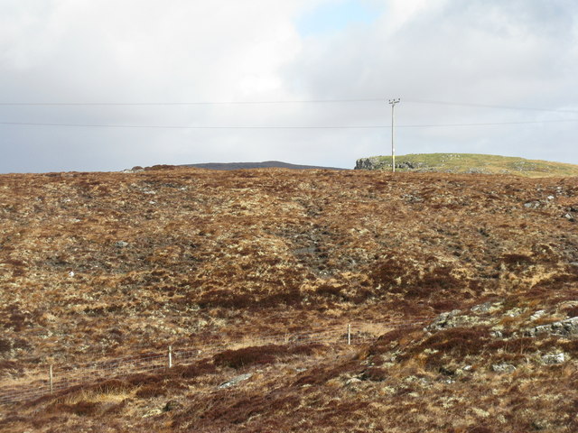
Cnoc Àirigh Mhic an t-Saoir is a prominent hill located in Ross-shire, Scotland. It is situated in the remote and picturesque countryside, surrounded by breathtaking landscapes. The hill is part of the wider mountain range in the area, offering stunning views of the surrounding peaks and valleys.

Standing at an elevation of approximately 500 meters (1,640 feet), Cnoc Àirigh Mhic an t-Saoir is a challenging but rewarding hike for outdoor enthusiasts. The hill is known for its rocky terrain, making it a popular destination for rock climbers and boulderers. The ascent requires some level of fitness and proper hiking gear, as the path can be steep and rugged in certain sections.

The summit of Cnoc Àirigh Mhic an t-Saoir provides panoramic views of the Scottish Highlands. On clear days, hikers can see the nearby lochs and rivers, as well as the vast expanse of greenery that stretches for miles. The hill is also known for its rich biodiversity, with various plant and animal species making their home in the surrounding area.

Cnoc Àirigh Mhic an t-Saoir is a popular spot for nature lovers and photographers, offering ample opportunities to capture the beauty of the Scottish countryside. The hill can be accessed through designated trails and paths, ensuring a safe and enjoyable experience for visitors.

If you have any feedback on the listing, please let us know in the comments section below.

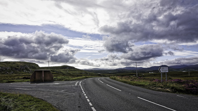
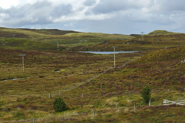
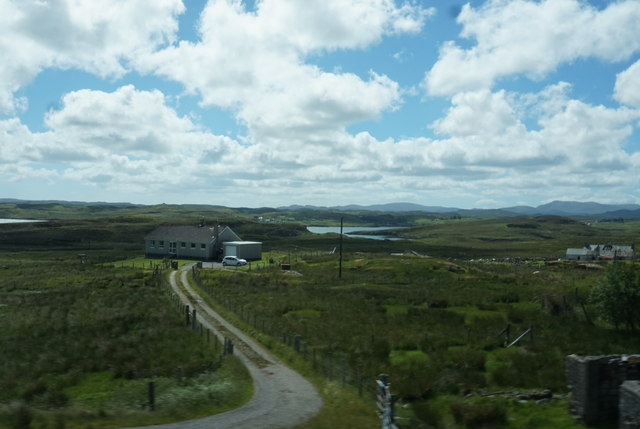
Cnoc Àirigh Mhic an t-Saoir Images

Images are sourced within 2km of 58.103773/-6.4908518 or Grid Reference NB3521. Thanks to Geograph Open Source API. All images are credited.
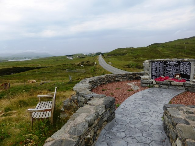
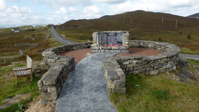
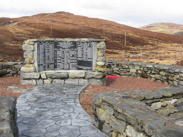
Gate above Loch nan Caor, Isle of Lewis I'm guessing that this somewhat decorative field gate has previously been in a more domestic location!

According to the OS Name Book of 1848-1852, Loch nan Caor means Rowan Trees Loch.
Gate above Loch nan Caor, Isle of Lewis
I'm guessing that this somewhat decorative field gate has previously been in a more domestic location! According to the OS Name Book of 1848-1852, Loch nan Caor means Rowan Trees Loch.
Bus shelter and signpost at a junction on the A859
Kinloch War Memorial 'In memory of all those from Kinloch who fought and died for Freedom'
A list of 54 men and women, aged from 15 - 46, who were lost in the Boer War [2], WW1 [41] and ww2 [11], and the crofts they came from. 
The hill beyond is Nabhar.
Kinloch War Memorial
'In memory of all those from Kinloch who fought and died for Freedom' A list of 54 men and women, aged from 15 - 46, who were lost in the Boer War [2], WW1 [41] and ww2 [11], and the crofts they came from. The hill beyond is Nabhar.
Loch Nabhar
Loch Nabhar
Laxay / Lacasaigh from the A859
Loch Cnoc Iain Duibh from the A859
Kinloch War Memorial, beside the A859
Kinloch War Memorial Further details are available on Canmore. <span class="nowrap"><a title="https://canmore.org.uk/site/318753/lewis-lacasaidh-kinloch-war-memorial" rel="nofollow ugc noopener" href="https://canmore.org.uk/site/318753/lewis-lacasaidh-kinloch-war-memorial">Link</a><img style="margin-left:2px;" alt="External link" title="External link - shift click to open in new window" src="https://s1.geograph.org.uk/img/external.png" width="10" height="10"/></span>
Kinloch War Memorial
Further details are available on Canmore. LinkExternal link
Moorland track east of Glìb Cheòis This track looks as if its main use is to provide access for peat cutting.
Moorland track east of Glìb Cheòis
This track looks as if its main use is to provide access for peat cutting.
Glìb Cheòis from the shore of Loch Cheòis Looking across the loch towards the last few houses at the end of the road in Glìb Cheòis.
Glìb Cheòis from the shore of Loch Cheòis
Looking across the loch towards the last few houses at the end of the road in Glìb Cheòis.
Island in Loch Cheòis A walk around the western shore of Loch Cheòis is an opportunity to watch for wildlife.
Island in Loch Cheòis
A walk around the western shore of Loch Cheòis is an opportunity to watch for wildlife.
Loch Èireasort A view across Loch Èireasort and a fish farm from the track at Glìb Cheòis.
Loch Èireasort
A view across Loch Èireasort and a fish farm from the track at Glìb Cheòis.
Platform in Loch Cheois This small concrete platform is at the southern end of Loch Cheois. There is nothing to indicate its function. (There is a slight possibility that it is associated with the WWII "chariot" training facility at Tavay.)
Platform in Loch Cheois
This small concrete platform is at the southern end of Loch Cheois. There is nothing to indicate its function. (There is a slight possibility that it is associated with the WWII "chariot" training facility at Tavay.)
Lacasaidh Lacasaidh with Loch Èireasort behind
Lacasaidh
Lacasaidh with Loch Èireasort behind
Abhainn Eallaidh from the cemetery Flowing south to Loch Èireasort.
Abhainn Eallaidh from the cemetery
Flowing south to Loch Èireasort.
Kinloch War Memorial On the A859, adjacent to the cemetery car park.
Kinloch War Memorial
On the A859, adjacent to the cemetery car park.
Looking across Abhainn Eallaidh from the cemetery To Loch Èireasort and  Lacasaidh.
Looking across Abhainn Eallaidh from the cemetery
To Loch Èireasort and Lacasaidh.
Moorland  near Lacasaidh With electricity transmission line, and Cnoc Glas on the horizon.
Moorland near Lacasaidh
With electricity transmission line, and Cnoc Glas on the horizon.
Show me another place!

Cnoc Àirigh Mhic an t-Saoir is located at Grid Ref: NB3521 (Lat: 58.103773, Lng: -6.4908518)

Unitary Authority: Na h-Eileanan an Iar

Police Authority: Highlands and Islands

What 3 Words

///grace.school.husky. Near Leurbost, Na h-Eileanan Siar

Related Wikis

Loch Erisort

Loch Erisort (Scottish Gaelic: Èireasort) is an 8-mile-long narrow sea inlet on the east coast of the Isle of Lewis in the Outer Hebrides off the west...

Cabharstadh

Cabharstadh or Caversta (Scottish Gaelic: Cabharstaigh) is a village on the Isle of Lewis in the Outer Hebrides, Scotland. Caversta is situated in the...

Eilean Chaluim Chille

Eilean Chaluim Chille (Gaelic: island of Saint Columba, Calum Cille) is an unpopulated island in the Outer Hebrides. It lies off the east coast of Lewis...

Cromore

Cromore (Scottish Gaelic: Crò Mòr) is a crofting township on the Isle of Lewis in the district of Pairc, in the Outer Hebrides, Scotland. The settlement...

Nearby Amenities

Located within 500m of 58.103773,-6.4908518
Created By: dmgroom_coastlines
Lat/Long: 58.09984/-6.48777
Created By: dmgroom_coastlines
Lat/Long: 58.09971/-6.48802
Created By: dmgroom_coastlines
Lat/Long: 58.09959/-6.48827
Created By: dmgroom_coastlines
Lat/Long: 58.09947/-6.48852
Created By: dmgroom_coastlines
Lat/Long: 58.10184/-6.49803
Bus Stop
Keose
Bus: yes
Fixme: exact position unknown
Naptan AtcoCode: 6010731699
Naptan Bearing: N
Naptan CommonName: Keose
Naptan Indicator: Village
Naptan Landmark: Village
Naptan NaptanCode: 94723745
Naptan Street: Village
Naptan Verified: no
Public Transport: platform
Source: naptan_import
Lat/Long: 58.1050316/-6.4871374
Post Office
Keose Mobile Post Office Service
Addr City: Eilean Leòdhais
Addr City En: Isle of Lewis
Addr Country: GB
Addr Postcode: HS2 9JT
Opening Hours: Mo 11:20-12:20
Ref Pol Id: 143858
Source: OS OpenData StreetView
Lat/Long: 58.1053482/-6.4906433
Passing Place
Lat/Long: 58.1047798/-6.4844535
Passing Place
Lat/Long: 58.1051436/-6.4882577
Barrier: cattle_grid
Lat/Long: 58.1038227/-6.4969197
Passing Place
Lat/Long: 58.0997479/-6.4930609
Passing Place
Lat/Long: 58.1005468/-6.4934603
Barrier: cattle_grid
Lat/Long: 58.1015294/-6.4920888
Barrier: cattle_grid
Lat/Long: 58.1019599/-6.4919048
Barrier: cattle_grid
Lat/Long: 58.1023928/-6.4915467
Barrier: cattle_grid
Lat/Long: 58.1025915/-6.4931369
Passing Place
Lat/Long: 58.1048011/-6.4859542
Barrier: cattle_grid
Lat/Long: 58.1050454/-6.4869736
Passing Place
Lat/Long: 58.103609/-6.4954253
Barrier: cattle_grid
Lat/Long: 58.1037397/-6.4935028
Barrier: cattle_grid
Lat/Long: 58.1037545/-6.4951372
Barrier: cattle_grid
Lat/Long: 58.1048396/-6.4857349
Ceòs
Name En: Keose
Name Gd: Ceòs
Place: village
Lat/Long: 58.1049378/-6.4907925
Passing Place
Lat/Long: 58.1046/-6.4981392
Passing Place
Lat/Long: 58.1042932/-6.4976752
Passing Place
Lat/Long: 58.1045385/-6.482933
Barrier: cattle_grid
Lat/Long: 58.1041188/-6.497034
Turning Circle
Lat/Long: 58.1017026/-6.49202
Turning Circle
Lat/Long: 58.1068293/-6.4906024
Barrier: cattle_grid
Lat/Long: 58.1051974/-6.4877175
Power: pole
Lat/Long: 58.1047037/-6.4914527
Power: pole
Lat/Long: 58.104692/-6.4899827
Power: pole
Lat/Long: 58.104685/-6.488173
Power: pole
Lat/Long: 58.1052482/-6.4852447
Power: pole
Lat/Long: 58.1054368/-6.4843363
Power: pole
Lat/Long: 58.1056175/-6.4834189
Power: pole
Lat/Long: 58.1035133/-6.4838701
Power: pole
Lat/Long: 58.1043578/-6.4837003
Power: pole
Lat/Long: 58.1049591/-6.4835738
Power: pole
Lat/Long: 58.1045219/-6.4838875
Power: pole
Lat/Long: 58.1049713/-6.4847242
Power: pole
Lat/Long: 58.1057527/-6.4883806
Power: pole
Lat/Long: 58.1055643/-6.4876659
Power: pole
Lat/Long: 58.1052963/-6.4867197
Power: pole
Lat/Long: 58.1050514/-6.4868359
Power: pole
Lat/Long: 58.1046841/-6.4869957
Power: pole
Lat/Long: 58.1038941/-6.4896024
Power: pole
Lat/Long: 58.1041496/-6.491608
Power: pole
Lat/Long: 58.1058861/-6.4913611
Power: pole
Lat/Long: 58.1054523/-6.4912672
Power: pole
Lat/Long: 58.1050875/-6.4913646
Power: pole
Lat/Long: 58.1033517/-6.4922507
Power: pole
Lat/Long: 58.103028/-6.492592
Power: pole
Lat/Long: 58.1022514/-6.493483
Power: pole
Lat/Long: 58.1020402/-6.4931504
Power: pole
Lat/Long: 58.1017631/-6.492722
Power: pole
Lat/Long: 58.101443/-6.4922294
Power: pole
Lat/Long: 58.1018439/-6.4921117
Power: pole
Lat/Long: 58.1036065/-6.4933116
Power: pole
Lat/Long: 58.1034611/-6.4949296
Power: pole
Lat/Long: 58.1035881/-6.4966702
Power: pole
Lat/Long: 58.1037037/-6.4977488
Power: pole
Lat/Long: 58.1040297/-6.4985923
Passing Place
Lat/Long: 58.1036378/-6.4965569
Barrier: cattle_grid
Lat/Long: 58.1054311/-6.4901648
Barrier: cattle_grid
Lat/Long: 58.1057473/-6.488928
Power: pole
Lat/Long: 58.1054026/-6.4870869
Barrier: cattle_grid
Lat/Long: 58.1047142/-6.4893072
Power: pole
Lat/Long: 58.1040946/-6.4897117
Power: pole
Lat/Long: 58.1046808/-6.4890958
Bench: yes
Leisure: picnic_table
Lat/Long: 58.1049773/-6.4878022
Aird Mhor Keose
Place: locality
Lat/Long: 58.0995938/-6.4906669
Defibrillator
Emergency: defibrillator
Lat/Long: 58.1045742/-6.4842438
Entrance: yes
Lat/Long: 58.1046255/-6.4841806
Bench: yes
Leisure: picnic_table
Lat/Long: 58.104363/-6.4839656
Street Lamp
Lamp Type: electric
Lat/Long: 58.1043656/-6.4831801
Street Lamp
Lamp Type: electric
Lat/Long: 58.1044153/-6.4842168
The data included in this document is from www.openstreetmap.org. The data is made available under ODbL.

Have you been to Cnoc Àirigh Mhic an t-Saoir?

Leave your review of Cnoc Àirigh Mhic an t-Saoir below (or comments, questions and feedback).