An t-Oighre

Island in Ross-shire

Scotland

An t-Oighre

Gate above Loch nan Caor, Isle of Lewis I'm guessing that this somewhat decorative field gate has previously been in a more domestic location!

According to the OS Name Book of 1848-1852, Loch nan Caor means Rowan Trees Loch.
Gate above Loch nan Caor, Isle of Lewis Credit: Claire Pegrum

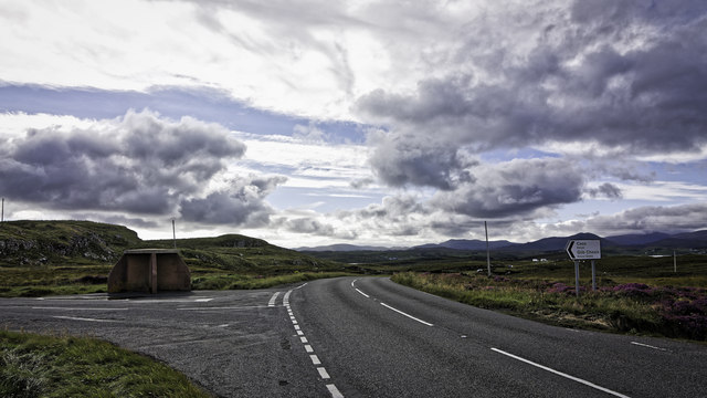
An t-Oighre, also known as the Island of An t-Oighre, is a small island located in the county of Ross-shire, Scotland. Situated off the west coast of the Scottish mainland, it is part of the Inner Hebrides archipelago.

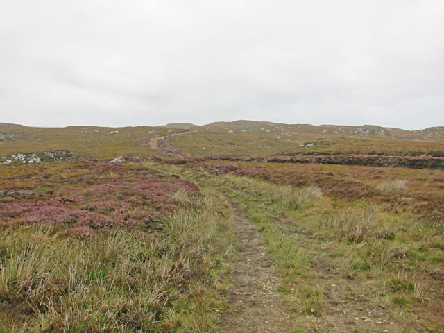
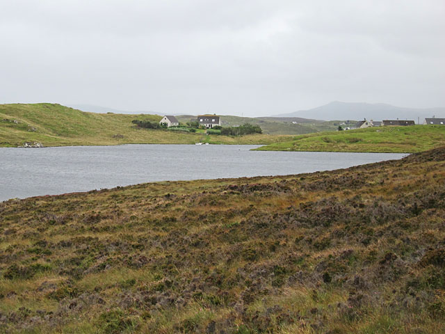
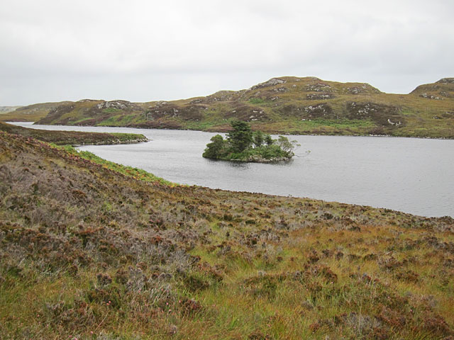
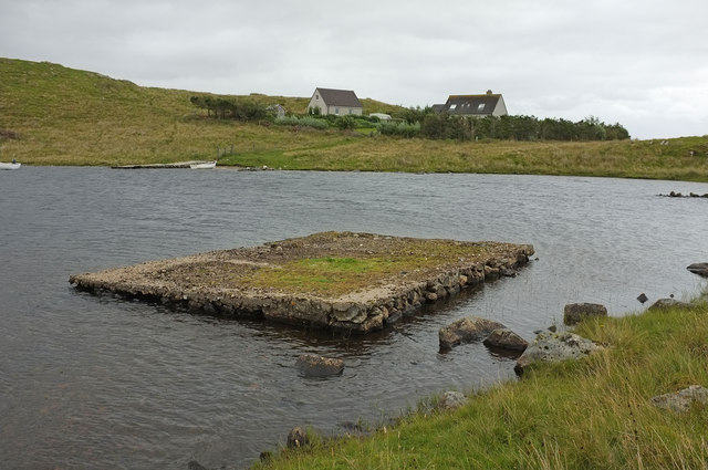
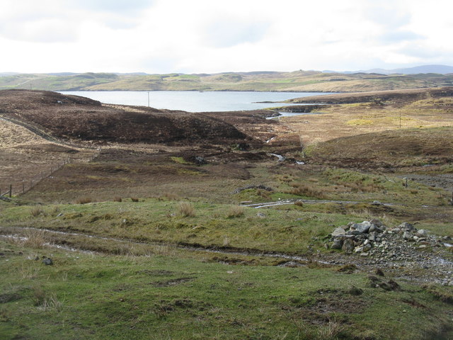
The island covers an area of approximately 1 square kilometer and is characterized by its rugged landscape, consisting of rocky cliffs, grassy hills, and a small beach. It is known for its breathtaking views of the surrounding sea and the neighboring islands.

An t-Oighre has a rich history, with evidence of human habitation dating back thousands of years. Archaeological excavations have uncovered ancient ruins, including a burial mound and a stone circle, indicating the island's significance in prehistoric times.

The island is uninhabited and has no permanent structures or facilities. It serves as a nature reserve and is home to a diverse range of wildlife, including seabirds, seals, and various marine species. The surrounding waters are also a popular spot for fishing and diving enthusiasts.

Access to An t-Oighre is mainly by boat, with regular ferry services operating from nearby ports. Visitors can explore the island on foot, following designated paths and trails that offer stunning views of the surrounding natural beauty.

An t-Oighre is a secluded and peaceful destination, ideal for those seeking solitude and a chance to reconnect with nature. Its untouched landscapes and rich history make it a must-visit for nature lovers and history enthusiasts alike.

If you have any feedback on the listing, please let us know in the comments section below.

An t-Oighre Images

Images are sourced within 2km of 58.100818/-6.482818 or Grid Reference NB3521. Thanks to Geograph Open Source API. All images are credited.
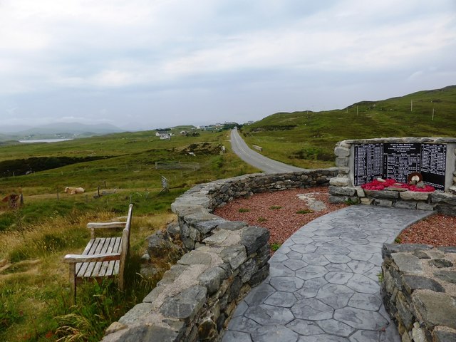
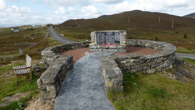
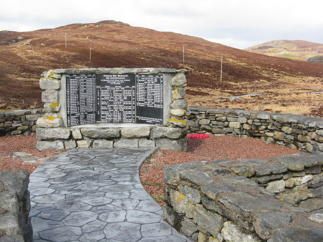
Gate above Loch nan Caor, Isle of Lewis I'm guessing that this somewhat decorative field gate has previously been in a more domestic location!

According to the OS Name Book of 1848-1852, Loch nan Caor means Rowan Trees Loch.
Gate above Loch nan Caor, Isle of Lewis
I'm guessing that this somewhat decorative field gate has previously been in a more domestic location! According to the OS Name Book of 1848-1852, Loch nan Caor means Rowan Trees Loch.
Bus shelter and signpost at a junction on the A859
Kinloch War Memorial 'In memory of all those from Kinloch who fought and died for Freedom'
A list of 54 men and women, aged from 15 - 46, who were lost in the Boer War [2], WW1 [41] and ww2 [11], and the crofts they came from. 
The hill beyond is Nabhar.
Kinloch War Memorial
'In memory of all those from Kinloch who fought and died for Freedom' A list of 54 men and women, aged from 15 - 46, who were lost in the Boer War [2], WW1 [41] and ww2 [11], and the crofts they came from. The hill beyond is Nabhar.
Kinloch War Memorial, beside the A859
Kinloch War Memorial Further details are available on Canmore. <span class="nowrap"><a title="https://canmore.org.uk/site/318753/lewis-lacasaidh-kinloch-war-memorial" rel="nofollow ugc noopener" href="https://canmore.org.uk/site/318753/lewis-lacasaidh-kinloch-war-memorial">Link</a><img style="margin-left:2px;" alt="External link" title="External link - shift click to open in new window" src="https://s1.geograph.org.uk/img/external.png" width="10" height="10"/></span>
Kinloch War Memorial
Further details are available on Canmore. LinkExternal link
Moorland track east of Glìb Cheòis This track looks as if its main use is to provide access for peat cutting.
Moorland track east of Glìb Cheòis
This track looks as if its main use is to provide access for peat cutting.
Glìb Cheòis from the shore of Loch Cheòis Looking across the loch towards the last few houses at the end of the road in Glìb Cheòis.
Glìb Cheòis from the shore of Loch Cheòis
Looking across the loch towards the last few houses at the end of the road in Glìb Cheòis.
Island in Loch Cheòis A walk around the western shore of Loch Cheòis is an opportunity to watch for wildlife.
Island in Loch Cheòis
A walk around the western shore of Loch Cheòis is an opportunity to watch for wildlife.
Loch Èireasort A view across Loch Èireasort and a fish farm from the track at Glìb Cheòis.
Loch Èireasort
A view across Loch Èireasort and a fish farm from the track at Glìb Cheòis.
Platform in Loch Cheois This small concrete platform is at the southern end of Loch Cheois. There is nothing to indicate its function. (There is a slight possibility that it is associated with the WWII "chariot" training facility at Tavay.)
Platform in Loch Cheois
This small concrete platform is at the southern end of Loch Cheois. There is nothing to indicate its function. (There is a slight possibility that it is associated with the WWII "chariot" training facility at Tavay.)
Abhainn Eallaidh from the cemetery Flowing south to Loch Èireasort.
Abhainn Eallaidh from the cemetery
Flowing south to Loch Èireasort.
Kinloch War Memorial On the A859, adjacent to the cemetery car park.
Kinloch War Memorial
On the A859, adjacent to the cemetery car park.
Looking across Abhainn Eallaidh from the cemetery To Loch Èireasort and  Lacasaidh.
Looking across Abhainn Eallaidh from the cemetery
To Loch Èireasort and Lacasaidh.
The Harbour at Cèos The harbour at the crofting community of Cèos is mostly used to support the fish farms in Loch Èireasort
The Harbour at Cèos
The harbour at the crofting community of Cèos is mostly used to support the fish farms in Loch Èireasort
Kinloch War Memorial The Kinloch War Memorial and Garden of Remembrance was officially opened in 2005 to commemorate those who died during the wars of the last century. The tablet shockingly shows those who died from each croft in each war.
Kinloch War Memorial
The Kinloch War Memorial and Garden of Remembrance was officially opened in 2005 to commemorate those who died during the wars of the last century. The tablet shockingly shows those who died from each croft in each war.
Croft in Garryvard The access gate to a croft in Garryvard. Crofting paraphanalia litters the area. A derelict croft house can be seen in the background.
Croft in Garryvard
The access gate to a croft in Garryvard. Crofting paraphanalia litters the area. A derelict croft house can be seen in the background.
Boats moored in Caversta A small inlet from Loch Erisort provides a perfect mooring for small boats.
Boats moored in Caversta
A small inlet from Loch Erisort provides a perfect mooring for small boats.
Evening on Loch Cheois Evening view of Loch Cheois
Evening on Loch Cheois
Evening view of Loch Cheois
Show me another place!

An t-Oighre is located at Grid Ref: NB3521 (Lat: 58.100818, Lng: -6.482818)

Unitary Authority: Na h-Eileanan an Iar

Police Authority: Highlands and Islands

What 3 Words

///soils.impulse.tightrope. Near Leurbost, Na h-Eileanan Siar

Related Wikis

Cabharstadh

Cabharstadh or Caversta (Scottish Gaelic: Cabharstaigh) is a village on the Isle of Lewis in the Outer Hebrides, Scotland. Caversta is situated in the...

Loch Erisort

Loch Erisort (Scottish Gaelic: Èireasort) is an 8-mile-long narrow sea inlet on the east coast of the Isle of Lewis in the Outer Hebrides off the west...

Eilean Chaluim Chille

Eilean Chaluim Chille (Gaelic: island of Saint Columba, Calum Cille) is an unpopulated island in the Outer Hebrides. It lies off the east coast of Lewis...

Cromore

Cromore (Scottish Gaelic: Crò Mòr) is a crofting township on the Isle of Lewis in the district of Pairc, in the Outer Hebrides, Scotland. The settlement...

Related Videos

Food growing events in Pairc - LHHP Introduction to Growing Produce in the Outer Hebrides.

Sarah Longbottom of Lewis and Harris Horticultural Producers gives an introduction to food growing in the Western Isles at the ...

Nearby Amenities

Located within 500m of 58.100818,-6.482818
Created By: dmgroom_coastlines
Lat/Long: 58.09984/-6.48777
Created By: dmgroom_coastlines
Lat/Long: 58.09971/-6.48802
Created By: dmgroom_coastlines
Lat/Long: 58.09959/-6.48827
Created By: dmgroom_coastlines
Lat/Long: 58.09947/-6.48852
Passing Place
Lat/Long: 58.1047798/-6.4844535
Passing Place
Lat/Long: 58.1048011/-6.4859542
Barrier: cattle_grid
Lat/Long: 58.1048396/-6.4857349
Passing Place
Lat/Long: 58.1045385/-6.482933
Power: pole
Lat/Long: 58.1035133/-6.4838701
Power: pole
Lat/Long: 58.1043578/-6.4837003
Power: pole
Lat/Long: 58.1049591/-6.4835738
Power: pole
Lat/Long: 58.1045219/-6.4838875
Power: pole
Lat/Long: 58.1049713/-6.4847242
Power: pole
Lat/Long: 58.1046841/-6.4869957
Aird Mhor Keose
Place: locality
Lat/Long: 58.0995938/-6.4906669
Defibrillator
Emergency: defibrillator
Lat/Long: 58.1045742/-6.4842438
Entrance: yes
Lat/Long: 58.1046255/-6.4841806
Bench: yes
Leisure: picnic_table
Lat/Long: 58.104363/-6.4839656
Generator Method: wind_turbine
Generator Output Electricity: small_installation
Generator Source: wind
Generator Type: horizontal_axis
Height: 8
Power: generator
Lat/Long: 58.1030815/-6.4815215
Generator Method: wind_turbine
Generator Output Electricity: small_installation
Generator Source: wind
Generator Type: horizontal_axis
Height: 8
Power: generator
Lat/Long: 58.102781/-6.4811889
Street Lamp
Lamp Type: electric
Lat/Long: 58.1043656/-6.4831801
Street Lamp
Lamp Type: electric
Lat/Long: 58.1044153/-6.4842168
The data included in this document is from www.openstreetmap.org. The data is made available under ODbL.

Have you been to An t-Oighre?

Leave your review of An t-Oighre below (or comments, questions and feedback).