Àird Bharabhais
Coastal Feature, Headland, Point in Ross-shire
Scotland
Àird Bharabhais

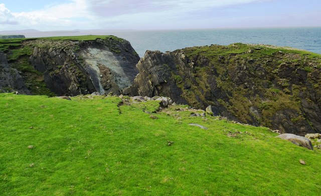
Àird Bharabhais is a coastal feature located in Ross-shire, Scotland. Situated on the west coast of the Highlands, it is a prominent headland that extends out into the North Atlantic Ocean. The name Àird Bharabhais translates to "Barvas Point" in English, and it is a well-known landmark in the region.
This headland is characterized by its rugged and rocky terrain, with steep cliffs that provide stunning panoramic views of the surrounding coastline. The area is rich in wildlife, with seabirds such as gannets, puffins, and razorbills nesting along the cliffs. The waters around Àird Bharabhais are home to a diverse range of marine life, including seals, dolphins, and occasionally whales.
The headland is a popular destination for outdoor enthusiasts and nature lovers. It offers opportunities for hiking and birdwatching, with several well-marked trails that lead visitors to the best vantage points. The dramatic coastal scenery and the sound of crashing waves make it a great spot for photography as well.
Àird Bharabhais also has historical significance. It was once a site of a coastal defense battery during World War II. Remnants of the battery, such as gun emplacements and observation posts, can still be seen scattered across the headland.
Overall, Àird Bharabhais is a remarkable coastal feature that combines natural beauty, wildlife, and historical interest. Its stunning location and diverse ecosystem make it a must-visit destination for those exploring the Ross-shire region.
If you have any feedback on the listing, please let us know in the comments section below.
Àird Bharabhais Images
Images are sourced within 2km of 58.387159/-6.529051 or Grid Reference NB3553. Thanks to Geograph Open Source API. All images are credited.


Àird Bharabhais is located at Grid Ref: NB3553 (Lat: 58.387159, Lng: -6.529051)
Unitary Authority: Na h-Eileanan an Iar
Police Authority: Highlands and Islands
What 3 Words
///kindness.fortnight.swift. Near Carloway, Na h-Eileanan Siar
Related Wikis
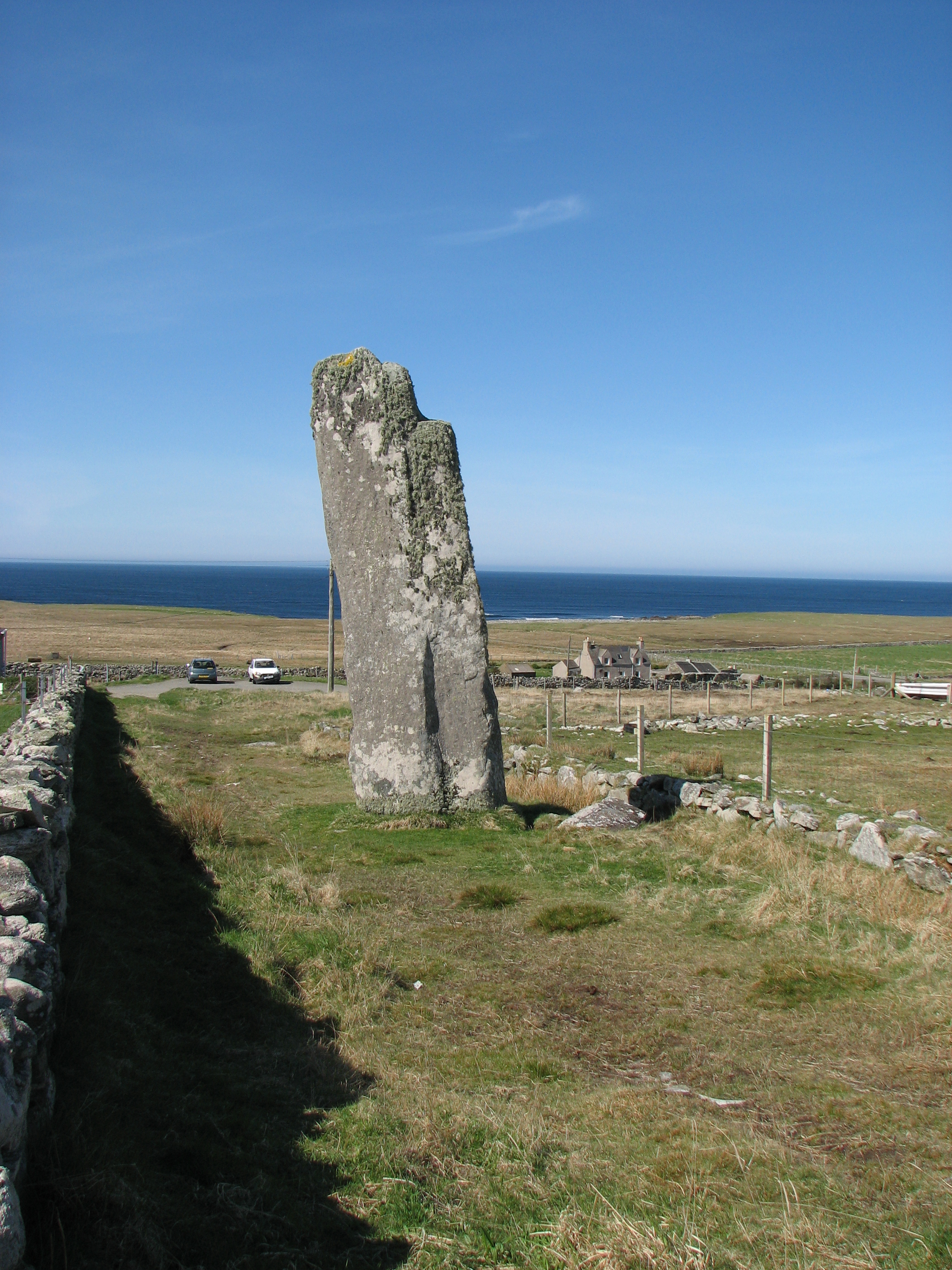
Clach an Trushal
Clach an Trushal (Scottish Gaelic: Clach an Truiseil, Scottish Gaelic pronunciation: [kʰl̪ˠax ən̪ˠ ˈt̪ʰɾuʃal], translated to English "Stone of Compassion...

Baile an Truiseil
Ballantrushal (Scottish Gaelic: Baile an Truiseil) is a village on the Isle of Lewis in the West Side district, in the Outer Hebrides, Scotland. Ballantrushal...

Barvas
Barvas (Scottish Gaelic: Barabhas or Barbhas, pronounced [baravəs]) is a settlement, community and civil parish on the Isle of Lewis in Scotland. It developed...

Mullen Bridge
Mullen Bridge is an old bridge crossing the Royal Canal in Maynooth in County Kildare, Ireland. It was built between 1790 and 1800.The bridge used to carry...
Nearby Amenities
Located within 500m of 58.387159,-6.529051Have you been to Àird Bharabhais?
Leave your review of Àird Bharabhais below (or comments, questions and feedback).