Codal
Bay in Ross-shire
Scotland
Codal
Codal Bay is a small, picturesque bay located in the Ross-shire region of Scotland. It is known for its stunning natural beauty, with rugged cliffs, sandy beaches, and crystal-clear waters. The bay is surrounded by rolling hills and lush greenery, making it a popular destination for nature lovers and outdoor enthusiasts.
Codal Bay is also a haven for wildlife, with a variety of bird species, marine life, and plants calling the area home. Visitors to the bay may spot seals, dolphins, and seabirds as they explore the shoreline and waters.
The bay is a peaceful and tranquil spot, perfect for relaxing and unwinding away from the hustle and bustle of everyday life. Visitors can enjoy leisurely walks along the beach, picnics on the sand, or simply sit back and take in the breathtaking views.
Overall, Codal Bay is a hidden gem in the Scottish Highlands, offering visitors a chance to connect with nature and experience the beauty of the natural world in a peaceful and serene setting.
If you have any feedback on the listing, please let us know in the comments section below.
Codal Images
Images are sourced within 2km of 58.389092/-6.5278263 or Grid Reference NB3553. Thanks to Geograph Open Source API. All images are credited.


![Shore at Siorrabhaig With the small burn Feadan Siorravaig [OS spelling] running into the sea.](https://s1.geograph.org.uk/geophotos/03/46/85/3468537_0b41831a.jpg)

Codal is located at Grid Ref: NB3553 (Lat: 58.389092, Lng: -6.5278263)
Unitary Authority: Na h-Eileanan an Iar
Police Authority: Highlands and Islands
What 3 Words
///chip.community.impaired. Near Carloway, Na h-Eileanan Siar
Related Wikis
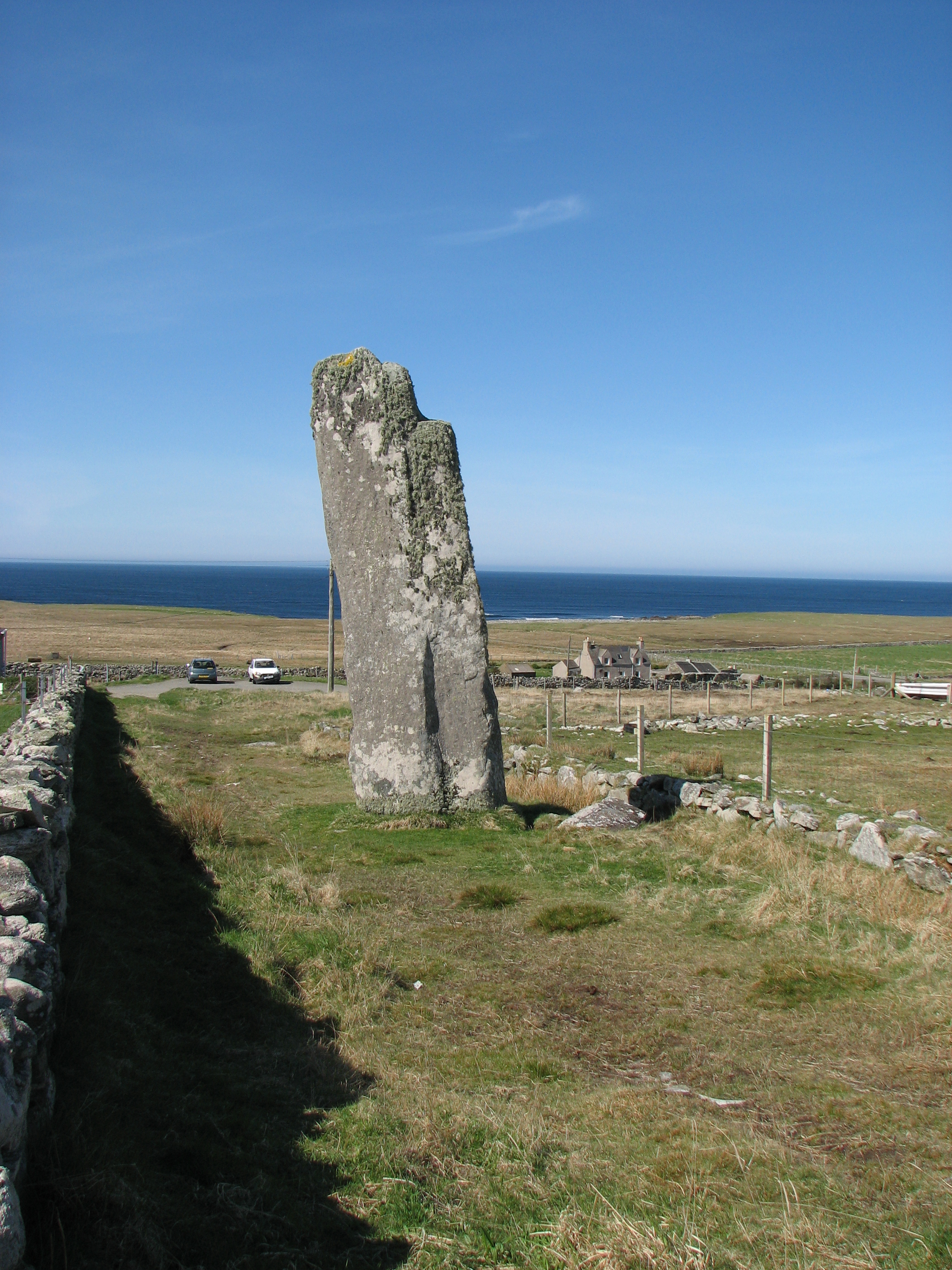
Clach an Trushal
Clach an Trushal (Scottish Gaelic: Clach an Truiseil, Scottish Gaelic pronunciation: [kʰl̪ˠax ən̪ˠ ˈt̪ʰɾuʃal], translated to English "Stone of Compassion...

Baile an Truiseil
Ballantrushal (Scottish Gaelic: Baile an Truiseil) is a village on the Isle of Lewis in the West Side district, in the Outer Hebrides, Scotland. Ballantrushal...

Barvas
Barvas (Scottish Gaelic: Barabhas or Barbhas, pronounced [baravəs]) is a settlement, community and civil parish on the Isle of Lewis in Scotland. It developed...

Mullen Bridge
Mullen Bridge is an old bridge crossing the Royal Canal in Maynooth in County Kildare, Ireland. It was built between 1790 and 1800.The bridge used to carry...
Nearby Amenities
Located within 500m of 58.389092,-6.5278263Have you been to Codal?
Leave your review of Codal below (or comments, questions and feedback).