Larch Spinney
Wood, Forest in Suffolk East Suffolk
England
Larch Spinney
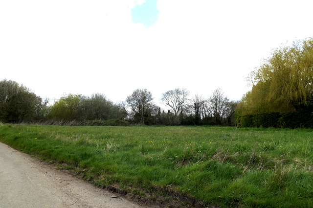
Larch Spinney is a small woodland area located in Suffolk, England. It is situated in the county's countryside, approximately 10 miles northwest of Ipswich. Spanning an area of around 20 acres, Larch Spinney is characterized by its dense population of larch trees, which give the woodland its name.
The forest is home to a variety of wildlife, including several bird species such as woodpeckers, owls, and various songbirds. Additionally, small mammals like squirrels and rabbits can be spotted among the trees. The diverse vegetation in Larch Spinney also supports a range of insects and other invertebrates.
The woodland offers a tranquil escape for nature enthusiasts and walkers who enjoy exploring the great outdoors. A network of well-maintained footpaths winds through the forest, allowing visitors to immerse themselves in the natural beauty of the area. These paths are also popular among dog walkers and families looking for a peaceful place to enjoy a picnic.
Larch Spinney is managed by the local Suffolk Wildlife Trust, which ensures the conservation and preservation of the woodland's ecosystem. The trust organizes occasional events and guided walks to educate visitors about the flora and fauna found within the forest.
Overall, Larch Spinney in Suffolk is a charming woodland retreat that offers a peaceful environment, rich biodiversity, and recreational opportunities for those seeking a connection with nature.
If you have any feedback on the listing, please let us know in the comments section below.
Larch Spinney Images
Images are sourced within 2km of 52.416621/1.4889359 or Grid Reference TM3785. Thanks to Geograph Open Source API. All images are credited.


Larch Spinney is located at Grid Ref: TM3785 (Lat: 52.416621, Lng: 1.4889359)
Administrative County: Suffolk
District: East Suffolk
Police Authority: Suffolk
What 3 Words
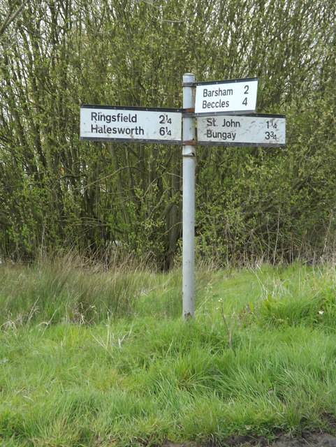
///grab.producing.thrones. Near Bungay, Suffolk
Nearby Locations
Related Wikis

The Saints, Suffolk
The Saints are a group of villages in the north of the English county of Suffolk, between the rivers Blyth and Waveney near to the border with Norfolk...

Ilketshall St Andrew
Ilketshall St Andrew is a village and civil parish in the north of the English county of Suffolk. It is 3 miles (4.8 km) south-east of Bungay and the same...

Ilketshall St Lawrence
Ilketshall St Lawrence is a village and civil parish in the East Suffolk district of the English county of Suffolk. It is 3 miles (4.8 km) south-east of...
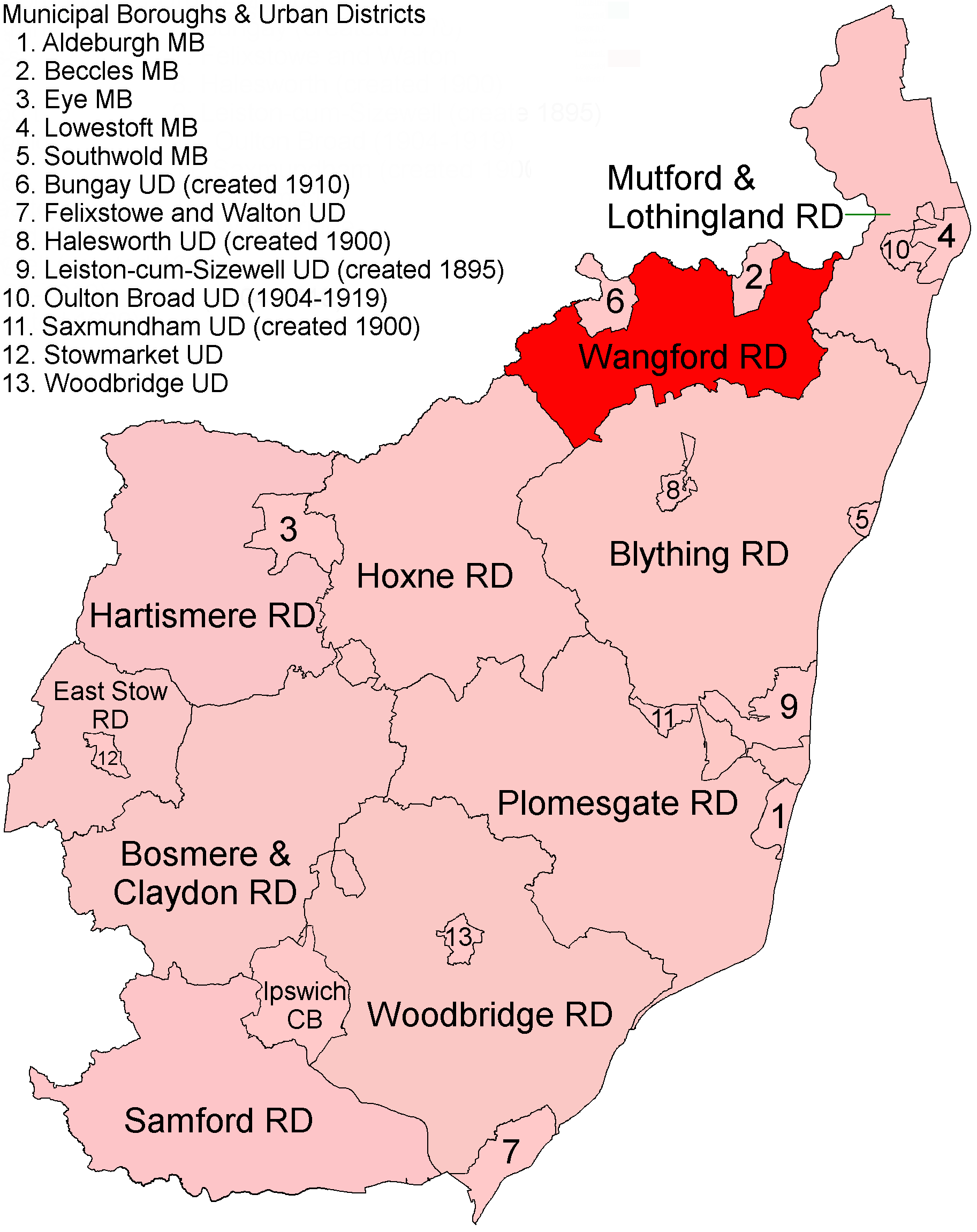
Wangford Rural District
Wangford Rural District was a rural district within the administrative county of East Suffolk between 1894 and 1934. It was created out of the earlier...
Nearby Amenities
Located within 500m of 52.416621,1.4889359Have you been to Larch Spinney?
Leave your review of Larch Spinney below (or comments, questions and feedback).