Palmsted Wood

Wood, Forest in Kent Canterbury

England

Palmsted Wood

The remains of Well Chapel "The ruins are those of the Chapel of Well (a 
strong spring rises there), once in the parish 
of Littlebourne, but now part of the parish of 
Ickham. The chapel had nothing to do with 
Bekesbourne Manor House, in the parish of 
that name. Well Chapel is probably on the 
site of a chapel attached to the manor of 
Garwinton (modern Garrington)" From <span class="nowrap"><a title="http://www.archive.org/stream/s9notesqueries03londuoft/s9notesqueries03londuoft_djvu.txt" rel="nofollow ugc noopener" href="http://www.archive.org/stream/s9notesqueries03londuoft/s9notesqueries03londuoft_djvu.txt">Link</a><img style="margin-left:2px;" alt="External link" title="External link - shift click to open in new window" src="https://s1.geograph.org.uk/img/external.png" width="10" height="10"/></span>
The remains of Well Chapel Credit: Nick Smith

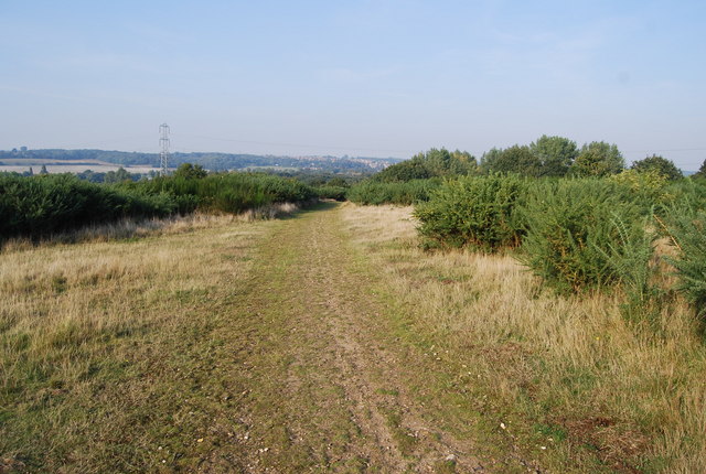
Palmsted Wood is a stunning forest located in the county of Kent, England. Covering an area of approximately 500 acres, this wood is a true haven for nature enthusiasts and outdoor adventurers alike.

The wood is predominantly made up of mature broadleaf trees, such as oak, beech, and hornbeam, which provide a dense canopy, creating a cool and shaded atmosphere. These trees also support a diverse ecosystem, with a variety of birds, insects, and small mammals calling this woodland their home.

The forest floor is carpeted with a rich undergrowth of ferns, bluebells, and wildflowers, creating a picturesque scene during the spring and summer months. There are also numerous walking trails and footpaths that meander through the wood, allowing visitors to explore its hidden corners and discover its natural beauty.

Palmsted Wood is known for its tranquil atmosphere, making it a popular destination for those seeking peace and solitude. The wood offers a welcome escape from the hustle and bustle of modern life, providing a serene setting for relaxation and reflection.

Visitors to Palmsted Wood can engage in a range of activities, from bird watching and nature photography to picnicking and hiking. The wood is also a great place for families, with designated picnic areas and children's play areas available.

Overall, Palmsted Wood in Kent is a remarkable forest that showcases the beauty of the English countryside. With its abundant wildlife, scenic trails, and peaceful ambiance, it offers a truly enchanting experience for all who visit.

If you have any feedback on the listing, please let us know in the comments section below.

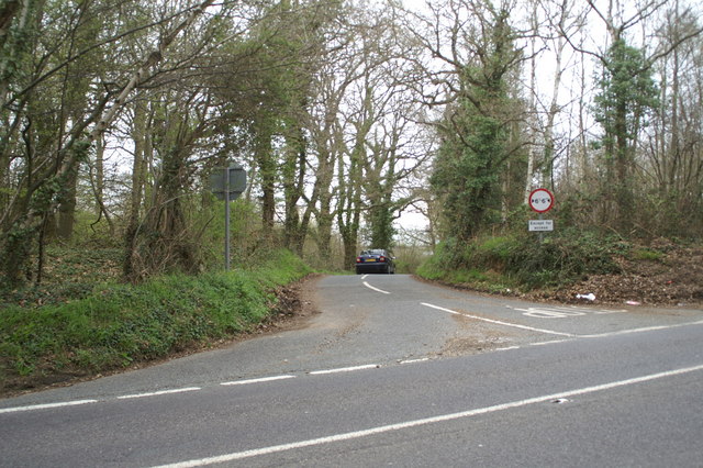
Palmsted Wood Images

Images are sourced within 2km of 51.26949/1.1251745 or Grid Reference TR1856. Thanks to Geograph Open Source API. All images are credited.

The remains of Well Chapel "The ruins are those of the Chapel of Well (a 
strong spring rises there), once in the parish 
of Littlebourne, but now part of the parish of 
Ickham. The chapel had nothing to do with 
Bekesbourne Manor House, in the parish of 
that name. Well Chapel is probably on the 
site of a chapel attached to the manor of 
Garwinton (modern Garrington)" From <span class="nowrap"><a title="http://www.archive.org/stream/s9notesqueries03londuoft/s9notesqueries03londuoft_djvu.txt" rel="nofollow ugc noopener" href="http://www.archive.org/stream/s9notesqueries03londuoft/s9notesqueries03londuoft_djvu.txt">Link</a><img style="margin-left:2px;" alt="External link" title="External link - shift click to open in new window" src="https://s1.geograph.org.uk/img/external.png" width="10" height="10"/></span>
The remains of Well Chapel
"The ruins are those of the Chapel of Well (a strong spring rises there), once in the parish of Littlebourne, but now part of the parish of Ickham. The chapel had nothing to do with Bekesbourne Manor House, in the parish of that name. Well Chapel is probably on the site of a chapel attached to the manor of Garwinton (modern Garrington)" From LinkExternal link
Remains of Well Chapel See <span class="nowrap"><a title="http://www.archive.org/stream/s9notesqueries03londuoft/s9notesqueries03londuoft_djvu.txt" rel="nofollow ugc noopener" href="http://www.archive.org/stream/s9notesqueries03londuoft/s9notesqueries03londuoft_djvu.txt">Link</a><img style="margin-left:2px;" alt="External link" title="External link - shift click to open in new window" src="https://s1.geograph.org.uk/img/external.png" width="10" height="10"/></span> for brief description
Remains of Well Chapel
See LinkExternal link for brief description
The rear of Lackenden Cottages from near Well Chapel
The remaining walls of Well Chapel
The elephant compound at Howletts zoo park
Footpath towards Bekesbourne A path leads from the Lower Garrington Farm track past the wood near the watercress beds, then towards a railway before leading towards School Lane, Bekesbourne.
Footpath towards Bekesbourne
A path leads from the Lower Garrington Farm track past the wood near the watercress beds, then towards a railway before leading towards School Lane, Bekesbourne.
Howletts Gate 2 On Bekesbourne Lane. This private works entrance leads to the animal attraction.
Howletts Gate 2
On Bekesbourne Lane. This private works entrance leads to the animal attraction.
Path in Howletts Animal Park A wide path leads through the various animal cages.
Path in Howletts Animal Park
A wide path leads through the various animal cages.
Clouded Leopard Part of Howletts Animal Park.
Seen from a footpath from Bekesbourne Lane towards the A257 Canterbury Road.

See <span class="nowrap"><a title="http://en.wikipedia.org/wiki/Clouded_Leopard" rel="nofollow ugc noopener" href="http://en.wikipedia.org/wiki/Clouded_Leopard">Link</a><img style="margin-left:2px;" alt="External link" title="External link - shift click to open in new window" src="https://s1.geograph.org.uk/img/external.png" width="10" height="10"/></span> for more details on the wildcat.
Clouded Leopard
Part of Howletts Animal Park. Seen from a footpath from Bekesbourne Lane towards the A257 Canterbury Road. See LinkExternal link for more details on the wildcat.
Bekesbourne Well Chapel Ancient chapel left as ruins on the edge of a field.
See <span class="nowrap"><a title="http://www.megalithic.co.uk/article.php?sid=19010" rel="nofollow ugc noopener" href="http://www.megalithic.co.uk/article.php?sid=19010">Link</a><img style="margin-left:2px;" alt="External link" title="External link - shift click to open in new window" src="https://s1.geograph.org.uk/img/external.png" width="10" height="10"/></span> for more details about the chapel.
Bekesbourne Well Chapel
Ancient chapel left as ruins on the edge of a field. See LinkExternal link for more details about the chapel.
To the woods Country road off the A257
To the woods
Country road off the A257
Converted oast house at the Fordwich turning
Canterbury Army Barracks
The Asylum's taken over the lunatics Canterbury's former Psychiatric Hospital is now Health Service Offices
The Asylum's taken over the lunatics
Canterbury's former Psychiatric Hospital is now Health Service Offices
Saint Mary's Church, Patrixbourne
Ford at Patrixbourne
River Nailbourne in flood. The Nailbourne river in flood during the winter of 2000.
River Nailbourne in flood.
The Nailbourne river in flood during the winter of 2000.
Footpath heading NE from Bekesbourne Lane.
Show me another place!

Palmsted Wood is located at Grid Ref: TR1856 (Lat: 51.26949, Lng: 1.1251745)

Administrative County: Kent

District: Canterbury

Police Authority: Kent

What 3 Words

///remotest.suiting.qualifier. Near Bridge, Kent

Related Wikis

Bekesbourne railway station

Bekesbourne railway station is on the Dover branch of the Chatham Main Line in England, and serves the villages of Bekesbourne and Patrixbourne, Kent....

St Martin's Hospital, Canterbury

St Martin's Hospital is a mental health facility on Littlebourne Road in Canterbury, Kent, England. It is managed by the Kent and Medway NHS and Social...

Bekesbourne-with-Patrixbourne

Bekesbourne-with-Patrixbourne is a civil parish in the City of Canterbury district of Kent, England. It is located 4 miles south-east of Canterbury.According...

Howletts Wild Animal Park

Howletts Wild Animal Park (formerly known as Howletts Zoo) in the parish of Bekesbourne, near Canterbury in Kent, was established as a private zoo in 1957...

Patrixbourne

Patrixbourne is a village and former civil parish, now in the parish of Bekesbourne-with-Patrixbourne, in the Canterbury district in Kent, England. It...

Chaucer School, Canterbury

Chaucer School (or known simply as Chaucer) was a partially selective, mixed ability comprehensive school in Canterbury, Kent. Former names of Chaucer...

Chequer's Wood and Old Park

Chequer's Wood and Old Park is a 106.9-hectare (264-acre) biological and geological Site of Special Scientific Interest on the eastern outskirts of Canterbury...

Bekesbourne

Bekesbourne is a village and former civil parish, now in the parish of Bekesbourne-with-Patrixbourne, in the Canterbury district, in Kent, South-East England...

Nearby Amenities

Located within 500m of 51.26949,1.1251745
Power: tower
Lat/Long: 51.2691461/1.1197113
Power: tower
Lat/Long: 51.2736918/1.1266299
Power: tower
Lat/Long: 51.2715115/1.1233892
Cobb's Meadow
Source: local_knowledge_2013
Tourism: caravan_site
Lat/Long: 51.2660843/1.1260194
Generator Output Electricity: yes
Generator Source: solar
Generator Type: solar_photovoltaic_panel
Location: roof
Power: generator
Lat/Long: 51.2719037/1.1191946
Generator Output Electricity: yes
Generator Source: solar
Generator Type: solar_photovoltaic_panel
Location: roof
Power: generator
Lat/Long: 51.2718593/1.1192013
Generator Output Electricity: yes
Generator Source: solar
Generator Type: solar_photovoltaic_panel
Location: roof
Power: generator
Lat/Long: 51.2718098/1.1192791
Generator Output Electricity: yes
Generator Source: solar
Generator Type: solar_photovoltaic_panel
Location: roof
Power: generator
Lat/Long: 51.2717854/1.1193569
The data included in this document is from www.openstreetmap.org. The data is made available under ODbL.

Have you been to Palmsted Wood?

Leave your review of Palmsted Wood below (or comments, questions and feedback).