Little Hall Wood

Wood, Forest in Kent Canterbury

England

Little Hall Wood

Orchard View, Sweechgate This view shows <a href="https://www.geograph.org.uk/photo/5665411">TR1661 : Orchard View, Sweechgate</a>, when the site was under construction
Orchard View, Sweechgate Credit: John Baker

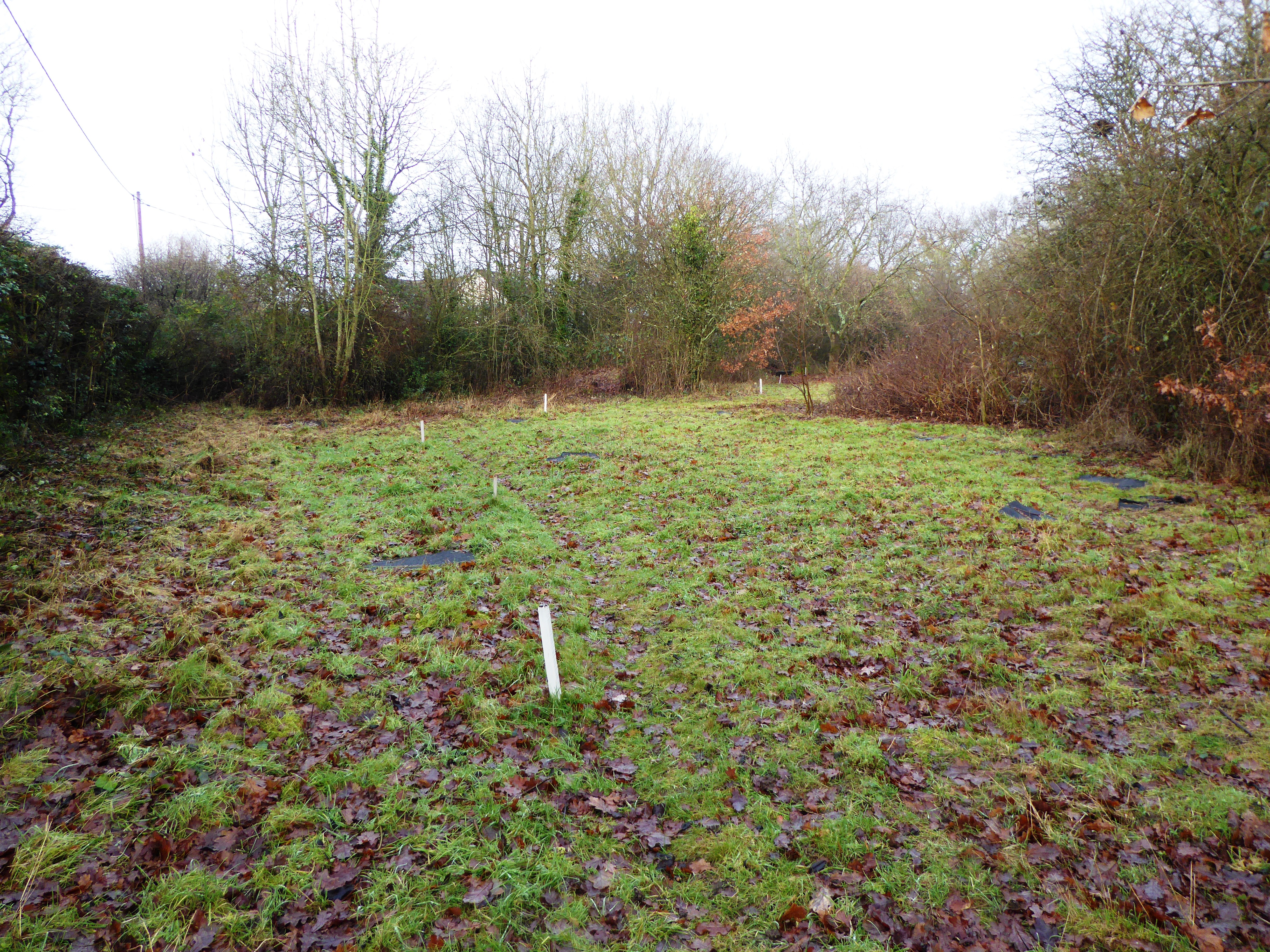
Little Hall Wood is a small woodland area located in the county of Kent, England. Situated near the village of Halling, the wood covers an area of around 20 acres and is part of a larger network of woodlands known as the North Downs woodlands.

The wood is predominantly made up of native broadleaf trees, including oak, beech, and ash. These trees create a lush canopy, providing shade and shelter for a diverse range of flora and fauna. The forest floor is rich with wildflowers such as bluebells and wood anemones, adding vibrant colors to the woodland landscape during the spring months.

Little Hall Wood is a popular destination for nature enthusiasts and walkers who enjoy exploring its tranquil surroundings. Several well-maintained footpaths wind their way through the wood, offering visitors the opportunity to immerse themselves in the natural beauty of the area. The wood also provides a habitat for a variety of wildlife, including foxes, squirrels, and a range of bird species, making it an ideal spot for birdwatching.

Managed by the local council, Little Hall Wood is carefully preserved to maintain its ecological balance and protect its natural resources. Regular maintenance and conservation efforts ensure the wood remains a haven for both wildlife and visitors.

Overall, Little Hall Wood is a picturesque woodland area in Kent, offering a peaceful retreat for those seeking a connection with nature. Its diverse range of flora and fauna, well-maintained footpaths, and serene ambiance make it a cherished destination for outdoor enthusiasts.

If you have any feedback on the listing, please let us know in the comments section below.

Little Hall Wood Images

Images are sourced within 2km of 51.306348/1.0852751 or Grid Reference TR1560. Thanks to Geograph Open Source API. All images are credited.

Orchard View, Sweechgate This view shows <a href="https://www.geograph.org.uk/photo/5665411">TR1661 : Orchard View, Sweechgate</a>, when the site was under construction
Orchard View, Sweechgate
This view shows TR1661 : Orchard View, Sweechgate, when the site was under construction
Close, Sweechgate The green noticeboard directs visitors to The Granary, Orchard House, Pond Bungalow and The Old Granary.
Close, Sweechgate
The green noticeboard directs visitors to The Granary, Orchard House, Pond Bungalow and The Old Granary.
83, Sweechgate Prior approval has been granted by Canterbury City Council under application number CA/21/00230 for an “application under the prior approval process for first floor extension with a maximum height of no more than 3.5 metres, where the existing dwelling house consists of one storey”.
83, Sweechgate
Prior approval has been granted by Canterbury City Council under application number CA/21/00230 for an “application under the prior approval process for first floor extension with a maximum height of no more than 3.5 metres, where the existing dwelling house consists of one storey”.
Farmland and pylon
Farmland and pylon
Broad Oak (Canterbury) Village Sign Village sign
Broad Oak (Canterbury) Village Sign
Village sign
Barton Down, NE of Canterbury: aerial 2022
Thatched cottage at Broad Oak This is seen from Shalloak Road by  the turning to Chapel Lane.
Thatched cottage at Broad Oak
This is seen from Shalloak Road by the turning to Chapel Lane.
Broad Oak Chapel The chapel was opened in 1867, and was licensed for marriage ceremonies in the 1940s as part of the Countess of Huntingdon Connexion - see <span class="nowrap"><a title="www.historyfiles.co.uk/ChurchesBritain/SouthEast/Kent_Canterbury11.htm" rel="nofollow ugc noopener" href="http://www.historyfiles.co.uk/ChurchesBritain/SouthEast/Kent_Canterbury11.htm">Link</a><img style="margin-left:2px;" alt="External link" title="External link - shift click to open in new window" src="https://s1.geograph.org.uk/img/external.png" width="10" height="10"/></span>

For more about the Countess of Huntingdon Connexion see <span class="nowrap"><a title="https://en.wikipedia.org/wiki/Countess_of_Huntingdon%27s_Connexion" rel="nofollow ugc noopener" href="https://en.wikipedia.org/wiki/Countess_of_Huntingdon%27s_Connexion">Link</a><img style="margin-left:2px;" alt="External link" title="External link - shift click to open in new window" src="https://s1.geograph.org.uk/img/external.png" width="10" height="10"/></span>
Broad Oak Chapel
The chapel was opened in 1867, and was licensed for marriage ceremonies in the 1940s as part of the Countess of Huntingdon Connexion - see LinkExternal link For more about the Countess of Huntingdon Connexion see LinkExternal link
University of Kent at Canterbury A road on the northern side of the campus site.
University of Kent at Canterbury
A road on the northern side of the campus site.
The Royal Oak - now closed There were two public houses in Broad Oak - the Royal Oak and the Golden Lion. The Royal Oak has been closed now for some little time and the garden is now very overgrown.

Update: as of June 2018 it has been converted into a house and is surrounded by a development of new houses - see Street View image <span class="nowrap"><a title="https://www.google.co.uk/maps/@51.3112924,1.1093765,3a,41.7y,6.94h,84.28t/data=!3m7!1e1!3m5!1sHW3gaodU_oaGB4gPSxpx5w!2e0!6shttps:%2F%2Fstreetviewpixels-pa.googleapis.com%2Fv1%2Fthumbnail%3Fpanoid%3DHW3gaodU_oaGB4gPSxpx5w%26cb_client%3Dmaps_sv.tactile.gps%26w%3D203%26h%3D100%26yaw%3D227.63286%26pitch%3D0%26thumbfov%3D100!7i16384!8i8192" rel="nofollow ugc noopener" href="https://www.google.co.uk/maps/@51.3112924,1.1093765,3a,41.7y,6.94h,84.28t/data=!3m7!1e1!3m5!1sHW3gaodU_oaGB4gPSxpx5w!2e0!6shttps:%2F%2Fstreetviewpixels-pa.googleapis.com%2Fv1%2Fthumbnail%3Fpanoid%3DHW3gaodU_oaGB4gPSxpx5w%26cb_client%3Dmaps_sv.tactile.gps%26w%3D203%26h%3D100%26yaw%3D227.63286%26pitch%3D0%26thumbfov%3D100!7i16384!8i8192">Link</a><img style="margin-left:2px;" alt="External link" title="External link - shift click to open in new window" src="https://s1.geograph.org.uk/img/external.png" width="10" height="10"/></span>
The Royal Oak - now closed
There were two public houses in Broad Oak - the Royal Oak and the Golden Lion. The Royal Oak has been closed now for some little time and the garden is now very overgrown. Update: as of June 2018 it has been converted into a house and is surrounded by a development of new houses - see Street View image LinkExternal link
The former Royal Oak at Broad Oak There were two public houses in Broad Oak - the Royal Oak and the Golden Lion. The Royal Oak has been closed for some little time and the garden is now very overgrown.

Update: as of June 2018 it has been converted into a house and is surrounded by a development of new houses - see Street View image <span class="nowrap"><a title="https://www.google.co.uk/maps/@51.3112924,1.1093765,3a,41.7y,6.94h,84.28t/data=!3m7!1e1!3m5!1sHW3gaodU_oaGB4gPSxpx5w!2e0!6shttps:%2F%2Fstreetviewpixels-pa.googleapis.com%2Fv1%2Fthumbnail%3Fpanoid%3DHW3gaodU_oaGB4gPSxpx5w%26cb_client%3Dmaps_sv.tactile.gps%26w%3D203%26h%3D100%26yaw%3D227.63286%26pitch%3D0%26thumbfov%3D100!7i16384!8i8192" rel="nofollow ugc noopener" href="https://www.google.co.uk/maps/@51.3112924,1.1093765,3a,41.7y,6.94h,84.28t/data=!3m7!1e1!3m5!1sHW3gaodU_oaGB4gPSxpx5w!2e0!6shttps:%2F%2Fstreetviewpixels-pa.googleapis.com%2Fv1%2Fthumbnail%3Fpanoid%3DHW3gaodU_oaGB4gPSxpx5w%26cb_client%3Dmaps_sv.tactile.gps%26w%3D203%26h%3D100%26yaw%3D227.63286%26pitch%3D0%26thumbfov%3D100!7i16384!8i8192">Link</a><img style="margin-left:2px;" alt="External link" title="External link - shift click to open in new window" src="https://s1.geograph.org.uk/img/external.png" width="10" height="10"/></span>
The former Royal Oak at Broad Oak
There were two public houses in Broad Oak - the Royal Oak and the Golden Lion. The Royal Oak has been closed for some little time and the garden is now very overgrown. Update: as of June 2018 it has been converted into a house and is surrounded by a development of new houses - see Street View image LinkExternal link
A closed pub - The Royal Oak at Broad Oak There were two public houses in Broad Oak - the Royal Oak and the Golden Lion. The Royal Oak has been closed for some little time and the garden is now very overgrown. It is seen here across Sweechgate.

Update: as of June 2018 it has been converted into a house and is surrounded by a development of new houses - see Street View image <span class="nowrap"><a title="https://www.google.co.uk/maps/@51.3112924,1.1093765,3a,41.7y,6.94h,84.28t/data=!3m7!1e1!3m5!1sHW3gaodU_oaGB4gPSxpx5w!2e0!6shttps:%2F%2Fstreetviewpixels-pa.googleapis.com%2Fv1%2Fthumbnail%3Fpanoid%3DHW3gaodU_oaGB4gPSxpx5w%26cb_client%3Dmaps_sv.tactile.gps%26w%3D203%26h%3D100%26yaw%3D227.63286%26pitch%3D0%26thumbfov%3D100!7i16384!8i8192" rel="nofollow ugc noopener" href="https://www.google.co.uk/maps/@51.3112924,1.1093765,3a,41.7y,6.94h,84.28t/data=!3m7!1e1!3m5!1sHW3gaodU_oaGB4gPSxpx5w!2e0!6shttps:%2F%2Fstreetviewpixels-pa.googleapis.com%2Fv1%2Fthumbnail%3Fpanoid%3DHW3gaodU_oaGB4gPSxpx5w%26cb_client%3Dmaps_sv.tactile.gps%26w%3D203%26h%3D100%26yaw%3D227.63286%26pitch%3D0%26thumbfov%3D100!7i16384!8i8192">Link</a><img style="margin-left:2px;" alt="External link" title="External link - shift click to open in new window" src="https://s1.geograph.org.uk/img/external.png" width="10" height="10"/></span>
A closed pub - The Royal Oak at Broad Oak
There were two public houses in Broad Oak - the Royal Oak and the Golden Lion. The Royal Oak has been closed for some little time and the garden is now very overgrown. It is seen here across Sweechgate. Update: as of June 2018 it has been converted into a house and is surrounded by a development of new houses - see Street View image LinkExternal link
The Golden Lion at Broad Oak There were two public houses in Broad Oak - the Royal Oak and the Golden Lion. The Royal Oak has been closed for some little time and only the Golden Lion remains. See also <a title="https://www.geograph.org.uk/photo/5072855" href="https://www.geograph.org.uk/photo/5072855">Link</a>
The Golden Lion at Broad Oak
There were two public houses in Broad Oak - the Royal Oak and the Golden Lion. The Royal Oak has been closed for some little time and only the Golden Lion remains. See also Link
Level crossing on Shalloak Road On 6th February 1846, the South Eastern Railway began services from Ashford to Canterbury West and two months later in April 1846 services were extended though here to Ramsgate. Electric services started on 9th October 1961 and in December 2009, the line became part of the Southeastern High Speed service to London St Pancras.

The next station to the right here is Canterbury West and to the left is Sturry, although the High Speed trains do not stop at the latter.
Level crossing on Shalloak Road
On 6th February 1846, the South Eastern Railway began services from Ashford to Canterbury West and two months later in April 1846 services were extended though here to Ramsgate. Electric services started on 9th October 1961 and in December 2009, the line became part of the Southeastern High Speed service to London St Pancras. The next station to the right here is Canterbury West and to the left is Sturry, although the High Speed trains do not stop at the latter.
Level crossing on Shalloak Road On 6th February 1846, the South Eastern Railway began services from Ashford to Canterbury West and two months later in April 1846 services were extended though here to Ramsgate. Electric services started on 9th October 1961 and in December 2009, the line became part of the Southeastern High Speed service to London St Pancras.

The next station to the left here is Canterbury West and to the right is Sturry, although the High Speed trains do not stop at the latter.
Level crossing on Shalloak Road
On 6th February 1846, the South Eastern Railway began services from Ashford to Canterbury West and two months later in April 1846 services were extended though here to Ramsgate. Electric services started on 9th October 1961 and in December 2009, the line became part of the Southeastern High Speed service to London St Pancras. The next station to the left here is Canterbury West and to the right is Sturry, although the High Speed trains do not stop at the latter.
View down the line from Broadoak Crossing On 6th February 1846, the South Eastern Railway began services from Ashford to Canterbury West and two months later in April 1846 services were extended though here to Ramsgate. Electric services started on 9th October 1961 and in December 2009, the line became part of the Southeastern High Speed service to London St Pancras.

This view is from Broadoak Crossing where Shalloak Road crosses the line. The next station in this direction is Sturry, although the High Speed trains do not stop there.
View down the line from Broadoak Crossing
On 6th February 1846, the South Eastern Railway began services from Ashford to Canterbury West and two months later in April 1846 services were extended though here to Ramsgate. Electric services started on 9th October 1961 and in December 2009, the line became part of the Southeastern High Speed service to London St Pancras. This view is from Broadoak Crossing where Shalloak Road crosses the line. The next station in this direction is Sturry, although the High Speed trains do not stop there.
Orchard View, Sweechgate Planning permission was granted by Canterbury City Council under application numbers CA//16/00554 & CA//16/00555 for the “erection of 13 residential dwellings, change of use of listed public house to a single residential dwelling and associated landscaping works”. The location was named as the Royal Oak Caravan Park. 

Bill Boaden’s image of <a href="https://www.geograph.org.uk/photo/3069006">TR1661 : The Royal Oak, Broad Oak</a> shows it when it was a thriving concern.
Orchard View, Sweechgate
Planning permission was granted by Canterbury City Council under application numbers CA//16/00554 & CA//16/00555 for the “erection of 13 residential dwellings, change of use of listed public house to a single residential dwelling and associated landscaping works”. The location was named as the Royal Oak Caravan Park. Bill Boaden’s image of TR1661 : The Royal Oak, Broad Oak shows it when it was a thriving concern.
Smiths Amusements, 112, Shalloak Road As well as providing the name of the business, the board on the gate reads: we attend fetes, galas, carnivals, fairs, donkey derbys [derbies] etc (also available for hire).
Smiths Amusements, 112, Shalloak Road
As well as providing the name of the business, the board on the gate reads: we attend fetes, galas, carnivals, fairs, donkey derbys [derbies] etc (also available for hire).
Show me another place!

Little Hall Wood is located at Grid Ref: TR1560 (Lat: 51.306348, Lng: 1.0852751)

Administrative County: Kent

District: Canterbury

Police Authority: Kent

What 3 Words

///trapdoor.pigtails.ascendant. Near Sturry, Kent

Related Wikis

Hackington

Hackington is an area of Canterbury in Kent, England, also known (especially historically) as St Stephen's, incorporating the northern part of the city...

Tyler Hill, Kent

Tyler Hill is a small village on the northern outskirts of Canterbury, Kent in England. The population is included in the civil parish of Hackington. Its...

Hales Place

The residential area known as Hales Place is part of the civil parish of Hackington, and lies to the north of the city of Canterbury in Kent, England....

Tyler Hill Meadow

Tyler Hill Meadow is a 0.8-hectare (2.0-acre) Local Nature Reserve in Hackington, north of Canterbury in Kent. It is owned by Hackington Parish Council...

British Cartoon Archive

The British Cartoon Archive (BCA) is a department of the University of Kent, at Canterbury in Kent, England, and holds the national collection of political...

University of Kent

The University of Kent (formerly the University of Kent at Canterbury, abbreviated as UKC) is a semi-collegiate public research university based in Kent...

CSR 97.4FM

Canterbury Student Radio (CSR FM) is a membership based student and community radio station based in Canterbury, England. It is currently funded by Kent...
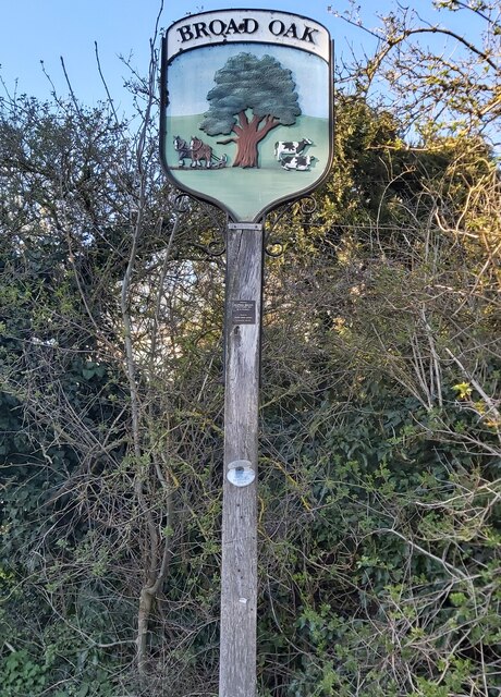
Broad Oak, Kent

Broad Oak is a village in Sturry parish, Kent, England. It lies west of the A291 road to Herne Bay; the centre of the village is about half a mile northwest...

Nearby Amenities

Located within 500m of 51.306348,1.0852751
Barrier: stile
Foot: yes
Lat/Long: 51.3070872/1.0859316
The data included in this document is from www.openstreetmap.org. The data is made available under ODbL.

Have you been to Little Hall Wood?

Leave your review of Little Hall Wood below (or comments, questions and feedback).