Barton Down

Downs, Moorland in Kent Canterbury

England

Barton Down

Orchard View, Sweechgate This view shows <a href="https://www.geograph.org.uk/photo/5665411">TR1661 : Orchard View, Sweechgate</a>, when the site was under construction
Orchard View, Sweechgate Credit: John Baker

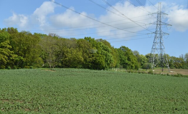
Barton Down is a picturesque area located in the county of Kent, England. It is part of the larger Kent Downs, which is an Area of Outstanding Natural Beauty (AONB). The Down is characterized by its rolling hills, expansive moorland, and diverse wildlife.

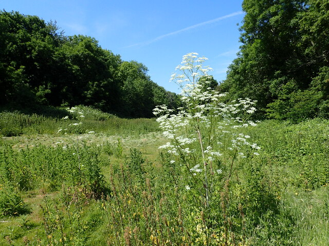
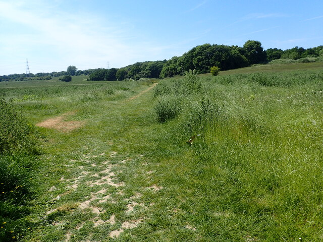
Covering an area of approximately 100 hectares, Barton Down is a haven for nature enthusiasts and walkers alike. The undulating landscape offers breathtaking views of the surrounding countryside, with its patchwork of fields and woodlands. The area is known for its rich biodiversity, with an array of plant and animal species calling it home.

The Down is predominantly covered in heathland, with carpets of heather and gorse providing a vibrant burst of color. These habitats support a wide range of wildlife, including numerous species of birds, butterflies, and reptiles. Visitors to Barton Down may be lucky enough to spot skylarks soaring above or catch a glimpse of the elusive adder basking in the sunshine.

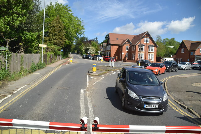
The area is crisscrossed by a network of footpaths and trails, offering visitors the opportunity to explore and appreciate its natural beauty. There are also picnic areas and benches scattered throughout, providing a perfect spot to relax and take in the surroundings.

Barton Down is not only a place of natural beauty but also plays an important role in the conservation of the local ecology. Efforts are made to protect and enhance the diverse habitats present, ensuring the longevity of this precious landscape for future generations to enjoy.

If you have any feedback on the listing, please let us know in the comments section below.
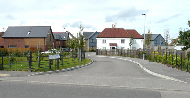
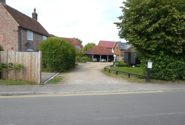
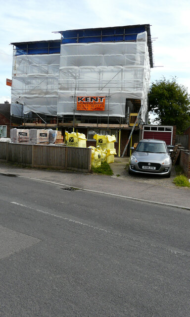
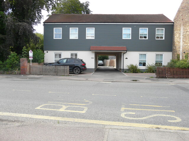
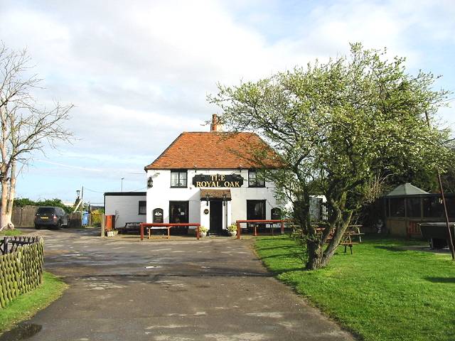
Barton Down Images

Images are sourced within 2km of 51.298371/1.0937501 or Grid Reference TR1560. Thanks to Geograph Open Source API. All images are credited.

Orchard View, Sweechgate This view shows <a href="https://www.geograph.org.uk/photo/5665411">TR1661 : Orchard View, Sweechgate</a>, when the site was under construction
Orchard View, Sweechgate
This view shows TR1661 : Orchard View, Sweechgate, when the site was under construction
Close, Sweechgate The green noticeboard directs visitors to The Granary, Orchard House, Pond Bungalow and The Old Granary.
Close, Sweechgate
The green noticeboard directs visitors to The Granary, Orchard House, Pond Bungalow and The Old Granary.
83, Sweechgate Prior approval has been granted by Canterbury City Council under application number CA/21/00230 for an “application under the prior approval process for first floor extension with a maximum height of no more than 3.5 metres, where the existing dwelling house consists of one storey”.
83, Sweechgate
Prior approval has been granted by Canterbury City Council under application number CA/21/00230 for an “application under the prior approval process for first floor extension with a maximum height of no more than 3.5 metres, where the existing dwelling house consists of one storey”.
The Coach House & Mill Lodge, Mill Road, Sturry The building used to be called <a href="https://www.geograph.org.uk/photo/5760133">TR1760 : The Coach House, 7, Mill Road, Sturry</a>, when it housed offices.
The Coach House & Mill Lodge, Mill Road, Sturry
The building used to be called TR1760 : The Coach House, 7, Mill Road, Sturry, when it housed offices.
Vape Minds, 16, High Street, Sturry The outlet used to be a <a href="https://www.geograph.org.uk/photo/5686977">TR1760 : Former co-operative shop, 16, High Street</a>.
Vape Minds, 16, High Street, Sturry
The Old Fire Station, High Street This view shows the <a href="https://www.geograph.org.uk/photo/5686964">TR1760 : Construction of flats, High Street</a>.
The Old Fire Station, High Street
17, High Street, Sturry Two notices were affixed to the front door; one referred to a warning of a forced entry notice and the other of a notice to quit
17, High Street, Sturry
Two notices were affixed to the front door; one referred to a warning of a forced entry notice and the other of a notice to quit
Farmland and pylon
Farmland and pylon
A28, Sturry The A28 is a 58 mile long road in southern England. It runs south-west from Margate in Kent to Hastings in East Sussex via  Canterbury, Ashford & Tenterden before joining the A21 <a href="https://www.geograph.org.uk/photo/5968545">TQ7913 : A21, A28 junction</a> .
<span class="nowrap"><a title="http://www.sabre-roads.org.uk/wiki/index.php?title=A28" rel="nofollow ugc noopener" href="http://www.sabre-roads.org.uk/wiki/index.php?title=A28">Link</a><img style="margin-left:2px;" alt="External link" title="External link - shift click to open in new window" src="https://s1.geograph.org.uk/img/external.png" width="10" height="10"/></span>
A28, Sturry
The A28 is a 58 mile long road in southern England. It runs south-west from Margate in Kent to Hastings in East Sussex via Canterbury, Ashford & Tenterden before joining the A21 TQ7913 : A21, A28 junction . LinkExternal link
Broad Oak (Canterbury) Village Sign Village sign
Broad Oak (Canterbury) Village Sign
Village sign
Barton Down, NE of Canterbury: aerial 2022
Sweechgate at Broad Oak The junction with Herne Bay Road is a little way ahead.
Sweechgate at Broad Oak
The junction with Herne Bay Road is a little way ahead.
Sweechgate at Broad Oak The white car in the distance has stopped at the junction with Herne Bay Road.
Sweechgate at Broad Oak
The white car in the distance has stopped at the junction with Herne Bay Road.
Thatched cottage at Broad Oak This is seen from Shalloak Road by  the turning to Chapel Lane.
Thatched cottage at Broad Oak
This is seen from Shalloak Road by the turning to Chapel Lane.
View to Canterbury Where the footpath from Broad Oak to Sturry emerges from Den Grove Wood, this view towards Canterbury Cathedral is revealed.
View to Canterbury
Where the footpath from Broad Oak to Sturry emerges from Den Grove Wood, this view towards Canterbury Cathedral is revealed.
Footpath to Broad Oak The footpath from Sturry to Broad Oak enters Den Grove Wood here.
Footpath to Broad Oak
The footpath from Sturry to Broad Oak enters Den Grove Wood here.
A clearing in Den Grove Wood This view is from the footpath from Broad Oak to Sturry.
A clearing in Den Grove Wood
This view is from the footpath from Broad Oak to Sturry.
Footpath to Broad Oak The footpath from Sturry to Broad Oak enters Den Grove Wood a little way ahead.
Footpath to Broad Oak
The footpath from Sturry to Broad Oak enters Den Grove Wood a little way ahead.
Show me another place!

Barton Down is located at Grid Ref: TR1560 (Lat: 51.298371, Lng: 1.0937501)

Administrative County: Kent

District: Canterbury

Police Authority: Kent

What 3 Words

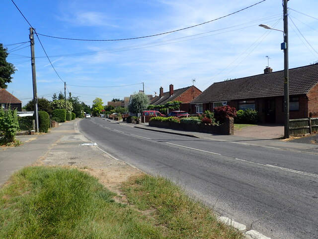
///rail.sunflower.dummy. Near Sturry, Kent

Related Wikis

Hales Place

The residential area known as Hales Place is part of the civil parish of Hackington, and lies to the north of the city of Canterbury in Kent, England....

Beverley Ground

The Beverley Ground was a cricket ground in Canterbury in Kent. It was in use in the mid-19th century, with recorded matches taking place between 1839...

Kingsmead Stadium

Kingsmead Stadium was a greyhound racing and motorcycle speedway track and Association football ground in Canterbury. It was host to Canterbury City F...

The Archbishop's School

The Archbishop's School is a mixed-ability Church of England secondary school and sixth form located on a parkland site on the outskirts of Canterbury...

Canterbury power station

Canterbury power station supplied electricity to the city of Canterbury, Kent, England from 1900 to 1960. This small generating station was owned and operated...

British Cartoon Archive

The British Cartoon Archive (BCA) is a department of the University of Kent, at Canterbury in Kent, England, and holds the national collection of political...
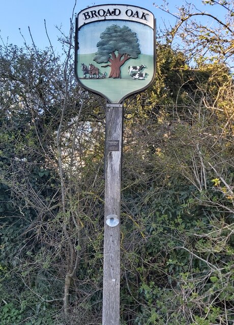
Broad Oak, Kent

Broad Oak is a village in Sturry parish, Kent, England. It lies west of the A291 road to Herne Bay; the centre of the village is about half a mile northwest...

University of Kent

The University of Kent (formerly the University of Kent at Canterbury, abbreviated as UKC) is a semi-collegiate public research university based in Kent...

Nearby Amenities

Located within 500m of 51.298371,1.0937501
Bus Stop
Hunton Gardens
Local Ref: adj
Naptan AtcoCode: 2400A040300A
Naptan Bearing: S
Naptan BusStopType: MKD
Naptan CommonName: Hunton Gardens
Naptan Indicator: adj
Naptan Landmark: Brabourne Close
Naptan NaptanCode: kntdpwap
Naptan PlusbusZoneRef: CNTBE
Naptan RevisionNumber: 4
Naptan Status: act
Naptan Street: Headcorn Drive
Naptan Verified: no
Public Transport: platform
Ref: kntdpwap
Source: naptan_import
Source Date: 2018-02-02
Lat/Long: 51.2974395/1.0878625
Bus Stop
Bicknor Close
Local Ref: adj
Naptan AtcoCode: 2400A040310A
Naptan Bearing: S
Naptan BusStopType: MKD
Naptan CommonName: Bicknor Close
Naptan Indicator: adj
Naptan Landmark: Bicknor Close
Naptan NaptanCode: kntdpwat
Naptan PlusbusZoneRef: CNTBE
Naptan RevisionNumber: 4
Naptan Status: act
Naptan Street: Headcorn Drive
Naptan Verified: no
Public Transport: platform
Ref: kntdpwat
Source: naptan_import
Source Date: 2018-02-02
Lat/Long: 51.2953363/1.0901889
Barrier: stile
Lat/Long: 51.2971184/1.1004707
Barrier: stile
Foot: yes
Lat/Long: 51.2972055/1.1000455
Barrier: kissing_gate
Lat/Long: 51.2968823/1.09431
Barrier: kissing_gate
Lat/Long: 51.2975299/1.0900998
Barrier: stile
Lat/Long: 51.2985871/1.0869205
Sand Pit
Railway: crossing
Source: Bing
Lat/Long: 51.2970991/1.1001102
Power: tower
Lat/Long: 51.294965/1.0971727
Power: tower
Lat/Long: 51.2963477/1.0999131
Folly Farm
Railway: crossing
Source: Bing
Lat/Long: 51.2940757/1.0924569
Power: tower
Lat/Long: 51.2989445/1.1007843
Power: portal
Lat/Long: 51.2945068/1.0963815
Power: portal
Lat/Long: 51.2945877/1.0969647
Power: switch
Lat/Long: 51.2943573/1.0966678
Footpath guide
Hiking: yes
Information: map
Map Size: site
Map Type: scheme
Tourism: information
Lat/Long: 51.2986858/1.086909
Barrier: stile
Bicycle: no
Foot: yes
Material: wood
Stile: stepover
Lat/Long: 51.3001017/1.0888866
Folly Farm
Railway: crossing
Source: Bing
Lat/Long: 51.2941041/1.0924241
Sand Pit
Railway: crossing
Source: Bing
Lat/Long: 51.2971338/1.1000901
Barrier: kissing_gate
Lat/Long: 51.2975525/1.0901169
Communication Microwave: no
Communication Mobile Phone: yes
Man Made: mast
Tower Type: communication
Lat/Long: 51.2966536/1.0987164
Communication Mobile Phone: yes
Man Made: mast
Tower Type: communication
Lat/Long: 51.2944418/1.0934112
Man Made: monitoring_station
Monitoring Traffic: induction_loop
Vehicle: yes
Lat/Long: 51.2959646/1.0971377
SH FID 1
Power: tower
Lat/Long: 51.2954303/1.0991344
Generator Method: photovoltaic
Generator Orientation: 190
Generator Solar Modules: 16
Generator Source: solar
Generator Type: solar_photovoltaic_panel
Location: roof
Power: generator
Lat/Long: 51.2965122/1.0900699
Generator Method: photovoltaic
Generator Orientation: 203
Generator Solar Modules: 13
Generator Source: solar
Generator Type: solar_photovoltaic_panel
Location: roof
Power: generator
Lat/Long: 51.2963855/1.0890453
Man Made: tower
Tower Type: communication
Lat/Long: 51.2944329/1.0934883
Power: tower
Lat/Long: 51.2978677/1.1000383
Power: tower
Lat/Long: 51.2964774/1.0956126
Power: tower
Lat/Long: 51.294884/1.0931531
Generator Method: photovoltaic
Generator Output Electricity: yes
Generator Source: solar
Generator Type: solar_photovoltaic_panel
Location: roof
Power: generator
Lat/Long: 51.2942578/1.0919209
Parcel Locker
Brand: Amazon hub
Colour: blue
Operator: Amazon
Lat/Long: 51.2958882/1.0974687
The data included in this document is from www.openstreetmap.org. The data is made available under ODbL.

Have you been to Barton Down?

Leave your review of Barton Down below (or comments, questions and feedback).