Fishpond Covert

Wood, Forest in Suffolk Ipswich

England

Fishpond Covert

View of an abutment of the Princes Street bridge reflected in the River Orwell Looking south-southwest.
View of an abutment of the Princes Street bridge reflected in the River Orwell Credit: Robert Lamb

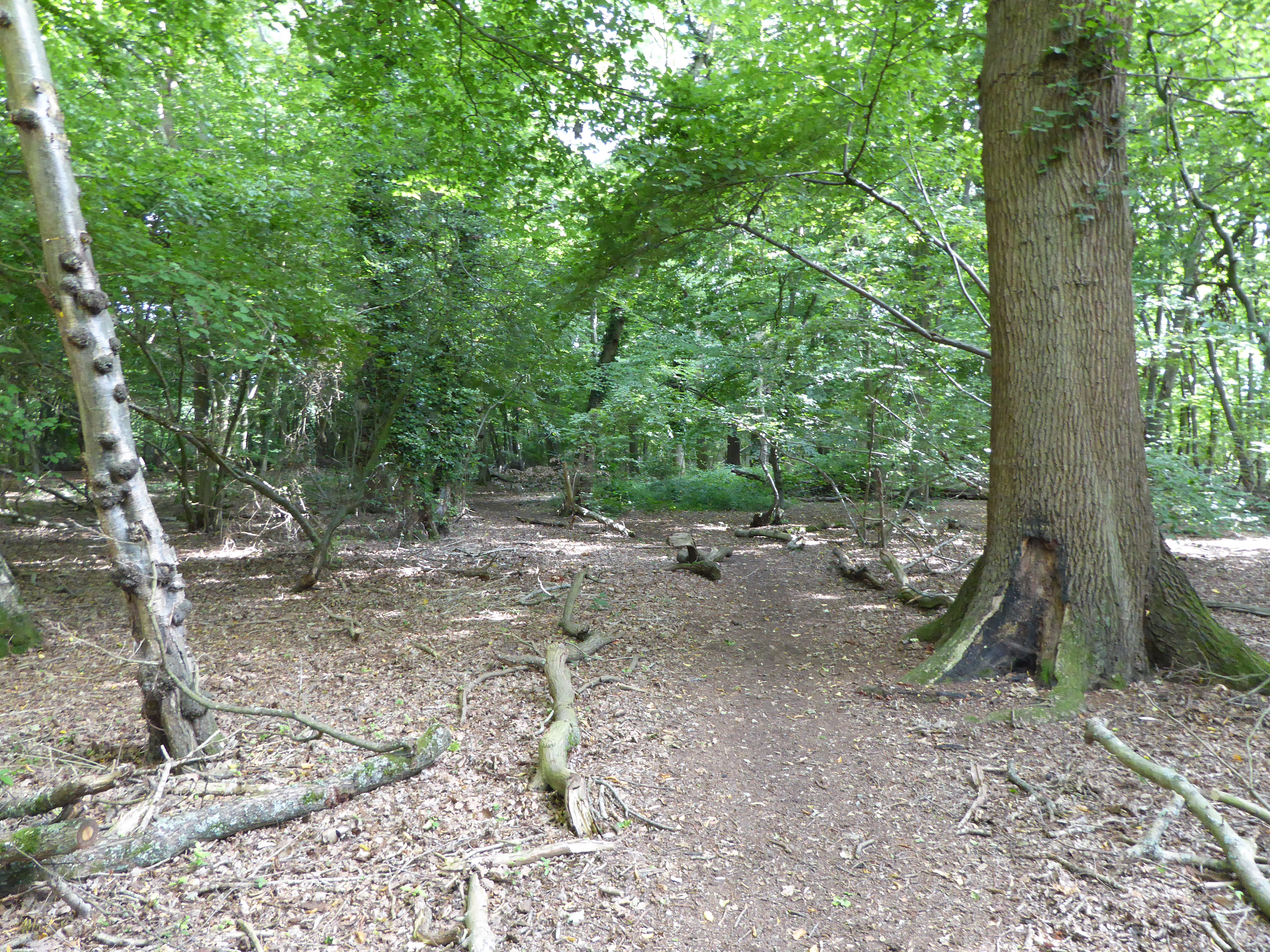
Fishpond Covert is a picturesque woodland situated in Suffolk, England. Covering an area of approximately 20 acres, it is a popular destination among nature enthusiasts and wildlife lovers. The covert is located in close proximity to the village of Woodbridge, making it easily accessible for visitors.

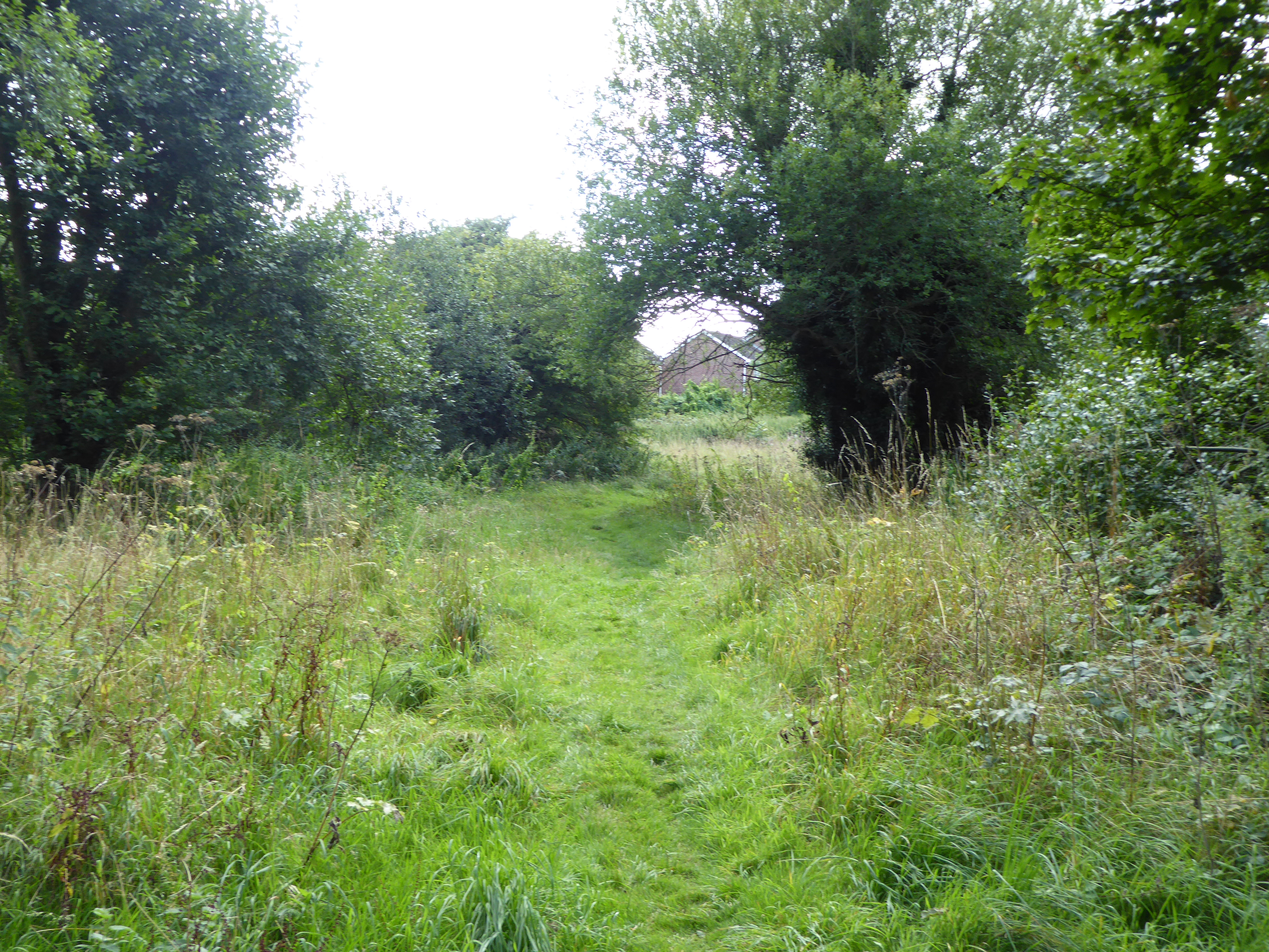
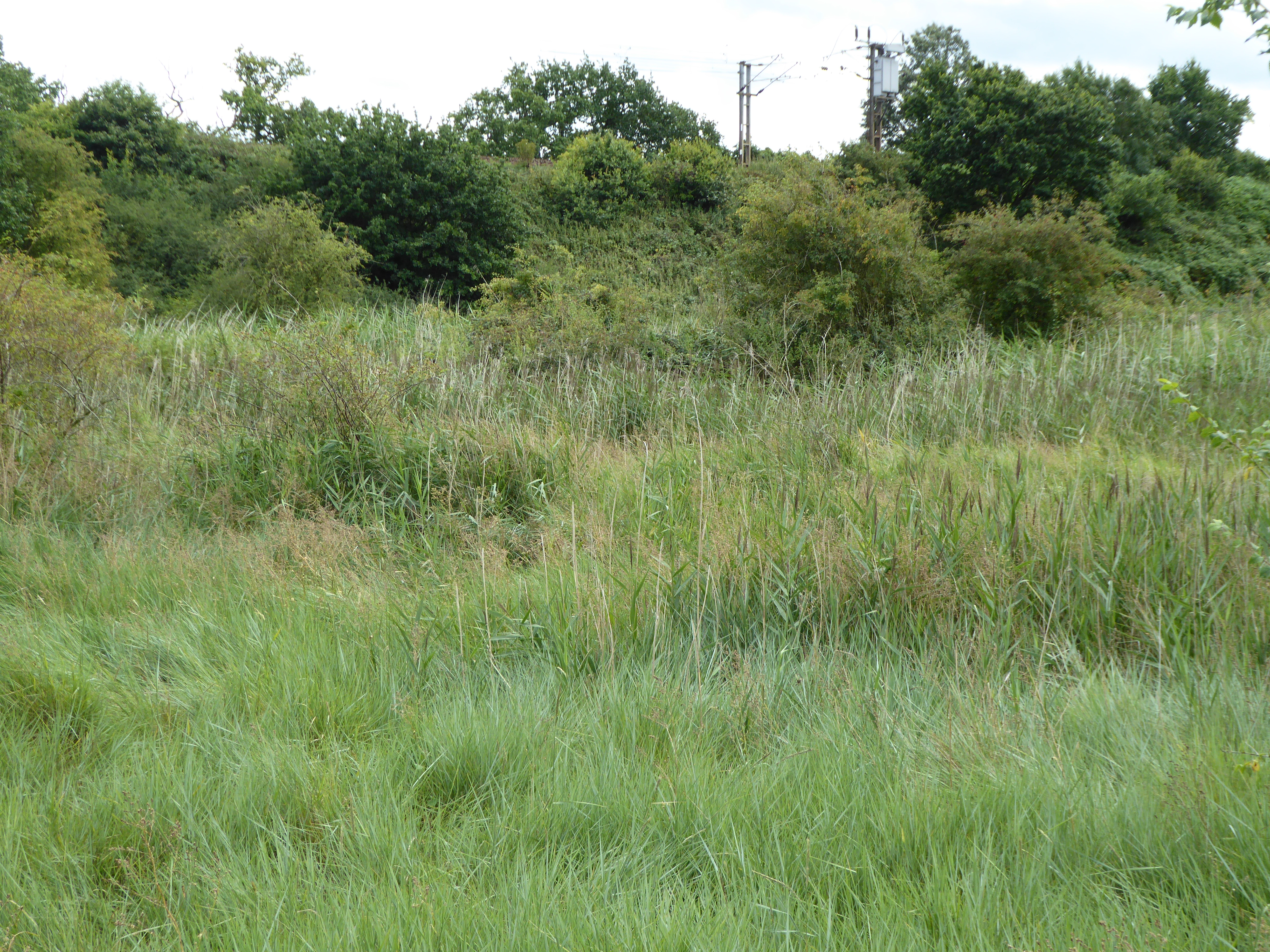
The woodland is characterized by its dense and mature trees, creating a serene and tranquil atmosphere. The dominant tree species in Fishpond Covert include oak, beech, and birch, which provide a diverse habitat for a wide range of flora and fauna.

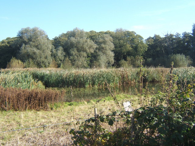
The covert is named after the historic fishpond that was once present in the area. Although the fishpond no longer exists, remnants of its past can still be detected in the form of depressions and channels. These features serve as a reminder of the area's rich history and add to the charm of the woodland.

Wildlife thrives in Fishpond Covert, with numerous species making it their home. Visitors may spot various birds, including woodpeckers, owls, and songbirds, as well as mammals such as foxes, deer, and squirrels. The woodland floor is adorned with an array of wildflowers and ferns, creating a colorful and vibrant display during the spring and summer months.

Fishpond Covert offers several walking trails, allowing visitors to explore the woodland and discover its hidden treasures. The peaceful ambiance and natural beauty of the area make it an ideal spot for walking, birdwatching, or simply immersing oneself in nature's wonders.

If you have any feedback on the listing, please let us know in the comments section below.

Fishpond Covert Images

Images are sourced within 2km of 52.034635/1.1336659 or Grid Reference TM1541. Thanks to Geograph Open Source API. All images are credited.

View of an abutment of the Princes Street bridge reflected in the River Orwell Looking south-southwest.
View of an abutment of the Princes Street bridge reflected in the River Orwell
Looking south-southwest.
A137 traffic island at junction for A14
Railway bridge over the A14 westbound near Ipswich
A14 westbound near Ipswich
A14 westbound approaching junction 55
GBFreightliner locomotive servicing facility, Ipswich With three Class 66 diesel locomotives, used principally on container trains from Felixstowe. A new full maintenance facility is planned on disused sidings on the opposite side of the main line.
GBFreightliner locomotive servicing facility, Ipswich
With three Class 66 diesel locomotives, used principally on container trains from Felixstowe. A new full maintenance facility is planned on disused sidings on the opposite side of the main line.
GBFreightliner locomotive servicing facility, Ipswich Administration building, see also <a title="https://www.geograph.org.uk/photo/7173875" href="https://www.geograph.org.uk/photo/7173875">Link</a>
GBFreightliner locomotive servicing facility, Ipswich
Administration building, see also Link
Off to work Freightliner Class 66 554 locomotive trundles out of the Ipswich servicing facility, probably heading for Felixstowe.
Off to work
Freightliner Class 66 554 locomotive trundles out of the Ipswich servicing facility, probably heading for Felixstowe.
Ipswich Station, north end View from the more westerly of the two footbridges.
Ipswich Station, north end
View from the more westerly of the two footbridges.
Happy nesters A pair of Herring Gulls nesting on the roof of Platform 1 canopy at Ipswich Station.  See <a title="https://www.geograph.org.uk/photo/7173881" href="https://www.geograph.org.uk/photo/7173881">Link</a> for location.
Happy nesters
A pair of Herring Gulls nesting on the roof of Platform 1 canopy at Ipswich Station. See Link for location.
What a tangled web we weave . . . . . . when we electrify our railways! Morning sunlight highlights the overhead wires leading into Ipswich Tunnel at the south end of the station.
What a tangled web we weave . . .
. . . when we electrify our railways! Morning sunlight highlights the overhead wires leading into Ipswich Tunnel at the south end of the station.
Train to London, Ipswich Station Class 720 535 waiting at Platform 3 to depart to London Liverpool Street on the 'local' service which terminates/starts at Ipswich and serves stations not served by the Norwich express services.
Train to London, Ipswich Station
Class 720 535 waiting at Platform 3 to depart to London Liverpool Street on the 'local' service which terminates/starts at Ipswich and serves stations not served by the Norwich express services.
On the way to Chantry Estate – 1971 Ipswich Corporation bus 7 climbs Ancaster Road on service 12. The low bridge under the railway in the background enforced the use of single deck buses on this route.

Bus 7 was the first single-deck motor bus to join the fleet, in 1954. It is an AEC Regal IV with Park Royal bodywork. Ipswich is one of a very small number of municipalities which still runs its own bus services.

This is one of a series of views featuring buses in the 60s, 70s, and 80s. <a title="https://www.geograph.org.uk/search.php?i=137652761" href="https://www.geograph.org.uk/search.php?i=137652761">Link</a>
On the way to Chantry Estate – 1971
Ipswich Corporation bus 7 climbs Ancaster Road on service 12. The low bridge under the railway in the background enforced the use of single deck buses on this route. Bus 7 was the first single-deck motor bus to join the fleet, in 1954. It is an AEC Regal IV with Park Royal bodywork. Ipswich is one of a very small number of municipalities which still runs its own bus services. This is one of a series of views featuring buses in the 60s, 70s, and 80s. Link
Ipswich Station The Great Eastern Main Line (East Anglia Main Line) is a 133 mile long railway line, which connects London Liverpool Street Station with destinations in east London and the East of England, including Chelmsford, Colchester, Ipswich, Norwich and several coastal resorts such as Clacton-on-Sea and Walton-on-the-Naze also the ports of Harwich and Felixstowe. 
The line opened in several sections but was mostly open by 1862.
Wikipedia: <span class="nowrap"><a title="http://en.wikipedia.org/wiki/Great_Eastern_Main_Line" rel="nofollow ugc noopener" href="http://en.wikipedia.org/wiki/Great_Eastern_Main_Line">Link</a><img style="margin-left:2px;" alt="External link" title="External link - shift click to open in new window" src="https://s1.geograph.org.uk/img/external.png" width="10" height="10"/></span>
Ipswich Station
The Great Eastern Main Line (East Anglia Main Line) is a 133 mile long railway line, which connects London Liverpool Street Station with destinations in east London and the East of England, including Chelmsford, Colchester, Ipswich, Norwich and several coastal resorts such as Clacton-on-Sea and Walton-on-the-Naze also the ports of Harwich and Felixstowe. The line opened in several sections but was mostly open by 1862. Wikipedia: LinkExternal link
Ipswich Station <span class="nowrap"><a title="https://en.wikipedia.org/wiki/Ipswich_railway_station" rel="nofollow ugc noopener" href="https://en.wikipedia.org/wiki/Ipswich_railway_station">Link</a><img style="margin-left:2px;" alt="External link" title="External link - shift click to open in new window" src="https://s1.geograph.org.uk/img/external.png" width="10" height="10"/></span>
Ipswich Station
A Norwich bound train starting from Ipswich On a service from London Liverpool Street.
A Norwich bound train starting from Ipswich
On a service from London Liverpool Street.
Cycle path beside railway Gippeswyk Park
Gippeswyk Park
Gippeswyk Park
Show me another place!

Fishpond Covert is located at Grid Ref: TM1541 (Lat: 52.034635, Lng: 1.1336659)

Administrative County: Suffolk

District: Ipswich

Police Authority: Suffolk

What 3 Words

///answers.winters.provoking. Near Ipswich, Suffolk

Related Wikis

Stoke Park Wood

Stoke Park Wood is a 2.2 hectare Local Nature Reserve in Ipswich in Suffolk. It is owned and managed by Ipswich Borough Council.This ancient wood was formerly...

Stoke Park, Suffolk

Stoke Park was a country estate located at the southern edge of the Stoke ridge. The estate was owned by the Barons Gwydyr, and sold in the 1920s to pay...

Bourne Park Reed Beds

Bourne Park Reed Beds is a 7.4 hectare Local Nature Reserve on the southern outskirts of Ipswich in Suffolk, United Kingdom. It is owned and managed by...

Bobbits Lane

Bobbits Lane is a 16.1 hectares (40 acres) Local Nature Reserve in Ipswich in Suffolk. It is owned by Ipswich Borough Council and managed by the Greenways...

Bobbitshole, Belstead

Bobbitshole is a 1.7-hectare (4.2-acre) geological Site of Special Scientific Interest in Belstead, on the southern outskirts of Ipswich in Suffolk. It...

Belstead Brook Hotel

The Belstead Brook Hotel in Ipswich, Suffolk is a building of historical significance. It was originally a 16th-century hunting lodge but was used later...

South West Area, Ipswich

The South West Area, Ipswich is one of five administrative areas in Ipswich, through which Ipswich Borough Council divides its spending and enables feedback...

Spring Wood, Belstead

Spring Wood is a 5.5 hectare Local Nature Reserve east of Belstead, on the southern outskirts of Ipswich in Suffolk. It is owned and managed by Ipswich...

Nearby Amenities

Located within 500m of 52.034635,1.1336659
Traffic Calming: island
Lat/Long: 52.0325543/1.133846
Crossing
Crossing: uncontrolled
Crossing Island: yes
Lat/Long: 52.0322218/1.1285106
Turning Circle
Lat/Long: 52.0380411/1.1293612
Turning Circle
Lat/Long: 52.038401/1.1310089
Stoke Park
Place: suburb
Wikidata: Q2279374
Wikipedia: en:Stoke Park, Suffolk
Lat/Long: 52.0378262/1.1342969
Bus Stop
Asda
Bus: yes
Local Ref: o/s
Naptan AtcoCode: 390030202
Naptan Bearing: SW
Naptan CommonName: Turning Point
Naptan Landmark: Turning Point
Naptan NaptanCode: sufamjmg
Naptan PlusbusZoneRef: IPSWICH
Naptan Street: Stoke Park Drive
Naptan Verified: no
Public Transport: platform
Source: naptan_import
Lat/Long: 52.0388141/1.1358384
Bus Stop
Blyth Close
Bus: yes
Local Ref: adj
Naptan AtcoCode: 390030203
Naptan Bearing: S
Naptan CommonName: Blyth Close
Naptan Landmark: Blyth Close
Naptan NaptanCode: sufamjmj
Naptan PlusbusZoneRef: IPSWICH
Naptan Street: Stoke Park Drive
Naptan Verified: no
Public Transport: platform
Source: naptan_import
Lat/Long: 52.0365668/1.1361187
Bus Stop
Blyth Close
Bus: yes
Local Ref: opp
Naptan AtcoCode: 390030204
Naptan Bearing: N
Naptan CommonName: Blyth Close
Naptan Landmark: Blyth Close
Naptan NaptanCode: sufamjmp
Naptan PlusbusZoneRef: IPSWICH
Naptan Street: Stoke Park Drive
Naptan Verified: no
Public Transport: platform
Source: naptan_import
Lat/Long: 52.0363084/1.1360277
Bus Stop
Winchester Way
Local Ref: adj
Naptan AtcoCode: 390030205
Naptan Bearing: N
Naptan CommonName: Winchester Way
Naptan Landmark: Winchester Way
Naptan NaptanCode: sufamjmt
Naptan PlusbusZoneRef: IPSWICH
Naptan Street: Stoke Park Drive
Naptan Verified: no
Public Transport: platform
Source: naptan_import
Lat/Long: 52.0334115/1.1340312
Bus Stop
Winchester Way
Local Ref: opp
Naptan AtcoCode: 390030206
Naptan Bearing: SW
Naptan CommonName: Winchester Way
Naptan Landmark: Winchester Way
Naptan NaptanCode: sufamjmw
Naptan PlusbusZoneRef: IPSWICH
Naptan Street: Stoke Park Drive
Naptan Verified: no
Public Transport: platform
Source: naptan_import
Lat/Long: 52.0323529/1.1337458
Bus Stop
Downside Close
Local Ref: adj
Naptan AtcoCode: 390030207
Naptan Bearing: SE
Naptan CommonName: Downside Close
Naptan Landmark: Downside Close
Naptan NaptanCode: sufamjpa
Naptan Street: Stoke Park Drive
Naptan Verified: no
Public Transport: platform
Source: naptan_import
Lat/Long: 52.0320836/1.1288792
Bus Stop
Downside Close
Local Ref: opp
Naptan AtcoCode: 390030208
Naptan Bearing: NW
Naptan CommonName: Downside Close
Naptan Landmark: Downside Close
Naptan NaptanCode: sufamjpd
Naptan PlusbusZoneRef: IPSWICH
Naptan Street: Stoke Park Drive
Naptan Verified: no
Public Transport: platform
Source: naptan_import
Lat/Long: 52.0325829/1.1278362
Bus Stop
Egglestone Close
Bus: yes
Local Ref: adj
Naptan AtcoCode: 390030213
Naptan Bearing: NE
Naptan CommonName: Egglestone Close
Naptan Landmark: Egglestone Close
Naptan NaptanCode: sufamjpw
Naptan PlusbusZoneRef: IPSWICH
Naptan Street: Fountains Road
Naptan Verified: no
Public Transport: platform
Source: naptan_import
Lat/Long: 52.0363769/1.129397
Bus Stop
Butley Close
Bus: yes
Local Ref: adj
Naptan AtcoCode: 390030215
Naptan Bearing: NW
Naptan CommonName: Butley Close
Naptan Landmark: Butley Close
Naptan NaptanCode: sufamjtd
Naptan PlusbusZoneRef: IPSWICH
Naptan Street: Fountains Road
Naptan Verified: no
Public Transport: platform
Source: naptan_import
Lat/Long: 52.0349784/1.1295617
Bus Stop
Leicester Close
Bus: yes
Local Ref: adj
Naptan AtcoCode: 390030217
Naptan Bearing: SW
Naptan CommonName: Leicester Close
Naptan Landmark: Leicester Close
Naptan NaptanCode: sufamjtj
Naptan PlusbusZoneRef: IPSWICH
Naptan Street: Fountains Road
Naptan Verified: no
Public Transport: platform
Source: naptan_import
Lat/Long: 52.0355597/1.1317169
Bus Stop
Glastonbury Close
Bus: yes
Local Ref: adj
Naptan AtcoCode: 390030219
Naptan Bearing: SW
Naptan CommonName: Glastonbury Close
Naptan Landmark: Glastonbury Close
Naptan NaptanCode: sufamjtp
Naptan PlusbusZoneRef: IPSWICH
Naptan Street: Fountains Road
Naptan Verified: no
Public Transport: platform
Source: naptan_import
Lat/Long: 52.0359944/1.1329578
Glastonbury Close
Local Ref: opp
Naptan AtcoCode: 390030220
Naptan Bearing: NE
Naptan BusStopType: CUS
Naptan CommonName: Glastonbury Close
Naptan Landmark: Glastonbury Close
Naptan NaptanCode: sufamjtw
Naptan PlusbusZoneRef: IPSWICH
Naptan Street: Fountains Road
Naptan Verified: no
Source: naptan_import
Lat/Long: 52.0360764/1.1329197
Bus Stop
Lindisfarne Close
Bus: yes
Local Ref: adj
Naptan AtcoCode: 390030221
Naptan Bearing: SW
Naptan CommonName: Lindisfarne Close
Naptan Landmark: Lindisfarne Close
Naptan NaptanCode: sufamjwa
Naptan PlusbusZoneRef: IPSWICH
Naptan Street: Fountains Road
Naptan Verified: no
Public Transport: platform
Source: naptan_import
Lat/Long: 52.0367724/1.1346985
Girton Way (closed)
Disused Highway: bus_stop
Local Ref: o/s 61
Naptan AtcoCode: 390030231
Naptan Bearing: NW
Naptan CommonName: Girton Way
Naptan Landmark: Girton Way
Naptan NaptanCode: sufampaj
Naptan PlusbusZoneRef: IPSWICH
Naptan Street: Girton Way
Naptan Verified: no
Source: naptan_import
Lat/Long: 52.0374746/1.1284157
Bus Stop
Balmoral Close
Local Ref: adj
Naptan AtcoCode: 390030295
Naptan Bearing: NE
Naptan CommonName: Balmoral Close
Naptan Landmark: Balmoral Close
Naptan NaptanCode: sufamtgj
Naptan PlusbusZoneRef: IPSWICH
Naptan Street: Belstead Road
Naptan Verified: no
Source: naptan_import
Lat/Long: 52.0378566/1.1310819
Balmoral Close
Local Ref: opp
Naptan AtcoCode: 390030296
Naptan Bearing: SW
Naptan BusStopType: CUS
Naptan CommonName: Balmoral Close
Naptan Landmark: Balmoral Close
Naptan NaptanCode: sufamtgm
Naptan PlusbusZoneRef: IPSWICH
Naptan Street: Belstead Road
Naptan Verified: no
Source: naptan_import
Lat/Long: 52.0377458/1.1312192
Bus Stop
Lindisfarne Crescent
Bus: yes
Local Ref: adj
Naptan AtcoCode: 390030867
Naptan Bearing: N
Naptan CommonName: Lindisfarne Crescent
Naptan Landmark: Lindisfarne Crescent
Naptan NaptanCode: sufatjad
Naptan PlusbusZoneRef: IPSWICH
Naptan Street: Fountain Road
Naptan Verified: no
Public Transport: platform
Source: naptan_import
Lat/Long: 52.0369149/1.1344839
Post Box
Collection Times: Mo-Fr 16:00; Sa 12:15
Operator: Royal Mail
Operator Wikidata: Q638098
Post Box Design: indoor_pillar
Post Box Type: pillar
Ref: IP2 8256
Royal Cypher: EIIR
Royal Cypher Wikidata: Q33102113
Source: survey
Lat/Long: 52.0380079/1.1369081
Source: survey
Tourism: viewpoint
Lat/Long: 52.038599/1.1368968
Bicycle Parking
Covered: yes
Lat/Long: 52.0382314/1.1366349
Crossing
Lat/Long: 52.0387472/1.1366247
Entrance: main
Lat/Long: 52.0381386/1.1367001
Addr Housenumber: 1
Addr Street: Neath Drive
Survey Date: 2014-02-15
Lat/Long: 52.0379188/1.1385301
Addr Housenumber: 10
Addr Street: Neath Drive
Survey Date: 2014-02-15
Lat/Long: 52.0372655/1.1385697
Addr Housenumber: 11
Addr Street: Neath Drive
Survey Date: 2014-02-15
Lat/Long: 52.0377141/1.1388114
Addr Housenumber: 12
Addr Street: Neath Drive
Survey Date: 2014-02-15
Lat/Long: 52.0372007/1.138628
Addr Housenumber: 13
Addr Street: Neath Drive
Survey Date: 2014-02-15
Lat/Long: 52.037306/1.1390268
Addr Housenumber: 14
Addr Street: Neath Drive
Survey Date: 2014-02-15
Lat/Long: 52.0371299/1.1386743
Addr Housenumber: 15
Addr Street: Neath Drive
Survey Date: 2014-02-15
Lat/Long: 52.0372703/1.1390829
Addr Housenumber: 16
Addr Street: Neath Drive
Survey Date: 2014-02-15
Lat/Long: 52.0370659/1.1387608
Addr Housenumber: 17
Addr Street: Neath Drive
Survey Date: 2014-02-15
Lat/Long: 52.0372016/1.1391383
Addr Housenumber: 18
Addr Street: Neath Drive
Survey Date: 2014-02-15
Lat/Long: 52.0370104/1.1387922
Addr Housenumber: 19
Addr Street: Neath Drive
Survey Date: 2014-02-15
Lat/Long: 52.037163/1.1391898
Addr Housenumber: 2
Addr Street: Neath Drive
Survey Date: 2014-02-15
Lat/Long: 52.037732/1.1383566
Addr Housenumber: 20
Addr Street: Neath Drive
Survey Date: 2014-02-15
Lat/Long: 52.0369558/1.1388938
Addr City: Ipswich
Addr Housenumber: 21
Addr Postcode: IP2 9TA
Addr Street: Neath Drive
Survey Date: 2014-02-15
Lat/Long: 52.037213/1.1395284
Addr Housenumber: 22
Addr Street: Neath Drive
Survey Date: 2014-02-15
Lat/Long: 52.0368955/1.1389221
Addr City: Ipswich
Addr Housenumber: 23
Addr Postcode: IP2 9TA
Addr Street: Neath Drive
Survey Date: 2014-02-15
Lat/Long: 52.0372471/1.1395826
Addr Housenumber: 3
Addr Street: Neath Drive
Survey Date: 2014-02-15
Lat/Long: 52.0378754/1.1385831
Addr Housenumber: 30
Addr Street: Neath Drive
Survey Date: 2014-02-15
Lat/Long: 52.0368195/1.1392293
Addr Housenumber: 32
Addr Street: Neath Drive
Survey Date: 2014-02-15
Lat/Long: 52.0368455/1.1392867
Addr Housenumber: 34
Addr Street: Neath Drive
Survey Date: 2014-02-15
Lat/Long: 52.0368823/1.1393466
Addr Housenumber: 36
Addr Street: Neath Drive
Survey Date: 2014-02-15
Lat/Long: 52.0369358/1.1394794
Addr Housenumber: 38
Addr Street: Neath Drive
Survey Date: 2014-02-15
Lat/Long: 52.0369691/1.1395432
Addr Housenumber: 4
Addr Street: Neath Drive
Survey Date: 2014-02-15
Lat/Long: 52.0374644/1.1385434
Addr Housenumber: 40
Addr Street: Neath Drive
Survey Date: 2014-02-15
Lat/Long: 52.0370122/1.1396182
Addr Housenumber: 42
Addr Street: Neath Drive
Survey Date: 2014-02-15
Lat/Long: 52.037048/1.1396766
Addr Housenumber: 44
Addr Street: Neath Drive
Survey Date: 2014-02-15
Lat/Long: 52.0370808/1.1397349
Addr Housenumber: 5
Addr Street: Neath Drive
Survey Date: 2014-02-15
Lat/Long: 52.0378247/1.1386443
Addr Housenumber: 58
Addr Street: Lanercost Way
Survey Date: 2014-02-15
Lat/Long: 52.0378775/1.1380695
Addr Housenumber: 6
Addr Street: Neath Drive
Survey Date: 2014-02-15
Lat/Long: 52.0373997/1.1385898
Addr Housenumber: 60
Addr Street: Medical Centre
Survey Date: 2014-02-15
Lat/Long: 52.0376502/1.1377864
Addr Housenumber: 62
Addr Street: Medical Centre
Survey Date: 2014-02-15
Lat/Long: 52.0376872/1.1376791
Addr Housenumber: 64
Addr Street: Medical Centre
Survey Date: 2014-02-15
Lat/Long: 52.0377206/1.1376239
Addr Housenumber: 66
Addr Street: Medical Centre
Survey Date: 2014-02-15
Lat/Long: 52.0377605/1.1375654
Addr Housenumber: 68
Addr Street: Medical Centre
Survey Date: 2014-02-15
Lat/Long: 52.0378041/1.1374853
Addr Housenumber: 69
Addr Street: Lanercost Way
Survey Date: 2014-02-15
Lat/Long: 52.0376973/1.1382492
Addr Housenumber: 7
Addr Street: Neath Drive
Survey Date: 2014-02-15
Lat/Long: 52.0377871/1.1387018
Addr Housenumber: 70
Addr Street: Medical Centre
Survey Date: 2014-02-15
Lat/Long: 52.0378371/1.1374485
Addr Housenumber: 75
Addr Street: Lanercost Way
Survey Date: 2014-02-15
Lat/Long: 52.0375214/1.138061
Addr Housenumber: 8
Addr Street: Neath Drive
Survey Date: 2014-02-15
Lat/Long: 52.0373222/1.1385445
Addr Housenumber: 9
Addr Street: Neath Drive
Survey Date: 2014-02-15
Lat/Long: 52.0377428/1.1387602
Atm
Lat/Long: 52.0378623/1.1369654
Post Box
Collection Times: Mo-Fr 09:00; Sa 07:00
Operator: Royal Mail
Post Box Design: type_a
Post Box Type: pillar
Ref: IP2 1422
Royal Cypher: EIIR
Royal Cypher Wikidata: Q33102113
Source: survey
Lat/Long: 52.0335119/1.1340546
Post Box
Collection Times: Mo-Fr 09:00; Sa 07:00
Operator: Royal Mail
Post Box Design: type_b
Post Box Type: pillar
Ref: IP2 1419
Royal Cypher: EIIR
Royal Cypher Wikidata: Q33102113
Source: survey
Lat/Long: 52.0321059/1.1287646
Post Box
Collection Times: Mo-Fr 16:00; Sa 12:15
Operator: Royal Mail
Operator Wikidata: Q638098
Post Box Design: type_a
Post Box Type: pillar
Ref: IP2 1041
Royal Cypher: EIIR
Royal Cypher Wikidata: Q33102113
Source: survey
Lat/Long: 52.0364413/1.1298808
Post Box
Operator: Royal Mail
Operator Wikidata: Q638098
Post Box Design: type_b
Post Box Type: pillar
Ref: IP2 1288
Royal Cypher: GR
Royal Cypher Wikidata: Q33102273
Lat/Long: 52.038431/1.1322047
Bus Stop
Asda
Bus: yes
Local Ref: opp
Public Transport: platform
Lat/Long: 52.0386969/1.1355709
Fixme: continues
Lat/Long: 52.0311427/1.1298574
The data included in this document is from www.openstreetmap.org. The data is made available under ODbL.

Have you been to Fishpond Covert?

Leave your review of Fishpond Covert below (or comments, questions and feedback).