The Belt

Wood, Forest in Norfolk North Norfolk

England

The Belt

Road to West Beckham
Road to West Beckham Credit: Hugh Venables

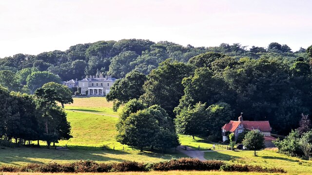
The Belt, Norfolk (Wood, Forest) is a picturesque woodland area located in Norfolk, England. Covering an estimated area of several acres, it is known for its diverse range of trees and wildlife. The Belt is situated in close proximity to the village of Wood, making it easily accessible for visitors.

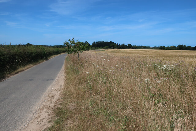
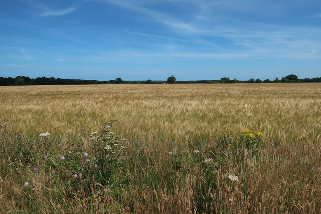
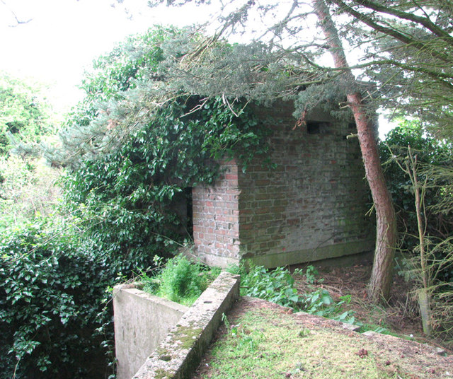
The woodland is characterized by a mix of both deciduous and coniferous trees, creating a vibrant and enchanting atmosphere. The dense canopy provides a sheltered habitat for various species of birds, mammals, and insects, making it a popular destination for nature enthusiasts and bird watchers.

Visitors to The Belt can explore the numerous walking trails that wind through the woodland, allowing for a peaceful and immersive experience. The paths are well-maintained and signposted, ensuring that visitors can easily navigate through the forest.

The Belt also offers several designated picnic areas, allowing visitors to relax and enjoy the serene surroundings. Additionally, there are several benches scattered throughout the woodland, providing ample opportunities for visitors to sit and take in the natural beauty of the area.

The woodland is managed by the local authority, who take great care to preserve its natural beauty and protect the diverse ecosystem. Regular maintenance work is carried out to ensure the safety of visitors and the preservation of the woodland's unique features.

Overall, The Belt, Norfolk (Wood, Forest) is a tranquil and captivating woodland area, offering a serene escape from the hustle and bustle of everyday life. Whether you are a nature lover, a hiker, or simply seeking solace in nature, The Belt is a must-visit destination in Norfolk.

If you have any feedback on the listing, please let us know in the comments section below.
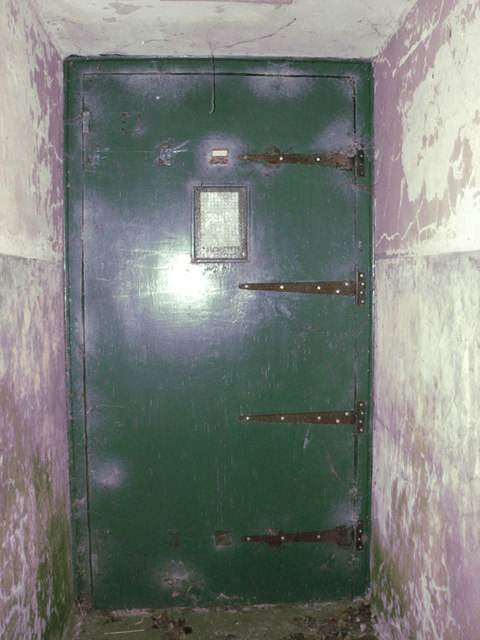
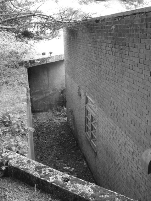
The Belt Images

Images are sourced within 2km of 52.923128/1.1794577 or Grid Reference TG1340. Thanks to Geograph Open Source API. All images are credited.

Road to West Beckham
Barley field near Bodham Hill
RAF West Beckham radar station (A Site) Remains of the IFF (Identification Friend or Foe) hut.
RAF West Beckham radar station (A Site)
Remains of the IFF (Identification Friend or Foe) hut.
RAF West Beckham radar station (A Site) Approach to the receiver block.
RAF West Beckham radar station (A Site)
Approach to the receiver block.
RAF West Beckham radar station (A Site) Entrance into the receiver block.
RAF West Beckham radar station (A Site)
Entrance into the receiver block.
RAF West Beckham radar station (A Site) View from the blast wall surrounding the receiver block.
RAF West Beckham radar station (A Site)
View from the blast wall surrounding the receiver block.
RAF West Beckham radar station (A Site) Pillbox located above the entrance/exit of the receiver block. It would appear to have been accessed via a ladder.
RAF West Beckham radar station (A Site)
Pillbox located above the entrance/exit of the receiver block. It would appear to have been accessed via a ladder.
Daffodil fields at Bodham
RAF design pillbox at Bodham
Sheringham Road and West Beckham village sign For more about the village sign see <a title="https://www.geograph.org.uk/photo/6675577" href="https://www.geograph.org.uk/photo/6675577">Link</a>
Sheringham Road and West Beckham village sign
For more about the village sign see Link
East and West Beckham War Memorial The Memorial bears nine names of the men lost in WW1. They are repeated on the Roll of Honour which stands outside the church and is in a very poor condition with the surface of the stone flaking badly. <a title="https://www.geograph.org.uk/photo/2113136" href="https://www.geograph.org.uk/photo/2113136">Link</a>
East and West Beckham War Memorial
The Memorial bears nine names of the men lost in WW1. They are repeated on the Roll of Honour which stands outside the church and is in a very poor condition with the surface of the stone flaking badly. Link
The Dales Hotel, Upper Sheringham
Car park at Sheringham Park National Trust site
Car park at Sheringham Park
National Trust site
End of  Park Run in Sheringham Park Packing away after the second post-Covid run through the National Trust's Sheringham Park property.
End of Park Run in Sheringham Park
Packing away after the second post-Covid run through the National Trust's Sheringham Park property.
Back road into Sheringham Park estate
All Saints parish church, Upper Sheringham A magnificent building for such a small hamlet
All Saints parish church, Upper Sheringham
A magnificent building for such a small hamlet
Sheringham Hall from afar
Drive to Sheringham Hall In National Trust's Sheringham Park
Drive to Sheringham Hall
In National Trust's Sheringham Park
Show me another place!

The Belt is located at Grid Ref: TG1340 (Lat: 52.923128, Lng: 1.1794577)

Administrative County: Norfolk

District: North Norfolk

Police Authority: Norfolk

What 3 Words

///groomed.wipe.proposals. Near Sheringham, Norfolk

Related Wikis

Sheringham Park

Sheringham Park is a landscape park and gardens near the town of Sheringham, Norfolk, England. The park surrounds Sheringham Hall, lying mostly to its...

Upper Sheringham

Upper Sheringham is a village and a civil parish in the English county of Norfolk. The village is 26.8 miles (43.1 km) north-north-west of Norwich, 6...

Bodham

Bodham is a civil parish in the English county of Norfolk. The village is 27.2 miles north north west of Norwich, 6.4 miles west of Cromer and 131 miles...

West Beckham

West Beckham is a village and a civil parish in the English county of Norfolk The village is 6.1 miles (9.8 km) west south west of Cromer, 25.3 miles...

Sheringham Woodfields School

Sheringham Woodfields School is a co-educational special school located in Sheringham in the English county of Norfolk.It is a Learning and Cognition Specialist...

RAF West Beckham

Royal Air Force Station West Beckham, commonly known as RAF West Beckham, is a former Chain Home radar station controlled by the Royal Air Force (RAF)...

Sheringham High School

Sheringham High School is a secondary school and sixth form located in the town of Sheringham in the English county of Norfolk. The school has around 700...

A1082 road

The A1082 is an English A road entirely in the county of Norfolk. It runs from a junction with the A148 King's Lynn to Cromer Road to a roundabout on the...

Nearby Amenities

Located within 500m of 52.923128,1.1794577
Sheringham Park, adj
Naptan AtcoCode: 2900S164
Naptan Bearing: N
Naptan BusStopType: CUS
Naptan CommonName: Sheringham Park
Naptan Indicator: adj
Naptan Landmark: park entrance
Naptan Locality: Upper Sheringham
Naptan NaptanCode: nfogpmdw
Naptan Street: Lodge Hill
Naptan Verified: no
Source: naptan_import
Lat/Long: 52.9237571/1.1817846
Sheringham Park, opp
Naptan AtcoCode: 2900S165
Naptan Bearing: S
Naptan BusStopType: CUS
Naptan CommonName: Sheringham Park
Naptan Indicator: opp
Naptan Landmark: park
Naptan Locality: Upper Sheringham
Naptan NaptanCode: nfogpmga
Naptan Street: Lodge Hill
Naptan Verified: no
Source: naptan_import
Lat/Long: 52.9237406/1.1820661
Bodham Covert
Natural: wood
Source: OS_OpenData_StreetView
Lat/Long: 52.9218663/1.1739776
Howe's Hill Wood
Natural: wood
Source: OS_OpenData_StreetView
Lat/Long: 52.9232708/1.1723431
The Belt
Natural: wood
Source: OS_OpenData_StreetView
Lat/Long: 52.923536/1.1805641
The Bower
Leisure: garden
Tourism: attraction
Lat/Long: 52.9264867/1.1806551
Howe's Hill
Place: locality
Lat/Long: 52.9240458/1.1723554
West Beckham Common
Place: locality
Lat/Long: 52.9221673/1.1804348
Wood Farm
Place: locality
Lat/Long: 52.9254731/1.1809581
Cafe
Courtyard Cafe
Lat/Long: 52.9253509/1.1809557
Information: board
Operator: National Trust
Tourism: information
Lat/Long: 52.9248578/1.1804729
Vending Machine
Vending: parking_tickets
Lat/Long: 52.9248333/1.1804885
Charging Station
Hugo-Gino
Capacity: 2
Fee: no
Network: PodPoint
Note: No charge for charging, but usual parking fees apply
Ref: PG-81515
Socket Type2: 2
Socket Type2 Output: 22 kW
Lat/Long: 52.9247047/1.1805797
Entrance: yes
Lat/Long: 52.9254673/1.1813136
Entrance: shop
Lat/Long: 52.9253915/1.1811817
Entrance: shop
Lat/Long: 52.9253569/1.1811171
Generator Method: photovoltaic
Generator Output Electricity: yes
Generator Solar Modules: 42
Generator Source: solar
Generator Type: solar_photovoltaic_panel
Location: roof
Power: generator
Lat/Long: 52.9230755/1.1825591
Generator Method: photovoltaic
Generator Output Electricity: yes
Generator Solar Modules: 128
Generator Source: solar
Generator Type: solar_photovoltaic_panel
Location: roof
Power: generator
Lat/Long: 52.9225904/1.1826101
Power: pole
Lat/Long: 52.9228168/1.1827362
Power: pole
Lat/Long: 52.9232898/1.1840008
Power: pole
Lat/Long: 52.9238606/1.1856343
The data included in this document is from www.openstreetmap.org. The data is made available under ODbL.

Have you been to The Belt?

Leave your review of The Belt below (or comments, questions and feedback).