Cockshott Wood

Wood, Forest in Kent Canterbury

England

Cockshott Wood

Ansdore village Ansdore is a tiny farming community along this short dead end road. Behind this point is the private farm of Upper Ansdore which I did not venture into.
Ansdore village Credit: David Howard

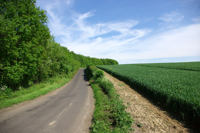
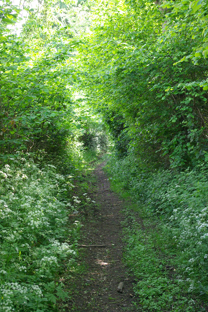
Cockshott Wood is a picturesque woodland located in the county of Kent, England. Situated near the village of Cockshott, it covers an area of approximately 50 acres and is considered to be one of the most beautiful and well-preserved woodlands in the region.

The woodland is characterized by a diverse range of tree species, including oak, beech, ash, and birch, creating a rich and vibrant ecosystem. The dense canopy of trees provides a haven for a variety of wildlife, including deer, foxes, badgers, and numerous bird species, making it an ideal destination for nature enthusiasts and birdwatchers.

Walking through Cockshott Wood, visitors are treated to a tranquil and serene environment, with a well-maintained network of footpaths leading through the forest. A small stream meanders through the woodland, adding to its charm and providing a source of water for the resident wildlife.

The wood is also home to a number of rare and endangered plant species, including bluebells and orchids, which bloom in abundance during the spring and summer months, creating a vibrant display of colors.

Due to its beauty and ecological importance, Cockshott Wood is designated as a Site of Special Scientific Interest (SSSI), ensuring its protection and preservation for future generations to enjoy. The wood is open to the public year-round, and visitors are encouraged to explore its natural wonders while respecting its delicate ecosystem.

If you have any feedback on the listing, please let us know in the comments section below.

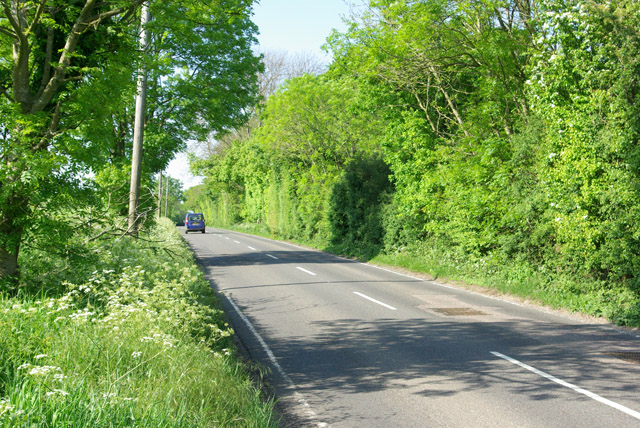
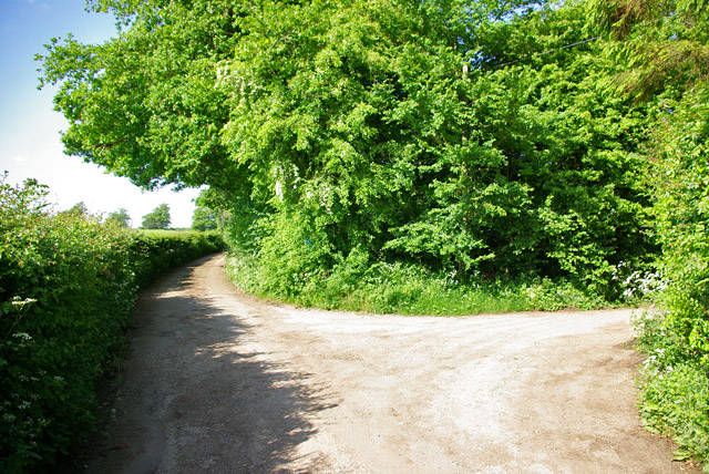
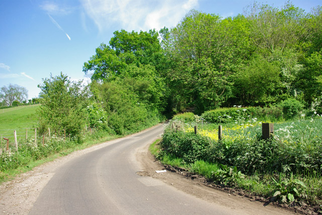
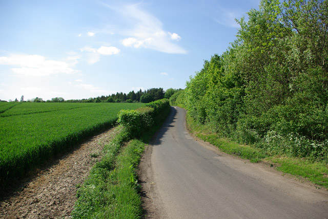
Cockshott Wood Images

Images are sourced within 2km of 51.19479/1.051902 or Grid Reference TR1348. Thanks to Geograph Open Source API. All images are credited.

Ansdore village Ansdore is a tiny farming community along this short dead end road. Behind this point is the private farm of Upper Ansdore which I did not venture into.
Ansdore village
Ansdore is a tiny farming community along this short dead end road. Behind this point is the private farm of Upper Ansdore which I did not venture into.
The road to Ansdore Off Duckpit Lane, this short track leads to the small collection of farms in Ansdore.
The road to Ansdore
Off Duckpit Lane, this short track leads to the small collection of farms in Ansdore.
Field in Ansdore
Field in Ansdore
The entrance to Springfield Farm, Ansdore
Duckpit Road, Ansdore
Fields by Duckpit Road
Stone Street - a Roman road The B2068 aligns with the Roman road south from Canterbury to the former coast at Lympne.
Stone Street - a Roman road
The B2068 aligns with the Roman road south from Canterbury to the former coast at Lympne.
Lane junction near North Leigh The through route turns right. Straight on is a short approach to premises with no public continuation.
Lane junction near North Leigh
The through route turns right. Straight on is a short approach to premises with no public continuation.
Lime Kiln Lane From Bossingham towards Stone Street.
Lime Kiln Lane
From Bossingham towards Stone Street.
Lime Kiln Lane From Bossingham towards Stone Street.
Lime Kiln Lane
From Bossingham towards Stone Street.
Lime Kiln Lane From Stone Street towards Bossingham.
Lime Kiln Lane
From Stone Street towards Bossingham.
Field near Frogs Hall A public footpath from the foreground gate goes to and through Cox Hill Wood at the far side of the field.
Field near Frogs Hall
A public footpath from the foreground gate goes to and through Cox Hill Wood at the far side of the field.
Field between Frogs Hall and Yew Tree Farm Looking towards Yew Tree Farm.
Field between Frogs Hall and Yew Tree Farm
Looking towards Yew Tree Farm.
Bridleway running south from Whiteacre Lane
Whiteacre Lane Heading nowhere in particular, but serving rural premises such as Whiteacre Farm.
Whiteacre Lane
Heading nowhere in particular, but serving rural premises such as Whiteacre Farm.
Stelling: St. Mary's Church
Show me another place!

Cockshott Wood is located at Grid Ref: TR1348 (Lat: 51.19479, Lng: 1.051902)

Administrative County: Kent

District: Canterbury

Police Authority: Kent

What 3 Words

///tells.overused.magical. Near Chartham, Kent

Related Wikis

Yockletts Bank

Yockletts Bank is a 25.4-hectare (63-acre) biological Site of Special Scientific Interest west of Stelling Minnis in Kent. It is managed by KWT and is...

Stelling Minnis

Stelling Minnis is a village and civil parish in the Folkestone and Hythe district in Kent, England. The village lies 13 kilometres (8 mi) to the south...

Bossingham

Bossingham is a village in the parish of Upper Hardres and the district of the City of Canterbury, Kent, England. It is located about five miles (8 km...

Davison's Mill, Stelling Minnis

Davison's Mill, also known as Stelling Minnis Windmill, is a Grade I listed smock mill in Stelling Minnis, Kent, England that was built in 1866. It was...

Nearby Amenities

Located within 500m of 51.19479,1.051902
Barrier: stile
Lat/Long: 51.1956657/1.0530896
Barrier: stile
Lat/Long: 51.1957989/1.0544674
Barrier: stile
Lat/Long: 51.1960179/1.056258
Barrier: stile
Lat/Long: 51.1957745/1.0580754
Power: pole
Lat/Long: 51.1934253/1.0586275
The data included in this document is from www.openstreetmap.org. The data is made available under ODbL.

Have you been to Cockshott Wood?

Leave your review of Cockshott Wood below (or comments, questions and feedback).