Mill Down Wood
Wood, Forest in Kent Ashford
England
Mill Down Wood
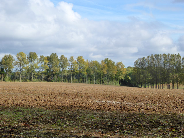
Mill Down Wood is a picturesque forest located in the county of Kent, England. Spread across an expansive area, this woodland offers a tranquil retreat for nature lovers and outdoor enthusiasts alike. The wood is situated in close proximity to the village of Pluckley, renowned for its charming countryside and historic landmarks.
The wood is characterized by its diverse range of trees, including oak, beech, and chestnut, which provide a stunning backdrop throughout the seasons. The forest floor is adorned with an assortment of wildflowers and ferns, creating a vibrant and colorful display during the spring and summer months.
Mill Down Wood is home to a variety of wildlife, making it an ideal spot for birdwatching and animal spotting. Visitors may catch a glimpse of elusive creatures such as deer, badgers, and foxes, as well as a plethora of bird species, including woodpeckers, owls, and buzzards.
The wood is crisscrossed by a network of well-maintained footpaths, enabling visitors to explore its beauty at their own pace. These pathways lead to hidden clearings, babbling brooks, and ancient ruins, adding an element of mystery and intrigue to the woodland experience.
Mill Down Wood is a popular destination for outdoor activities such as walking, jogging, and picnicking. It also provides a serene environment for mindfulness and meditation, with many visitors seeking solace and relaxation amid the natural surroundings.
Overall, Mill Down Wood is a captivating woodland retreat in Kent, offering a harmonious blend of nature, history, and tranquility for all who venture within its enchanting realm.
If you have any feedback on the listing, please let us know in the comments section below.
Mill Down Wood Images
Images are sourced within 2km of 51.174717/0.98067708 or Grid Reference TR0845. Thanks to Geograph Open Source API. All images are credited.


Mill Down Wood is located at Grid Ref: TR0845 (Lat: 51.174717, Lng: 0.98067708)
Administrative County: Kent
District: Ashford
Police Authority: Kent
What 3 Words
///greed.fuzzy.amuse. Near Wye, Kent
Nearby Locations
Related Wikis

Wye and Crundale Downs
Wye and Crundale Downs is a 358.3-hectare (885-acre) biological and geological Site of Special Scientific Interest in a number of separate areas east of...

Shrub's Wood Long Barrow
Shrub's Wood Long Barrow is an unchambered long barrow located near to the village of Elmsted in the south-eastern English county of Kent. It was probably...

Hastingleigh
Hastingleigh is a small civil parish centred on an escarpment of the Kent Downs. The parish is three miles east of Wye and ten miles south of Canterbury...

Park Gate Down
Park Gate Down or Parkgate Down is a 7-hectare (17-acre) biological Site of Special Scientific Interest south-east of Stelling Minnis in Kent. It is also...
Nearby Amenities
Located within 500m of 51.174717,0.98067708Have you been to Mill Down Wood?
Leave your review of Mill Down Wood below (or comments, questions and feedback).