The Flats

Wood, Forest in Kent Tunbridge Wells

England

The Flats

Entrance to Sissinghurst Gardens The blue car is emerging from the entrance, on the A262.
Entrance to Sissinghurst Gardens Credit: Robin Webster

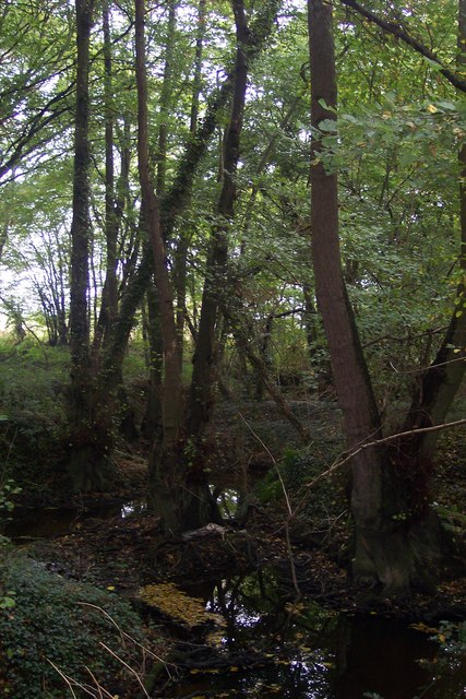
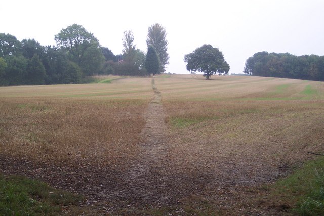
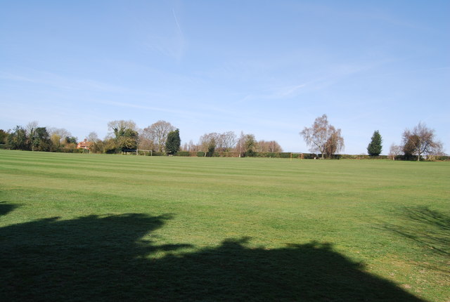
The Flats, Kent (Wood, Forest) is a nature reserve located in the county of Kent, England. Spanning over 500 acres, it is a significant area of ancient woodland and forest, known for its diverse ecosystem and rich biodiversity. The Flats is situated in close proximity to the village of Wood, providing easy access for visitors.

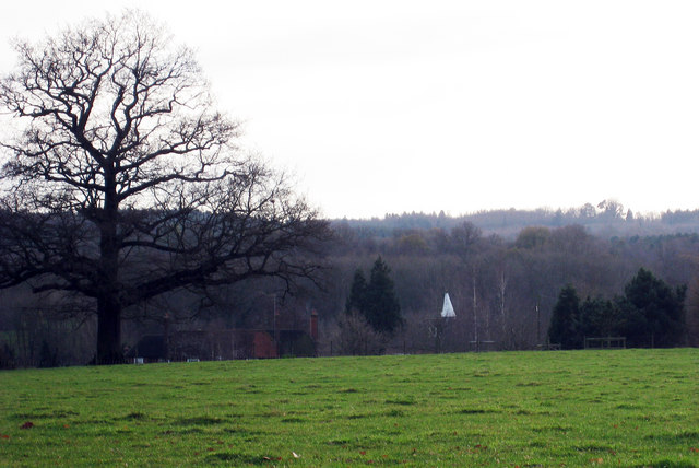
This nature reserve is characterized by its dense woodland, comprising a mixture of deciduous and coniferous trees. The towering trees, some of which are centuries old, create a captivating and serene atmosphere. The forest floor is covered with a thick carpet of moss, ferns, and wildflowers, adding to the enchanting beauty of the area.

The Flats, Kent (Wood, Forest) is home to a wide range of wildlife species. Visitors may encounter various bird species, including woodpeckers, owls, and songbirds. Additionally, the reserve supports a population of small mammals, such as squirrels, rabbits, and foxes. Rare species, including bats and several types of butterflies, can also be found within the woodland.

The reserve offers numerous walking trails, allowing visitors to explore the natural beauty of The Flats at their own pace. These trails wind through the forest, providing stunning views and opportunities for peaceful contemplation. The reserve is a popular destination for nature enthusiasts, hikers, and birdwatchers alike.

With its ancient woodland, diverse wildlife, and tranquil ambiance, The Flats, Kent (Wood, Forest) is a haven for nature lovers seeking to immerse themselves in the beauty of the natural world.

If you have any feedback on the listing, please let us know in the comments section below.
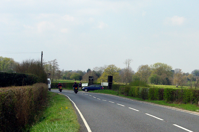
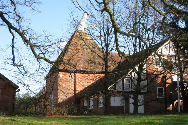
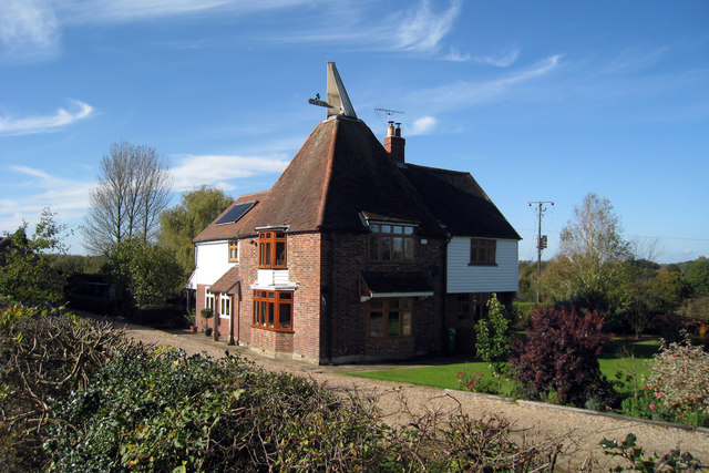
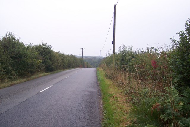
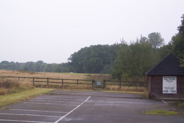
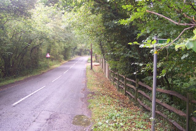
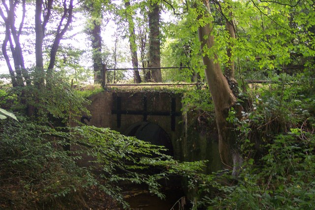
The Flats Images

Images are sourced within 2km of 51.100497/0.55447175 or Grid Reference TQ7836. Thanks to Geograph Open Source API. All images are credited.

Entrance to Sissinghurst Gardens The blue car is emerging from the entrance, on the A262.
Entrance to Sissinghurst Gardens
The blue car is emerging from the entrance, on the A262.
Oast House at Hemsted Forest Golf Club, Golford Road, Benenden, Kent Single round kiln oast house. Part of golf club restaurant.
Oast House at Hemsted Forest Golf Club, Golford Road, Benenden, Kent
Single round kiln oast house. Part of golf club restaurant.
Lane to Sissinghurst Castle, Sissinghurst, Kent
Oast House Single round kiln oast house. Unsympathetic conversion of kiln.
Oast House
Single round kiln oast house. Unsympathetic conversion of kiln.
Oast House Two oasthouses at Middleton Farm. One early internal kiln oast house and one twin round kiln oast house, stowage roofs continued over roundels. A square kiln was removed 1940/50s.
Oast House
Two oasthouses at Middleton Farm. One early internal kiln oast house and one twin round kiln oast house, stowage roofs continued over roundels. A square kiln was removed 1940/50s.
Chapel Lane This lane leads towards Benenden. It passes Hemsted Golf Club further down the hill.
Chapel Lane
This lane leads towards Benenden. It passes Hemsted Golf Club further down the hill.
Hemsted Forest Golf Range Driving range on Chapel Lane, near Hemsted Forest Golf Club.
Hemsted Forest Golf Range
Driving range on Chapel Lane, near Hemsted Forest Golf Club.
Chapel Lane This lane leads from Golford to Benenden. The footpath on the right leads to Golford or Courseholme Farm.
Chapel Lane
This lane leads from Golford to Benenden. The footpath on the right leads to Golford or Courseholme Farm.
Chapel Lane road bridge This leads over an unnamed stream leading to the Crane Brook. Seen from a footpath from the lane to Golford.
Chapel Lane road bridge
This leads over an unnamed stream leading to the Crane Brook. Seen from a footpath from the lane to Golford.
Stream in Little Ommerden Wood This stream leads right from Folly Gill towards Crane Brook.
Stream in Little Ommerden Wood
This stream leads right from Folly Gill towards Crane Brook.
Footpath to Cherrybrook Farm This path leads from Golford to a farm on Chapel Lane.
Footpath to Cherrybrook Farm
This path leads from Golford to a farm on Chapel Lane.
The A252 Sissinghurst Road This road leads from Sissinghurst and Wisley Pound to Biddenden. The footpath and stile on the right head downhill to High Tilt Farm.
The A252 Sissinghurst Road
This road leads from Sissinghurst and Wisley Pound to Biddenden. The footpath and stile on the right head downhill to High Tilt Farm.
Cranbrook Union Mill Looking across a row of terraced houses on The Hill to the sails of Union Mill, decorated in bunting, celebrating the Royal Wedding.
Cranbrook Union Mill
Looking across a row of terraced houses on The Hill to the sails of Union Mill, decorated in bunting, celebrating the Royal Wedding.
Cranbrook Union Mill The sails of Union Mill are decorated in bunting celebrating the Royal Wedding.
Cranbrook Union Mill
The sails of Union Mill are decorated in bunting celebrating the Royal Wedding.
Cranbrook Union Mill The sails of Union Mill, decorated in bunting celebrating the Royal Wedding.
Cranbrook Union Mill
The sails of Union Mill, decorated in bunting celebrating the Royal Wedding.
Cranbrook Union Mill The lower section and sail of Union Mill, decorated in bunting to celebrate the Royal Wedding.
Cranbrook Union Mill
The lower section and sail of Union Mill, decorated in bunting to celebrate the Royal Wedding.
Cranbrook Union Mill Seen from the Waterloo Road, the Union Mill, decorated in bunting to celebrate the Royal Wedding.
Cranbrook Union Mill
Seen from the Waterloo Road, the Union Mill, decorated in bunting to celebrate the Royal Wedding.
Cranbrook Union Mill Seen from The Tanyard car park.
Cranbrook Union Mill
Seen from The Tanyard car park.
Show me another place!

The Flats is located at Grid Ref: TQ7836 (Lat: 51.100497, Lng: 0.55447175)

Administrative County: Kent

District: Tunbridge Wells

Police Authority: Kent

What 3 Words

///walnuts.obvious.viewer. Near Sissinghurst, Kent

Related Wikis

Swifts Park

Swifts Park is a former country estate and manor house 1 mile (1.6 km) north-east of the town of Cranbrook in the English county of Kent. Through its history...

Coursehorn

Coursehorn is a hamlet located immediately to the east of the village of Cranbrook in Kent, England. It is the site of the local cemetery; and Dulwich...

Sissinghurst

Sissinghurst is a small village in the borough of Tunbridge Wells in Kent, England. Originally called Milkhouse Street (also referred to as Mylkehouse...

Iden Green

Iden Green is a small village, near Benenden, in the county of Kent. It belongs to the civil parish of Benenden and the Tunbridge Wells Borough District...

Dulwich Prep Cranbrook

Dulwich Cranbrook is a co-educational independent school for children aged 2–16 near Cranbrook, Kent. Since September 2023, the Head has been Sophie Bradshaw...

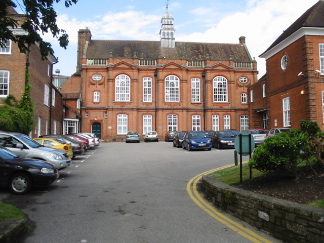
Cranbrook School, Kent

Cranbrook School (formerly Queen Elizabeth's Grammar School) is a co-educational state funded boarding and day grammar school in the market town of Cranbrook...

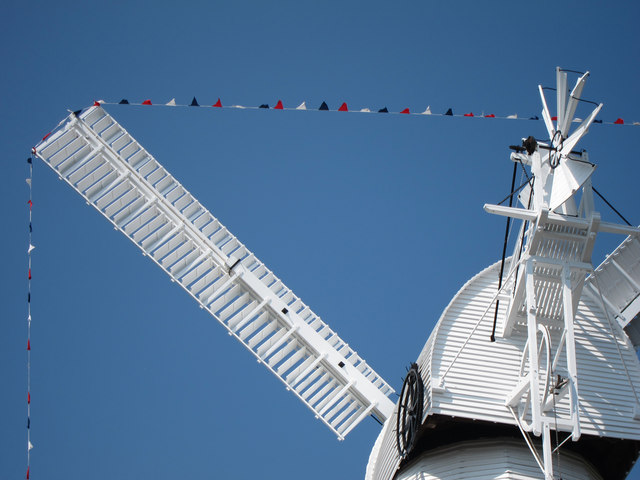
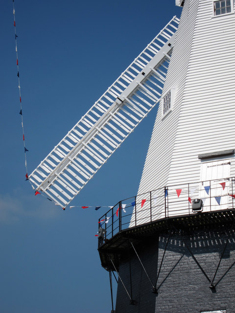
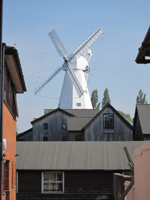
Union Mill, Cranbrook

Union Mill is a Grade I listed smock mill in Cranbrook, Kent, England, which has been restored to working order. It is the tallest smock mill in the United...

School Field, Cranbrook

School Field Ground is a sports ground owned by Cranbrook School located in the town of Cranbrook, Kent. It is known by the school as Big Side Playing...

Nearby Amenities

Located within 500m of 51.100497,0.55447175
Mini Roundabout
Lat/Long: 51.0966064/0.5563372
Barrier: kissing_gate
Lat/Long: 51.1032858/0.5554883
Mini Roundabout
Lat/Long: 51.0967093/0.5578273
The data included in this document is from www.openstreetmap.org. The data is made available under ODbL.

Have you been to The Flats?

Leave your review of The Flats below (or comments, questions and feedback).