Gill's Wood

Wood, Forest in Sussex Rother

England

Gill's Wood

Fields South Of Ticehurst, East Sussex A view across fields to Ticehurst, from a footpath from Pashley Road to the Cherry Tree pub in Ticehurst.
Fields South Of Ticehurst, East Sussex Credit: Tim Knight

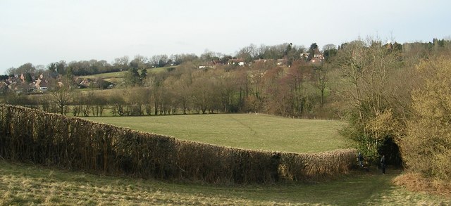
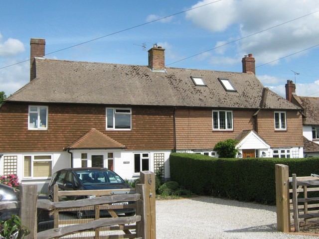
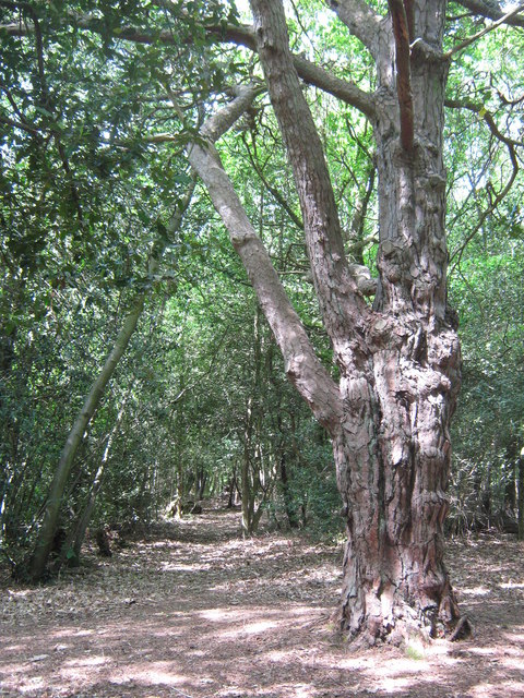
Gill's Wood is a picturesque woodland located in the county of Sussex, England. Spread over an area of approximately 200 acres, this enchanting forest offers visitors a serene and tranquil escape from the bustling city life.

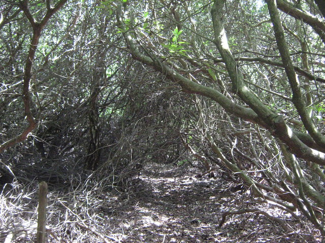
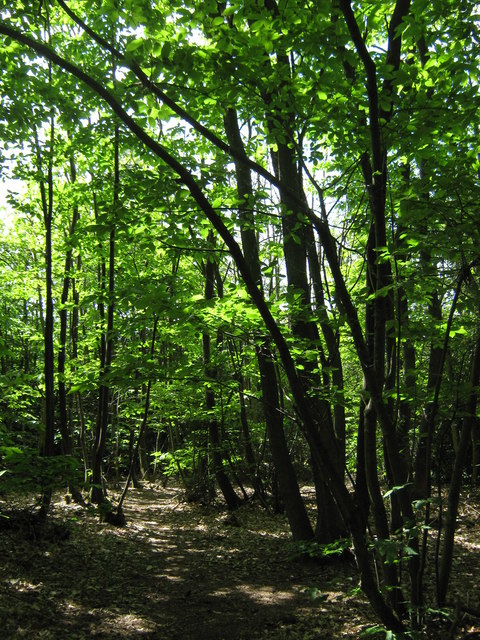
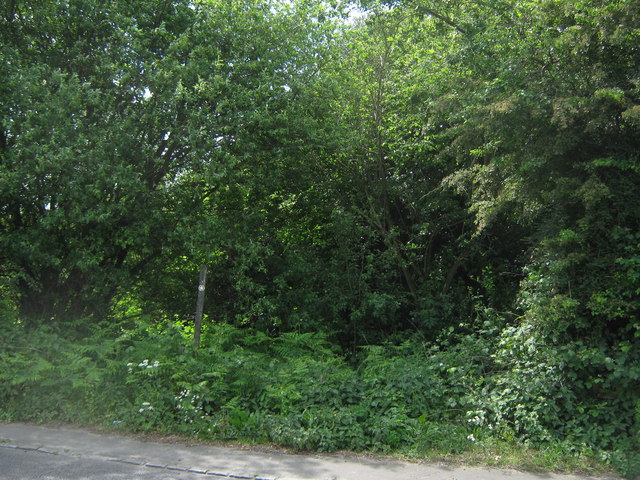
As one enters Gill's Wood, they are greeted by a dense canopy of towering trees, predominantly composed of oak, beech, and ash. The woodland floor is adorned with a vibrant tapestry of wildflowers, moss, and ferns, creating a stunning display of colors throughout the year.

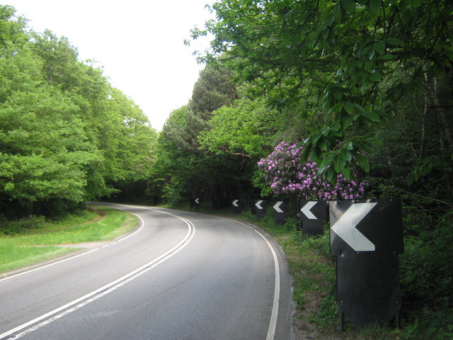
The wood is crisscrossed by a network of well-maintained footpaths, allowing visitors to explore its beauty at their leisure. These paths wind their way through the forest, leading to hidden clearings, babbling brooks, and small ponds, which are home to an array of wildlife.

Nature enthusiasts will appreciate the diverse wildlife that calls Gill's Wood its home. The forest is teeming with creatures such as deer, foxes, badgers, and a variety of bird species. Birdwatchers are particularly drawn to this woodland due to its population of rare and migratory birds, making it a haven for ornithologists.

Gill's Wood is not only a haven for wildlife but also serves as an important ecological site. The forest acts as a natural carbon sink, contributing to the reduction of greenhouse gases in the atmosphere. It also plays a crucial role in maintaining the local ecosystem and provides a habitat for numerous plant and animal species.

With its natural beauty and rich biodiversity, Gill's Wood is a must-visit destination for nature lovers and those seeking a peaceful retreat in the heart of Sussex.

If you have any feedback on the listing, please let us know in the comments section below.

Gill's Wood Images

Images are sourced within 2km of 51.052635/0.43291235 or Grid Reference TQ7030. Thanks to Geograph Open Source API. All images are credited.

Fields South Of Ticehurst, East Sussex A view across fields to Ticehurst, from a footpath from Pashley Road to the Cherry Tree pub in Ticehurst.
Fields South Of Ticehurst, East Sussex
A view across fields to Ticehurst, from a footpath from Pashley Road to the Cherry Tree pub in Ticehurst.
Pashley Road Towards Ticehurst
Pashley Road
Towards Ticehurst
The Royal Oak, Flimwell Pub beside the busy A21.
The Royal Oak, Flimwell
Pub beside the busy A21.
Flimwell crossroads Looking from A268 Hawkhurst Road onto a busy junction with the A21 (left and right) and High Street (ahead). It was proposed to bypass this junction to the East of here, including a by pass of Hurst Green, to improve the A21 to Hastings, however this was recently completely scrapped and numerous houses compulsory purchased for millions decades ago are now being sold.
Flimwell crossroads
Looking from A268 Hawkhurst Road onto a busy junction with the A21 (left and right) and High Street (ahead). It was proposed to bypass this junction to the East of here, including a by pass of Hurst Green, to improve the A21 to Hastings, however this was recently completely scrapped and numerous houses compulsory purchased for millions decades ago are now being sold.
Country Furniture Barns Ltd Furniture shop on Hawkhurst Road.
Country Furniture Barns Ltd
Furniture shop on Hawkhurst Road.
Coach Holidays As the name suggests the firm provides coach holidays to Europe.
Coach Holidays
As the name suggests the firm provides coach holidays to Europe.
Coach Holidays As the name suggests the firm provides coach holidays to Europe.
Coach Holidays
As the name suggests the firm provides coach holidays to Europe.
A21 at Flimwell The A21 is a 63 mile major trunk road running  from Lewisham in Greater London to Hastings, East Sussex. The road is broken up by the M25 motorway between junction 4 and 5.
Wikipedia <span class="nowrap"><a title="http://en.wikipedia.org/wiki/A21_road_(England)" rel="nofollow ugc noopener" href="http://en.wikipedia.org/wiki/A21_road_(England)">Link</a><img style="margin-left:2px;" alt="External link" title="External link - shift click to open in new window" src="https://s1.geograph.org.uk/img/external.png" width="10" height="10"/></span>
A21 at Flimwell
The A21 is a 63 mile major trunk road running from Lewisham in Greater London to Hastings, East Sussex. The road is broken up by the M25 motorway between junction 4 and 5. Wikipedia LinkExternal link
Houses by the A21 On London Road opposite <a href="https://www.geograph.org.uk/photo/2318995">TQ7131 : The Royal Oak, Flimwell</a>
Houses by the A21
On London Road opposite TQ7131 : The Royal Oak, Flimwell
Mick Gould Commercials Breakdown recovery and repair workshop for trucks. The company has a fleet or distinct American style red recovery trucks.
Mick Gould Commercials
Breakdown recovery and repair workshop for trucks. The company has a fleet or distinct American style red recovery trucks.
Providence Chapel Converted chapel on the B2087 Flimwell High Street.
Providence Chapel
Converted chapel on the B2087 Flimwell High Street.
No. 6 and 5 Red Oast Cottages On the B2087 Flimwell High Street is three pairs of cottages. This is the third pair.
No. 6 and 5 Red Oast Cottages
On the B2087 Flimwell High Street is three pairs of cottages. This is the third pair.
A21 to Flimwell This road leads up from Hurst Green towards Lamberhurst.
It winds past Ringden Wood on the right.
A21 to Flimwell
This road leads up from Hurst Green towards Lamberhurst. It winds past Ringden Wood on the right.
Overgrown path to Hawkhurst Road This path leads up through Ringden Wood (through overgrown rhododendron shrubs) towards the road near Mount Pleasant Farm.
Overgrown path to Hawkhurst Road
This path leads up through Ringden Wood (through overgrown rhododendron shrubs) towards the road near Mount Pleasant Farm.
Track in Ringden Wood Leads parallel towards Hawkhurst Road.
Track in Ringden Wood
Leads parallel towards Hawkhurst Road.
Pine tree in Ringden Wood This mixed woodland is near the A21.
Pine tree in Ringden Wood
This mixed woodland is near the A21.
Footpath into Ringden Wood This path leads into a overgrown wood, heading towards the A21 road to Hurst Green.
Footpath into Ringden Wood
This path leads into a overgrown wood, heading towards the A21 road to Hurst Green.
Show me another place!

Gill's Wood is located at Grid Ref: TQ7030 (Lat: 51.052635, Lng: 0.43291235)

Administrative County: East Sussex

District: Rother

Police Authority: Sussex

What 3 Words

///riches.rollover.inclined. Near Flimwell, East Sussex

Related Wikis

Flimwell

Flimwell is a village in the civil parish of Ticehurst, in the Rother district of East Sussex, England. It is located close to the border with Kent at...

Ticehurst

Ticehurst is both a village and a large civil parish in the Rother district of East Sussex, England. The parish lies in the upper reaches of both the Bewl...

St Augustine's Church, Flimwell

St Augustine's Church is the Anglican parish church of Flimwell, a village in the Rother district of East Sussex, England. It was consecrated in 1839 after...

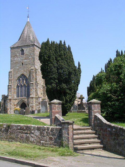
St Mary's Church, Ticehurst

St Mary's Church is a 14th-century parish church dedicated to St Mary the Virgin in Ticehurst, East Sussex, England. Part of the Diocese of Chichester...

Combwell Priory

Combwell Priory was a priory near Bedgebury Cross about 10 miles southeast of Tunbridge Wells in Kent, England. == History == This is a Grade II listed...

Ticehurst House Hospital

Ticehurst House Hospital was a mental health facility. It opened in 1792 and was owned and run by five generations of members of the Newington family until...

Bedgebury Forest

Bedgebury Forest is a 10.5 square kilometres (2,600 acres) forest surrounding Bedgebury National Pinetum, near Flimwell in Kent. In contrast to the National...

Bedgebury National Pinetum

Bedgebury National Pinetum at Bedgebury, Kent, in the United Kingdom, is a recreational and conservational arboretum managed by Forestry England that was...

Nearby Amenities

Located within 500m of 51.052635,0.43291235
Union Street
Place: hamlet
Source: OS_OpenData_StreetView
Lat/Long: 51.0558885/0.4362881
Barrier: yes
Lat/Long: 51.054857/0.4342475
Generator Method: photovoltaic
Generator Output Electricity: yes
Generator Source: solar
Generator Type: solar_photovoltaic_panel
Location: roof
Power: generator
Lat/Long: 51.0533114/0.4299916
Generator Method: photovoltaic
Generator Output Electricity: yes
Generator Source: solar
Generator Type: solar_photovoltaic_panel
Location: roof
Power: generator
Lat/Long: 51.0542438/0.4355814
Generator Method: photovoltaic
Generator Output Electricity: yes
Generator Source: solar
Generator Type: solar_photovoltaic_panel
Location: roof
Power: generator
Lat/Long: 51.0555378/0.4376829
Generator Method: photovoltaic
Generator Output Electricity: yes
Generator Source: solar
Generator Type: solar_photovoltaic_panel
Location: roof
Power: generator
Lat/Long: 51.0553683/0.4365188
Generator Method: photovoltaic
Generator Output Electricity: yes
Generator Source: solar
Generator Type: solar_photovoltaic_panel
Location: roof
Power: generator
Lat/Long: 51.0553675/0.4365751
Generator Method: photovoltaic
Generator Output Electricity: yes
Generator Source: solar
Generator Type: solar_photovoltaic_panel
Location: roof
Power: generator
Lat/Long: 51.0550792/0.4365295
Generator Method: photovoltaic
Generator Output Electricity: yes
Generator Source: solar
Generator Type: solar_photovoltaic_panel
Location: roof
Power: generator
Lat/Long: 51.0550758/0.4366797
Generator Method: photovoltaic
Generator Output Electricity: yes
Generator Source: solar
Generator Type: solar_photovoltaic_panel
Location: roof
Power: generator
Lat/Long: 51.0550809/0.4366153
Generator Method: photovoltaic
Generator Output Electricity: yes
Generator Source: solar
Generator Type: solar_photovoltaic_panel
Location: roof
Power: generator
Lat/Long: 51.054468/0.4376467
Generator Method: photovoltaic
Generator Output Electricity: yes
Generator Source: solar
Generator Type: solar_photovoltaic_panel
Location: roof
Power: generator
Lat/Long: 51.0544318/0.4383118
Generator Method: photovoltaic
Generator Output Electricity: yes
Generator Source: solar
Generator Type: solar_photovoltaic_panel
Location: roof
Power: generator
Lat/Long: 51.0544343/0.4383896
Generator Method: photovoltaic
Generator Output Electricity: yes
Generator Source: solar
Generator Type: solar_photovoltaic_panel
Location: roof
Power: generator
Lat/Long: 51.0549679/0.4386163
The data included in this document is from www.openstreetmap.org. The data is made available under ODbL.

Have you been to Gill's Wood?

Leave your review of Gill's Wood below (or comments, questions and feedback).