Spring Wood
Wood, Forest in Sussex Rother
England
Spring Wood

Spring Wood is a picturesque woodland located in Sussex, England. Spread across a sprawling area, it is a popular destination for nature enthusiasts and outdoor lovers. The wood is situated in close proximity to several villages and towns, making it easily accessible for visitors.
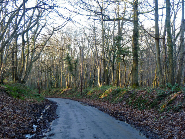
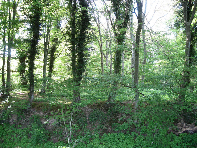
Covered in a lush green canopy, Spring Wood is characterized by its diverse range of trees, including oak, beech, and birch. These trees create a serene environment and provide a home to numerous species of birds, small mammals, and insects. Wildflowers and ferns can also be found scattered throughout the woodland, adding bursts of color to the landscape.
The wood features well-maintained walking trails that meander through the trees, allowing visitors to explore and immerse themselves in the natural beauty of the surroundings. These paths offer opportunities for peaceful strolls, jogging, or even dog walking. In the springtime, the wood truly comes alive with a vibrant display of bluebells that carpet the forest floor, creating a breathtaking sight.
Spring Wood is not only a haven for nature lovers, but also a site of historical significance. It is believed that the wood has been in existence for centuries and has witnessed various historical events. Archaeological remnants and ancient earthworks can be found within its boundaries, giving it an added layer of intrigue and fascination.
Overall, Spring Wood in Sussex is a tranquil and captivating destination that offers a perfect blend of natural beauty and historical significance. Whether it's for a leisurely walk, wildlife spotting, or a deeper connection with nature, this woodland provides a serene escape from the hustle and bustle of modern life.
If you have any feedback on the listing, please let us know in the comments section below.
Spring Wood Images
Images are sourced within 2km of 50.981867/0.42921014 or Grid Reference TQ7023. Thanks to Geograph Open Source API. All images are credited.


Spring Wood is located at Grid Ref: TQ7023 (Lat: 50.981867, Lng: 0.42921014)
Administrative County: East Sussex
District: Rother
Police Authority: Sussex
What 3 Words
///apricot.comedians.pocketed. Near Robertsbridge, East Sussex
Nearby Locations
Related Wikis

Etchingham
Etchingham is a village and civil parish in the Rother district of East Sussex in southern England. The village is located approximately 15 miles (24 km...
Darwell Reservoir
Darwell Reservoir lies to the west of Mountfield, East Sussex, England. The reservoir provides water for Southern Water customers. The reservoir covers...
Glottenham Castle
Glottenham Castle was a castle in Mountfield, East Sussex, around 5 miles (8 km) north of Battle Abbey. Built in the 13th century, it was abandoned in...
Robertsbridge Community College
Robertsbridge Community College is a coeducational secondary school located in Robertsbridge in the English county of East Sussex.It was established in...
Robertsbridge Junction railway station
Robertsbridge Junction is the terminus of the Rother Valley Railway, the extension of the Kent and East Sussex Railway from Bodiam to Robertsbridge. Because...
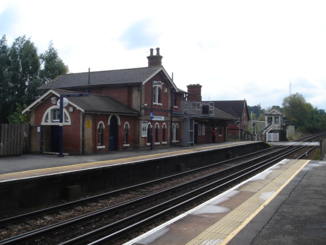
Robertsbridge railway station
Robertsbridge railway station is on the Hastings line in the south of England and serves the village of Robertsbridge, East Sussex. It is 49 miles 47 chains...
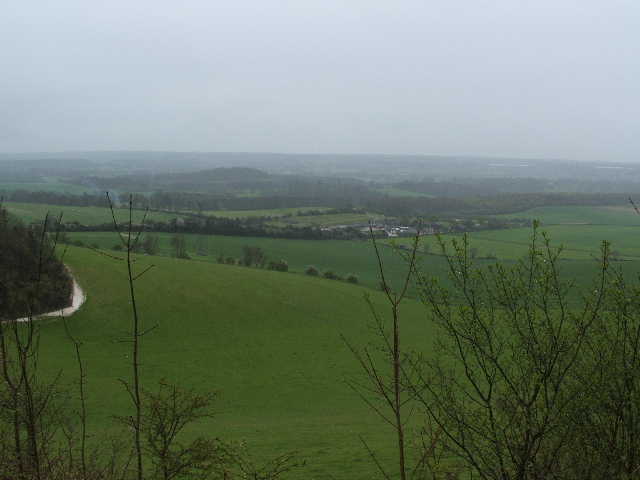
Weald
The Weald () is an area of South East England between the parallel chalk escarpments of the North and the South Downs. It crosses the counties of Hampshire...
Robertsbridge
Robertsbridge is a village in the civil parish of Salehurst and Robertsbridge, and the Rother district of East Sussex, England. It is approximately 10...
Have you been to Spring Wood?
Leave your review of Spring Wood below (or comments, questions and feedback).