Cowstall Plantation

Wood, Forest in Sussex Wealden

England

Cowstall Plantation

A267 north of the junction with the B2102 The A267 road is a 21 mile long road from Tunbridge Wells <a href="https://www.geograph.org.uk/photo/6669020">TQ5838 : A26, A267 junction</a> to Horsebridge.
Website: <span class="nowrap"><a title="http://www.sabre-roads.org.uk/wiki/index.php?title=A267" rel="nofollow ugc noopener" href="http://www.sabre-roads.org.uk/wiki/index.php?title=A267">Link</a><img style="margin-left:2px;" alt="External link" title="External link - shift click to open in new window" src="https://s1.geograph.org.uk/img/external.png" width="10" height="10"/></span>
A267 north of the junction with the B2102 Credit: N Chadwick

Cowstall Plantation is a picturesque woodland located in Sussex, England. Covering an area of approximately 100 hectares, this enchanting forest is situated near the village of Cowstall, nestled between the South Downs and the Ashdown Forest.

Characterized by its diverse range of tree species, Cowstall Plantation is home to a rich assortment of both deciduous and evergreen trees. Oak, beech, birch, and conifers dominate the landscape, creating a harmonious blend of colors throughout the year. The woodland floor is adorned with an array of native flora, including bluebells, wild garlic, and ferns, adding to the natural beauty of the area.

The forest is crisscrossed with numerous well-maintained footpaths, allowing visitors to explore its serene surroundings. These paths wind their way through the woodland, leading to hidden clearings, secluded ponds, and tranquil picnic spots. The plantation also offers designated cycling trails, catering to outdoor enthusiasts of all ages.

Cowstall Plantation is renowned for its diverse wildlife. Birdwatchers can spot a variety of species, including woodpeckers, owls, and various songbirds. The forest is also home to small mammals such as foxes, badgers, and rabbits, as well as a plethora of insects and butterflies.

With its idyllic setting and ample opportunities for outdoor activities, Cowstall Plantation attracts visitors throughout the year. Whether one seeks a peaceful stroll, a family day out, or a chance to observe nature in all its glory, this enchanting woodland provides a serene and captivating experience for all who visit.

If you have any feedback on the listing, please let us know in the comments section below.

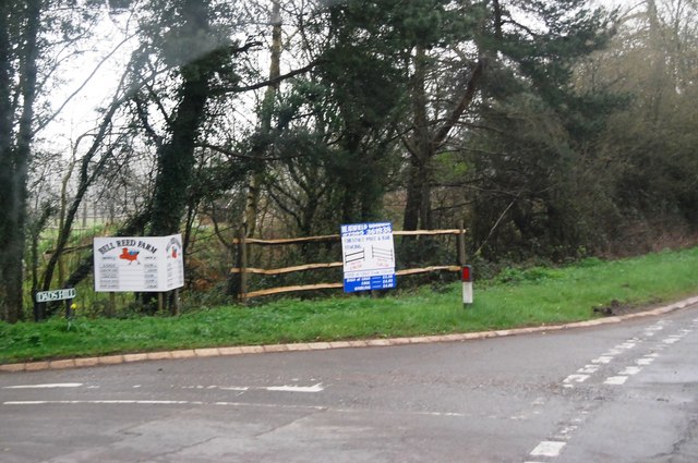
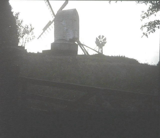
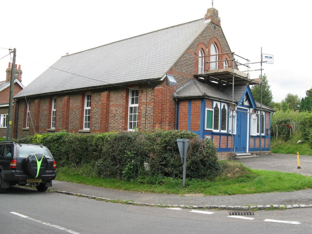
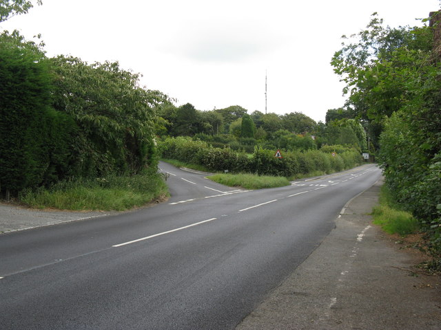
Cowstall Plantation Images

Images are sourced within 2km of 50.973915/0.20400598 or Grid Reference TQ5421. Thanks to Geograph Open Source API. All images are credited.

A267 north of the junction with the B2102 The A267 road is a 21 mile long road from Tunbridge Wells <a href="https://www.geograph.org.uk/photo/6669020">TQ5838 : A26, A267 junction</a> to Horsebridge.
Website: <span class="nowrap"><a title="http://www.sabre-roads.org.uk/wiki/index.php?title=A267" rel="nofollow ugc noopener" href="http://www.sabre-roads.org.uk/wiki/index.php?title=A267">Link</a><img style="margin-left:2px;" alt="External link" title="External link - shift click to open in new window" src="https://s1.geograph.org.uk/img/external.png" width="10" height="10"/></span>
A267 north of the junction with the B2102
The A267 road is a 21 mile long road from Tunbridge Wells TQ5838 : A26, A267 junction to Horsebridge. Website: LinkExternal link
A267 looking south The A267 road is a 21 mile long road from Tunbridge Wells <a href="https://www.geograph.org.uk/photo/6669020">TQ5838 : A26, A267 junction</a> to Horsebridge.
Website: <span class="nowrap"><a title="http://www.sabre-roads.org.uk/wiki/index.php?title=A267" rel="nofollow ugc noopener" href="http://www.sabre-roads.org.uk/wiki/index.php?title=A267">Link</a><img style="margin-left:2px;" alt="External link" title="External link - shift click to open in new window" src="https://s1.geograph.org.uk/img/external.png" width="10" height="10"/></span>
A267 looking south
The A267 road is a 21 mile long road from Tunbridge Wells TQ5838 : A26, A267 junction to Horsebridge. Website: LinkExternal link
B2102, Nursery Lane junction
B2102, Possingworth Park
B2102, Waldron Down
B2102, Waldron Down
B2102 at Sharlands
B2102 at Sharlands
A267, Cross in Hand The A267 road is a 21 mile long road from Tunbridge Wells <a href="https://www.geograph.org.uk/photo/6669020">TQ5838 : A26, A267 junction</a> to Horsebridge.
Website: <span class="nowrap"><a title="http://www.sabre-roads.org.uk/wiki/index.php?title=A267" rel="nofollow ugc noopener" href="http://www.sabre-roads.org.uk/wiki/index.php?title=A267">Link</a><img style="margin-left:2px;" alt="External link" title="External link - shift click to open in new window" src="https://s1.geograph.org.uk/img/external.png" width="10" height="10"/></span>
A267, Cross in Hand
The A267 road is a 21 mile long road from Tunbridge Wells TQ5838 : A26, A267 junction to Horsebridge. Website: LinkExternal link
Road sign, Cross in Hand
JW Groombridge, Cross In Hand Cross in Hand is a village in East Sussex, close to Heathfield. It is located around the junction of the A267 and B2102.
Wikipedia: <span class="nowrap"><a title="https://en.wikipedia.org/wiki/Cross_In_Hand" rel="nofollow ugc noopener" href="https://en.wikipedia.org/wiki/Cross_In_Hand">Link</a><img style="margin-left:2px;" alt="External link" title="External link - shift click to open in new window" src="https://s1.geograph.org.uk/img/external.png" width="10" height="10"/></span>
JW Groombridge, Cross In Hand
Cross in Hand is a village in East Sussex, close to Heathfield. It is located around the junction of the A267 and B2102. Wikipedia: LinkExternal link
Dad's Hill off the A267
Junction of B2102 and A267
A267 heading north The A267 road is a 21 mile long road from Tunbridge Wells <a href="https://www.geograph.org.uk/photo/6669020">TQ5838 : A26, A267 junction</a> to Horsebridge.
Website: <span class="nowrap"><a title="http://www.sabre-roads.org.uk/wiki/index.php?title=A267" rel="nofollow ugc noopener" href="http://www.sabre-roads.org.uk/wiki/index.php?title=A267">Link</a><img style="margin-left:2px;" alt="External link" title="External link - shift click to open in new window" src="https://s1.geograph.org.uk/img/external.png" width="10" height="10"/></span>
A267 heading north
The A267 road is a 21 mile long road from Tunbridge Wells TQ5838 : A26, A267 junction to Horsebridge. Website: LinkExternal link
The A267 The A267 road is a 21 mile long road from Tunbridge Wells <a href="https://www.geograph.org.uk/photo/6669020">TQ5838 : A26, A267 junction</a> to Horsebridge.
Website: <span class="nowrap"><a title="http://www.sabre-roads.org.uk/wiki/index.php?title=A267" rel="nofollow ugc noopener" href="http://www.sabre-roads.org.uk/wiki/index.php?title=A267">Link</a><img style="margin-left:2px;" alt="External link" title="External link - shift click to open in new window" src="https://s1.geograph.org.uk/img/external.png" width="10" height="10"/></span>
The A267
The A267 road is a 21 mile long road from Tunbridge Wells TQ5838 : A26, A267 junction to Horsebridge. Website: LinkExternal link
New Mill, Cross in Hand in 1967 In the days when it had all its sails.
New Mill, Cross in Hand in 1967
In the days when it had all its sails.
Methodist Chapel under repair On the corner of Firgrove Road and the B2102 at Cross in Hand.
Methodist Chapel under repair
On the corner of Firgrove Road and the B2102 at Cross in Hand.
Dads Hill off the B2102 New Mill is on Dads Hill.
Dads Hill off the B2102
New Mill is on Dads Hill.
Volkswagen camper, Cross in Hand, East Sussex
Signboard near Blackboys, East Sussex
Show me another place!

Cowstall Plantation is located at Grid Ref: TQ5421 (Lat: 50.973915, Lng: 0.20400598)

Administrative County: East Sussex

District: Wealden

Police Authority: Sussex

What 3 Words

///immune.disprove.thin. Near Heathfield, East Sussex

Related Wikis

Holy Cross Priory, Cross-in-Hand

Holy Cross Priory, Cross-in-Hand, is a priory of the Benedictine Sisters of Grace and Compassion which provides homes for the elderly. It was established...

New Mill, Cross-in-Hand

New Mill is a Grade II* listed post mill at Cross in Hand near Heathfield, East Sussex, England. It was the last windmill working commercially by wind...

Roser's Cross

Roser's Cross is a village in the Wealden district of East Sussex.

Selwyns Wood

Selwyns Wood is a 11-hectare (27-acre) nature reserve west of Heathfield in Sussex. It is managed by the Sussex Wildlife Trust.This reserve has woodland...

Cross-in-Hand

Cross-in-Hand is a small village outside Heathfield town to its west, in the Wealden District situated in East Sussex, England. It is occasionally referred...

Heathfield transmitting station

The Heathfield transmitting station is a facility for FM and television transmission at Heathfield, East Sussex, UK (grid reference TQ566220). Opened in...

Great Bush Railway

The Great Bush Railway is a private, 2 ft (610 mm) narrow gauge running round the edge of Tinkers Park, Hadlow Down, Sussex. The railway is operated by...

Wealden (UK Parliament constituency)

Wealden is a constituency represented in the House of Commons of the UK Parliament since 2015 by Nus Ghani, a Conservative. Ghani is the first Muslim woman...

Nearby Amenities

Located within 500m of 50.973915,0.20400598
Bus Stop
Cross-in-Hand Motor Museum
Bus: yes
Naptan AtcoCode: 1400WE0606
Naptan NaptanCode: esudamwm
Public Transport: platform
Shelter: yes
Lat/Long: 50.9728067/0.2019094
Post Box
Brand: Royal Mail
Brand Wikidata: Q638098
Brand Wikipedia: en:Royal Mail
Operator: Royal Mail
Operator Wikidata: Q638098
Post Box Type: lamp
Ref: TN21 28
Royal Cypher: EIIR
Royal Cypher Wikidata: Q33102113
Lat/Long: 50.9727882/0.2019466
Bus Stop
Cross-in-Hand Motor Museum
Bus: yes
Naptan AtcoCode: 1400WE0605
Naptan NaptanCode: esudamwj
Public Transport: platform
Lat/Long: 50.9729075/0.2026114
Holy Cross Priory Village
Place: hamlet
Website: https://www.holycrosspriory.co.uk/
Lat/Long: 50.9718258/0.19939
Addr City: Cross In Hand
Addr Place: Holy Cross Priory
Addr Postcode: TN21 0EW
Lat/Long: 50.9716529/0.1980776
The data included in this document is from www.openstreetmap.org. The data is made available under ODbL.

Have you been to Cowstall Plantation?

Leave your review of Cowstall Plantation below (or comments, questions and feedback).