Star Hill Wood

Wood, Forest in Kent Sevenoaks

England

Star Hill Wood

Footpath on Otford Lane This lane leads from the A224 Polhill to Halstead. The path on the left leads on a wide farm track to Knockholt Pound through Broomfield Wood.
Footpath on Otford Lane Credit: David Anstiss

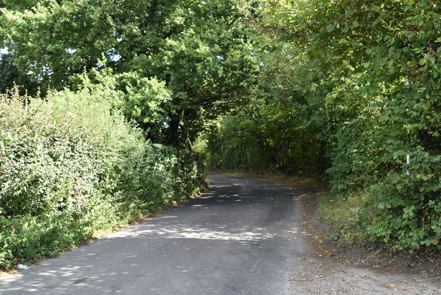
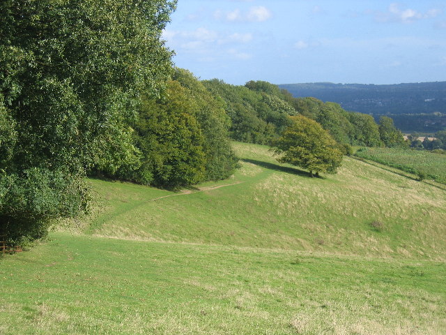
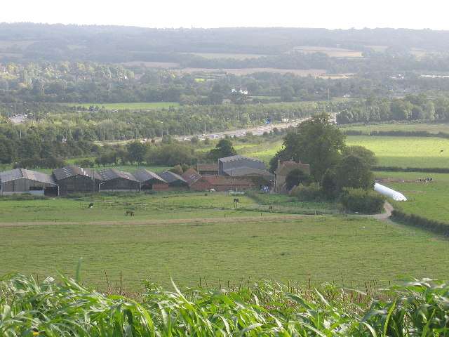
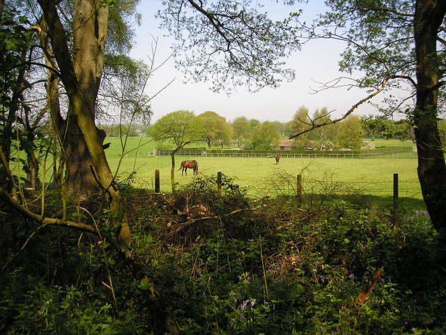
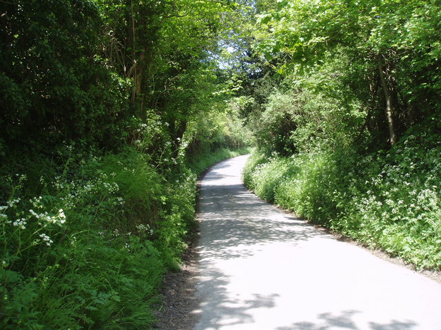
Star Hill Wood is a picturesque woodland located in Kent, England. Covering an area of approximately 80 acres, it is a captivating mix of ancient woodland and newly planted areas. The wood is situated just outside the village of Stelling Minnis, nestled within the rolling countryside of the North Downs.

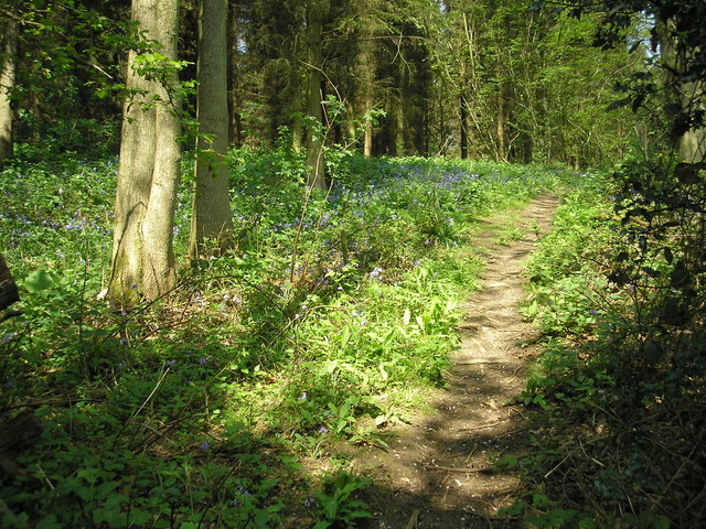
The ancient woodland in Star Hill Wood is comprised of a diverse range of tree species, including oak, beech, and ash. This creates a rich and varied habitat that supports a wide array of wildlife, such as birds, insects, and small mammals. The wood is particularly renowned for its impressive bluebell displays in the spring, attracting visitors from far and wide.

In recent years, efforts have been made to enhance the woodland by planting new trees and creating open spaces. This has helped to increase biodiversity and provide additional habitats for species such as butterflies and wildflowers. The wood is also home to several well-maintained footpaths and trails, making it a popular destination for walking enthusiasts and nature lovers.

Star Hill Wood offers a tranquil escape from the hustle and bustle of everyday life, providing visitors with the opportunity to immerse themselves in the beauty of nature. Whether it is a leisurely stroll, a picnic among the trees, or simply a moment of solitude, this enchanting woodland offers a unique experience for all who venture within its boundaries.

If you have any feedback on the listing, please let us know in the comments section below.

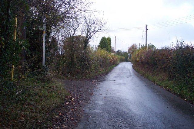
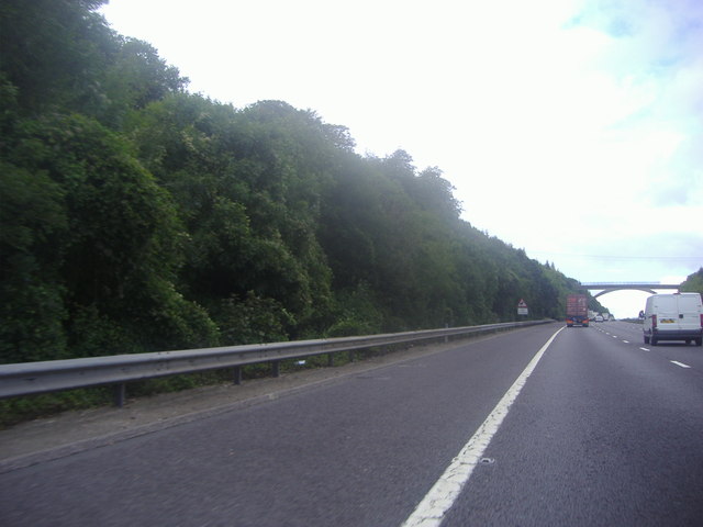
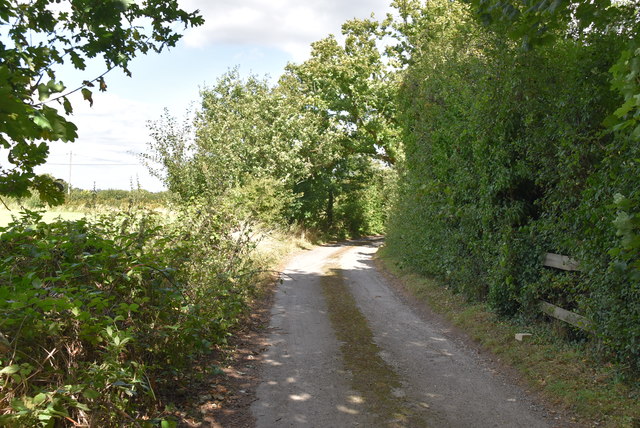
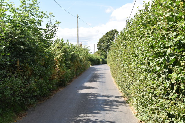
Star Hill Wood Images

Images are sourced within 2km of 51.307187/0.13983361 or Grid Reference TQ4958. Thanks to Geograph Open Source API. All images are credited.

Footpath on Otford Lane This lane leads from the A224 Polhill to Halstead. The path on the left leads on a wide farm track to Knockholt Pound through Broomfield Wood.
Footpath on Otford Lane
This lane leads from the A224 Polhill to Halstead. The path on the left leads on a wide farm track to Knockholt Pound through Broomfield Wood.
The M25 approaching footbridge, Polhill
M25 at Polhill The M25 is a 117 mile orbital motorway that encircles London. It was constructed between 1975 and 1986.
The motorway is not a continuous loop as a section to the East of London at The Dartford Crossing is an A-Road.
Wikipedia; <span class="nowrap"><a title="http://en.wikipedia.org/wiki/M25_motorway" rel="nofollow ugc noopener" href="http://en.wikipedia.org/wiki/M25_motorway">Link</a><img style="margin-left:2px;" alt="External link" title="External link - shift click to open in new window" src="https://s1.geograph.org.uk/img/external.png" width="10" height="10"/></span>
M25 at Polhill
The M25 is a 117 mile orbital motorway that encircles London. It was constructed between 1975 and 1986. The motorway is not a continuous loop as a section to the East of London at The Dartford Crossing is an A-Road. Wikipedia; LinkExternal link
M25 looking clockwise Rather more photographs are taken of the viewpoint bridlepath bridge than are taken from it.
M25 looking clockwise
Rather more photographs are taken of the viewpoint bridlepath bridge than are taken from it.
To Otford Lane
To Otford Lane
Otford Lane
Otford Lane
Otford Lane
Otford Lane
M25 & M26 near Chevening & Chipstead This is where the M25 London Orbital Road turns to the north (left in the picture) and the M26 continues to the east.
M25 & M26 near Chevening & Chipstead
This is where the M25 London Orbital Road turns to the north (left in the picture) and the M26 continues to the east.
The North Downs Way - a grassy stretch It's stretches like this that make the North Downs Way a pleasure.
The North Downs Way - a grassy stretch
It's stretches like this that make the North Downs Way a pleasure.
Turvins Farm and the M25
St. Botolphs Church Where my grandparents were married.
St. Botolphs Church
Where my grandparents were married.
Horses at pasture These horses look peaceful enough, but behind the photographer runs a high chain-link and razor-wire fence enclosing a very large tract of MOD property. It actually occupies more than half of this gridsquare and portions of its neighbours to the west, south and east.  Any buildings are concealed by tree cover.  Even the locals do not know what goes on inside, except that loud bangs or explosions are occasionally heard.
Horses at pasture
These horses look peaceful enough, but behind the photographer runs a high chain-link and razor-wire fence enclosing a very large tract of MOD property. It actually occupies more than half of this gridsquare and portions of its neighbours to the west, south and east. Any buildings are concealed by tree cover. Even the locals do not know what goes on inside, except that loud bangs or explosions are occasionally heard.
Bluebells on the North Downs Way The North Downs Way is a very popular long-distance path, paralleling for long stretches the ancient Pilgrim's Way to Canterbury.  In mid-May it is seen at its best as it crosses the north-east corner of this gridsquare.
Bluebells on the North Downs Way
The North Downs Way is a very popular long-distance path, paralleling for long stretches the ancient Pilgrim's Way to Canterbury. In mid-May it is seen at its best as it crosses the north-east corner of this gridsquare.
Road junction, Knockholt Pound, Kent Knockholt Pound and its near neighbour Knockholt are not on the M.o.T A and B road network, but are served by a tangle of minor roads and lanes.  In this photograph, taken from the steps of the Harrow public house, the fork to the right leads to Pratt's Bottom and Chelsfield, while the left-hand road goes to Biggin Hill and Westerham
Road junction, Knockholt Pound, Kent
Knockholt Pound and its near neighbour Knockholt are not on the M.o.T A and B road network, but are served by a tangle of minor roads and lanes. In this photograph, taken from the steps of the Harrow public house, the fork to the right leads to Pratt's Bottom and Chelsfield, while the left-hand road goes to Biggin Hill and Westerham
Cooling's Nurseries and Landscape Centre, Knockholt, Kent If you are planning your garden on the grand scale, this is the place to come for supplies and advice.  Everyone is made welcome, and there is even a coffee shop.
Cooling's Nurseries and Landscape Centre, Knockholt, Kent
If you are planning your garden on the grand scale, this is the place to come for supplies and advice. Everyone is made welcome, and there is even a coffee shop.
Sundridge Hill, Kent We are on the scarp slope of the North Downs here, and many of the lanes crossing it are both narrow and steep.  This one rates a "more than 14%" symbol on the OS map.  If you are motoring in this area, please use extra care.
Sundridge Hill, Kent
We are on the scarp slope of the North Downs here, and many of the lanes crossing it are both narrow and steep. This one rates a "more than 14%" symbol on the OS map. If you are motoring in this area, please use extra care.
Morants Court Farm - near Chevening, Sevenoaks The North Downs Way runs steeply northwest up through this farm.
Morants Court Farm - near Chevening, Sevenoaks
The North Downs Way runs steeply northwest up through this farm.
Chevening This small village is set along the eastern boundary of the grounds of Chevening House, the official country residence of the Foreign Secretary.

For a similar photo in late spring, see <a href="https://www.geograph.org.uk/photo/1888129">TQ4857 : Chevening</a>.
Chevening
This small village is set along the eastern boundary of the grounds of Chevening House, the official country residence of the Foreign Secretary. For a similar photo in late spring, see TQ4857 : Chevening.
Show me another place!

Star Hill Wood is located at Grid Ref: TQ4958 (Lat: 51.307187, Lng: 0.13983361)

Administrative County: Kent

District: Sevenoaks

Police Authority: Kent

What 3 Words

///exist.bucked.bricks. Near Sundridge, Kent

Related Wikis

Fort Halstead

Fort Halstead was a research site of the Defence Science and Technology Laboratory (Dstl), an executive agency of the UK Ministry of Defence. It is situated...

Chevening

Chevening House () is a large country house in the parish of Chevening in Kent, England. Built between 1617 and 1630 to a design reputedly by Inigo Jones...

Chatham Vase

The Chatham Vase is a stone sculpture by John Bacon commissioned as a memorial to William Pitt the Elder by his wife, Hester, Countess of Chatham. It was...

Polhill Anglo-Saxon cemetery

Polhill Anglo-Saxon cemetery is a place of burial that was used in the seventh and eighth centuries CE. It is located close to the hamlet of Polhill, near...

Chevening, Kent

Chevening () is a village and civil parish in the Sevenoaks District of Kent, England. It was the location for the world's earliest known organised cricket...

Chevening Halt railway station

Chevening Halt is a now-closed intermediate railway station on the Westerham branch line in Kent. The line was built as single track with provision for...

Knockholt

Knockholt is a village and civil parish in the Sevenoaks District of Kent, England. It is located 5 mi (8 km) north west of Sevenoaks & 5.7 mi (9.2 km...

St Katharine's Church, Knockholt

St Katharine's Church is an Anglican parish church in the village of Knockholt and the Sevenoaks deanery. St Katharine's and St Margaret's came together...

Nearby Amenities

Located within 500m of 51.307187,0.13983361
Barrier: stile
Foot: yes
Lat/Long: 51.303613/0.1440978
Barrier: kissing_gate
Foot: yes
Lat/Long: 51.3082515/0.136004
Bus Stop
Star Hill Road
Flag: no
Naptan AtcoCode: 2400A034500A
Naptan Bearing: NW
Naptan BusStopType: CUS
Naptan CommonName: Star Hill Road
Naptan Indicator: NW-bound
Naptan Landmark: Fort Halstead
Naptan NaptanCode: kntdmdmj
Naptan Street: Star Hill Road
Naptan Verified: no
Public Transport: platform
Source: naptan_import
Lat/Long: 51.3092876/0.1371152
Bus Stop
Star Hill Road
Naptan AtcoCode: 2400A034510A
Naptan Bearing: SE
Naptan CommonName: Star Hill Road
Naptan Indicator: SE-bound
Naptan Landmark: Fort Halstead
Naptan NaptanCode: kntdmdmp
Naptan Street: Star Hill Road
Naptan Verified: no
Public Transport: platform
Source: naptan_import
Lat/Long: 51.3093387/0.1372754
Tourism: viewpoint
Lat/Long: 51.3051612/0.1428643
Barrier: kissing_gate
Foot: yes
Lat/Long: 51.3059503/0.1414333
Bench
Backrest: yes
Colour: brown
Material: wood
Seats: 3
Lat/Long: 51.3051421/0.1429445
Star Hill
Natural: peak
Lat/Long: 51.3098983/0.1396634
Barrier: stile
Lat/Long: 51.3067642/0.146388
The data included in this document is from www.openstreetmap.org. The data is made available under ODbL.

Have you been to Star Hill Wood?

Leave your review of Star Hill Wood below (or comments, questions and feedback).