Gernon Bushes

Wood, Forest in Essex Epping Forest

England

Gernon Bushes

North Weald station The Eastern Counties Railway Loughton branch line opened on 22nd August 1856. It  ran north-east between the small villages of Leyton and Leytonstone, reaching the Roding Valley at Wanstead. It then followed the west side of the valley to reach Loughton which was then a village of 1,500 people. At the time Epping was a small agricultural town of just over 2,000 people along the Newmarket Road and five miles to the east was the town of Chipping Ongar. An eleven and a quarter mile extension beyond Loughton was opened as a single line extension from Loughton through Epping to Ongar on 24th April 1865. A double track was completed as far as Epping in January 1893. At the opening of the Loughton branch most trains terminated at Fenchurch Street, but from 1874 most trains were diverted to Liverpool Street.

By the outbreak of the Second World War much of the land between Epping Forest and the River Roding was covered with houses as far as Loughton but there was much discontent with the LNER steam service. Tube train operation of the branch was first mooted in the early 1930s and a major objective of the 1935-1940 London Railways New Works Programme was to give the eastern suburbs of London a more direct link to the West End. The Central line would be extended beyond Stratford to Leyton where it would take over the working of the Ongar line. The new station at Loughton was opened on 28th April 1940 but LNER steam trains served it until 1948. Work resumed in 1945 and Tube trains reached Leytonstone on 5th May 1947. Loughton received its electric trains on 21st November 1948.  

Electrification was carried through to Epping on 25th September 1949. GER tank engines ran through to Ongar for a further eight years until it was decided to electrify the single line and Tube trains arrived at the remote Ongar station on 18th November 1957. After Tube trains arrived Epping soon showed signs of suburban growth. However, much of the line beyond was rural and because of low usage and prospective heavy engineering work, London Transport sought to close the Epping Ongar section in 1970. However, trains continued to run until 30th September 1994 when the line was finally closed. The track remains though and heritage trains are now run by the Epping Ongar Railway - see <span class="nowrap"><a title="http://eorailway.co.uk/" rel="nofollow ugc noopener" href="http://eorailway.co.uk/">Link</a><img style="margin-left:2px;" alt="External link" title="External link - shift click to open in new window" src="https://s1.geograph.org.uk/img/external.png" width="10" height="10"/></span>

North Weald is now the central base for the Epping Ongar Railway's motive power fleet. The station has been restored to its Great Eastern Railway appearance and is very much as it would have been during the LNER period of the early 1940s. The original signal box seen here has been completely restored. In 2016 the original GER lattice footbridge which had come from South Woodford further down on the Central line was totally restored and placed here. It was brought here to replace the previously condemned London Underground concrete structure.

This view looks towards Ongar station. This was London Transport Weekend which celebrated the Epping Ongar Railway's links with London Transport.
North Weald station Credit: Marathon

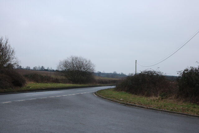
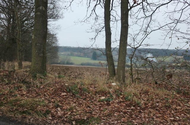
Gernon Bushes is a picturesque woodland area located in the county of Essex, England. Nestled within the larger Epping Forest, Gernon Bushes is known for its rich biodiversity and tranquil atmosphere, making it a popular destination for nature enthusiasts and hikers.

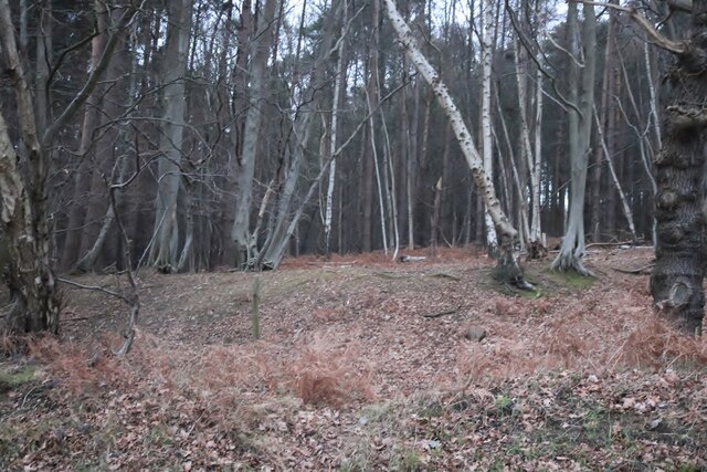
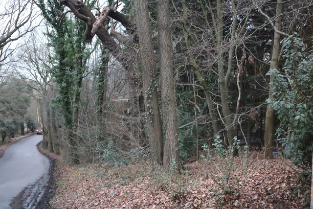
Covering an area of approximately 100 hectares, Gernon Bushes is characterized by its dense, ancient woodland. The site is home to a wide variety of tree species, including oak, beech, and birch, which create a vibrant canopy that shelters an array of wildlife. The forest floor is adorned with an assortment of flowering plants and ferns, adding to the area's natural charm.

Visitors to Gernon Bushes can explore a network of well-maintained footpaths and trails that wind through the woodland, providing an opportunity to immerse themselves in the peaceful surroundings. The area is also intersected by small streams and ponds, attracting a variety of bird species and other aquatic wildlife.

One notable feature of Gernon Bushes is its history. The woodland has been part of Epping Forest for centuries, dating back to the medieval times when it was used for hunting by the local nobility. Today, the area is protected and managed by the City of London Corporation, ensuring its preservation for future generations.

Overall, Gernon Bushes offers visitors a chance to escape the hustle and bustle of urban life and connect with nature. Whether for a leisurely stroll, birdwatching, or simply enjoying the serenity of the woodland, this tranquil Essex gem is a haven for those seeking a peaceful retreat in a natural setting.

If you have any feedback on the listing, please let us know in the comments section below.

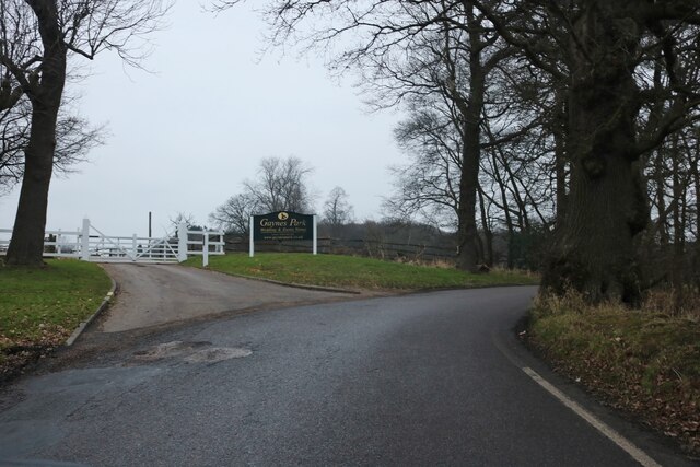
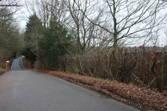
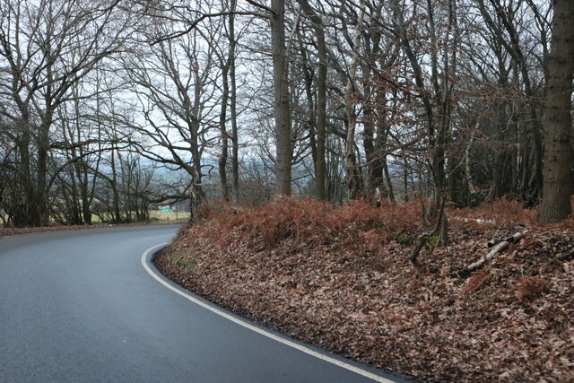
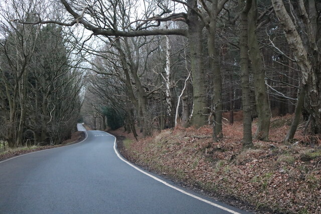
Gernon Bushes Images

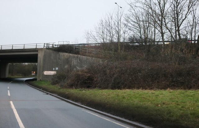
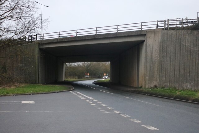
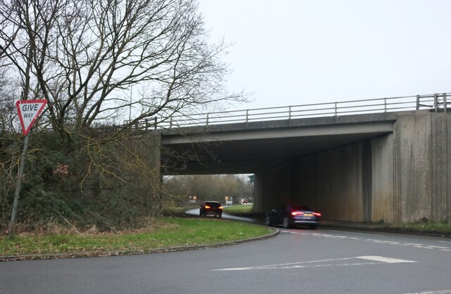
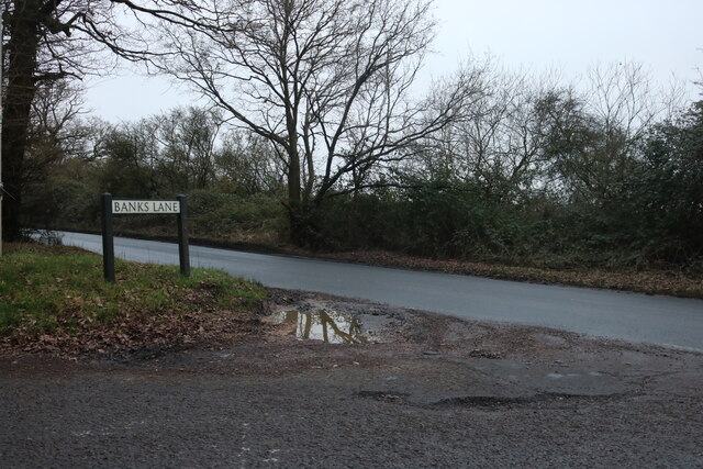
Images are sourced within 2km of 51.702986/0.13960093 or Grid Reference TL4702. Thanks to Geograph Open Source API. All images are credited.

North Weald station The Eastern Counties Railway Loughton branch line opened on 22nd August 1856. It  ran north-east between the small villages of Leyton and Leytonstone, reaching the Roding Valley at Wanstead. It then followed the west side of the valley to reach Loughton which was then a village of 1,500 people. At the time Epping was a small agricultural town of just over 2,000 people along the Newmarket Road and five miles to the east was the town of Chipping Ongar. An eleven and a quarter mile extension beyond Loughton was opened as a single line extension from Loughton through Epping to Ongar on 24th April 1865. A double track was completed as far as Epping in January 1893. At the opening of the Loughton branch most trains terminated at Fenchurch Street, but from 1874 most trains were diverted to Liverpool Street.

By the outbreak of the Second World War much of the land between Epping Forest and the River Roding was covered with houses as far as Loughton but there was much discontent with the LNER steam service. Tube train operation of the branch was first mooted in the early 1930s and a major objective of the 1935-1940 London Railways New Works Programme was to give the eastern suburbs of London a more direct link to the West End. The Central line would be extended beyond Stratford to Leyton where it would take over the working of the Ongar line. The new station at Loughton was opened on 28th April 1940 but LNER steam trains served it until 1948. Work resumed in 1945 and Tube trains reached Leytonstone on 5th May 1947. Loughton received its electric trains on 21st November 1948.  

Electrification was carried through to Epping on 25th September 1949. GER tank engines ran through to Ongar for a further eight years until it was decided to electrify the single line and Tube trains arrived at the remote Ongar station on 18th November 1957. After Tube trains arrived Epping soon showed signs of suburban growth. However, much of the line beyond was rural and because of low usage and prospective heavy engineering work, London Transport sought to close the Epping Ongar section in 1970. However, trains continued to run until 30th September 1994 when the line was finally closed. The track remains though and heritage trains are now run by the Epping Ongar Railway - see <span class="nowrap"><a title="http://eorailway.co.uk/" rel="nofollow ugc noopener" href="http://eorailway.co.uk/">Link</a><img style="margin-left:2px;" alt="External link" title="External link - shift click to open in new window" src="https://s1.geograph.org.uk/img/external.png" width="10" height="10"/></span>

North Weald is now the central base for the Epping Ongar Railway's motive power fleet. The station has been restored to its Great Eastern Railway appearance and is very much as it would have been during the LNER period of the early 1940s. The original signal box seen here has been completely restored. In 2016 the original GER lattice footbridge which had come from South Woodford further down on the Central line was totally restored and placed here. It was brought here to replace the previously condemned London Underground concrete structure.

This view looks towards Ongar station. This was London Transport Weekend which celebrated the Epping Ongar Railway's links with London Transport.
North Weald station
The Eastern Counties Railway Loughton branch line opened on 22nd August 1856. It ran north-east between the small villages of Leyton and Leytonstone, reaching the Roding Valley at Wanstead. It then followed the west side of the valley to reach Loughton which was then a village of 1,500 people. At the time Epping was a small agricultural town of just over 2,000 people along the Newmarket Road and five miles to the east was the town of Chipping Ongar. An eleven and a quarter mile extension beyond Loughton was opened as a single line extension from Loughton through Epping to Ongar on 24th April 1865. A double track was completed as far as Epping in January 1893. At the opening of the Loughton branch most trains terminated at Fenchurch Street, but from 1874 most trains were diverted to Liverpool Street. By the outbreak of the Second World War much of the land between Epping Forest and the River Roding was covered with houses as far as Loughton but there was much discontent with the LNER steam service. Tube train operation of the branch was first mooted in the early 1930s and a major objective of the 1935-1940 London Railways New Works Programme was to give the eastern suburbs of London a more direct link to the West End. The Central line would be extended beyond Stratford to Leyton where it would take over the working of the Ongar line. The new station at Loughton was opened on 28th April 1940 but LNER steam trains served it until 1948. Work resumed in 1945 and Tube trains reached Leytonstone on 5th May 1947. Loughton received its electric trains on 21st November 1948. Electrification was carried through to Epping on 25th September 1949. GER tank engines ran through to Ongar for a further eight years until it was decided to electrify the single line and Tube trains arrived at the remote Ongar station on 18th November 1957. After Tube trains arrived Epping soon showed signs of suburban growth. However, much of the line beyond was rural and because of low usage and prospective heavy engineering work, London Transport sought to close the Epping Ongar section in 1970. However, trains continued to run until 30th September 1994 when the line was finally closed. The track remains though and heritage trains are now run by the Epping Ongar Railway - see LinkExternal link North Weald is now the central base for the Epping Ongar Railway's motive power fleet. The station has been restored to its Great Eastern Railway appearance and is very much as it would have been during the LNER period of the early 1940s. The original signal box seen here has been completely restored. In 2016 the original GER lattice footbridge which had come from South Woodford further down on the Central line was totally restored and placed here. It was brought here to replace the previously condemned London Underground concrete structure. This view looks towards Ongar station. This was London Transport Weekend which celebrated the Epping Ongar Railway's links with London Transport.
The countryside next to North Weald station It is hard to believe that this was ever part of the London Underground system. Oxford Circus it is not. This is the view from the footbridge at North Weald station. For more about the line and the station see <a title="https://www.geograph.org.uk/photo/6987498" href="https://www.geograph.org.uk/photo/6987498">Link</a>
The countryside next to North Weald station
It is hard to believe that this was ever part of the London Underground system. Oxford Circus it is not. This is the view from the footbridge at North Weald station. For more about the line and the station see Link
Footpath leading away from North Weald station It is hard to believe that North Weald was ever part of the London Underground system. Oxford Circus it is not. This is the view of the footpath leading away from the footbridge at North Weald station. For more about the line and the station see <a title="https://www.geograph.org.uk/photo/6987498" href="https://www.geograph.org.uk/photo/6987498">Link</a>
Footpath leading away from North Weald station
It is hard to believe that North Weald was ever part of the London Underground system. Oxford Circus it is not. This is the view of the footpath leading away from the footbridge at North Weald station. For more about the line and the station see Link
Mount Road going beneath the M25
Mount Road at the end of Banks Lane
Banks Lane, Mount End By Gaynes Park wedding venue <span class="nowrap"><a title="https://gaynespark.co.uk/" rel="nofollow ugc noopener" href="https://gaynespark.co.uk/">Link</a><img style="margin-left:2px;" alt="External link" title="External link - shift click to open in new window" src="https://s1.geograph.org.uk/img/external.png" width="10" height="10"/></span>
Banks Lane, Mount End
By Gaynes Park wedding venue LinkExternal link
Banks Lane, Mount End
Banks Lane, Mount End Going through High Warren
Banks Lane, Mount End
Going through High Warren
High Warren, Mount End
Banks Lane, Mount End
The entrance to Gaynes Park wedding venue <span class="nowrap"><a title="https://gaynespark.co.uk/" rel="nofollow ugc noopener" href="https://gaynespark.co.uk/">Link</a><img style="margin-left:2px;" alt="External link" title="External link - shift click to open in new window" src="https://s1.geograph.org.uk/img/external.png" width="10" height="10"/></span>
The entrance to Gaynes Park wedding venue
Barn at Horne Farm, Mount End
Mount Road at the end of Hobbs Cross Road
View from Banks Lane, Mount End
Show me another place!

Gernon Bushes is located at Grid Ref: TL4702 (Lat: 51.702986, Lng: 0.13960093)

Administrative County: Essex

District: Epping Forest

Police Authority: Essex

What 3 Words

///things.pits.marble. Near Epping, Essex

Related Wikis

Gernon Bushes

Gernon Bushes is a 32 hectare nature reserve north-east of Epping in Essex. It is managed by the Essex Wildlife Trust. It is part of the Epping Forest...

Coopersale

Coopersale, also termed Coopersale Common, is a village in the civil parish of Epping, within the Epping Forest District of Essex, England. In 2018 it...

Coopersale Street

Coopersale Street is a hamlet in the civil parish of Epping, within the Epping Forest District of Essex, England, and is 1,300 yards (1,000 m) east from...

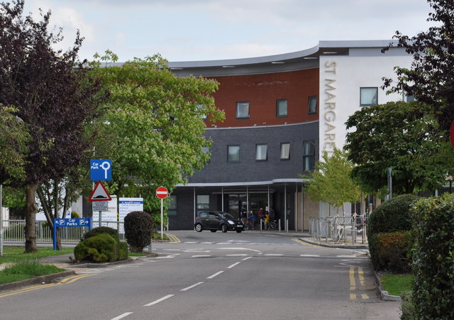
St Margaret's Hospital, Epping

St Margaret's Hospital is a hospital in Epping, Essex. It is managed by the Princess Alexandra Hospital NHS Trust. == History == The hospital has its origins...

Nearby Amenities

Located within 500m of 51.702986,0.13960093
Created By: YahooApplet 1.0
Lat/Long: 51.7004945/0.1424634
Created By: YahooApplet 1.0
Lat/Long: 51.700549/0.1422473
Created By: YahooApplet 1.0
Lat/Long: 51.703106/0.1444736
Created By: YahooApplet 1.0
Lat/Long: 51.7031498/0.144279
Created By: YahooApplet 1.0
Lat/Long: 51.7048594/0.1453834
Created By: YahooApplet 1.0
Lat/Long: 51.7048766/0.1451717
Created By: YahooApplet 1.0
Lat/Long: 51.7041525/0.1448381
Created By: YahooApplet 1.0
Lat/Long: 51.7018918/0.1435828
Created By: YahooApplet 1.0
Lat/Long: 51.7019384/0.1433789
Created By: YahooApplet 1.0
Lat/Long: 51.6990791/0.1412332
Created By: YahooApplet 1.0
Lat/Long: 51.6990459/0.1414478
Coopersale
Created By: YahooApplet 1.1
Place: village
Source: npe
Wikidata: Q2191942
Lat/Long: 51.7050169/0.1350534
Piazza
Naptan AtcoCode: 1500IM906
Naptan Bearing: S
Naptan BusStopType: CUS
Naptan CommonName: Piazza
Naptan Crossing: Institute Road
Naptan Indicator: S-bound
Naptan Landmark: Piazza
Naptan NaptanCode: esxadgta
Naptan Street: Coopersale Common
Naptan Verified: no
Public Transport: platform
Source: naptan_import
Lat/Long: 51.7049202/0.1357101
Piazza
Naptan AtcoCode: 1500IM906Y
Naptan Bearing: N
Naptan BusStopType: CUS
Naptan CommonName: Piazza
Naptan Crossing: Institute Road
Naptan Indicator: N-bound
Naptan Landmark: Piazza
Naptan NaptanCode: esxjadaj
Naptan Street: Coopersale Common
Naptan Verified: no
Public Transport: platform
Source: naptan_import
Lat/Long: 51.7048866/0.1355572
Turning Circle
Lat/Long: 51.7049272/0.1383426
Turning Circle
Lat/Long: 51.7048334/0.1375112
Gernon Bushes Nature Reserve
Source: visit... information board on the forest reserve
Tourism: information
Lat/Long: 51.702519/0.1350459
Place Of Worship
The Ark
Religion: christian
Source: visit
Lat/Long: 51.7023536/0.1346064
Gernon Bushes Nature Reserve
Tourism: information
Lat/Long: 51.7065024/0.1380343
Gernon Bushes Nature Reserve
Place: locality
Source: visit
Lat/Long: 51.7035767/0.1417813
Hambrook
Addr Housename: Hambrook
Addr Postcode: CM16 7RE
Addr Street: Parklands
Shop: convenience
Source: visit
Lat/Long: 51.7053116/0.1361378
Post Office
Addr Housenumber: 30
Addr Postcode: CM16 7RE
Addr Street: Parklands
Brand: Post Office
Operator: Handy Stores
Source: visit
Lat/Long: 51.7053146/0.1360389
Post Box
Lat/Long: 51.705312/0.1357037
Restaurant
Herb 'N' Spice Tandoori
Addr Housenumber: 31-32
Addr Postcode: CM16 7RE
Addr Street: Parklands
Cuisine: indian
Source: visit
Lat/Long: 51.7053147/0.1359246
C.M.L. Hair Studio
Addr Housename: C.M.L. Hair Studio
Addr Housenumber: 28
Addr Postcode: CM16 7RE
Addr Street: Parklands
Shop: hairdresser
Source: visit
Lat/Long: 51.7053122/0.1362122
Turning Circle
Lat/Long: 51.7054861/0.1373717
Fixme: link?
Lat/Long: 51.7066864/0.1378918
Hawkshill Wood
Place: locality
Lat/Long: 51.6991705/0.1431241
Man Made: mast
Tower Type: communication
Lat/Long: 51.7028685/0.1447856
Man Made: mast
Tower Type: communication
Lat/Long: 51.703329/0.1450485
Entrance: yes
Lat/Long: 51.7046888/0.1345543
The data included in this document is from www.openstreetmap.org. The data is made available under ODbL.

Have you been to Gernon Bushes?

Leave your review of Gernon Bushes below (or comments, questions and feedback).