Little Padmires

Wood, Forest in Lincolnshire East Lindsey

England

Little Padmires

Direction Sign – Signpost on Summergates Lane, Burgh le Marsh Located on the northeast side of the junction of Summergates Lane, Wildshed Lane and Millfield Lane in Burgh le Marsh parish. 3 arms and no finial. See also <a title="https://www.geograph.org.uk/photo/4433889" href="https://www.geograph.org.uk/photo/4433889">Link</a>.

Milestone Society National ID: LI_TF4864
Direction Sign – Signpost on Summergates Lane, Burgh le Marsh Credit: A Riley

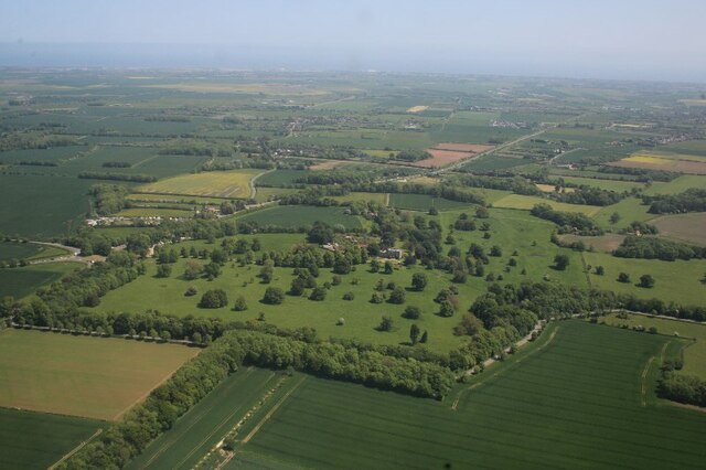
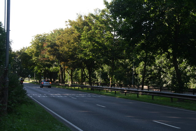
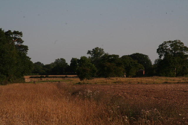
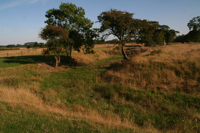
Little Padmires is a charming woodland area located in the county of Lincolnshire, England. Situated in the heart of the Lincolnshire Wolds, this serene and picturesque destination offers a peaceful retreat for nature lovers and outdoor enthusiasts.

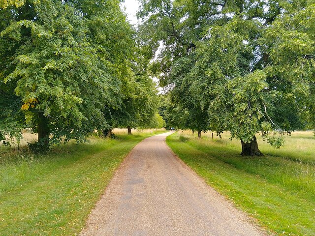
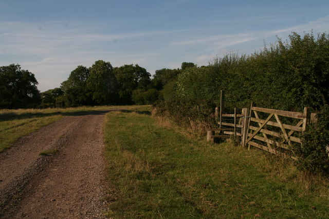
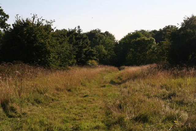
Covering an area of approximately 50 hectares, Little Padmires is characterized by its dense forest, which is predominantly composed of a variety of deciduous trees such as oak, beech, and ash. The woodland is interspersed with meandering footpaths and trails, providing visitors with the opportunity to explore and immerse themselves in the natural beauty of the area.

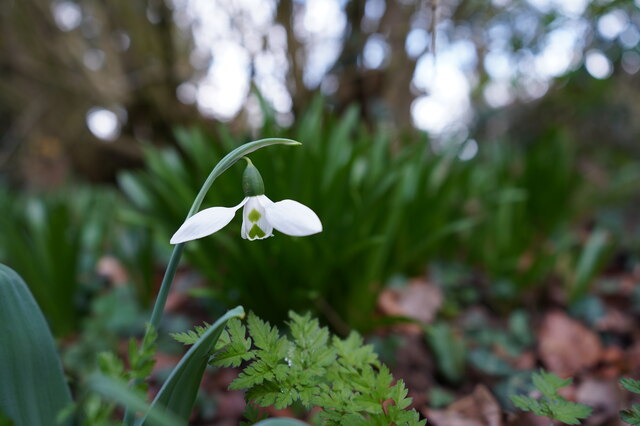
Wildlife thrives within Little Padmires, offering visitors the chance to spot a diverse range of species. The woodland is home to various birds, including woodpeckers, song thrushes, and owls, as well as small mammals like rabbits, squirrels, and voles. In the spring and summer months, the forest floor comes alive with colorful wildflowers, creating a vibrant and enchanting atmosphere.

Little Padmires is a popular destination for outdoor activities such as hiking, birdwatching, and photography. The well-maintained footpaths and trails ensure easy access to the woodland, making it suitable for visitors of all ages and abilities.

With its tranquil ambiance and natural splendor, Little Padmires offers a welcome escape from the hustle and bustle of everyday life. Whether seeking solitude or a family day out in nature, this woodland area in Lincolnshire provides an idyllic setting for relaxation and exploration.

If you have any feedback on the listing, please let us know in the comments section below.

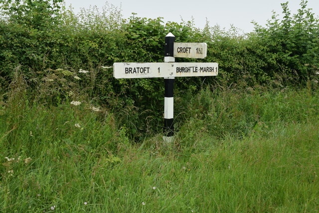
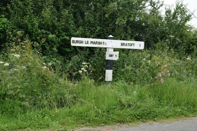
Little Padmires Images

Images are sourced within 2km of 53.167363/0.21001239 or Grid Reference TF4765. Thanks to Geograph Open Source API. All images are credited.

Direction Sign – Signpost on Summergates Lane, Burgh le Marsh Located on the northeast side of the junction of Summergates Lane, Wildshed Lane and Millfield Lane in Burgh le Marsh parish. 3 arms and no finial. See also <a title="https://www.geograph.org.uk/photo/4433889" href="https://www.geograph.org.uk/photo/4433889">Link</a>.

Milestone Society National ID: LI_TF4864
Direction Sign – Signpost on Summergates Lane, Burgh le Marsh
Located on the northeast side of the junction of Summergates Lane, Wildshed Lane and Millfield Lane in Burgh le Marsh parish. 3 arms and no finial. See also Link. Milestone Society National ID: LI_TF4864
Direction Sign – Signpost on Gravel Pits Lane, Burgh le Marsh Located on the southwest side of the junction of North Road, Gravel Pits Lane and Bratoft Lane in Burgh le Marsh parish. 3 arms and no finial.

Milestone Society National ID: LI_TF4865
Direction Sign – Signpost on Gravel Pits Lane, Burgh le Marsh
Located on the southwest side of the junction of North Road, Gravel Pits Lane and Bratoft Lane in Burgh le Marsh parish. 3 arms and no finial. Milestone Society National ID: LI_TF4865
Exquisite beauty This solitary snowdrop displays its finery to its full extent.
Exquisite beauty
This solitary snowdrop displays its finery to its full extent.
Here kitty, kitty, kitty. ....  Kitty?! Amongst the myriad of scattered drinks cans, bottles, takeaway wrappers, cigarette papers and other items ejected from thoughtless vehicle windows, someone has discarded this poor unfortunate creature at the end of the pleasant footpath.
 
Lucky black cat anyone?
Here kitty, kitty, kitty. .... Kitty?!
Amongst the myriad of scattered drinks cans, bottles, takeaway wrappers, cigarette papers and other items ejected from thoughtless vehicle windows, someone has discarded this poor unfortunate creature at the end of the pleasant footpath. Lucky black cat anyone?
Gunby: aerial 2023
Gunby: aerial 2023
Gunby Hall path The path to Gunby Hall, a National Trust property.
Gunby Hall path
The path to Gunby Hall, a National Trust property.
Gunby Hall garden
Gunby Hall garden
Onions ripening Gunby Hall
East aspect Gunby Hall
Orchard Gunby Hall
Orchard Gunby Hall
One of many dead trees in Gunby Park No criticism intended, quite nice to let them decay naturally. Apart from those killed by disease, I suppose given that many were planted at the same time over a century ago they have simply reached the end of their lives.
Elsewhere in the park a tree had been "saved" by breaking the ivy's stranglehold - see <a href="https://www.geograph.org.uk/photo/4626554">TF4666 : Breaking the ivy's stranglehold: tree by Little Wood, Gunby</a>.
One of many dead trees in Gunby Park
No criticism intended, quite nice to let them decay naturally. Apart from those killed by disease, I suppose given that many were planted at the same time over a century ago they have simply reached the end of their lives. Elsewhere in the park a tree had been "saved" by breaking the ivy's stranglehold - see TF4666 : Breaking the ivy's stranglehold: tree by Little Wood, Gunby.
House, pub (and Wifi Hotspot) by the A158 at Gunby
Shady avenue, Gunby Actually one side of a strange short length of dual carriageway in the middle of nowhere.
Shady avenue, Gunby
Actually one side of a strange short length of dual carriageway in the middle of nowhere.
Footpath through Gunby Park to the A158
Run, chicken, run: footpath to the former railway, Gunby
Path down the former railway's trackbed Now owned by the National Trust.
Path down the former railway's trackbed
Now owned by the National Trust.
Path from Gunby to Bratoft
Moated site of Bratoft Hall Bratoft Hall was a medieval house built by the Markham family who owned the site between 1409 and 1538. The house subsequently passed through marriage to the Massingberds, who in 1698 had Bratoft Hall demolished and moved to a new house at Gunby. The remains include the earthworks of a raised moated platform where the buried remains of the medieval house are located.
See: <span class="nowrap"><a title="http://www.pastscape.org.uk/hob.aspx?hob_id=355260&sort=2&rational=m&recordsperpage=10&maplat=53.16450000&maplong=0.20390000&mapisa=1000&mapist=ll&mapilo=0.2039&mapila=53.1645&mapiloe=e&mapilan=n&mapios=TF473653&mapigrn=365342&mapigre=547317&mapipc=" rel="nofollow ugc noopener" href="http://www.pastscape.org.uk/hob.aspx?hob_id=355260&sort=2&rational=m&recordsperpage=10&maplat=53.16450000&maplong=0.20390000&mapisa=1000&mapist=ll&mapilo=0.2039&mapila=53.1645&mapiloe=e&mapilan=n&mapios=TF473653&mapigrn=365342&mapigre=547317&mapipc=">Link</a><img style="margin-left:2px;" alt="External link" title="External link - shift click to open in new window" src="https://s1.geograph.org.uk/img/external.png" width="10" height="10"/></span>
Moated site of Bratoft Hall
Bratoft Hall was a medieval house built by the Markham family who owned the site between 1409 and 1538. The house subsequently passed through marriage to the Massingberds, who in 1698 had Bratoft Hall demolished and moved to a new house at Gunby. The remains include the earthworks of a raised moated platform where the buried remains of the medieval house are located. See: LinkExternal link
Show me another place!

Little Padmires is located at Grid Ref: TF4765 (Lat: 53.167363, Lng: 0.21001239)

Administrative County: Lincolnshire

District: East Lindsey

Police Authority: Lincolnshire

What 3 Words

///producing.outsmart.massaged. Near Burgh le Marsh, Lincolnshire

Related Wikis

Bratoft

Bratoft is a small hamlet in the East Lindsey district of Lincolnshire, England. It is situated approximately 5 miles (8 km) east from Spilsby, 2 miles...

Burgh-le-Marsh railway station

Burgh-le-Marsh was a railway station on the East Lincolnshire Railway which served the town of Burgh le Marsh in Lincolnshire between 1848 and 1970. It...
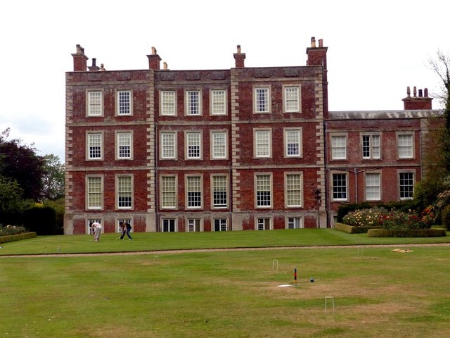
Gunby Hall

Gunby Hall is a country house in Gunby, near Spilsby, in Lincolnshire, England, reached by a half mile long private drive. The Estate comprises the 42...

Burgh le Marsh

Burgh le Marsh is a town and civil parish in the East Lindsey district of Lincolnshire, England. == Geography == The town is built on a low hill surrounded...

Irby in the Marsh

Irby in the Marsh is a village and civil parish in the East Lindsey district of Lincolnshire, England. It is situated on the B1195 road, geographically...

Orby

Orby is a village and civil parish in the East Lindsey district of Lincolnshire, England. It is situated approximately 9 miles (14 km) east from the town...

Burgh Bypass

Burgh Bypass is a bypass of the town of Burgh Le Marsh near Skegness. It was passed in 2005 and construction began in September 2006 after a lengthy campaign...

Firsby railway station

Firsby railway station was a station in Firsby, Lincolnshire. It served as a main line station and a terminus for two branch lines to Skegness and Spilsby...

Nearby Amenities

Located within 500m of 53.167363,0.21001239
Elmstead Farm
Place: farm
Source: Bing
Lat/Long: 53.1663626/0.2145471
The data included in this document is from www.openstreetmap.org. The data is made available under ODbL.

Have you been to Little Padmires?

Leave your review of Little Padmires below (or comments, questions and feedback).