Upper Wood

Wood, Forest in Essex Epping Forest

England

Upper Wood

Church of St. Mary the Virgin, Great Parndon, Harlow, Essex Not far from 'The Cock' Public House
Church of St. Mary the Virgin, Great Parndon, Harlow, Essex Credit: Patrick Lee

Upper Wood is a small rural settlement located in the county of Essex, England. Situated within the district of Epping Forest, Upper Wood is nestled amidst the picturesque landscapes of the Wood Forest, which is renowned for its natural beauty and tranquil atmosphere.

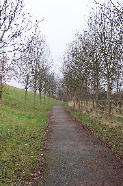
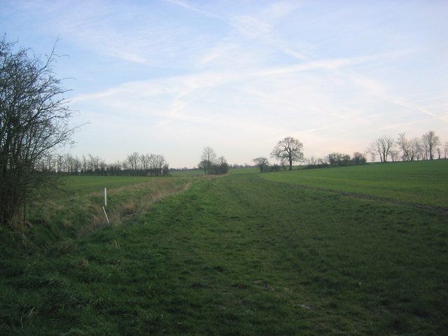
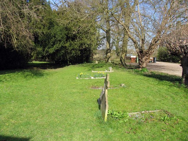
As its name suggests, Upper Wood is predominantly made up of dense woodland areas, with towering trees and a rich variety of flora and fauna. The village itself consists of a small cluster of houses and cottages that blend seamlessly with the surrounding natural environment.

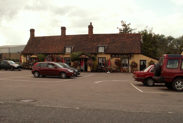
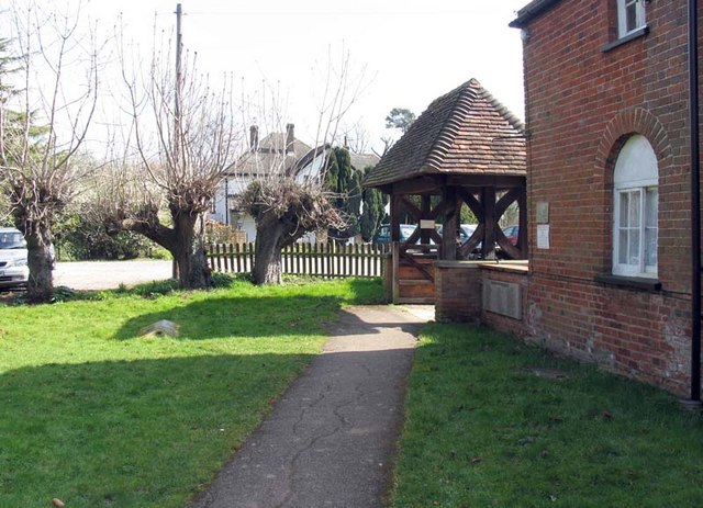
The community of Upper Wood is close-knit, with a population of around 200 residents. Many of the locals are involved in agriculture and forestry, taking advantage of the abundant natural resources the area has to offer. The village also boasts a few small businesses, such as a quaint local pub and a small convenience store, catering to the needs of both residents and visitors.

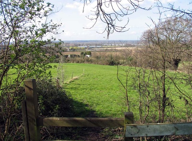
Upper Wood is a haven for nature enthusiasts, offering numerous walking trails and cycling routes that wind through the enchanting woodlands. The area is also home to a diverse range of wildlife, including deer, foxes, and various bird species, making it a popular spot for birdwatching.

Overall, Upper Wood, Essex, provides a tranquil and idyllic setting for those seeking a peaceful escape from the hustle and bustle of city life. With its lush woodlands and close-knit community, it is a charming destination for nature lovers and those seeking a slower pace of life.

If you have any feedback on the listing, please let us know in the comments section below.
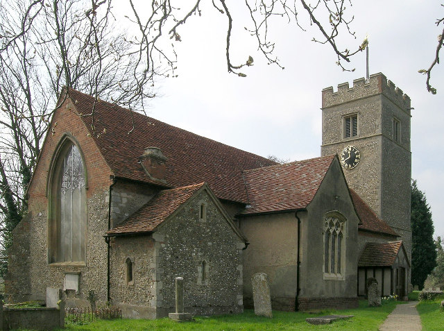
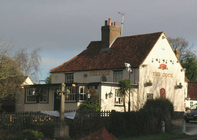
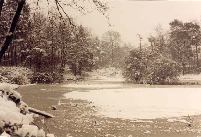
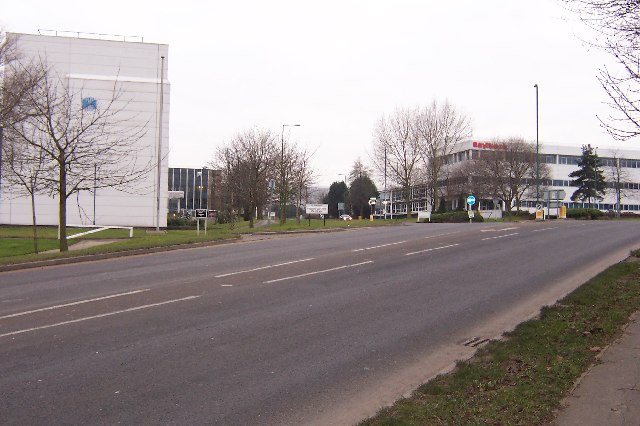
Upper Wood Images

Images are sourced within 2km of 51.756271/0.06493173 or Grid Reference TL4208. Thanks to Geograph Open Source API. All images are credited.

Church of St. Mary the Virgin, Great Parndon, Harlow, Essex Not far from 'The Cock' Public House
Church of St. Mary the Virgin, Great Parndon, Harlow, Essex
Not far from 'The Cock' Public House
'The Cock' Public House, Great Parndon, Harlow, Essex
Oakwood Pond, Harlow in Winter Oakwood Pond and the surrounding wood is one of the many "nature" or green areas in Harlow New Town, thus preserving wildlife for the residents
Oakwood Pond, Harlow in Winter
Oakwood Pond and the surrounding wood is one of the many "nature" or green areas in Harlow New Town, thus preserving wildlife for the residents
Entrance to an Industrial Estate The two factories shown mark the beginning of The Pinnacles industrial estate on the north west corner of Harlow.
Entrance to an Industrial Estate
The two factories shown mark the beginning of The Pinnacles industrial estate on the north west corner of Harlow.
Winter Avenue of Trees, Jean McAlpine Park, Harlow Jean McAlpine Park is a landscaped land-fill site in Harlow. It is an area which provides good habitat for wildlife.
Winter Avenue of Trees, Jean McAlpine Park, Harlow
Jean McAlpine Park is a landscaped land-fill site in Harlow. It is an area which provides good habitat for wildlife.
Staple Tye Shopping Centre, Harlow New Town, Essex
'Black Swan' inn, Broadley Common, Essex
Harlow: A1169 Third Avenue This is an elegant footbridge that links the New Frontiers Science Park with the GlaxoSmithKline site over the A1169 road.
Harlow: A1169 Third Avenue
This is an elegant footbridge that links the New Frontiers Science Park with the GlaxoSmithKline site over the A1169 road.
All Saints, Nazeing, Essex
Path through fields south of Broadley Common Path leading through green fields to Epping Green.
Path through fields south of Broadley Common
Path leading through green fields to Epping Green.
All Saints, Nazeing, Essex - Churchyard
All Saints, Nazeing, Essex - Lychgate
All Saints, Nazeing, Essex - Churchyard
All Saints, Nazeing, Essex - Porch
View from All Saints, Nazeing churchyard, Essex
All Saints, Nazeing, Essex
Show me another place!

Upper Wood is located at Grid Ref: TL4208 (Lat: 51.756271, Lng: 0.06493173)

Administrative County: Essex

District: Epping Forest

Police Authority: Essex

What 3 Words

///push.asset.music. Near Roydon, Essex

Related Wikis

Hawkenbury Meadow

Hawkenbury Meadow is a 1.6 hectare Local Nature Reserve in Harlow in Essex. It is owned and managed by Harlow District Council.The site is neutral grassland...

Great Parndon

Great Parndon is an area and former civil parish in Essex, England, that has been absorbed by the new town of Harlow and is now an electoral ward. It had...

Roydon Hamlet

Roydon Hamlet is a hamlet in the Epping Forest district in the English county of Essex. Nearby settlements include the large town of Harlow and the village...

Harlow Jewish Community

Harlow Jewish Community, a member of the Movement for Reform Judaism, is a Reform Jewish congregation whose synagogue is at Harberts Road, Harlow, in Essex...

Harlow Town F.C.

Harlow Town Football Club is an English football club based in Harlow, Essex. The club is a member of the Eastern Counties League Division One South and...

Cannons Wood F.C.

Cannons Wood Football Club is a non-league football club based in Harlow, England. They are currently members of the Eastern Counties League Division One...

Harlow Stadium

Harlow Stadium is a greyhound racing track located in Harlow, Essex, England. The stadium also has executive suites, a restaurant, a number of bars and...

Stewards Academy

Stewards Academy (formerly Stewards Schools) is an 11–16 mixed secondary school with academy status in Harlow, Essex, England. == References == == External... ==

Nearby Amenities

Located within 500m of 51.756271,0.06493173
Created By: YahooApplet 1.0
Lat/Long: 51.7571464/0.0689315
Created By: YahooApplet 1.0
Lat/Long: 51.7570999/0.069232
Created By: YahooApplet 1.0
Lat/Long: 51.7550411/0.0658524
Created By: YahooApplet 1.0
Lat/Long: 51.7549349/0.0659704
Created By: YahooApplet 1.0
Lat/Long: 51.7548751/0.0666678
Created By: YahooApplet 1.0
Lat/Long: 51.7537195/0.066421
Created By: YahooApplet 1.0
Lat/Long: 51.7550146/0.0698864
Created By: YahooApplet 1.0
Lat/Long: 51.7549216/0.0691676
Created By: YahooApplet 1.0
Lat/Long: 51.756635/0.0666892
Created By: YahooApplet 1.0
Lat/Long: 51.756728/0.0665283
Created By: YahooApplet 1.0
Lat/Long: 51.7577308/0.0689959
Created By: YahooApplet 1.0
Lat/Long: 51.7578769/0.0682127
Created By: YahooApplet 1.0
Lat/Long: 51.7579832/0.0684917
Created By: YahooApplet 1.0
Lat/Long: 51.7580828/0.0691247
Crossing
Crossing: unmarked
Crossing Island: yes
Crossing Markings: no
Tactile Paving: yes
Lat/Long: 51.7580417/0.0715963
Created By: YahooApplet 1.0
Lat/Long: 51.7584281/0.0684166
Created By: YahooApplet 1.0
Lat/Long: 51.7585144/0.0681483
Created By: YahooApplet 1.0
Lat/Long: 51.7590258/0.0694465
Created By: YahooApplet 1.0
Lat/Long: 51.7577308/0.0674724
Created By: YahooApplet 1.0
Lat/Long: 51.7576113/0.0673651
Created By: YahooApplet 1.0
Lat/Long: 51.7574917/0.0673115
Created By: YahooApplet 1.0
Lat/Long: 51.7572659/0.067333
Created By: YahooApplet 1.0
Lat/Long: 51.7579832/0.0600373
Created By: YahooApplet 1.0
Lat/Long: 51.7581558/0.0603056
Created By: YahooApplet 1.0
Lat/Long: 51.7583285/0.0606918
Created By: YahooApplet 1.0
Lat/Long: 51.7584547/0.0610137
Bus Stop
Peacocks
Bus: yes
Naptan AtcoCode: 150035033004
Naptan Bearing: S
Naptan CommonName: Peacocks
Naptan Indicator: Adj
Naptan Landmark: Peacocks
Naptan NaptanCode: esxapwmd
Naptan PlusbusZoneRef: HRLWTWN
Naptan Street: Brookside
Naptan Verified: no
Public Transport: platform
Source: naptan_import
Lat/Long: 51.7570637/0.0678924
Bus Stop
Tithelands
Bus: yes
Naptan AtcoCode: 1500IM1433
Naptan Bearing: E
Naptan CommonName: Tithelands
Naptan Indicator: Opp
Naptan Landmark: Tithelands
Naptan NaptanCode: esxapwjt
Naptan PlusbusZoneRef: HRLWTWN
Naptan Street: Brookside
Naptan Verified: no
Public Transport: platform
Source: naptan_import
Lat/Long: 51.7556396/0.0704662
Bus Stop
Brookside
Bus: yes
Naptan AtcoCode: 1500IM1433B
Naptan Bearing: S
Naptan CommonName: Brookside
Naptan Crossing: Red Willow
Naptan Indicator: S-bound
Naptan Landmark: Brookside
Naptan NaptanCode: esxapwmg
Naptan Street: Brookside
Naptan Verified: no
Public Transport: platform
Source: naptan_import
Lat/Long: 51.7546609/0.0678002
Bus Stop
Katherines Hatch
Bus: yes
Naptan AtcoCode: 1500IM2694
Naptan Bearing: W
Naptan CommonName: Katherines Hatch
Naptan Indicator: o/s
Naptan Landmark: Katherines Hatch
Naptan NaptanCode: esxapwma
Naptan PlusbusZoneRef: HRLWTWN
Naptan Street: Brookside
Naptan Verified: no
Public Transport: platform
Source: naptan_import
Lat/Long: 51.7580046/0.0711482
Crossing
Crossing: unmarked
Crossing Island: yes
Lat/Long: 51.7555582/0.0700201
Katherines
Place: suburb
Lat/Long: 51.756661/0.070549
Roy's Convenience Store
Shop: convenience
Lat/Long: 51.757877/0.0710538
Amo News
Shop: convenience
Lat/Long: 51.7578506/0.0712575
Fast Food
Fortune Inn
Cuisine: chinese
Lat/Long: 51.7578472/0.0711824
Bus Stop
Water Lane
Bus: yes
Naptan AtcoCode: 150035021003
Naptan Bearing: SW
Naptan CommonName: Water Lane
Naptan Crossing: Broadley Lane
Naptan Indicator: SW-bound
Naptan Landmark: Water Lane
Naptan NaptanCode: esxaptmp
Naptan PlusbusZoneRef: HRLWTWN
Naptan Street: Water Lane
Naptan Verified: no
Public Transport: platform
Shelter: yes
Source: naptan_import
Lat/Long: 51.753222/0.0696659
Cycleway: both
Direction: forward
Traffic Calming: choker
Lat/Long: 51.7560098/0.0677856
Bench
Lat/Long: 51.7560928/0.0676836
Cycleway: both
Direction: forward
Traffic Calming: choker
Lat/Long: 51.7580768/0.0694547
Bus Stop
Water Lane
Bus: yes
Naptan AtcoCode: 1500WATERLN1
Naptan Bearing: NE
Naptan CommonName: Water Lane
Naptan Crossing: Broadley Lane
Naptan Indicator: NE-bound
Naptan Landmark: Water Lane
Naptan NaptanCode: esxaptmt
Naptan PlusbusZoneRef: HRLWTWN
Naptan Street: Water Lane
Naptan Verified: no
Public Transport: platform
Shelter: yes
Source: naptan_import
Lat/Long: 51.7534368/0.0699048
Direction: backward
Traffic Calming: choker
Lat/Long: 51.7554496/0.0689817
Barrier: bollard
Bollard: rising
Lat/Long: 51.7543717/0.0709317
Loading Dock
Lat/Long: 51.7603332/0.067746
The data included in this document is from www.openstreetmap.org. The data is made available under ODbL.

Have you been to Upper Wood?

Leave your review of Upper Wood below (or comments, questions and feedback).