Five Acre Shaw

Wood, Forest in Surrey Tandridge

England

Five Acre Shaw

Radio masts and reservoir A familiar sight when driving south out of Warlingham down towards Oxted. The ridge of the North Downs has numerous radio masts, dating back to WWII.
Radio masts and reservoir Credit: Nigel Freeman

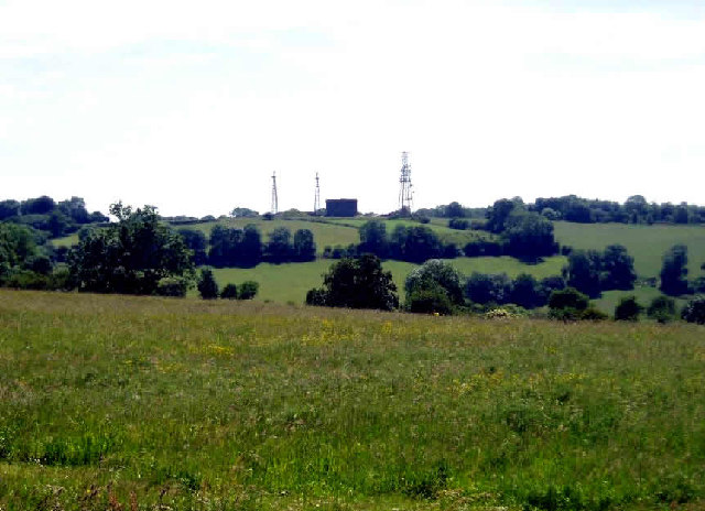
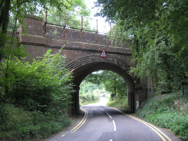
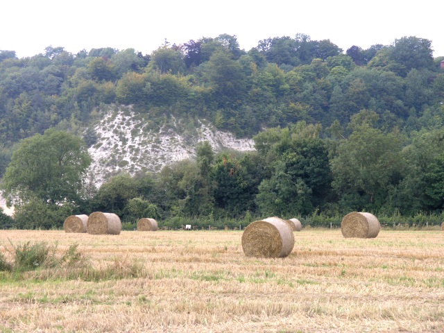
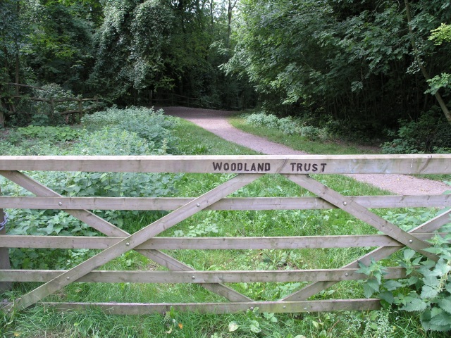
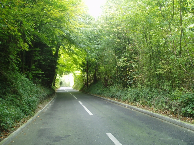
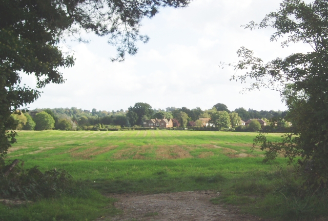
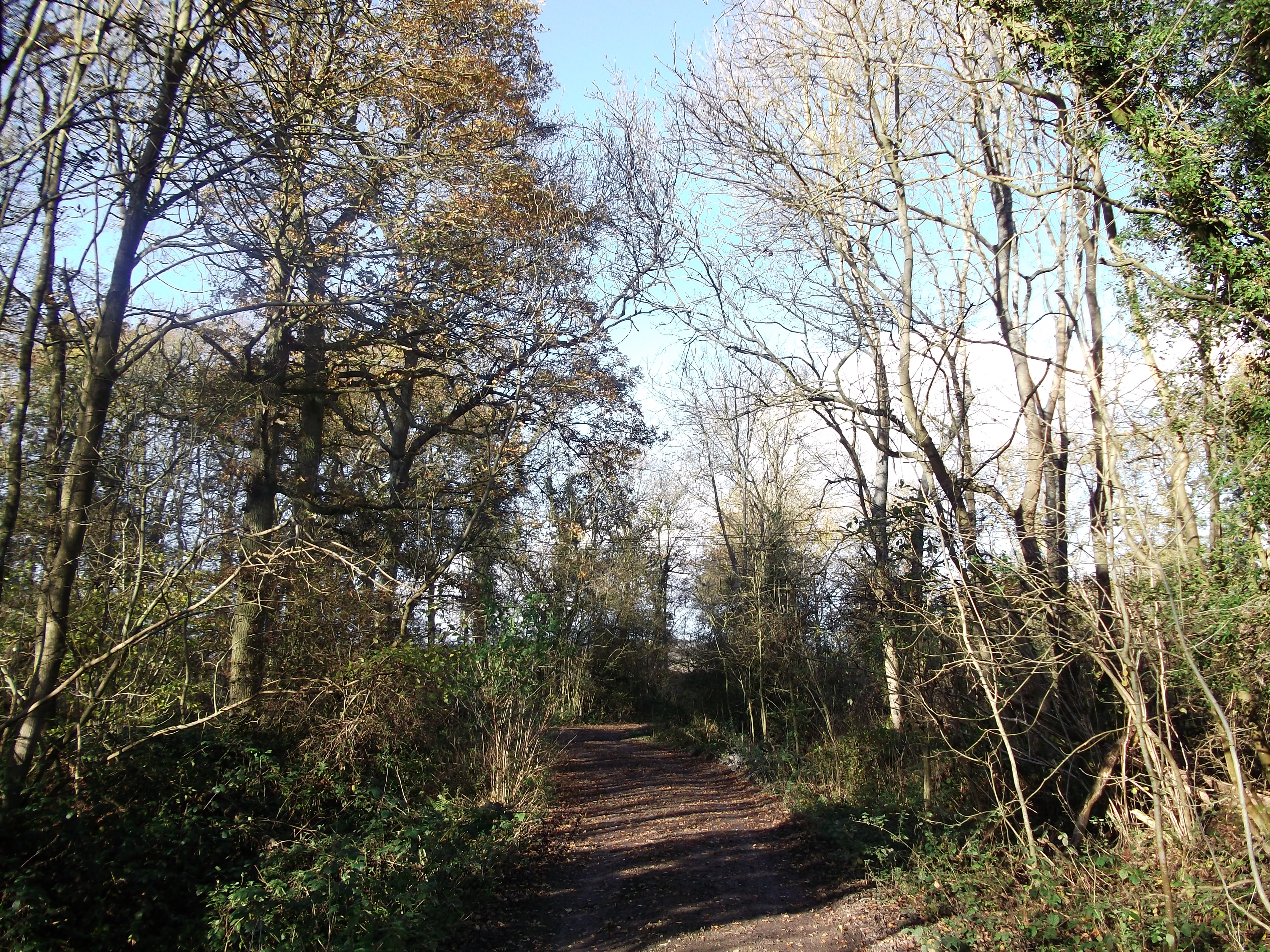
Five Acre Shaw is a woodland located in the county of Surrey, England. Covering an area of approximately five acres, the shaw is nestled within the picturesque countryside, surrounded by rolling hills and lush greenery. It is situated near the small village of Wood, providing a peaceful and tranquil setting for visitors.

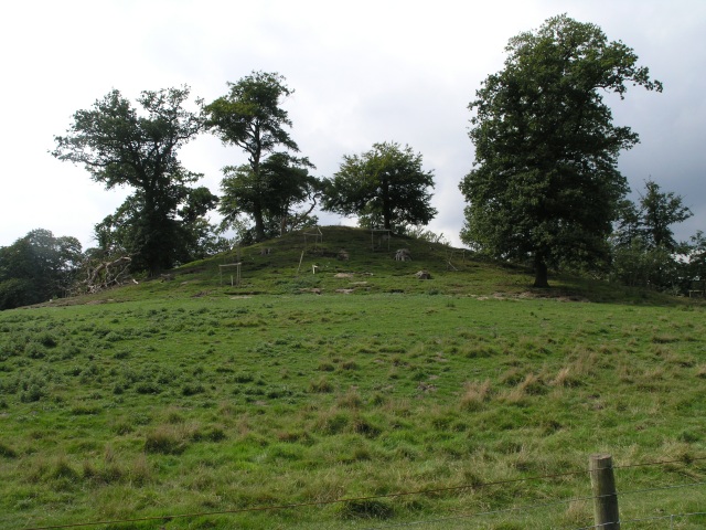
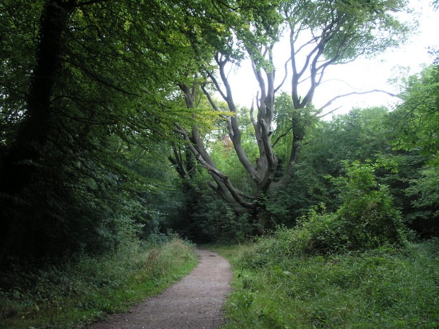
The woodland consists primarily of mature trees, predominantly oak and beech, creating a dense and diverse canopy that offers shade and shelter to various wildlife species. The forest floor is covered with a rich carpet of ferns and wildflowers, adding to the natural beauty of the area.

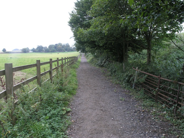
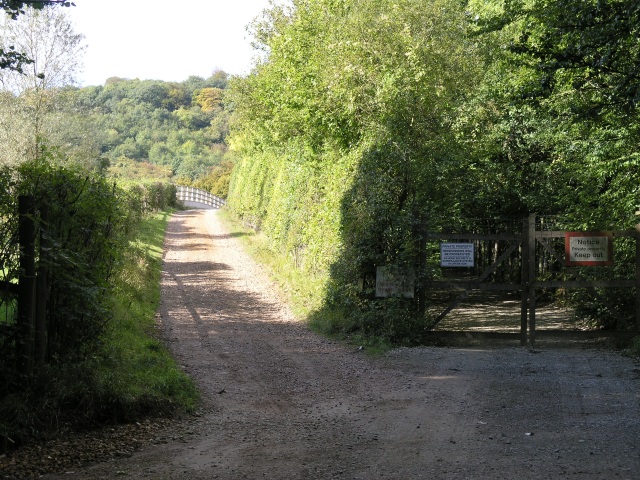
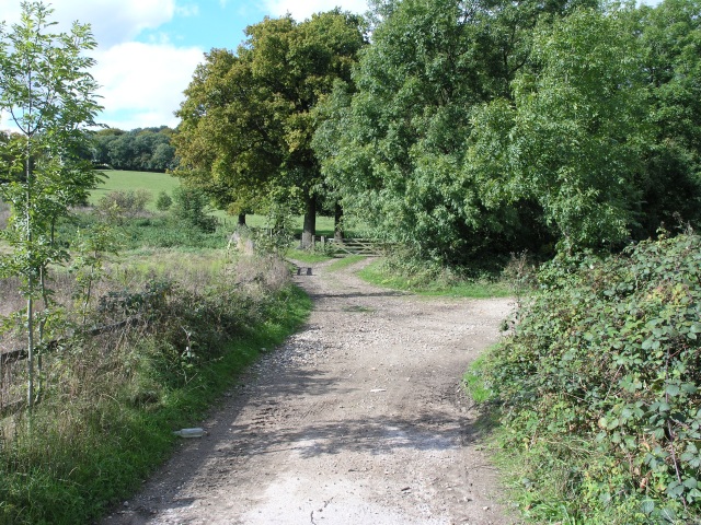
Five Acre Shaw is a popular destination for nature enthusiasts, offering a range of recreational activities such as walking, hiking, and birdwatching. The well-maintained trails and pathways allow visitors to explore the woodland while experiencing the sights and sounds of the surrounding wildlife.

The shaw is home to a variety of animal species, including deer, foxes, squirrels, and numerous bird species. Birdwatchers can spot woodpeckers, thrushes, and owls among the trees, making it an ideal location for observing and appreciating the local avian life.

The management of Five Acre Shaw is focused on preserving the natural habitat and promoting biodiversity. Regular conservation efforts are undertaken to maintain the health of the woodland and protect its inhabitants.

Overall, Five Acre Shaw offers a serene and idyllic retreat for nature lovers, providing a haven for wildlife and a peaceful escape from the hustle and bustle of everyday life.

If you have any feedback on the listing, please let us know in the comments section below.

Five Acre Shaw Images

Images are sourced within 2km of 51.263599/-0.018075349 or Grid Reference TQ3853. Thanks to Geograph Open Source API. All images are credited.

Radio masts and reservoir A familiar sight when driving south out of Warlingham down towards Oxted. The ridge of the North Downs has numerous radio masts, dating back to WWII.
Radio masts and reservoir
A familiar sight when driving south out of Warlingham down towards Oxted. The ridge of the North Downs has numerous radio masts, dating back to WWII.
Railway bridge over the A25 at Oxted The Oxted to East Grinstead line crosses the main road here, just close to Oxted Station
Railway bridge over the A25 at Oxted
The Oxted to East Grinstead line crosses the main road here, just close to Oxted Station
Public Bridleway, near the A25 A public bridleway that links two local roads.
Public Bridleway, near the A25
A public bridleway that links two local roads.
The Mount, near Oxted The Mount is a tumulus, an ancient burial mound near Oxted.
The Mount, near Oxted
The Mount is a tumulus, an ancient burial mound near Oxted.
Railway Bridge, near Oxted A railway bridge where the road passes under the railway on the approach to Oxted
Railway Bridge, near Oxted
A railway bridge where the road passes under the railway on the approach to Oxted
Hay Fields with the North Downs in the background The hay has been collected ready for storage.  In the background a quarry can be seen cutting into the North Downs.
Hay Fields with the North Downs in the background
The hay has been collected ready for storage. In the background a quarry can be seen cutting into the North Downs.
Quarry, looking down from the top Looking down from the edge of the quarry that occupies much of this square.
Quarry, looking down from the top
Looking down from the edge of the quarry that occupies much of this square.
North Downs Golf Course This seat commands a good view of several of the greens on the North Downs Golf Course
North Downs Golf Course
This seat commands a good view of several of the greens on the North Downs Golf Course
Woodland Footpath, part of the Woldingham Country Walk This footpath is managed by the Woodlands Trust and is about 5.5 miles of walk ending up in Woldingham station.
Woodland Footpath, part of the Woldingham Country Walk
This footpath is managed by the Woodlands Trust and is about 5.5 miles of walk ending up in Woldingham station.
Marlesdon Park footpath A public footpath that runs through Marlesdon Park.  Marlesdon Park was a barren stretch of land until Sir Robert Claydon, the Lord Mayer of London (1679-80) built his home and estate there, planting many trees.
Marlesdon Park footpath
A public footpath that runs through Marlesdon Park. Marlesdon Park was a barren stretch of land until Sir Robert Claydon, the Lord Mayer of London (1679-80) built his home and estate there, planting many trees.
Radio aerials and water reservoir The Woldingham Water Reservoir is a landmark from all around.
Radio aerials and water reservoir
The Woldingham Water Reservoir is a landmark from all around.
Narrow steep road past the quarry The road allows you to descend from the north Downs at Woldingham to Oxted
Narrow steep road past the quarry
The road allows you to descend from the north Downs at Woldingham to Oxted
Towards Oxted At the junction of Chalk Pit Road with Barrow Green Road, you can see over a field towards Oxted.
Towards Oxted
At the junction of Chalk Pit Road with Barrow Green Road, you can see over a field towards Oxted.
Country bridleway with M25 bridge in the distance This bridleway runs through the land of Barrow Green Court.  The residents definitely don't want unwanted visitors judging by the multiple signs and security features.  In the distance, the bridlepath can be seen crossing the M25.
Country bridleway with M25 bridge in the distance
This bridleway runs through the land of Barrow Green Court. The residents definitely don't want unwanted visitors judging by the multiple signs and security features. In the distance, the bridlepath can be seen crossing the M25.
Parting of the ways After crossing the M25, this bridleway parts into two.  A nice rural looking scene.  In reality accompanied by the roar of traffic from the M25.
Parting of the ways
After crossing the M25, this bridleway parts into two. A nice rural looking scene. In reality accompanied by the roar of traffic from the M25.
St. Mary the Virgin, Oxted and Cemetery St. Mary's, Oxted was built in stages, with the earliest section being built over 900 years ago.  It has quite a large cemetery, pictured here.
St. Mary the Virgin, Oxted and Cemetery
St. Mary's, Oxted was built in stages, with the earliest section being built over 900 years ago. It has quite a large cemetery, pictured here.
St Agatha's Church, Woldingham, Surrey The ancient parish church of Woldingham
St Agatha's Church, Woldingham, Surrey
The ancient parish church of Woldingham
Electric, diesel and gas A new diesel train and an old electric train at Oxted station together with a large gas holder.
Electric, diesel and gas
A new diesel train and an old electric train at Oxted station together with a large gas holder.
Show me another place!

Five Acre Shaw is located at Grid Ref: TQ3853 (Lat: 51.263599, Lng: -0.018075349)

Administrative County: Surrey

District: Tandridge

Police Authority: Surrey

What 3 Words

///spot.float.races. Near Oxted, Surrey

Related Wikis

Barrow Green Court

Barrow Green Court is a Grade I listed house near Oxted, Surrey, England.The house was built in the early-17th century, with mid-18th century alterations...

All Saints Church, Oxted

All Saints Church is a Roman Catholic Parish church in Oxted, Surrey. Building work on the church started in 1913 and was delayed by World War I. Aspects...

Oxted railway station

Oxted railway station is on the Oxted line in southern England, serving the commuter town of Oxted, Surrey. It is 20 miles 25 chains (20.31 miles, 32.69...

Oxted

Oxted is a town and civil parish in the Tandridge district of Surrey, England, at the foot of the North Downs. It is 9 miles (14 km) south south-east of...

Oxted School

Oxted School is a coeducational secondary school and sixth form located in the English town of Oxted, Surrey. It was opened in 1929 as the first mixed...

Titsey Woods

Titsey Woods is a 45.3-hectare (112-acre) biological Site of Special Scientific Interest north-west of Oxted in Surrey.This site is composed of wet semi...

Godstone Rural District

Godstone Rural District was a rural district in Surrey, England from 1894 to 1974, covering an area in the south-east of the county. == Origins == The...

Tandridge District

Tandridge is a local government district in east Surrey, England. Its council is based in Oxted, although the largest settlement is Caterham; other notable...

Nearby Amenities

Located within 500m of 51.263599,-0.018075349
Post Box
Collection Times: Mo-Fr 09:00; Sa 07:00
Operator: Royal Mail
Operator Wikidata: Q638098
Post Box Design: type_b
Post Box Type: pillar
Ref: RH8 280D
Royal Cypher: GVIR
Royal Cypher Wikidata: Q33102169
Lat/Long: 51.2634247/-0.0130631
Man Made: tower
Tower Type: communication
Lat/Long: 51.2663271/-0.0232529
Telephone
Booth: KX100
Covered: booth
Lat/Long: 51.2634366/-0.0131539
Bus Stop
Hail & Ride Chalkpit Wood
Naptan AtcoCode: 40004410814D
Naptan NaptanCode: surdtawg
Physically Present: no
Public Transport: platform
Wheelchair: yes
Lat/Long: 51.265147/-0.0122225
Post Box
Collection Times: Mo-Fr 09:00; Sa 07:00
Operator: Royal Mail
Post Box Mounting: pier
Post Box Type: lamp
Ref: RH8 176D
Royal Cypher: EIIR
Royal Cypher Wikidata: Q33102113
Lat/Long: 51.2649775/-0.0163816
Post Box
Collection Times: Mo-Fr 09:00; Sa 07:00
Operator: Royal Mail
Post Box Type: pillar
Ref: RH8 337D
Royal Cypher: EIIR
Royal Cypher Wikidata: Q33102113
Lat/Long: 51.265173/-0.0125487
The data included in this document is from www.openstreetmap.org. The data is made available under ODbL.

Have you been to Five Acre Shaw?

Leave your review of Five Acre Shaw below (or comments, questions and feedback).