Furze Wood

Wood, Forest in Sussex Mid Sussex

England

Furze Wood

Path in Big Wood, Bedelands Farm A local nature reserve.
Path in Big Wood, Bedelands Farm Credit: Robin Webster

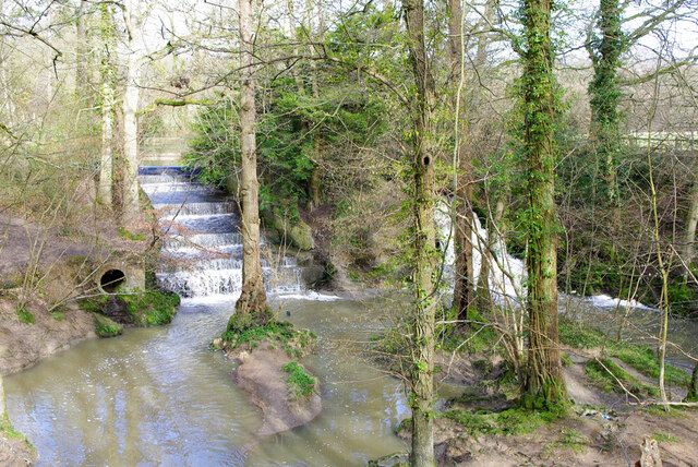
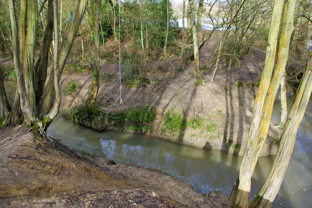
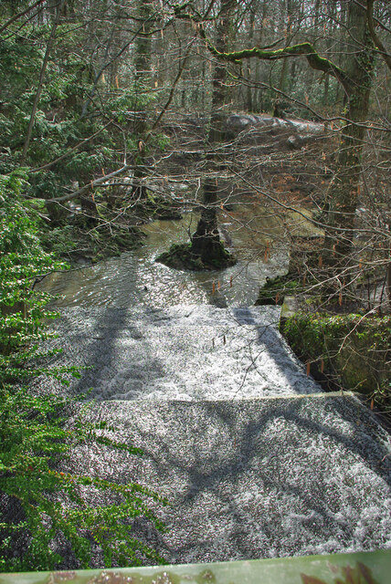
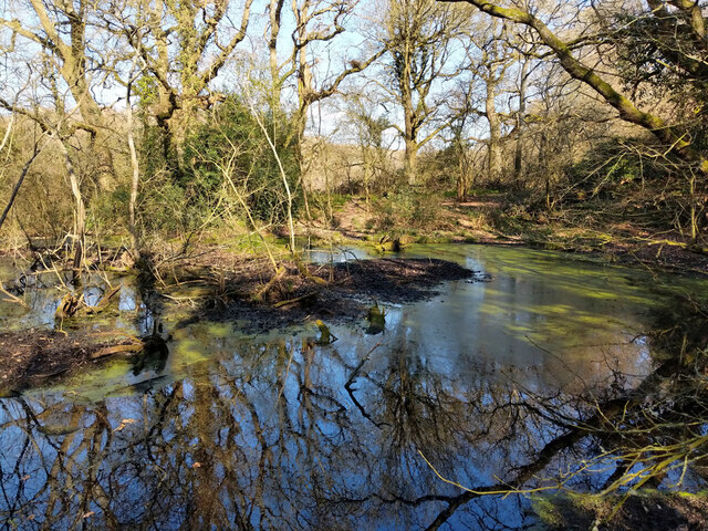
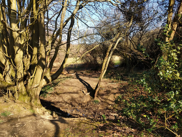
Furze Wood is a picturesque woodland located in Sussex, England. This enchanting forest covers an area of approximately 150 acres and is known for its diverse range of flora and fauna. The wood is named after the vibrant yellow gorse bushes, also known as furze, which are scattered throughout the area, adding a splash of color to the landscape.

The wood is predominantly made up of deciduous trees such as oak, beech, and birch, which provide a dense canopy and create a tranquil atmosphere. The forest floor is covered in a thick layer of moss and ferns, adding to the natural beauty of the woodland. Numerous walking trails wind their way through the wood, offering visitors the opportunity to explore its hidden gems.

Furze Wood is home to a variety of wildlife, including deer, badgers, foxes, and a wide range of bird species. Birdwatchers can often spot woodpeckers, owls, and various songbirds flitting amongst the treetops. The wood is also a haven for butterfly enthusiasts, with species such as the orange tip and silver-washed fritillary gracing the area during the warmer months.

The wood is managed by a local conservation group, who work tirelessly to preserve its natural beauty and protect its inhabitants. As a result, the woodland remains largely untouched by human intervention, allowing visitors to experience a true sense of tranquility and escape from the hustle and bustle of daily life.

Overall, Furze Wood is a hidden gem in Sussex, offering visitors the chance to immerse themselves in nature and enjoy the beauty of a traditional English woodland.

If you have any feedback on the listing, please let us know in the comments section below.

Furze Wood Images

Images are sourced within 2km of 50.981195/-0.10309728 or Grid Reference TQ3321. Thanks to Geograph Open Source API. All images are credited.

Path in Big Wood, Bedelands Farm A local nature reserve.
Path in Big Wood, Bedelands Farm
A local nature reserve.
Spillways, Valebridge Pond On the eastern branch of the River Adur.
Spillways, Valebridge Pond
On the eastern branch of the River Adur.
Blue rope hanging over River Adur Standard equipment for such places.
Blue rope hanging over River Adur
Standard equipment for such places.
Spillway, Valebridge Pond On the eastern branch of the River Adur.
Spillway, Valebridge Pond
On the eastern branch of the River Adur.
Pond by Freek's Lane Probably dug for iron - Freek's Lane crosses a clay-ironstone seam about here.
Pond by Freek's Lane
Probably dug for iron - Freek's Lane crosses a clay-ironstone seam about here.
Pond by Freek's Lane Probably dug for iron - Freek's Lane crosses a clay-ironstone seam about here.
Pond by Freek's Lane
Probably dug for iron - Freek's Lane crosses a clay-ironstone seam about here.
Pond by Freek's Lane Probably dug for iron - Freek's Lane crosses a clay-ironstone seam about here.
Pond by Freek's Lane
Probably dug for iron - Freek's Lane crosses a clay-ironstone seam about here.
Glimpse of a field east of Freek's Lane
Freek's Lane heading north It is footpath 96CR and very much a footpath rather than a lane here.
Freek's Lane heading north
It is footpath 96CR and very much a footpath rather than a lane here.
Freek's Lane heading north It is footpath 96CR and very much a footpath rather than a lane here.
Freek's Lane heading north
It is footpath 96CR and very much a footpath rather than a lane here.
Freek's Lane heading north It is footpath 96CR and very much a footpath rather than a lane here.
Freek's Lane heading north
It is footpath 96CR and very much a footpath rather than a lane here.
Woodland east of Freek's Lane
Woodland drainage running down to River Adur To the east of Freek's Lane.
Woodland drainage running down to River Adur
To the east of Freek's Lane.
Footpath junction near River Adur Freek's Lane, if it is still called that, continues straight on, changing footpath number from 96CR to 94CR. Right is 95CR, following the Adur valley up to the Valebridge pond bay.
Footpath junction near River Adur
Freek's Lane, if it is still called that, continues straight on, changing footpath number from 96CR to 94CR. Right is 95CR, following the Adur valley up to the Valebridge pond bay.
Footpath 94CR heading north This might still be called Freek's Lane, the route certainly is behind the camera, that part has reference 96CR. Right is 95CR, following the Adur valley up to the Valebridge pond bay.
Footpath 94CR heading north
This might still be called Freek's Lane, the route certainly is behind the camera, that part has reference 96CR. Right is 95CR, following the Adur valley up to the Valebridge pond bay.
By the River Adur The river, not very big, is over by the central tree.
By the River Adur
The river, not very big, is over by the central tree.
Footpath 95CR towards Valebridge Pond Or an approximation to it, both my GPS devices showed something somewhat north of the mapped route.
Footpath 95CR towards Valebridge Pond
Or an approximation to it, both my GPS devices showed something somewhat north of the mapped route.
Show me another place!

Furze Wood is located at Grid Ref: TQ3321 (Lat: 50.981195, Lng: -0.10309728)

Administrative County: West Sussex

District: Mid Sussex

Police Authority: Sussex

What 3 Words

///vest.rescue.taped. Near Haywards Heath, West Sussex

Related Wikis

St Francis Rangers F.C.

St Francis Rangers F.C. is a football club based in Haywards Heath, England. They are currently members of the Southern Combination Division Two and play...

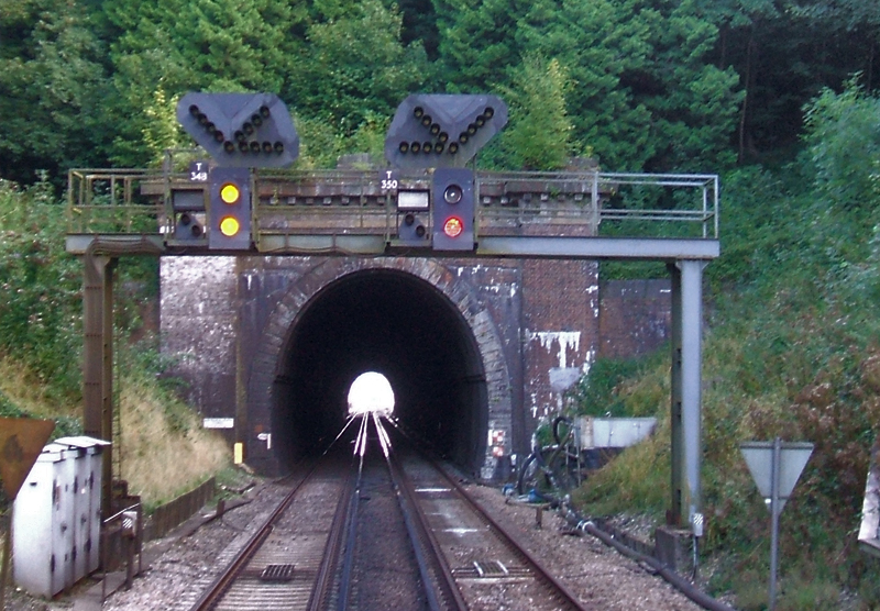
Haywards Heath Tunnel

Haywards Heath tunnel, also known as Folly Hill tunnel, is a railway tunnel on the Brighton Main Line between Haywards Heath and Wivelsfield. It is 249...

St Francis Hospital, Haywards Heath

St Francis Hospital was a mental health facility in Haywards Heath, West Sussex, England. The main building survives and is a Grade II listed building...

Ashenground and Bolnore Woods

Ashenground and Bolnore Woods is a 14.4-hectare (36-acre) Local Nature Reserve in Haywards Heath in West Sussex. It is owned and managed by Mid Sussex...

Jireh Chapel, Haywards Heath

The Jireh Chapel is a Strict Baptist place of worship in the town of Haywards Heath in the English county of West Sussex. The chapel was built in 1879...

Princess Royal Hospital, Haywards Heath

The Princess Royal Hospital, also known as PRH, is an acute, teaching, general hospital located in Haywards Heath, West Sussex, England. It is the main...

Wivelsfield

Wivelsfield () village and the larger adjacent village of Wivelsfield Green are the core of the civil parish of Wivelsfield in the Lewes District of East...

Bedelands Farm Nature Reserve

Bedelands Farm Nature Reserve is a 35.2-hectare (87-acre) Local Nature Reserve on the northern outskirts of Burgess Hill in West Sussex. It is owned and...

Nearby Amenities

Located within 500m of 50.981195,-0.10309728
Post Box
Brand: Royal Mail
Brand Wikidata: Q638098
Brand Wikipedia: en:Royal Mail
Operator: Royal Mail
Operator Wikidata: Q638098
Post Box Type: wall
Ref: RH16 21
Royal Cypher: EIIR
Royal Cypher Wikidata: Q33102113
Lat/Long: 50.98177/-0.0970733
Turning Loop
Lat/Long: 50.9831339/-0.0996035
Pub
Fox and Hounds
Brand: Ember Inns
Brand Wikidata: Q116272278
Contact Website: https://www.emberinns.co.uk/nationalsearch/southeast/the-fox-and-hounds-fox-hill
Lat/Long: 50.981142/-0.0966752
Bus Stop
Fox and Hounds
Bus: yes
Naptan AtcoCode: 4400EG0015
Naptan Bearing: S
Naptan CommonName: Fox and Hounds
Naptan Indicator: Outside Fox and Hounds PH
Naptan Landmark: Hurstwood Lane
Naptan NaptanCode: wsxampdp
Naptan Street: Fox Hill
Naptan Verified: yes
Public Transport: platform
Source: naptan_import
Lat/Long: 50.9813663/-0.0965663
Bus Stop
Weald Rise
Bus: yes
Naptan AtcoCode: 4400EG0016
Naptan Bearing: N
Naptan CommonName: Weald Rise
Naptan Indicator: adj Weald Rise
Naptan Landmark: Weald Rise
Naptan NaptanCode: wsxampdt
Naptan Street: Fox Hill
Naptan Verified: no
Public Transport: platform
Source: naptan_import
Lat/Long: 50.9840886/-0.0990675
Fox Hill
Is In: Haywards Heath;West Sussex;England;United Kingdom
Place: neighbourhood
Lat/Long: 50.9835495/-0.0998006
Addr City: Haywards Heath
Addr Housename: Scrase Hill Terrace
Addr Postcode: RH16 4QY
Addr Street: Fox Hill
Lat/Long: 50.9815526/-0.0971921
Barrier: stile
Stile: squeezer
Lat/Long: 50.9805607/-0.1097944
The data included in this document is from www.openstreetmap.org. The data is made available under ODbL.

Have you been to Furze Wood?

Leave your review of Furze Wood below (or comments, questions and feedback).