Ash Plantation

Wood, Forest in Cambridgeshire South Cambridgeshire

England

Ash Plantation

Derelict building at Battle Gate This is at the end of the southern road out of Boxworth which can be driven down, but not beyond this point. The surrounding fields are on one of the highest parts of the clay 'uplands' (nearby spot height is 67m) which form the southern border of the Fens.
Derelict building at Battle Gate Credit: Sue Jones

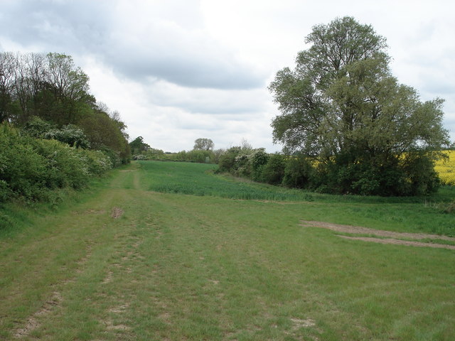
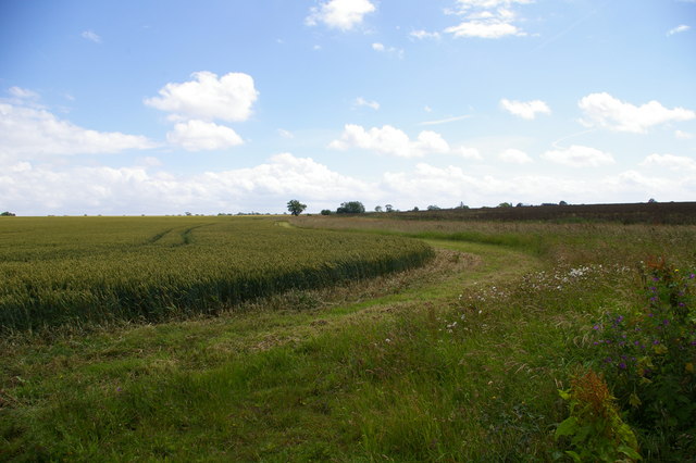
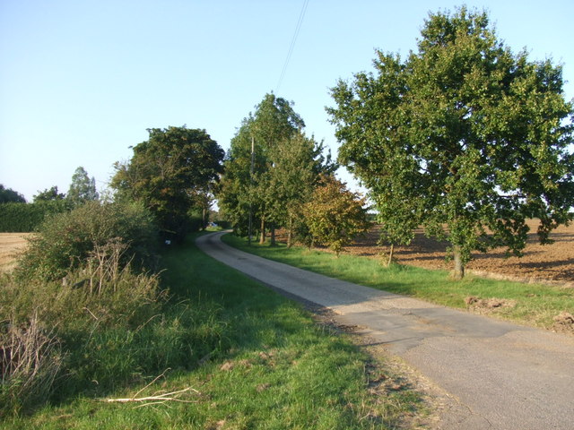
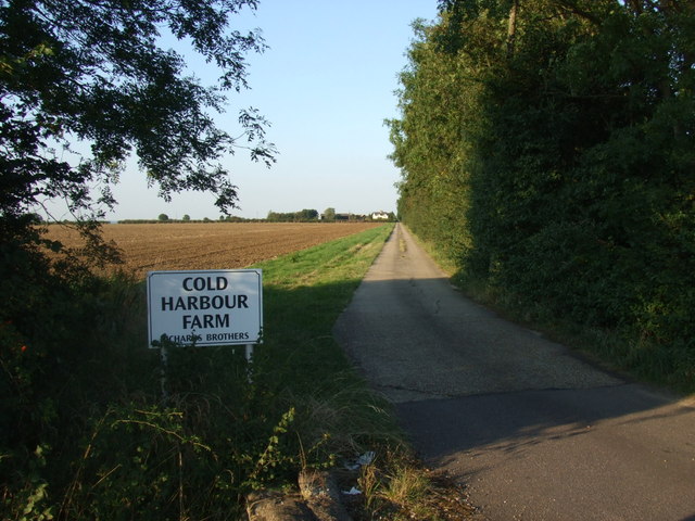
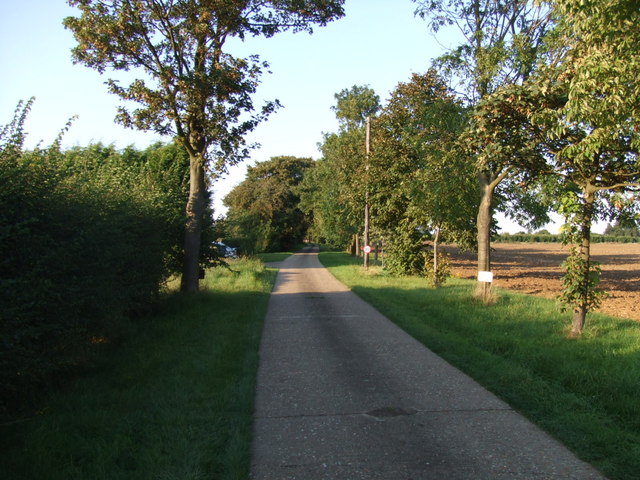
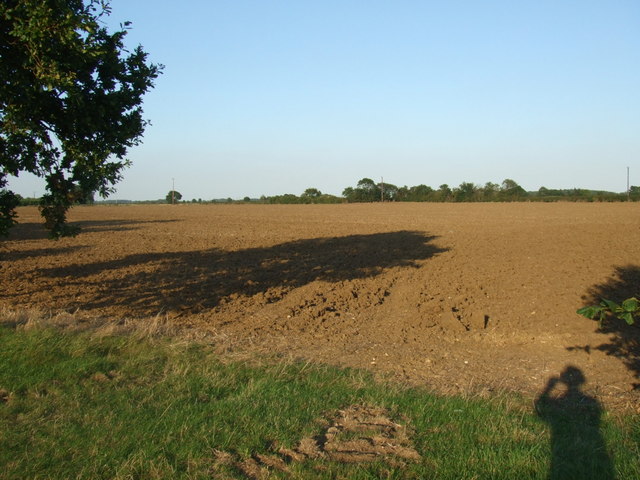
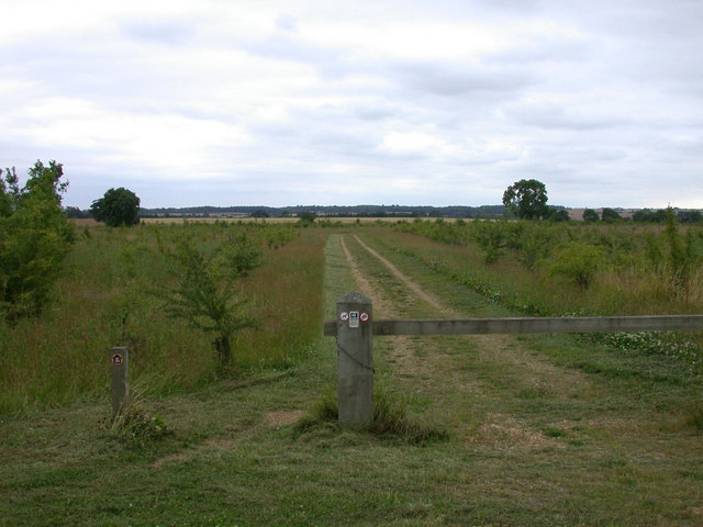
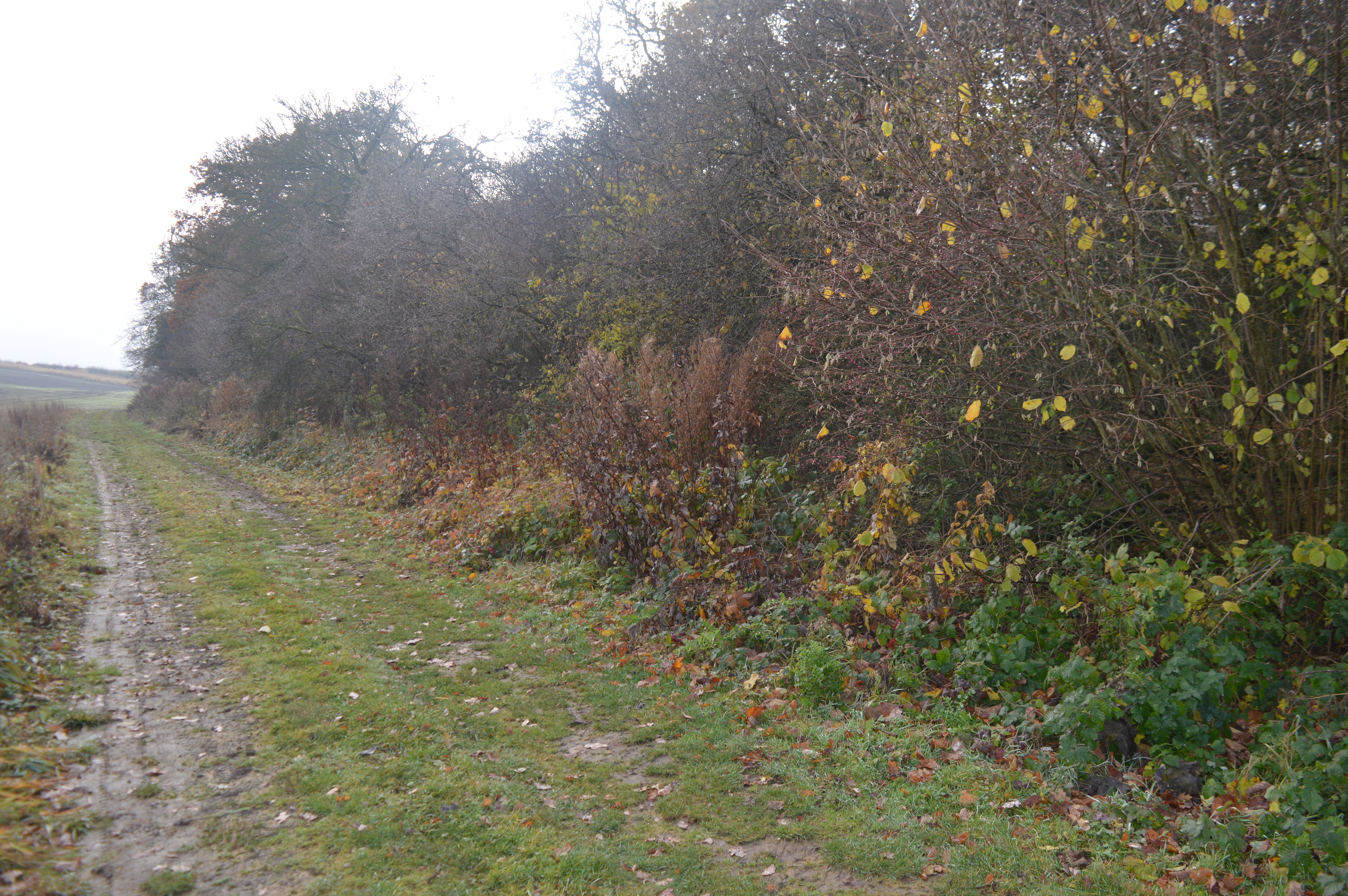
Ash Plantation is a picturesque woodland located in Cambridgeshire, England. Covering an area of approximately 100 acres, it is a popular destination for nature enthusiasts and hikers alike. The plantation is predominantly composed of ash trees, hence its name, which provide a dense canopy and create a serene atmosphere.

The forest boasts a diverse range of flora and fauna, making it a haven for wildlife. Visitors can expect to encounter various species of birds, such as woodpeckers and robins, as well as small mammals like rabbits and squirrels. The woodland floor is adorned with a vibrant carpet of wildflowers during the spring and summer months, adding bursts of color to the predominantly green landscape.

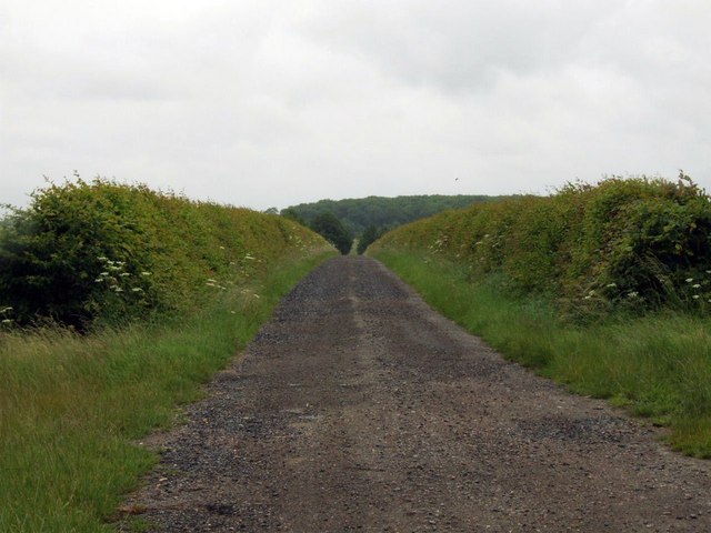
Trails and footpaths wind their way through the plantation, offering visitors the opportunity to explore the woodland and admire its natural beauty. The paths are well-maintained and suitable for all ages and fitness levels, making it an ideal destination for families and recreational walkers. Additionally, there are picnic areas and benches scattered throughout the woodland, providing a perfect spot for visitors to rest and enjoy a packed lunch amidst the tranquility of nature.

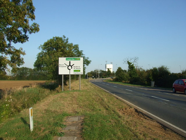
Ash Plantation is easily accessible, with ample parking available nearby. It is open to the public year-round, although the autumn months are particularly popular due to the stunning display of colors as the leaves change. Whether one seeks a peaceful stroll, a chance to observe wildlife, or simply a break from the hustle and bustle of everyday life, Ash Plantation offers a serene and enchanting escape into nature.

If you have any feedback on the listing, please let us know in the comments section below.

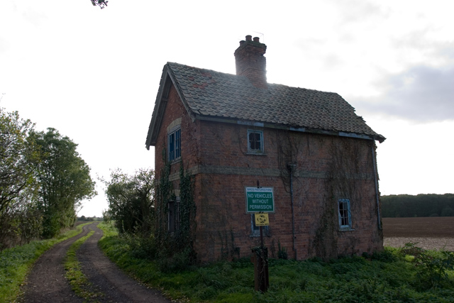
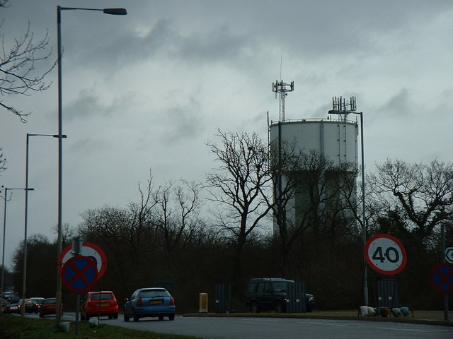
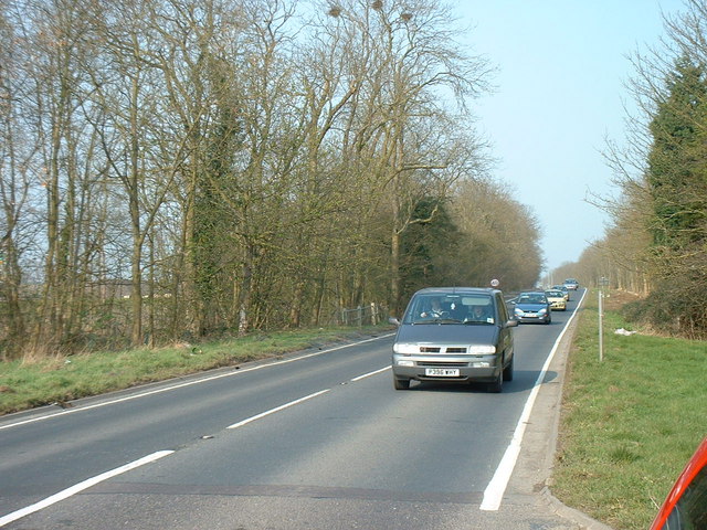
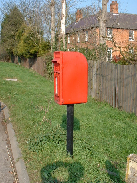
Ash Plantation Images

Images are sourced within 2km of 52.222941/-0.050629379 or Grid Reference TL3360. Thanks to Geograph Open Source API. All images are credited.

Derelict building at Battle Gate This is at the end of the southern road out of Boxworth which can be driven down, but not beyond this point. The surrounding fields are on one of the highest parts of the clay 'uplands' (nearby spot height is 67m) which form the southern border of the Fens.
Derelict building at Battle Gate
This is at the end of the southern road out of Boxworth which can be driven down, but not beyond this point. The surrounding fields are on one of the highest parts of the clay 'uplands' (nearby spot height is 67m) which form the southern border of the Fens.
Water Tower, St. Neots Road. This water tower is only just in square TL3160, but can be seen from the whole area.
Water Tower, St. Neots Road.
This water tower is only just in square TL3160, but can be seen from the whole area.
The old St. Neots Road This stretch of the old St. Neots Road near Cambourne, is soon to be replaced by the A428 dual carriageway.
The old St. Neots Road
This stretch of the old St. Neots Road near Cambourne, is soon to be replaced by the A428 dual carriageway.
St.Neots Road Postbox near New Inn Farm The odd shadow at the bottom of this photo is the photographer!
Postbox No.CB23 276
This Postbox has been renamed Monks Drive Postbox and has the new postbox number of CB3 393
St.Neots Road Postbox near New Inn Farm
The odd shadow at the bottom of this photo is the photographer! Postbox No.CB23 276 This Postbox has been renamed Monks Drive Postbox and has the new postbox number of CB3 393
Farmland at Grange Farm, Knapwell Part of the RSPB's 'Hope Farm'.
Farmland at Grange Farm, Knapwell
Part of the RSPB's 'Hope Farm'.
Courses for horses Horse jumping practice ring at Bird's Pastures Farm, near Knapwell. The surface of the practice ring is made from chopped up car tyres. Very green.
Courses for horses
Horse jumping practice ring at Bird's Pastures Farm, near Knapwell. The surface of the practice ring is made from chopped up car tyres. Very green.
Track to New Farm
Track to New Farm
Farm buildings at Wood farm
Farmland The edge of a wheat (I think) field near Bird's Pastures Farm.
Farmland
The edge of a wheat (I think) field near Bird's Pastures Farm.
Road bridge over the A428 This bridge takes traffic into Cambourne.
Road bridge over the A428
This bridge takes traffic into Cambourne.
Road sign to Boxworth Coldharbour Farm can be seen in the far distance.
Road sign to Boxworth
Coldharbour Farm can be seen in the far distance.
Public footpath sign to Knapwell
The lane to Lawn Farm
Lane to Cold Harbour Farm
Along the lane to Lawn Farm
View over ploughed field I make a shadow appearance in this field which makes up quite a lot of this grid square.
View over ploughed field
I make a shadow appearance in this field which makes up quite a lot of this grid square.
Road sign and water tower
Cambourne roundabout Cambourne has a series of roundabouts to negotiate when arriving from the North, this is the first.
Cambourne roundabout
Cambourne has a series of roundabouts to negotiate when arriving from the North, this is the first.
Show me another place!

Ash Plantation is located at Grid Ref: TL3360 (Lat: 52.222941, Lng: -0.050629379)

Administrative County: Cambridgeshire

District: South Cambridgeshire

Police Authority: Cambridgeshire

What 3 Words

///lecturing.tram.lottery. Near Cambourne, Cambridgeshire

Related Wikis

Cambourne Church

Cambourne Church is a "local ecumenical partnership" between the Church of England, Baptist Union of Great Britain, Methodist Church of Great Britain and...
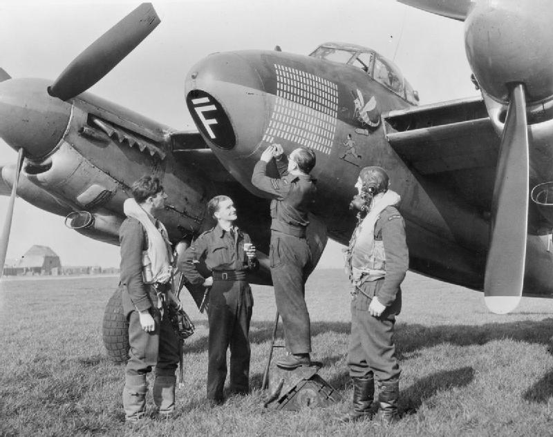
RAF Bourn

Royal Air Force Bourn or more simply RAF Bourn is a former Royal Air Force station located 2 miles (3.2 km) north of Bourn, Cambridgeshire and 6.9 miles...

Cambourne

Cambourne is a new settlement and civil parish in Cambridgeshire, England, in the district of South Cambridgeshire. It lies on the A428 road between Cambridge...

Bourn Airfield

Bourn Airport (IATA: n/a, ICAO: EGSN) is located 7 NM (13 km; 8.1 mi) west of Cambridge, Cambridgeshire, England. The airfield was originally constructed...

Cambourne Nature Reserve

Cambourne Nature Reserve is a 90 hectare nature reserve in Cambourne in Cambridgeshire. It is managed by the Wildlife Trust for Bedfordshire, Cambridgeshire...

Cambourne Village College

Cambourne Village College is a mixed secondary school located in Cambourne, Cambridgeshire, England. It is a free school that opened in 2013, and is part...

Elsworth Wood

Elsworth Wood is a 6.9-hectare (17-acre) biological Site of Special Scientific Interest between Cambourne and Elsworth in Cambridgeshire.This site has...

Childerley

Childerley, also known as Great Childerley and Little Childerly, was a small rural village in the county of Cambridgeshire in the East of England, United...

Nearby Amenities

Located within 500m of 52.222941,-0.050629379
Parking
Note: lay-by
Source: GPS
Lat/Long: 52.2212355/-0.050165
Parking
Source: GPS
Lat/Long: 52.2223856/-0.0536776
Bus Stop
Fixme: Redundant? (re: Naptan import)
Source: dictaphone
Lat/Long: 52.2216451/-0.0462377
Bus Stop
Broadway
Naptan AtcoCode: 0500SCAMB006
Naptan Bearing: W
Naptan BusStopType: CUS
Naptan CommonName: Broadway
Naptan Indicator: near
Naptan Landmark: Broadway
Naptan NaptanCode: cmbdtwgp
Naptan ShortCommonName: Broadway
Naptan Street: St Neots Road
Naptan Verified: no
Public Transport: platform
Source: naptan_import
Lat/Long: 52.221603/-0.0469713
Bus Stop
Broadway
Naptan AtcoCode: 0500SKNAP002
Naptan Bearing: E
Naptan CommonName: Broadway
Naptan Indicator: opp
Naptan Landmark: Broadway
Naptan NaptanCode: cmbgagam
Naptan ShortCommonName: Broadway
Naptan Street: St Neots Road
Naptan Verified: no
Public Transport: platform
Source: naptan_import
Lat/Long: 52.2215037/-0.0453176
Addr City: Cambridge
Addr Country: GB
Addr Housenumber: 6
Addr Locality: Upper Cambourne
Addr Postcode: CB23 6ED
Addr Street: Hudson Road
Addr Town: Cambourne
Lat/Long: 52.2197131/-0.0513846
Phone
Emergency: phone
Lat/Long: 52.2211813/-0.0503772
Phone
Emergency: phone
Lat/Long: 52.222353/-0.0535032
Turning Circle
Lat/Long: 52.219241/-0.0533314
Entrance: main
Lat/Long: 52.2196752/-0.0514702
Turning Circle
Lat/Long: 52.2188292/-0.0522106
Bus Stop
Hurricane Way
Bench: no
Bin: yes
Lit: yes
Naptan AtcoCode: 0500SCAMB023
Naptan Bearing: E
Naptan CommonName: Hurricane Way
Naptan Indicator: opp
Naptan Landmark: Jurricane Way
Naptan NaptanCode: CMBGMJAD
Naptan ShortCommonName: Hurricane Way
Naptan Street: Sterling Way
Public Transport: platform
Shelter: no
Source: naptan;make_stop.py;survey
Tactile Paving: no
Lat/Long: 52.2201135/-0.0541058
Give Way
Lat/Long: 52.2214844/-0.0462936
Generator Method: photovoltaic
Generator Output Electricity: yes
Generator Source: solar
Generator Type: solar_photovoltaic_panel
Location: roof
Power: generator
Lat/Long: 52.2193832/-0.0535148
Generator Method: photovoltaic
Generator Output Electricity: yes
Generator Source: solar
Generator Type: solar_photovoltaic_panel
Location: roof
Power: generator
Lat/Long: 52.2194879/-0.0534772
Generator Method: photovoltaic
Generator Output Electricity: yes
Generator Source: solar
Generator Type: solar_photovoltaic_panel
Location: roof
Power: generator
Lat/Long: 52.2193327/-0.0529026
Generator Method: photovoltaic
Generator Output Electricity: yes
Generator Source: solar
Generator Type: solar_photovoltaic_panel
Location: roof
Power: generator
Lat/Long: 52.2193483/-0.0529924
Generator Method: photovoltaic
Generator Output Electricity: yes
Generator Source: solar
Generator Type: solar_photovoltaic_panel
Location: roof
Power: generator
Lat/Long: 52.2193721/-0.0531547
Generator Method: photovoltaic
Generator Output Electricity: yes
Generator Source: solar
Generator Type: solar_photovoltaic_panel
Location: roof
Power: generator
Lat/Long: 52.2199131/-0.0543871
Generator Method: photovoltaic
Generator Output Electricity: yes
Generator Source: solar
Generator Type: solar_photovoltaic_panel
Location: roof
Power: generator
Lat/Long: 52.2195003/-0.0541243
Generator Method: photovoltaic
Generator Output Electricity: yes
Generator Source: solar
Generator Type: solar_photovoltaic_panel
Location: roof
Power: generator
Lat/Long: 52.2196005/-0.0541109
Generator Method: photovoltaic
Generator Output Electricity: yes
Generator Source: solar
Generator Type: solar_photovoltaic_panel
Location: roof
Power: generator
Lat/Long: 52.219695/-0.0542986
Generator Method: photovoltaic
Generator Output Electricity: yes
Generator Source: solar
Generator Type: solar_photovoltaic_panel
Location: roof
Power: generator
Lat/Long: 52.2197558/-0.054308
Generator Method: photovoltaic
Generator Output Electricity: yes
Generator Source: solar
Generator Type: solar_photovoltaic_panel
Location: roof
Power: generator
Lat/Long: 52.219937/-0.0541572
Generator Method: photovoltaic
Generator Output Electricity: yes
Generator Source: solar
Generator Type: solar_photovoltaic_panel
Location: roof
Power: generator
Lat/Long: 52.2199423/-0.0538654
Generator Method: photovoltaic
Generator Output Electricity: yes
Generator Source: solar
Generator Type: solar_photovoltaic_panel
Location: roof
Power: generator
Lat/Long: 52.2196515/-0.0535282
Generator Method: photovoltaic
Generator Output Electricity: yes
Generator Source: solar
Generator Type: solar_photovoltaic_panel
Location: roof
Power: generator
Lat/Long: 52.2196745/-0.0537012
Generator Method: photovoltaic
Generator Output Electricity: yes
Generator Source: solar
Generator Type: solar_photovoltaic_panel
Location: roof
Power: generator
Lat/Long: 52.2196675/-0.0536516
Generator Method: photovoltaic
Generator Output Electricity: yes
Generator Source: solar
Generator Type: solar_photovoltaic_panel
Location: roof
Power: generator
Lat/Long: 52.2196642/-0.053612
Generator Method: photovoltaic
Generator Output Electricity: yes
Generator Source: solar
Generator Type: solar_photovoltaic_panel
Location: roof
Power: generator
Lat/Long: 52.2196564/-0.053571
Generator Method: photovoltaic
Generator Output Electricity: yes
Generator Source: solar
Generator Type: solar_photovoltaic_panel
Location: roof
Power: generator
Lat/Long: 52.2196445/-0.0534718
Generator Method: photovoltaic
Generator Output Electricity: yes
Generator Source: solar
Generator Type: solar_photovoltaic_panel
Location: roof
Power: generator
Lat/Long: 52.2199292/-0.0536911
Generator Method: photovoltaic
Generator Output Electricity: yes
Generator Source: solar
Generator Type: solar_photovoltaic_panel
Location: roof
Power: generator
Lat/Long: 52.2199094/-0.0535168
Generator Method: photovoltaic
Generator Output Electricity: yes
Generator Source: solar
Generator Type: solar_photovoltaic_panel
Location: roof
Power: generator
Lat/Long: 52.2198856/-0.0533304
Generator Method: photovoltaic
Generator Output Electricity: yes
Generator Source: solar
Generator Type: solar_photovoltaic_panel
Location: roof
Power: generator
Lat/Long: 52.2198594/-0.05316
Generator Method: photovoltaic
Generator Output Electricity: yes
Generator Source: solar
Generator Type: solar_photovoltaic_panel
Location: roof
Power: generator
Lat/Long: 52.219534/-0.0528529
Generator Method: photovoltaic
Generator Output Electricity: yes
Generator Source: solar
Generator Type: solar_photovoltaic_panel
Location: roof
Power: generator
Lat/Long: 52.2197517/-0.0528127
Generator Method: photovoltaic
Generator Output Electricity: yes
Generator Source: solar
Generator Type: solar_photovoltaic_panel
Location: roof
Power: generator
Lat/Long: 52.2198371/-0.0529656
Generator Method: photovoltaic
Generator Output Electricity: yes
Generator Source: solar
Generator Type: solar_photovoltaic_panel
Location: roof
Power: generator
Lat/Long: 52.2195718/-0.0530058
Generator Method: photovoltaic
Generator Output Electricity: yes
Generator Source: solar
Generator Type: solar_photovoltaic_panel
Location: roof
Power: generator
Lat/Long: 52.219587/-0.0531265
Generator Method: photovoltaic
Generator Output Electricity: yes
Generator Source: solar
Generator Type: solar_photovoltaic_panel
Location: roof
Power: generator
Lat/Long: 52.2196194/-0.0533464
Generator Method: photovoltaic
Generator Output Electricity: yes
Generator Source: solar
Generator Type: solar_photovoltaic_panel
Location: roof
Power: generator
Lat/Long: 52.2196646/-0.053325
Generator Method: photovoltaic
Generator Output Electricity: yes
Generator Source: solar
Generator Type: solar_photovoltaic_panel
Location: roof
Power: generator
Lat/Long: 52.2194666/-0.0514555
Generator Method: photovoltaic
Generator Output Electricity: yes
Generator Source: solar
Generator Type: solar_photovoltaic_panel
Location: roof
Power: generator
Lat/Long: 52.219603/-0.0503705
Generator Method: photovoltaic
Generator Output Electricity: yes
Generator Source: solar
Generator Type: solar_photovoltaic_panel
Location: roof
Power: generator
Lat/Long: 52.2190179/-0.0505623
Generator Method: photovoltaic
Generator Output Electricity: yes
Generator Source: solar
Generator Type: solar_photovoltaic_panel
Location: roof
Power: generator
Lat/Long: 52.2193179/-0.0500125
Generator Method: photovoltaic
Generator Output Electricity: yes
Generator Source: solar
Generator Type: solar_photovoltaic_panel
Location: roof
Power: generator
Lat/Long: 52.2194198/-0.049987
Generator Method: photovoltaic
Generator Output Electricity: yes
Generator Source: solar
Generator Type: solar_photovoltaic_panel
Location: roof
Power: generator
Lat/Long: 52.2189021/-0.0498046
Generator Method: photovoltaic
Generator Output Electricity: yes
Generator Source: solar
Generator Type: solar_photovoltaic_panel
Location: roof
Power: generator
Lat/Long: 52.2188586/-0.0494573
Generator Method: photovoltaic
Generator Output Electricity: yes
Generator Source: solar
Generator Type: solar_photovoltaic_panel
Location: roof
Power: generator
Lat/Long: 52.2190459/-0.0491917
Generator Method: photovoltaic
Generator Output Electricity: yes
Generator Source: solar
Generator Type: solar_photovoltaic_panel
Location: roof
Power: generator
Lat/Long: 52.219338/-0.0480015
Generator Method: photovoltaic
Generator Output Electricity: yes
Generator Source: solar
Generator Type: solar_photovoltaic_panel
Location: roof
Power: generator
Lat/Long: 52.220805/-0.0559428
Addr City: Cambridge
Addr Country: GB
Addr Housenumber: 12
Addr Locality: Upper Cambourne
Addr Postcode: CB23 6ED
Addr Street: Hudson Road
Addr Town: Cambourne
Lat/Long: 52.2196087/-0.051426
Entrance: main
Lat/Long: 52.2196638/-0.0537226
Entrance: yes
Lat/Long: 52.2197406/-0.0536958
Entrance: yes
Lat/Long: 52.2196991/-0.0534081
Entrance: main
Lat/Long: 52.2196215/-0.053445
Addr City: Cambridge
Addr Country: GB
Addr Housenumber: 19
Addr Locality: Upper Cambourne
Addr Postcode: CB23 6DG
Addr Street: Hurricane Way
Addr Town: Cambourne
Lat/Long: 52.2196469/-0.0533418
Addr City: Cambridge
Addr Country: GB
Addr Housenumber: 11
Addr Locality: Upper Cambourne
Addr Postcode: CB23 6DG
Addr Street: Hurricane Way
Addr Town: Cambourne
Lat/Long: 52.2196716/-0.0535215
Addr City: Cambridge
Addr Country: GB
Addr Housenumber: 9
Addr Locality: Upper Cambourne
Addr Postcode: CB23 6DG
Addr Street: Hurricane Way
Addr Town: Cambourne
Lat/Long: 52.2196888/-0.0536039
Addr City: Cambridge
Addr Country: GB
Addr Housenumber: 1
Addr Locality: Upper Cambourne
Addr Postcode: CB23 6DG
Addr Street: Hurricane Way
Addr Town: Cambourne
Lat/Long: 52.2197127/-0.0537716
Generator Method: photovoltaic
Generator Output Electricity: yes
Generator Source: solar
Generator Type: solar_photovoltaic_panel
Location: roof
Power: generator
Lat/Long: 52.2196872/-0.0538138
Generator Method: photovoltaic
Generator Output Electricity: yes
Generator Source: solar
Generator Type: solar_photovoltaic_panel
Location: roof
Power: generator
Lat/Long: 52.2197291/-0.0537991
Generator Method: photovoltaic
Generator Output Electricity: yes
Generator Source: solar
Generator Type: solar_photovoltaic_panel
Location: roof
Power: generator
Lat/Long: 52.2185184/-0.0506958
Cambourne
Description: Proposed station for East West Rail
Lat/Long: 52.2248558/-0.0562959
The data included in this document is from www.openstreetmap.org. The data is made available under ODbL.

Have you been to Ash Plantation?

Leave your review of Ash Plantation below (or comments, questions and feedback).