Kiln Wood

Wood, Forest in Sussex Mid Sussex

England

Kiln Wood

Path in Big Wood, Bedelands Farm A local nature reserve.
Path in Big Wood, Bedelands Farm Credit: Robin Webster

Kiln Wood is a picturesque forest located in Sussex, England. Covering an area of approximately 100 acres, it is a haven for nature enthusiasts and outdoor lovers alike. The wood is situated near the village of Horsham and is easily accessible by both car and public transport.

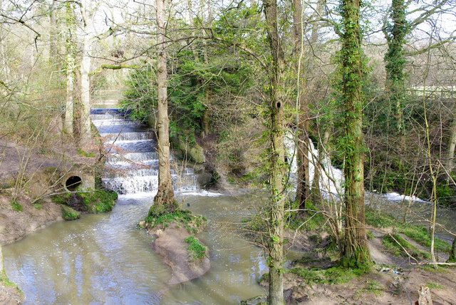
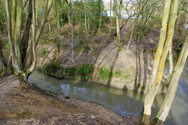
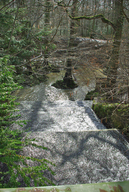
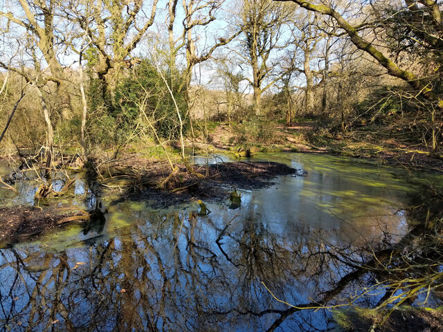
The woodland is predominantly composed of broadleaf trees, including oak, beech, and birch, offering a diverse and vibrant landscape throughout the year. It is known for its rich biodiversity, hosting a variety of flora and fauna species. The forest floor is adorned with a carpet of bluebells in the spring, creating a stunning display of color.

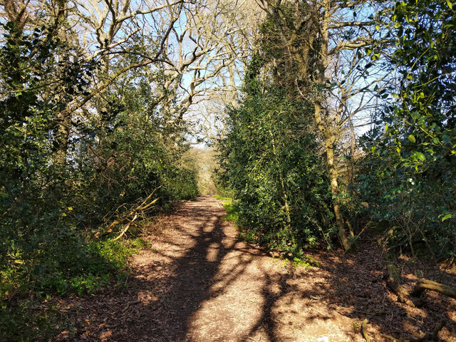
Kiln Wood boasts well-maintained walking trails that wind their way through the forest, allowing visitors to explore its beauty at their own pace. These paths range from easy strolls to more challenging hikes, catering to individuals of all fitness levels. Along the way, visitors may encounter wildlife such as deer, squirrels, and a wide array of bird species, making it an ideal spot for birdwatching.

In addition to its natural beauty, Kiln Wood offers several amenities to make visitors' experiences more enjoyable. There are picnic areas with benches and tables, providing a perfect setting for a leisurely lunch amidst the tranquil surroundings. The wood also features a small visitor center that provides information about the forest's history, wildlife, and conservation efforts.

Overall, Kiln Wood is a true gem in the heart of Sussex, offering a peaceful retreat from the hustle and bustle of everyday life. Whether one seeks a tranquil walk, a wildlife encounter, or simply a moment of serenity, this woodland is sure to leave a lasting impression.

If you have any feedback on the listing, please let us know in the comments section below.

Kiln Wood Images

Images are sourced within 2km of 50.981222/-0.10641565 or Grid Reference TQ3321. Thanks to Geograph Open Source API. All images are credited.

Path in Big Wood, Bedelands Farm A local nature reserve.
Path in Big Wood, Bedelands Farm
A local nature reserve.
Spillways, Valebridge Pond On the eastern branch of the River Adur.
Spillways, Valebridge Pond
On the eastern branch of the River Adur.
Blue rope hanging over River Adur Standard equipment for such places.
Blue rope hanging over River Adur
Standard equipment for such places.
Spillway, Valebridge Pond On the eastern branch of the River Adur.
Spillway, Valebridge Pond
On the eastern branch of the River Adur.
Path towards Bedelands Farm Local Nature Reserve
Path with footbridge, Leylands Wood Part of Bedelands Farm Local Nature Reserve.
Path with footbridge, Leylands Wood
Part of Bedelands Farm Local Nature Reserve.
Brook in Leylands Wood Part of Bedelands Farm Local Nature Reserve. The water emerges from a culvert under a built-up area and feeds into the River Adur, eastern branch.
Brook in Leylands Wood
Part of Bedelands Farm Local Nature Reserve. The water emerges from a culvert under a built-up area and feeds into the River Adur, eastern branch.
Path in Leylands Wood Part of Bedelands Farm Local Nature Reserve, although this route is a public footpath, 101CR, the CR probably being Cuckfield Rural.
Path in Leylands Wood
Part of Bedelands Farm Local Nature Reserve, although this route is a public footpath, 101CR, the CR probably being Cuckfield Rural.
Paths in Leylands Wood Part of Bedelands Farm Local Nature Reserve, although one route is a public footpath, 101CR, the CR probably being Cuckfield Rural. The helpful board on the right is one of several similar ones at key points, with a map of the nature reserve and its paths and where the local paths go. The reserve is an irregular patchwork of open fields and woods, quite easy to get lost in.
Paths in Leylands Wood
Part of Bedelands Farm Local Nature Reserve, although one route is a public footpath, 101CR, the CR probably being Cuckfield Rural. The helpful board on the right is one of several similar ones at key points, with a map of the nature reserve and its paths and where the local paths go. The reserve is an irregular patchwork of open fields and woods, quite easy to get lost in.
Entrance to fields north of Lowlands Farm
Freek's Lane north of Lowlands Farm The surface degenerates northwards from here. It is footpath 96CR.
Freek's Lane north of Lowlands Farm
The surface degenerates northwards from here. It is footpath 96CR.
Freek's Lane heading north It is footpath 96CR.
Freek's Lane heading north
It is footpath 96CR.
Freek's Lane heading north It is footpath 96CR. Just here, it coincides briefly with course of a Roman road, which may explain the good surface. Where it veers away ahead the surface is appalling.
Freek's Lane heading north
It is footpath 96CR. Just here, it coincides briefly with course of a Roman road, which may explain the good surface. Where it veers away ahead the surface is appalling.
Freek's Lane heading north It is footpath 96CR. North from here the lane degenerates into a very muddy and bushy footpath.
Freek's Lane heading north
It is footpath 96CR. North from here the lane degenerates into a very muddy and bushy footpath.
Pond by Freek's Lane Probably dug for iron - Freek's Lane crosses a clay-ironstone seam about here.
Pond by Freek's Lane
Probably dug for iron - Freek's Lane crosses a clay-ironstone seam about here.
Pond by Freek's Lane Probably dug for iron - Freek's Lane crosses a clay-ironstone seam about here.
Pond by Freek's Lane
Probably dug for iron - Freek's Lane crosses a clay-ironstone seam about here.
Show me another place!

Kiln Wood is located at Grid Ref: TQ3321 (Lat: 50.981222, Lng: -0.10641565)

Administrative County: West Sussex

District: Mid Sussex

Police Authority: Sussex

What 3 Words

///crisis.energetic.native. Near Haywards Heath, West Sussex

Related Wikis

St Francis Rangers F.C.

St Francis Rangers F.C. is a football club based in Haywards Heath, England. They are currently members of the Southern Combination Division Two and play...

St Francis Hospital, Haywards Heath

St Francis Hospital was a mental health facility in Haywards Heath, West Sussex, England. The main building survives and is a Grade II listed building...

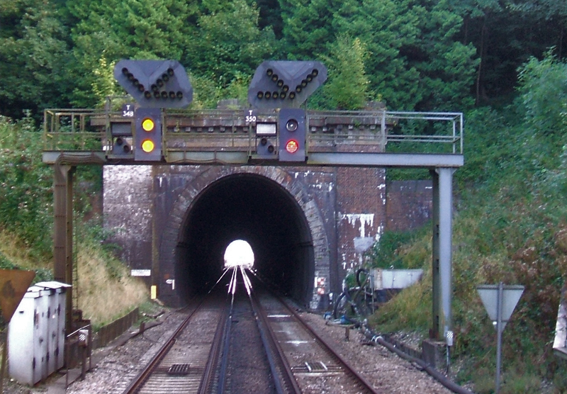
Haywards Heath Tunnel

Haywards Heath tunnel, also known as Folly Hill tunnel, is a railway tunnel on the Brighton Main Line between Haywards Heath and Wivelsfield. It is 249...

Ashenground and Bolnore Woods

Ashenground and Bolnore Woods is a 14.4-hectare (36-acre) Local Nature Reserve in Haywards Heath in West Sussex. It is owned and managed by Mid Sussex...

Jireh Chapel, Haywards Heath

The Jireh Chapel is a Strict Baptist place of worship in the town of Haywards Heath in the English county of West Sussex. The chapel was built in 1879...

Bedelands Farm Nature Reserve

Bedelands Farm Nature Reserve is a 35.2-hectare (87-acre) Local Nature Reserve on the northern outskirts of Burgess Hill in West Sussex. It is owned and...

Princess Royal Hospital, Haywards Heath

The Princess Royal Hospital, also known as PRH, is an acute, teaching, general hospital located in Haywards Heath, West Sussex, England. It is the main...

Wivelsfield

Wivelsfield () village and the larger adjacent village of Wivelsfield Green are the core of the civil parish of Wivelsfield in the Lewes District of East...

Nearby Amenities

Located within 500m of 50.981222,-0.10641565
Power: tower
Lat/Long: 50.9768409/-0.105262
Barrier: stile
Stile: squeezer
Lat/Long: 50.9797366/-0.1110005
Barrier: entrance
Lat/Long: 50.9783469/-0.1100014
Barrier: stile
Lat/Long: 50.9774819/-0.1083835
Barrier: stile
Lat/Long: 50.9771904/-0.1080472
Barrier: stile
Stile: squeezer
Lat/Long: 50.9805607/-0.1097944
The data included in this document is from www.openstreetmap.org. The data is made available under ODbL.

Have you been to Kiln Wood?

Leave your review of Kiln Wood below (or comments, questions and feedback).