Tilebarn Wood

Wood, Forest in Sussex Lewes

England

Tilebarn Wood

Little used BMX track, Burgess Hill, 2010 Not a circuit, but end to end with three banked corners.
Little used BMX track, Burgess Hill, 2010 Credit: Robin Webster

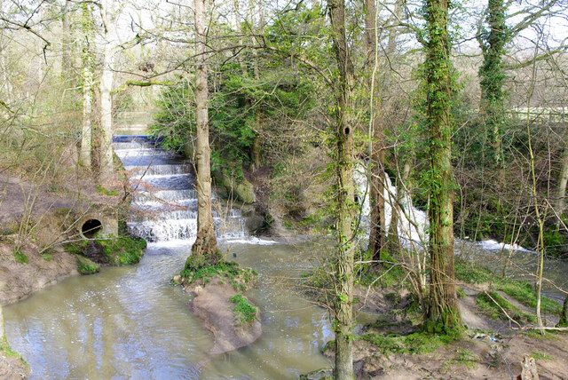
Tilebarn Wood is a woodland area located in Sussex, England. Covering an area of approximately 50 hectares, it is a designated Site of Special Scientific Interest (SSSI) due to its rich biodiversity and ecological significance. The wood is situated near the village of Broyle, just south of the town of Lewes.

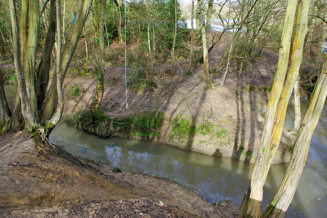
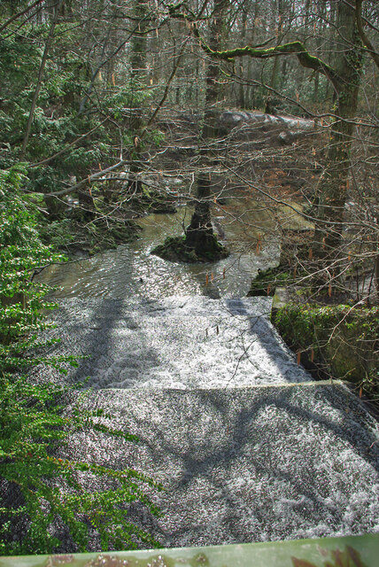
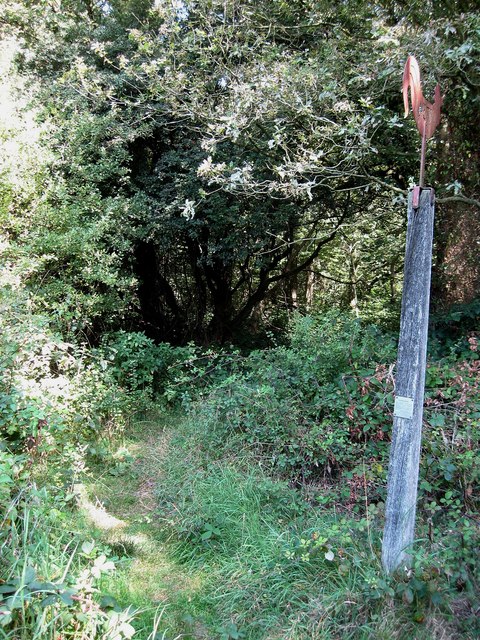
The woodland consists primarily of native broadleaf trees such as oak, beech, ash, and birch, creating a diverse and varied landscape. Dense undergrowth of ferns, bluebells, and wildflowers adds to the natural beauty of the wood. The canopy provides essential habitat for a wide range of bird species, including woodpeckers, tits, and warblers.

Tilebarn Wood is intersected by several footpaths and trails, making it easily accessible for visitors who wish to explore its natural wonders. The wood offers a peaceful and tranquil environment, attracting nature enthusiasts, hikers, and dog walkers alike.

The wood has a rich history, dating back centuries. It was once part of the manor of South Malling, and its name likely derives from the tile-making industry that existed in the area. Evidence of ancient ironworking has also been found within the wood, further adding to its historical significance.

Conservation efforts are in place to protect and maintain the woodland's delicate ecosystem. This includes controlled management of the trees and undergrowth, as well as monitoring and protection of the wildlife species that call Tilebarn Wood their home.

Overall, Tilebarn Wood is a picturesque and ecologically important woodland, providing both recreational opportunities and a haven for a diverse range of flora and fauna.

If you have any feedback on the listing, please let us know in the comments section below.

Tilebarn Wood Images

Images are sourced within 2km of 50.973793/-0.10640445 or Grid Reference TQ3321. Thanks to Geograph Open Source API. All images are credited.

Little used BMX track, Burgess Hill, 2010 Not a circuit, but end to end with three banked corners.
Little used BMX track, Burgess Hill, 2010
Not a circuit, but end to end with three banked corners.
Little used BMX track, Burgess Hill, 2010 Not a circuit, but end to end with three banked corners. This view is from the first corner towards the start.
Little used BMX track, Burgess Hill, 2010
Not a circuit, but end to end with three banked corners. This view is from the first corner towards the start.
Green lane towards municipal dump, 2010 Not a public right-of-way now, not sure what it was then, but I used it.
Green lane towards municipal dump, 2010
Not a public right-of-way now, not sure what it was then, but I used it.
Path in Big Wood, Bedelands Farm A local nature reserve.
Path in Big Wood, Bedelands Farm
A local nature reserve.
Spillways, Valebridge Pond On the eastern branch of the River Adur.
Spillways, Valebridge Pond
On the eastern branch of the River Adur.
Blue rope hanging over River Adur Standard equipment for such places.
Blue rope hanging over River Adur
Standard equipment for such places.
Spillway, Valebridge Pond On the eastern branch of the River Adur.
Spillway, Valebridge Pond
On the eastern branch of the River Adur.
Path towards Bedelands Farm Local Nature Reserve
Path with footbridge, Leylands Wood Part of Bedelands Farm Local Nature Reserve.
Path with footbridge, Leylands Wood
Part of Bedelands Farm Local Nature Reserve.
Brook in Leylands Wood Part of Bedelands Farm Local Nature Reserve. The water emerges from a culvert under a built-up area and feeds into the River Adur, eastern branch.
Brook in Leylands Wood
Part of Bedelands Farm Local Nature Reserve. The water emerges from a culvert under a built-up area and feeds into the River Adur, eastern branch.
Path in Leylands Wood Part of Bedelands Farm Local Nature Reserve, although this route is a public footpath, 101CR, the CR probably being Cuckfield Rural.
Path in Leylands Wood
Part of Bedelands Farm Local Nature Reserve, although this route is a public footpath, 101CR, the CR probably being Cuckfield Rural.
Paths in Leylands Wood Part of Bedelands Farm Local Nature Reserve, although one route is a public footpath, 101CR, the CR probably being Cuckfield Rural. The helpful board on the right is one of several similar ones at key points, with a map of the nature reserve and its paths and where the local paths go. The reserve is an irregular patchwork of open fields and woods, quite easy to get lost in.
Paths in Leylands Wood
Part of Bedelands Farm Local Nature Reserve, although one route is a public footpath, 101CR, the CR probably being Cuckfield Rural. The helpful board on the right is one of several similar ones at key points, with a map of the nature reserve and its paths and where the local paths go. The reserve is an irregular patchwork of open fields and woods, quite easy to get lost in.
Brook in Leylands Wood Part of Bedelands Farm Local Nature Reserve. The water emerges from a culvert under a built-up area and feeds into the River Adur, eastern branch.
Brook in Leylands Wood
Part of Bedelands Farm Local Nature Reserve. The water emerges from a culvert under a built-up area and feeds into the River Adur, eastern branch.
Footbridge on footpath 46BH The footpath is a continuation into another parish of 101CR, it crosses here a drainage ditch down the side of a football field.
Footbridge on footpath 46BH
The footpath is a continuation into another parish of 101CR, it crosses here a drainage ditch down the side of a football field.
Woodland west of Bedelands Farm nature reserve Continuous with reserve woodland, but just outside its boundary.
Woodland west of Bedelands Farm nature reserve
Continuous with reserve woodland, but just outside its boundary.
Freek's Lane, Burgess Hill Public footpath 45BH.
Freek's Lane, Burgess Hill
Public footpath 45BH.
Show me another place!

Tilebarn Wood is located at Grid Ref: TQ3321 (Lat: 50.973793, Lng: -0.10640445)

Administrative County: East Sussex

District: Lewes

Police Authority: Sussex

What 3 Words

///reveal.expect.longer. Near Burgess Hill, West Sussex

Related Wikis

Bedelands Farm Nature Reserve

Bedelands Farm Nature Reserve is a 35.2-hectare (87-acre) Local Nature Reserve on the northern outskirts of Burgess Hill in West Sussex. It is owned and...

Wivelsfield

Wivelsfield () village and the larger adjacent village of Wivelsfield Green are the core of the civil parish of Wivelsfield in the Lewes District of East...

World's End, West Sussex

World's End is a neighbourhood located in Burgess Hill, West Sussex. It is thought that the name arrived with the railway – it was here that the 'up' line...

Bethel Strict Baptist Chapel, Wivelsfield

Bethel Baptist Chapel is a Strict Baptist place of worship in the village of Wivelsfield in East Sussex, England. The cause was founded in 1763 by members...

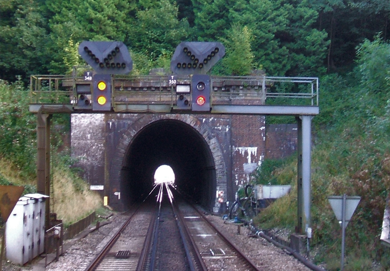
Haywards Heath Tunnel

Haywards Heath tunnel, also known as Folly Hill tunnel, is a railway tunnel on the Brighton Main Line between Haywards Heath and Wivelsfield. It is 249...

Burgess Hill Town F.C.

Burgess Hill Town Football Club is an English football club currently playing in the Isthmian League South East Division. The club plays its home games...

Wivelsfield railway station

Wivelsfield railway station is a railway station on the Brighton Main Line in West Sussex, England. Located in northern Burgess Hill, it primarily serves...

Jacob's Post

Jacob's Post is a post outside the old Royal Oak pub just inside the north of Ditchling Common to the east of Burgess Hill, in Lewes district, East Sussex...

Nearby Amenities

Located within 500m of 50.973793,-0.10640445
Power: tower
Lat/Long: 50.9768409/-0.105262
Barrier: stile
Lat/Long: 50.9764175/-0.106595
Barrier: stile
Lat/Long: 50.9774819/-0.1083835
Barrier: stile
Lat/Long: 50.9771904/-0.1080472
Barrier: stile
Lat/Long: 50.9730593/-0.1020844
Barrier: stile
Lat/Long: 50.9752364/-0.1033655
Barrier: stile
Lat/Long: 50.973592/-0.1019596
The data included in this document is from www.openstreetmap.org. The data is made available under ODbL.

Have you been to Tilebarn Wood?

Leave your review of Tilebarn Wood below (or comments, questions and feedback).