Cave Wood

Wood, Forest in Hertfordshire Welwyn Hatfield

England

Cave Wood

Knebworth Station Just to confirm that one exists
Knebworth Station Credit: Jack Hill

Cave Wood is a picturesque woodland located in the county of Hertfordshire, England. Situated on the eastern outskirts of the town of St Albans, this ancient forest covers an area of approximately 60 acres and is a popular destination for nature enthusiasts and outdoor adventurers.

The wood is characterized by its dense canopy of mature trees, including oak, beech, and hornbeam, which provide shelter and habitat for a variety of wildlife. The forest floor is adorned with a rich carpet of bluebells during the spring months, creating a stunning display of vibrant colors.

Cave Wood is intersected by a network of footpaths and trails, allowing visitors to explore its natural beauty at their leisure. These paths wind their way through the woodland, leading to charming clearings and secluded spots, perfect for picnics or simply enjoying the tranquility of the surroundings.

The wood is also home to an abundance of wildlife, including deer, rabbits, and a variety of bird species. Nature enthusiasts can often spot woodpeckers, tawny owls, and even the occasional glimpse of a red kite soaring overhead.

Cave Wood holds historical significance as well, with evidence of human activity dating back to the Roman era. Archaeological remains, such as pottery fragments and coins, have been discovered in the area, adding to its cultural and historical appeal.

Overall, Cave Wood offers a delightful escape from the hustle and bustle of everyday life, providing visitors with a serene and enchanting natural environment to explore and enjoy.

If you have any feedback on the listing, please let us know in the comments section below.

Cave Wood Images

Images are sourced within 2km of 51.85346/-0.17075098 or Grid Reference TL2618. Thanks to Geograph Open Source API. All images are credited.

Knebworth Station Just to confirm that one exists
Knebworth Station
Just to confirm that one exists
Knebworth   Reformed Church The banner at least will perpetuate a sentiment
Knebworth Reformed Church
The banner at least will perpetuate a sentiment
Knebworth telephone exchange With a modern extension on the back.
Knebworth telephone exchange
With a modern extension on the back.
St Martin, Knebworth, Herts
St Martin, Knebworth, Herts - Chapel
St Martin, Knebworth, Herts - East end
St Martin, Knebworth, Herts
St Martin, Knebworth, Herts - Font
St Martin, Knebworth, Herts
St Martin, Knebworth, Herts - East end
Park Lane & Knebworth A view across Park Lane and Knebworth taken after the snowfall at the end of October 2008
Park Lane & Knebworth
A view across Park Lane and Knebworth taken after the snowfall at the end of October 2008
Railway bridges over Station Road This is viewed from Gun Lane.
Railway bridges over Station Road
This is viewed from Gun Lane.
Knebworth Primary & Nursery School Take away the flat-roofed extensions at the front and the remaining three gable-ended buildings represent the basic fabric of the school as it was opened in 1912. The central section has an attractive bell tower. The school was built primarily to serve the large increase in population in "new" Knebworth following the opening of the railway station built to serve "old" Knebworth in 1884.

The photo was taken at the end of a wet November Sunday afternoon that was just about to get an awful lot wetter... 

The School's website is here <span class="nowrap"><a title="http://www.knebworth.herts.sch.uk/" rel="nofollow ugc noopener" href="http://www.knebworth.herts.sch.uk/">Link</a><img style="margin-left:2px;" alt="External link" title="External link - shift click to open in new window" src="https://s1.geograph.org.uk/img/external.png" width="10" height="10"/></span>
Knebworth Primary & Nursery School
Take away the flat-roofed extensions at the front and the remaining three gable-ended buildings represent the basic fabric of the school as it was opened in 1912. The central section has an attractive bell tower. The school was built primarily to serve the large increase in population in "new" Knebworth following the opening of the railway station built to serve "old" Knebworth in 1884. The photo was taken at the end of a wet November Sunday afternoon that was just about to get an awful lot wetter... The School's website is here LinkExternal link
Knebworth: St Martin's Church St Martin's was one of the very few religious buildings designed by the eminent architect, Sir Edwin Landseer Lutyens (1869-1944). Construction commenced in 1914 and the church was consecrated in the following year. Lutyens insisted that only the best materials were to be used and this is reflected in the quality of the brickwork and the pantiled roof. The church hall just visible to the right is a modern development built in the style of the church. Lutyens' connections with Knebworth came from his marriage to a daughter of the local Lytton family in 1897.
Knebworth: St Martin's Church
St Martin's was one of the very few religious buildings designed by the eminent architect, Sir Edwin Landseer Lutyens (1869-1944). Construction commenced in 1914 and the church was consecrated in the following year. Lutyens insisted that only the best materials were to be used and this is reflected in the quality of the brickwork and the pantiled roof. The church hall just visible to the right is a modern development built in the style of the church. Lutyens' connections with Knebworth came from his marriage to a daughter of the local Lytton family in 1897.
Knebworth railway station, Hertfordshire Opened in 1884 by the Great Northern Railway on its line from London to Stevenage. View north towards Stevenage and Peterborough, two years after the station had received new platform shelters and railings. See <a href="https://www.geograph.org.uk/photo/3242098">TL2420 : Knebworth railway station, Hertfordshire, 2008</a> for an earlier view from a similar camera position.
Knebworth railway station, Hertfordshire
Opened in 1884 by the Great Northern Railway on its line from London to Stevenage. View north towards Stevenage and Peterborough, two years after the station had received new platform shelters and railings. See TL2420 : Knebworth railway station, Hertfordshire, 2008 for an earlier view from a similar camera position.
Station Road, Knebworth
Show me another place!

Cave Wood is located at Grid Ref: TL2618 (Lat: 51.85346, Lng: -0.17075098)

Administrative County: Hertfordshire

District: Welwyn Hatfield

Police Authority: Hertfordshire

What 3 Words

///slips.kinds.guilty. Near Datchworth, Hertfordshire

Related Wikis

Woolmer Green

Woolmer Green is a small village and civil parish in Hertfordshire, England. The 2011 census figure for the population (from the Office for National Statistics...

Datchworth

Datchworth is a village and civil parish between the towns of Hertford, Stevenage and Welwyn Garden City in the county of Hertfordshire, England. Sited...

The Tilbury, Datchworth

The Tilbury is a public house and restaurant in Datchworth, Hertfordshire, England. It was formerly known as The Inn on the Green and The Three Horseshoes...

Hopper's Hall

Hopper's Hall is a grade II listed house in Watton Road, Datchworth, Hertfordshire. It dates from around 1640 with minor additions and alterations since...

St Martin's Church, Knebworth

St Martin's Church is an active Anglican church in Knebworth, Hertfordshire, England. The building, which is designated grade II*, was designed by Edwin...

Mardley Heath

Mardley Heath is a 41.1 hectare Local Nature Reserve in Welwyn in Hertfordshire. It is owned by Welwyn Hatfield Borough Council and managed by the council...

Knebworth

Knebworth is a village and civil parish in the north of Hertfordshire, England, immediately south of Stevenage. The civil parish covers an area between...

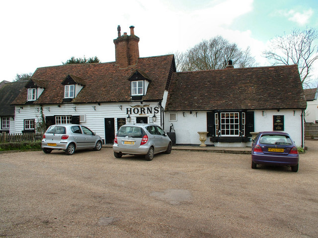
The Horns, Bull's Green

The Horns is a public house in Datchworth, Hertfordshire, England. It is situated on Bramfield Road in Bull's Green, a hamlet in the parish of Datchworth...

Nearby Amenities

Located within 500m of 51.85346,-0.17075098
Mardleybury
Place: hamlet
Lat/Long: 51.8504276/-0.1719996
Barrier: kissing_gate
Lat/Long: 51.8555852/-0.1709976
Barrier: kissing_gate
Lat/Long: 51.8556048/-0.1698983
Barrier: kissing_gate
Lat/Long: 51.8555978/-0.1685302
Barrier: kissing_gate
Lat/Long: 51.8559182/-0.1701295
Barrier: kissing_gate
Lat/Long: 51.8565673/-0.1689874
Barrier: kissing_gate
Lat/Long: 51.8555346/-0.1682989
Bench
Backrest: yes
Check Date: 2021-03-07
Material: wood
Seats: 4
Lat/Long: 51.8555459/-0.1709787
Noexit: yes
Lat/Long: 51.8502699/-0.1736977
The data included in this document is from www.openstreetmap.org. The data is made available under ODbL.

Have you been to Cave Wood?

Leave your review of Cave Wood below (or comments, questions and feedback).