Mitchell's Wood

Wood, Forest in Hertfordshire Welwyn Hatfield

England

Mitchell's Wood

Edge of Homer's Wood
Edge of Homer's Wood Credit: Mr Ignavy

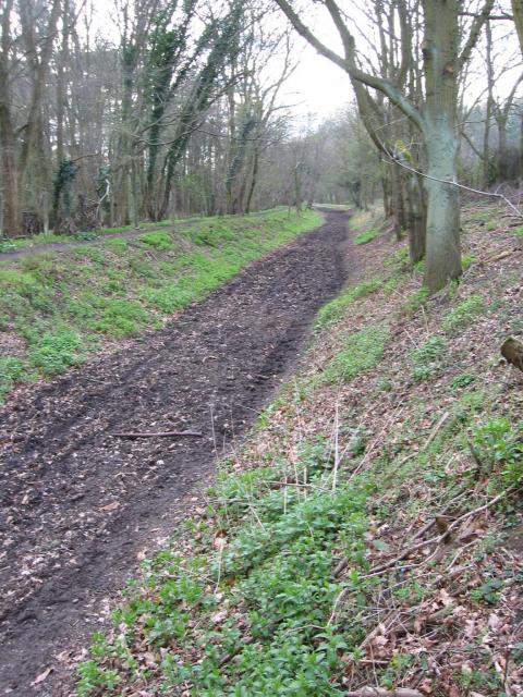
Mitchell's Wood is a picturesque forest located in Hertfordshire, England. Covering an area of approximately 100 acres, this woodland is renowned for its natural beauty and diverse flora and fauna. The wood is named after the Mitchell family, who were the original owners of the land.

The forest is predominantly composed of mixed woodland, featuring a variety of tree species such as oak, beech, birch, and ash. These trees create a dense canopy, providing shelter and habitat for numerous wildlife species. Visitors to Mitchell's Wood can expect to encounter a wide range of birds, including woodpeckers, owls, and various songbirds.

Walking through the wood, one can also discover a rich carpet of wildflowers, such as bluebells, primroses, and foxgloves, which bloom in abundance during the spring and summer months. This creates a vibrant and colorful environment, perfect for nature enthusiasts and photographers.

Mitchell's Wood is open to the public and offers various footpaths and trails, allowing visitors to explore its natural wonders at their own pace. The woodland is a popular destination for hikers, joggers, and dog walkers, who can enjoy the tranquility and peacefulness that the forest provides.

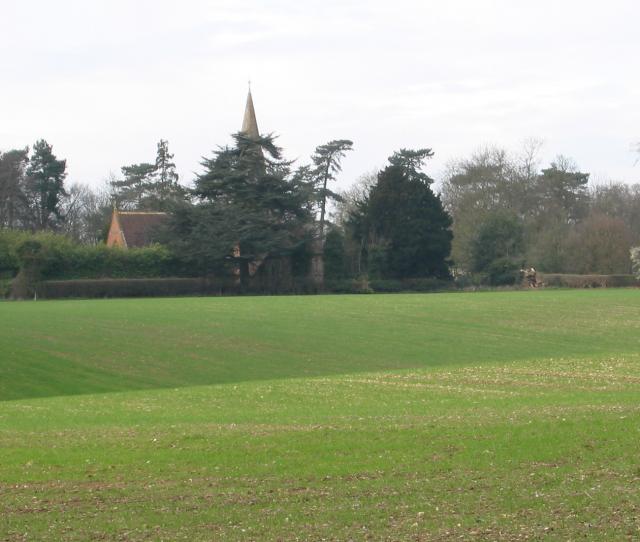
In addition to its natural beauty, Mitchell's Wood also has historical significance. It is believed to have been part of a medieval hunting ground and has remnants of ancient structures, including a disused well and an old boundary wall.

Overall, Mitchell's Wood in Hertfordshire is a haven for nature lovers, offering a serene and enchanting environment filled with diverse wildlife, stunning flora, and a touch of history.

If you have any feedback on the listing, please let us know in the comments section below.

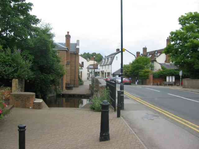
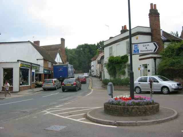
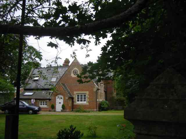
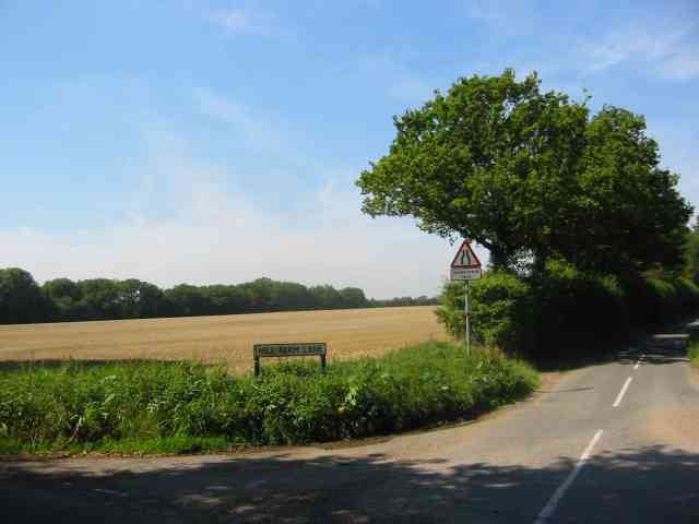
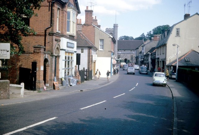
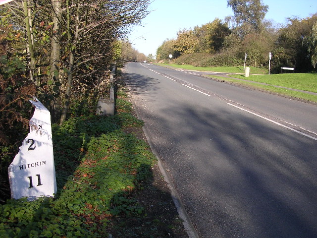
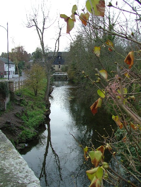
Mitchell's Wood Images

Images are sourced within 2km of 51.815585/-0.23307473 or Grid Reference TL2114. Thanks to Geograph Open Source API. All images are credited.

Edge of Homer's Wood
Waterend Looking North from TL204136 to the ford at Waterend on the River Lea, West of Welwyn Garden City. It's dry, but the water only has to rise a foot or so to flood the road - hence the little footbridge so people can cross without getting their feet wet.
Waterend
Looking North from TL204136 to the ford at Waterend on the River Lea, West of Welwyn Garden City. It's dry, but the water only has to rise a foot or so to flood the road - hence the little footbridge so people can cross without getting their feet wet.
Waterend house The large house just North of the ford (TL204137)
Waterend house
The large house just North of the ford (TL204137)
Brocket Hall gates Looking south from TL218139 to the gates of Brocket Hall - home of convicted fraudster and annoying D-list reality TV celeb Lord Brocket. Most of the rest of the grid square South of here is private, and judging by the spikes, CCTV and "STOP" notices I don't think he'll let you in.
Brocket Hall gates
Looking south from TL218139 to the gates of Brocket Hall - home of convicted fraudster and annoying D-list reality TV celeb Lord Brocket. Most of the rest of the grid square South of here is private, and judging by the spikes, CCTV and "STOP" notices I don't think he'll let you in.
Greenway bridge Looking South to a bridge at TL209145 which carries the Ayot Greenway - a length of old railway line converted into cycle path and bridleway, covering most of the way from Wheathampstead to Welwyn Garden City.
Greenway bridge
Looking South to a bridge at TL209145 which carries the Ayot Greenway - a length of old railway line converted into cycle path and bridleway, covering most of the way from Wheathampstead to Welwyn Garden City.
Ayot Greenway Looking West from TL218146 along the greenway - a length of abandoned railway line running most of the way from Wheathampstead to Welwyn Garden City.
Ayot Greenway
Looking West from TL218146 along the greenway - a length of abandoned railway line running most of the way from Wheathampstead to Welwyn Garden City.
Church, Ayot St Peter, from afar. Peering North from TL218146, through the trees at the edge of the old railway line & across the fields to the church in Ayot St Peter (TL218149)
Church, Ayot St Peter, from afar.
Peering North from TL218146, through the trees at the edge of the old railway line & across the fields to the church in Ayot St Peter (TL218149)
Ayot St Peter Church Taken from the road looking WSW towards the Church
Ayot St Peter Church
Taken from the road looking WSW towards the Church
Brocket Hall, Lemsford This is the view one gets from the highway.
Brocket Hall, Lemsford
This is the view one gets from the highway.
Welwyn village The ducks have disappeared   otherwise a busy village scene
Welwyn village
The ducks have disappeared otherwise a busy village scene
Welwyn Village View up Codicote Road towards High Street. 
Congestion charges needed
Welwyn Village
View up Codicote Road towards High Street. Congestion charges needed
Ayot St Peter The church seems to be operational but where would the congregation come from?
Ayot St Peter
The church seems to be operational but where would the congregation come from?
Ayot St Peter This building is next door to the church. Looks like it was the school but is now a house
Ayot St Peter
This building is next door to the church. Looks like it was the school but is now a house
Road sign to Hill Farm Lane The area was lacking in tangible elements being woods and open fields.
Road sign to Hill Farm Lane
The area was lacking in tangible elements being woods and open fields.
Welwyn High Street
Welwyn High Street
Milepost on Great North Rd This broken milepost stands on the old Great North Rd.  This is now the B197 Stevenage to Welwyn Garden City road.  In fact most people making this journey use  the A1 which runs parallel and about 50 yards to the left.  This milepost is cast iron and has been broken at some stage.  This is the road that Dick Turpin would have ridden from York to London on.
Milepost on Great North Rd
This broken milepost stands on the old Great North Rd. This is now the B197 Stevenage to Welwyn Garden City road. In fact most people making this journey use the A1 which runs parallel and about 50 yards to the left. This milepost is cast iron and has been broken at some stage. This is the road that Dick Turpin would have ridden from York to London on.
Lemsford mill and the River Lea. Taken from the very edge of the square facing the mill.
Lemsford mill and the River Lea.
Taken from the very edge of the square facing the mill.
River from Waterend Ford View of the River Lea taken from Waterend Ford looking South-East
River from Waterend Ford
View of the River Lea taken from Waterend Ford looking South-East
Show me another place!

Mitchell's Wood is located at Grid Ref: TL2114 (Lat: 51.815585, Lng: -0.23307473)

Administrative County: Hertfordshire

District: Welwyn Hatfield

Police Authority: Hertfordshire

What 3 Words

///venue.among.gloves. Near Welwyn, Hertfordshire

Related Wikis

Ayot Green

Ayot Green is a hamlet in Hertfordshire, England and is near the A1(M) Motorway, close to Welwyn Garden City. It is a typical traditional English village...

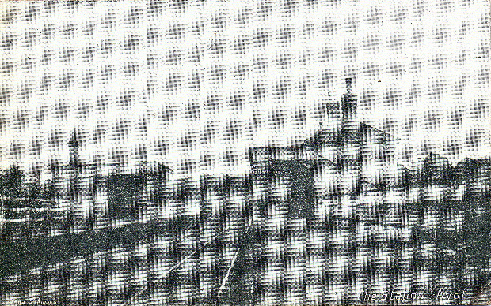
Ayot railway station

Ayot was a railway station serving Ayot St Peter near Welwyn Garden City in Hertfordshire, England. It was on the branch line to Dunstable. == History... ==

Ayot St Peter

Ayot St Peter is a village and civil parish in the Welwyn Hatfield district of Hertfordshire, England, about two miles north-west of Welwyn Garden City...

Station IX

Station IX (formerly known as the Inter-Services Research Bureau) was a secret British Special Operations Executive factory making special weapons and...

Nearby Amenities

Located within 500m of 51.815585,-0.23307473
Barrier: kissing_gate
Bicycle: no
Foot: yes
Source: GPS
Lat/Long: 51.8163688/-0.2386511
Ayot Little Green
Created By: Potlatch 0.8a
Place: hamlet
Lat/Long: 51.814431/-0.2332296
Ayot Green
Created By: Potlatch 0.8a
Place: hamlet
Wikidata: Q4831581
Lat/Long: 51.8117247/-0.2300453
Parking
Access: yes
Parking: surface
Lat/Long: 51.8147381/-0.2282091
Power: pole
Lat/Long: 51.815412/-0.2309756
Material: wood
Power: pole
Lat/Long: 51.814321/-0.2286524
Power: pole
Lat/Long: 51.8157552/-0.2316328
Material: wood
Power: pole
Lat/Long: 51.8138932/-0.227601
Material: wood
Power: pole
Lat/Long: 51.8133111/-0.2282532
Material: wood
Power: pole
Lat/Long: 51.813525/-0.2267216
Material: wood
Power: pole
Lat/Long: 51.8147571/-0.2297065
Barrier: kissing_gate
Bicycle: no
Foot: yes
Source: GPS
Lat/Long: 51.8158408/-0.2380289
Parking
Parking: street_side
Lat/Long: 51.8153518/-0.2297345
Building: yes
Lat/Long: 51.8151197/-0.2296326
Place: farm
Lat/Long: 51.8121565/-0.2342514
Drinking Water
Man Made: water_tap
Lat/Long: 51.8200505/-0.2333917
Bench
Lat/Long: 51.8175293/-0.2394059
Barrier: kissing_gate
Bicycle: no
Foot: yes
Source: GPS, observation
Lat/Long: 51.8149091/-0.2287602
The data included in this document is from www.openstreetmap.org. The data is made available under ODbL.

Have you been to Mitchell's Wood?

Leave your review of Mitchell's Wood below (or comments, questions and feedback).