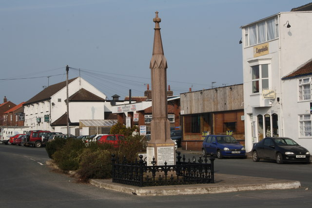
Square Wood

Wood, Forest in Yorkshire

England

Square Wood
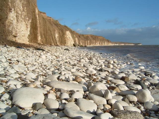
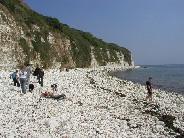
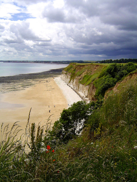
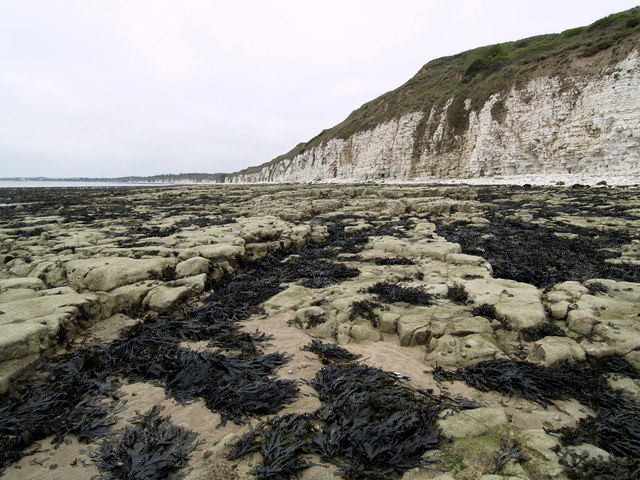
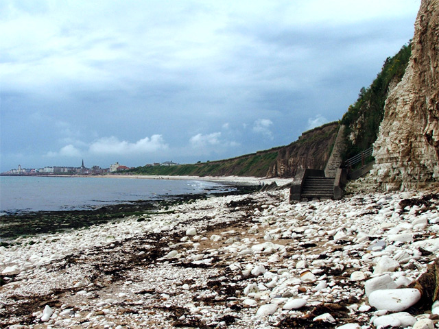
Chalk Pebble beach at Sewerby, Near Bridlington. Looking North East towards Flamborough Head
Chalk Pebble beach at Sewerby, Near Bridlington. Credit: Paul Allison

Square Wood is a picturesque forest located in Yorkshire, England. It covers an area of approximately 100 acres and is nestled within the beautiful countryside of Yorkshire. The forest is known for its dense canopy of trees and diverse wildlife, making it a popular destination for nature lovers and outdoor enthusiasts.

The wood is predominantly composed of broadleaf trees such as oak, beech, and birch, which provide a stunning display of colors during the autumn season. Walking trails wind their way through the forest, offering visitors the opportunity to explore its natural beauty at their own pace. These paths are well-maintained and suitable for all ages and abilities.

The forest is home to a wide variety of wildlife, including deer, foxes, badgers, and numerous species of birds. Birdwatchers can spot woodpeckers, owls, and other woodland birds throughout the year. Additionally, the forest provides a habitat for various insects, butterflies, and fungi, making it a haven for nature enthusiasts and photographers.

Square Wood is managed by the local authorities, who ensure the preservation and conservation of its natural resources. This includes maintaining the trails, managing the wildlife, and implementing sustainable practices.

Visitors to Square Wood can enjoy a peaceful and tranquil experience in the heart of nature. The forest offers a welcome escape from the hustle and bustle of everyday life and provides an opportunity to connect with the natural world. Whether it's a leisurely stroll, a picnic, or wildlife spotting, Square Wood has something to offer for everyone.

If you have any feedback on the listing, please let us know in the comments section below.

Square Wood Images

Images are sourced within 2km of 54.107162/-0.15614513 or Grid Reference TA2069. Thanks to Geograph Open Source API. All images are credited.
Chalk Pebble beach at Sewerby, Near Bridlington. Looking North East towards Flamborough Head
Chalk Pebble beach at Sewerby, Near Bridlington.
Looking North East towards Flamborough Head
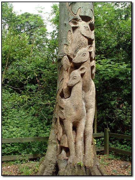
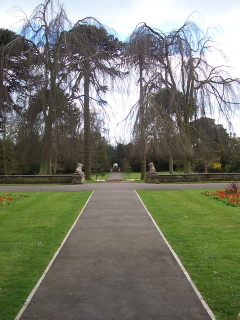
Carving - Sewerby Hall The gardeners at Sewerby Hall are kept busy with the huge garden.  Apart from the carvings there are amazing and weird trees and bushes and some beautiful formal gardens.
Carving - Sewerby Hall
The gardeners at Sewerby Hall are kept busy with the huge garden. Apart from the carvings there are amazing and weird trees and bushes and some beautiful formal gardens.
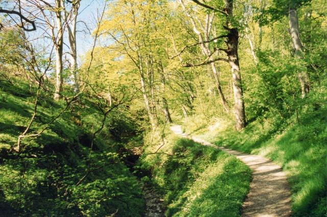
Danes Dyke Danes’ Dyke consists of prehistoric earthworks, possibly intended as a defence, and woodland that runs 2½ miles across Flamborough Head. Despite its name, Danes’ Dyke had nothing to do with the Danes, and was a much earlier site - probably dating back to the Bronze Age.
Danes Dyke
Danes’ Dyke consists of prehistoric earthworks, possibly intended as a defence, and woodland that runs 2½ miles across Flamborough Head. Despite its name, Danes’ Dyke had nothing to do with the Danes, and was a much earlier site - probably dating back to the Bronze Age.
Where Dane's Dyke meets the North Sea
View towards Bridlington from Southern end of Danes Dyke
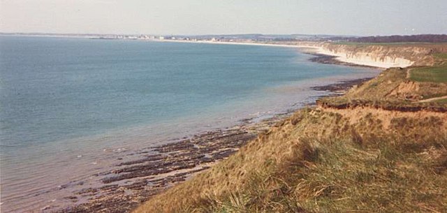
Beacon Hill Views The South Landing and cliffs at Flamborough Head from just beyond Beacon Hill. Looking out across Danes Dyke End, you can just make out Bridlington in the distance.
Beacon Hill Views
The South Landing and cliffs at Flamborough Head from just beyond Beacon Hill. Looking out across Danes Dyke End, you can just make out Bridlington in the distance.
Sewerby Hall Gardens
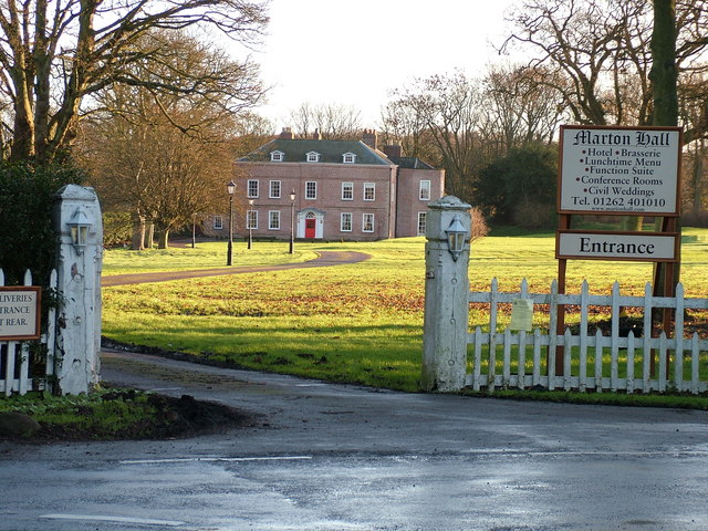
Marton Hall This photo is actually taken from just outside the gridsquare TA2069, in which the hall is situated.
Marton Hall
This photo is actually taken from just outside the gridsquare TA2069, in which the hall is situated.
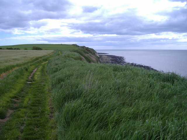
Beacon Hill The view eastwards along the cliff top from the very edge of the gridsquare towards Beacon Hill.
Beacon Hill
The view eastwards along the cliff top from the very edge of the gridsquare towards Beacon Hill.
South Flamborough Beach
South Flamborough Beach Looking Towards Danes' Dyke.
South Flamborough Beach
Looking Towards Danes' Dyke.
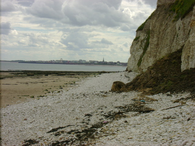
Sewerby Rocks Bridlington in the background, taken from Danes Dyke Beach
Sewerby Rocks
Bridlington in the background, taken from Danes Dyke Beach
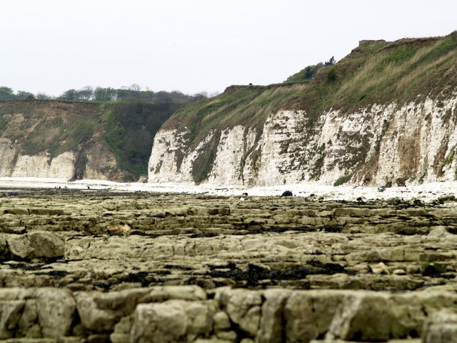
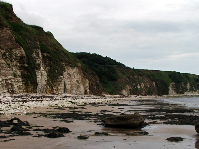
Cliff face, Sewerby An eastwards shot of the cliff face near Dykes End from Sewerby Rocks.
Cliff face, Sewerby
An eastwards shot of the cliff face near Dykes End from Sewerby Rocks.
Steps onto Sewerby Rocks Steps leading from the cliffside footpath down onto Sewerby Rocks. Bridlington's North Sands and the sea front can be seen in the distance.
Steps onto Sewerby Rocks
Steps leading from the cliffside footpath down onto Sewerby Rocks. Bridlington's North Sands and the sea front can be seen in the distance.
Dane's Dyke from the beach A wide view of Dane's Dyke taken from the beach (Dyke's End).
Dane's Dyke from the beach
A wide view of Dane's Dyke taken from the beach (Dyke's End).
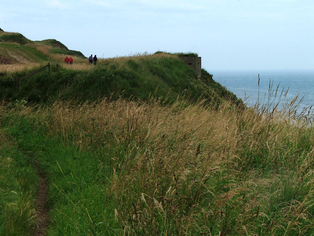
Pillbox near Beacon Hill In this photo, what appears to be a pillbox can be seen overlooking the sea. The pillbox may be a Type 22, if it is indeed a pillbox. Inside, there are metal brackets where a wooden shelf would have been fitted had it been a Type 22. There is full access to this structure but there is little to look at internally.
Pillbox near Beacon Hill
In this photo, what appears to be a pillbox can be seen overlooking the sea. The pillbox may be a Type 22, if it is indeed a pillbox. Inside, there are metal brackets where a wooden shelf would have been fitted had it been a Type 22. There is full access to this structure but there is little to look at internally.
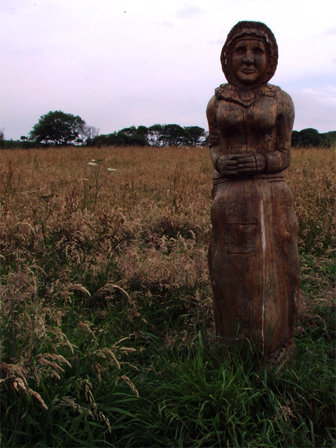
Carving, Cliff Plantation A carving of a fisherman's wife, looking out to sea.
Carving, Cliff Plantation
A carving of a fisherman's wife, looking out to sea.
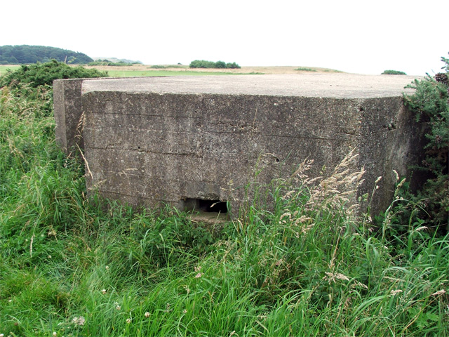
Pillbox on golf course A pillbox stationed a way off from the cliff edge on a golf course. A footpath passes by it but there appears to be no entry to the structure.
Pillbox on golf course
A pillbox stationed a way off from the cliff edge on a golf course. A footpath passes by it but there appears to be no entry to the structure.
Show me another place!

Square Wood is located at Grid Ref: TA2069 (Lat: 54.107162, Lng: -0.15614513)

Division: East Riding

Unitary Authority: East Riding of Yorkshire

Police Authority: Humberside

What 3 Words

///timed.sprouting.wizard. Near Flamborough, East Yorkshire

Related Wikis

Sewerby Hall

Sewerby Hall (also known as Sewerby House) is a Grade I listed Georgian country house set in 50 acres (20 ha) of landscaped gardens in the village of Sewerby...

Sewerby

Sewerby is a village in the East Riding of Yorkshire, England approximately 1 mile (1.6 km) north-east of Bridlington on the North Sea coast. The village...

Flamborough railway station

Flamborough railway station was located in the village of Marton, and was originally named after that location. However, there were several other railway...

Headlands School

Headlands School is a coeducational comprehensive school situated on Sewerby Road near the B1255, Bridlington, East Riding of Yorkshire, England. The school...

Flamborough

Flamborough is a village and civil parish in the East Riding of Yorkshire, England. It is situated approximately 4 miles (6 km) north-east of Bridlington...

Flamborough Lifeboat Station

Flamborough Lifeboat Station is a Royal National Lifeboat Institution (RNLI) lifeboat station located at Flamborough in the East Riding of Yorkshire, England...

Bempton railway station

Bempton railway station serves the village of Bempton in the East Riding of Yorkshire, England. It is located on the Yorkshire Coast Line and is operated...

Bempton

Bempton is a village and civil parish in the East Riding of Yorkshire, England, near the border with North Yorkshire. It is near the North Sea coast and...

Nearby Amenities

Located within 500m of 54.107162,-0.15614513
Bunker Type: pillbox
Military: bunker
Source: survey
Lat/Long: 54.1043023/-0.150351
Marton Flamborough Road
Naptan AtcoCode: 2200YEA00595
Naptan Bearing: W
Naptan CommonName: Marton Flamborough Road
Naptan Landmark: Caravan Park
Naptan Street: Flamborough Road
Note: Paved area but no sign or post
Physically Present: no
Shelter: no
Source: naptan + survey
Lat/Long: 54.1099432/-0.1617261
Sewerby Hall and Gardens
Tourism: attraction
Wikidata: Q7458244
Lat/Long: 54.1040302/-0.1609905
Golf: pin
Lat/Long: 54.1027705/-0.1548111
Golf: tee
Lat/Long: 54.1035699/-0.1527473
Golf: pin
Lat/Long: 54.1036534/-0.1545792
Golf: tee
Lat/Long: 54.1036886/-0.155578
Golf: pin
Lat/Long: 54.1051922/-0.1509528
Golf: pin
Lat/Long: 54.1054049/-0.14998
Golf: pin
Lat/Long: 54.1058268/-0.1569255
Golf: tee
Lat/Long: 54.1058531/-0.1575129
Golf: tee
Lat/Long: 54.1058657/-0.1547366
Golf: tee
Lat/Long: 54.1063877/-0.150555
Golf: pin
Lat/Long: 54.1065664/-0.1527529
Golf: pin
Lat/Long: 54.1066871/-0.1564099
Golf: pin
Lat/Long: 54.1068265/-0.1593963
Golf: tee
Lat/Long: 54.1069579/-0.1486576
Golf: tee
Lat/Long: 54.1070825/-0.1576105
Golf: tee
Lat/Long: 54.1071429/-0.1595843
Golf: tee
Lat/Long: 54.1080151/-0.1542264
Golf: tee
Lat/Long: 54.1080477/-0.1575274
Golf: tee
Lat/Long: 54.1080746/-0.1508033
Golf: pin
Lat/Long: 54.108294/-0.1577761
Golf: pin
Lat/Long: 54.1084126/-0.1503506
Golf: pin
Lat/Long: 54.1084373/-0.155778
Golf: tee
Lat/Long: 54.1088874/-0.1533396
Golf: pin
Lat/Long: 54.1090748/-0.1526046
Golf: pin
Lat/Long: 54.1091243/-0.1572875
Golf: tee
Lat/Long: 54.109214/-0.1565498
Golf: pin
Lat/Long: 54.1097463/-0.1569483
Golf: tee
Lat/Long: 54.1097794/-0.1574047
Golf: pin
Lat/Long: 54.1106048/-0.1576517
Golf: tee
Lat/Long: 54.1106321/-0.153442
Golf: tee
Lat/Long: 54.1107983/-0.1518678
Golf: tee
Lat/Long: 54.1108512/-0.1572198
Golf: pin
Lat/Long: 54.1110064/-0.1552091
Golf: pin
Lat/Long: 54.1110685/-0.1539476
Golf: tee
Lat/Long: 54.1115521/-0.1556065
Restaurant
Danesdyke Restaurant
Lat/Long: 54.1057873/-0.1510176
The data included in this document is from www.openstreetmap.org. The data is made available under ODbL.

Have you been to Square Wood?

Leave your review of Square Wood below (or comments, questions and feedback).