Yarburgh Plantation

Wood, Forest in Yorkshire

England

Yarburgh Plantation

Coastguard Search and Rescue practice near Sewerby Steps
Coastguard Search and Rescue practice near Sewerby Steps Credit: JThomas

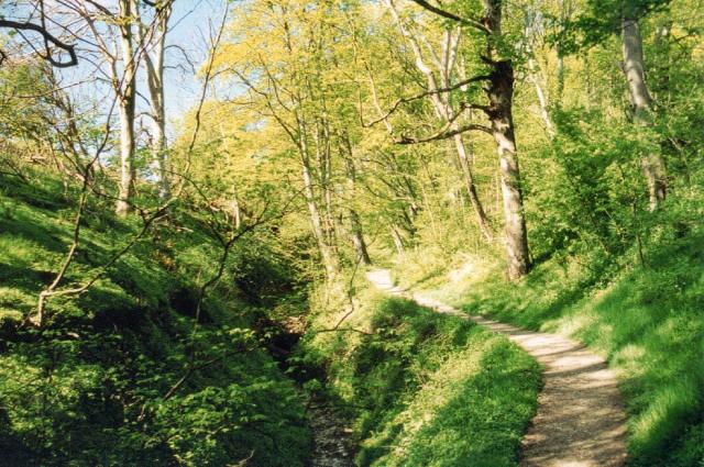
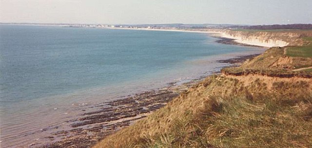
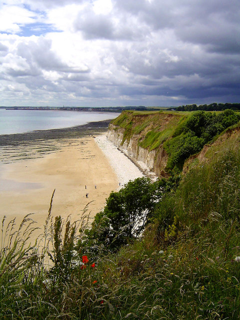
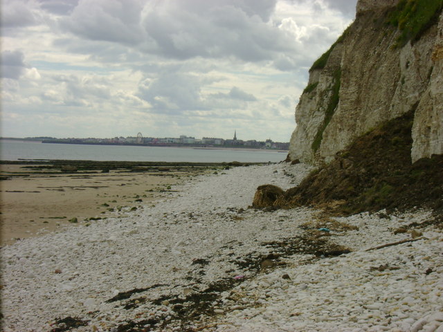
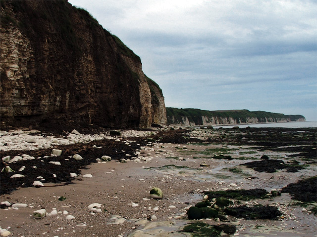
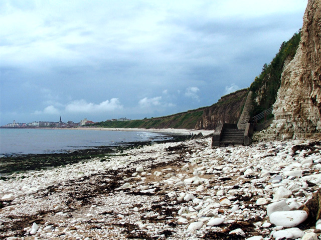
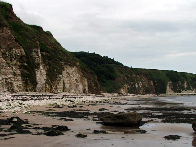
Yarburgh Plantation is a picturesque woodland located in the county of Yorkshire, England. Situated near the village of Yarburgh, this plantation covers a vast area and is known for its scenic beauty and rich biodiversity.

The plantation primarily consists of a mix of deciduous and coniferous trees, creating a diverse and vibrant ecosystem. Oak, beech, and ash trees dominate the landscape, providing a dense canopy that shelters various wildlife species. The forest floor is adorned with an array of wildflowers and ferns, adding to the plantation's natural beauty.

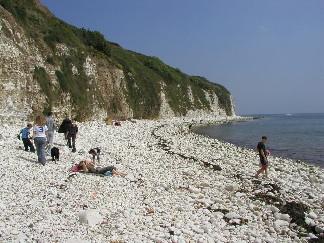
Yarburgh Plantation is home to a wide range of wildlife, making it a popular spot for nature enthusiasts and birdwatchers. Bird species such as woodpeckers, owls, and thrushes can be spotted within the woodland, while deer, rabbits, and foxes roam freely in their natural habitat. The plantation also supports a variety of insect species, including butterflies and bees.

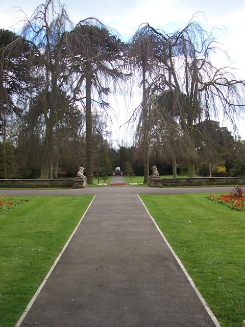
Visitors to Yarburgh Plantation can enjoy a peaceful walk along the well-maintained trails that wind through the woodland. The paths offer breathtaking views of the surrounding countryside and provide an opportunity to immerse oneself in nature. The plantation is equipped with picnic areas and benches, allowing visitors to relax and enjoy the tranquility of the forest.

Yarburgh Plantation is not only a sanctuary for wildlife but also plays a vital role in maintaining the ecological balance of the region. Its preservation and conservation efforts ensure that future generations can continue to enjoy the beauty and serenity of this remarkable woodland.

If you have any feedback on the listing, please let us know in the comments section below.

Yarburgh Plantation Images

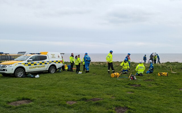
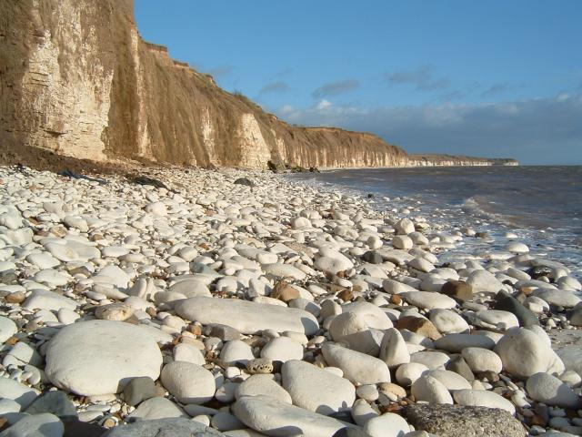
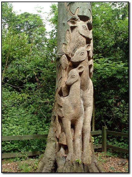
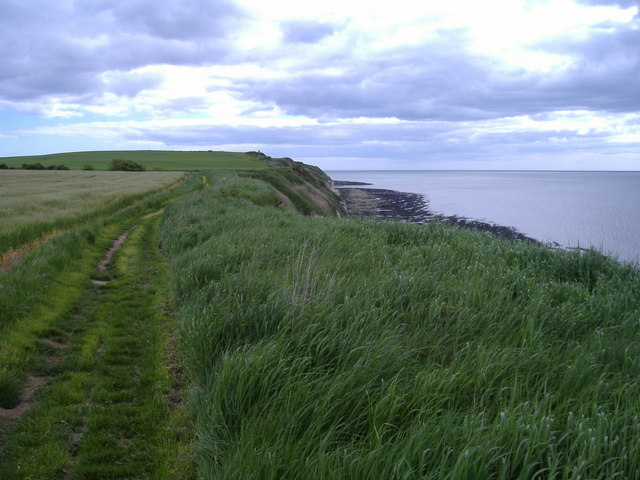
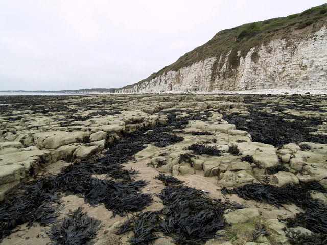
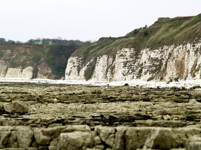
Images are sourced within 2km of 54.105018/-0.15824402 or Grid Reference TA2069. Thanks to Geograph Open Source API. All images are credited.

Coastguard Search and Rescue practice near Sewerby Steps
Bus stop and shelter on Limekiln Lane Another incomprehensible advert for a telecoms company.
Bus stop and shelter on Limekiln Lane
Another incomprehensible advert for a telecoms company.
Chalk Pebble beach at Sewerby, Near Bridlington. Looking North East towards Flamborough Head
Chalk Pebble beach at Sewerby, Near Bridlington.
Looking North East towards Flamborough Head
Carving - Sewerby Hall The gardeners at Sewerby Hall are kept busy with the huge garden.  Apart from the carvings there are amazing and weird trees and bushes and some beautiful formal gardens.
Carving - Sewerby Hall
The gardeners at Sewerby Hall are kept busy with the huge garden. Apart from the carvings there are amazing and weird trees and bushes and some beautiful formal gardens.
Danes Dyke Danes’ Dyke consists of prehistoric earthworks, possibly intended as a defence, and woodland that runs 2½ miles across Flamborough Head. Despite its name, Danes’ Dyke had nothing to do with the Danes, and was a much earlier site - probably dating back to the Bronze Age.
Danes Dyke
Danes’ Dyke consists of prehistoric earthworks, possibly intended as a defence, and woodland that runs 2½ miles across Flamborough Head. Despite its name, Danes’ Dyke had nothing to do with the Danes, and was a much earlier site - probably dating back to the Bronze Age.
Where Dane's Dyke meets the North Sea
View towards Bridlington from Southern end of Danes Dyke
Beacon Hill Views The South Landing and cliffs at Flamborough Head from just beyond Beacon Hill. Looking out across Danes Dyke End, you can just make out Bridlington in the distance.
Beacon Hill Views
The South Landing and cliffs at Flamborough Head from just beyond Beacon Hill. Looking out across Danes Dyke End, you can just make out Bridlington in the distance.
Sewerby Hall Gardens
Marton Hall This photo is actually taken from just outside the gridsquare TA2069, in which the hall is situated.
Marton Hall
This photo is actually taken from just outside the gridsquare TA2069, in which the hall is situated.
Beacon Hill The view eastwards along the cliff top from the very edge of the gridsquare towards Beacon Hill.
Beacon Hill
The view eastwards along the cliff top from the very edge of the gridsquare towards Beacon Hill.
South Flamborough Beach
South Flamborough Beach Looking Towards Danes' Dyke.
South Flamborough Beach
Looking Towards Danes' Dyke.
Sewerby Rocks Bridlington in the background, taken from Danes Dyke Beach
Sewerby Rocks
Bridlington in the background, taken from Danes Dyke Beach
Cliff face, Sewerby An eastwards shot of the cliff face near Dykes End from Sewerby Rocks.
Cliff face, Sewerby
An eastwards shot of the cliff face near Dykes End from Sewerby Rocks.
Steps onto Sewerby Rocks Steps leading from the cliffside footpath down onto Sewerby Rocks. Bridlington's North Sands and the sea front can be seen in the distance.
Steps onto Sewerby Rocks
Steps leading from the cliffside footpath down onto Sewerby Rocks. Bridlington's North Sands and the sea front can be seen in the distance.
Dane's Dyke from the beach A wide view of Dane's Dyke taken from the beach (Dyke's End).
Dane's Dyke from the beach
A wide view of Dane's Dyke taken from the beach (Dyke's End).
Show me another place!

Yarburgh Plantation is located at Grid Ref: TA2069 (Lat: 54.105018, Lng: -0.15824402)

Division: East Riding

Unitary Authority: East Riding of Yorkshire

Police Authority: Humberside

What 3 Words

///widen.years.almost. Near Flamborough, East Yorkshire

Related Wikis

Sewerby Hall

Sewerby Hall (also known as Sewerby House) is a Grade I listed Georgian country house set in 50 acres (20 ha) of landscaped gardens in the village of Sewerby...

Sewerby

Sewerby is a village in the East Riding of Yorkshire, England approximately 1 mile (1.6 km) north-east of Bridlington on the North Sea coast. The village...

Flamborough railway station

Flamborough railway station was located in the village of Marton, and was originally named after that location. However, there were several other railway...

Headlands School

Headlands School is a coeducational comprehensive school situated on Sewerby Road near the B1255, Bridlington, East Riding of Yorkshire, England. The school...

Nearby Amenities

Located within 500m of 54.105018,-0.15824402
Barrier: bollard
Source: survey
Lat/Long: 54.1034901/-0.1613651
Barrier: bollard
Source: survey
Lat/Long: 54.1022402/-0.1642232
Bus Stop
Sewerby Church Lane
Kerb: raised
Naptan AtcoCode: 2200YEA00454
Naptan Bearing: S
Naptan CommonName: Sewerby Church Lane
Naptan Crossing: Main Street
Naptan Landmark: Sewerby Hall
Naptan Street: Church Lane
Note: bearing should be N;moved N
Shelter: no
Source: naptan + survey
Lat/Long: 54.1025763/-0.1646553
Bus Stop
Bridlington Church Lane
Kerb: raised
Naptan AtcoCode: 2200YEA00455
Naptan Bearing: S
Naptan CommonName: Bridlington Church Lane
Naptan Landmark: Backing Sewerby Hall And Gardens
Naptan Street: Church Lane
Shelter: yes
Source: naptan + survey
Lat/Long: 54.1025052/-0.1644669
Noexit: yes
Lat/Long: 54.1032854/-0.1626076
Cafe
The Clock Tower
Source: survey
Lat/Long: 54.1034783/-0.1617622
Toilets
Source: survey
Wheelchair: yes
Lat/Long: 54.1036077/-0.1613232
Sewerby Hall and Gardens
Tourism: attraction
Lat/Long: 54.1040302/-0.1609905
Golf: tee
Lat/Long: 54.1015494/-0.1547691
Golf: pin
Lat/Long: 54.1023678/-0.1537175
Golf: pin
Lat/Long: 54.1027705/-0.1548111
Golf: tee
Lat/Long: 54.1035699/-0.1527473
Golf: pin
Lat/Long: 54.1036534/-0.1545792
Golf: tee
Lat/Long: 54.1036886/-0.155578
Golf: pin
Lat/Long: 54.1051922/-0.1509528
Golf: pin
Lat/Long: 54.1058268/-0.1569255
Golf: tee
Lat/Long: 54.1058531/-0.1575129
Golf: tee
Lat/Long: 54.1058657/-0.1547366
Golf: pin
Lat/Long: 54.1065664/-0.1527529
Golf: pin
Lat/Long: 54.1066871/-0.1564099
Golf: pin
Lat/Long: 54.1068265/-0.1593963
Golf: tee
Lat/Long: 54.1070825/-0.1576105
Golf: tee
Lat/Long: 54.1071429/-0.1595843
Golf: tee
Lat/Long: 54.1080151/-0.1542264
Golf: tee
Lat/Long: 54.1080477/-0.1575274
Golf: pin
Lat/Long: 54.108294/-0.1577761
Golf: pin
Lat/Long: 54.1084373/-0.155778
Golf: pin
Lat/Long: 54.1091243/-0.1572875
Golf: tee
Lat/Long: 54.109214/-0.1565498
Restaurant
Danesdyke Restaurant
Lat/Long: 54.1057873/-0.1510176
Defibrillator
Access: yes
Defibrillator Location: outside Bridlington Bay Bowling Club building
Emergency: defibrillator
Indoor: no
Lat/Long: 54.1025156/-0.1590603
Bench
Lat/Long: 54.1024824/-0.1590586
Bench
Lat/Long: 54.1024567/-0.1590479
Bench
Lat/Long: 54.1024336/-0.1590425
Bench
Lat/Long: 54.1024079/-0.159038
Bench
Lat/Long: 54.1023833/-0.1590282
Bench
Lat/Long: 54.1026423/-0.1597345
Bench
Lat/Long: 54.1026564/-0.1596326
Bench
Lat/Long: 54.10267/-0.1595235
Bench
Lat/Long: 54.1026831/-0.1594171
Bench
Lat/Long: 54.1026952/-0.1593134
Bench
Lat/Long: 54.1027099/-0.1592061
The data included in this document is from www.openstreetmap.org. The data is made available under ODbL.

Have you been to Yarburgh Plantation?

Leave your review of Yarburgh Plantation below (or comments, questions and feedback).