Chapel Copse
Wood, Forest in Surrey Mole Valley
England
Chapel Copse
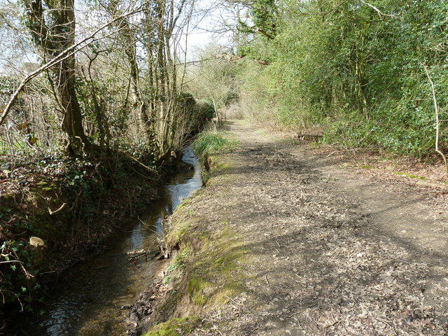
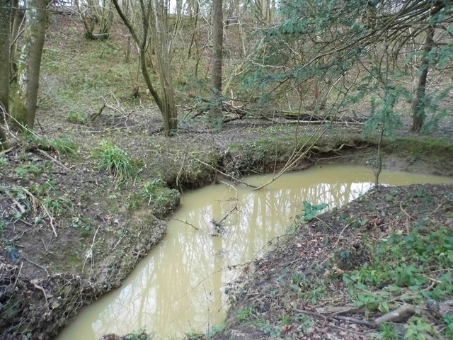
Chapel Copse is a picturesque woodland located in Surrey, England. Spanning over a vast area, it is renowned for its natural beauty and tranquil atmosphere. The copse is a mixture of ancient woodland and newer plantations, making it a diverse and thriving ecosystem.
Covered in a dense canopy of trees, Chapel Copse is home to a variety of tree species, including oak, beech, and birch. These towering giants provide shelter and habitat for numerous wildlife species, such as squirrels, birds, and insects. The forest floor is adorned with a carpet of wildflowers and ferns, adding to the copse's enchanting charm.
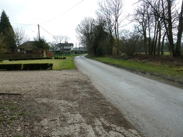
A prominent feature of Chapel Copse is its network of footpaths and trails, which wind their way through the forest. These paths allow visitors to explore the copse and immerse themselves in its natural wonders. Along the trails, there are several secluded clearings and viewpoints, offering stunning vistas of the surrounding countryside.
The copse also has a rich historical significance. It is rumored that an ancient chapel once stood within its boundaries, giving rise to its name. Although no remnants of the chapel remain, the area still exudes an aura of tranquility and spirituality.
Chapel Copse is a popular destination for nature lovers, hikers, and photographers. Its serene ambiance and abundant wildlife make it an ideal spot for birdwatching and wildlife photography. Whether one seeks solitude or seeks to connect with nature, Chapel Copse offers an idyllic retreat from the bustle of everyday life.
If you have any feedback on the listing, please let us know in the comments section below.
Chapel Copse Images
Images are sourced within 2km of 51.131827/-0.38618774 or Grid Reference TQ1338. Thanks to Geograph Open Source API. All images are credited.


Chapel Copse is located at Grid Ref: TQ1338 (Lat: 51.131827, Lng: -0.38618774)
Administrative County: Surrey
District: Mole Valley
Police Authority: Surrey
What 3 Words
///ushering.vegans.reshaping. Near Ewhurst, Surrey
Nearby Locations
Related Wikis

Wallis Wood
Wallis Wood is a 14-hectare (35-acre) nature reserve south-east of Ewhurst in Surrey. It is managed by the Surrey Wildlife Trust.A stream runs through...

Stane Street (Chichester)
Stane Street is the modern name of the 91 km-long (57 mi) Roman road in southern England that linked Londinium (London) to Noviomagus Reginorum (Chichester...

Smokejack Clay Pit
Smokejack Clay Pit is a 56-hectare (140-acre) geological Site of Special Scientific Interest east of Cranleigh in Surrey. It is a Geological Conservation...

Vann Lake and Ockley Woods
Vann Lake and Ockley Woods is a 57.8-hectare (143-acre) biological Site of Special Scientific Interest south of Ockley in Surrey. Vann Lake is part of...

Ockley
Ockley is a rural village in Surrey. It lies astride the A29, the modern road using the alignment of Stane Street (Chichester). The A29 diverges from the...

High Weald AONB
The High Weald Area of Outstanding Natural Beauty is in south-east England. Covering an area of 1,450 square kilometres (560 sq mi), it takes up parts...

Auclaye
Auclaye is a 0.6-hectare (1.5-acre) geological Site of Special Scientific Interest south of Capel in Surrey. It is a Geological Conservation Review site...

Greensand Ridge
The Greensand Ridge, also known as the Wealden Greensand, is an extensive, prominent, often wooded, mixed greensand/sandstone escarpment in south-east...
Nearby Amenities
Located within 500m of 51.131827,-0.38618774Have you been to Chapel Copse?
Leave your review of Chapel Copse below (or comments, questions and feedback).